| [3] |
Name on the Register |
Image |
Date listed[4] |
Location |
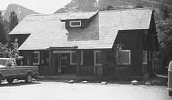
City or town |
Description |
|---|
| 1 |
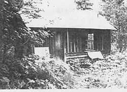
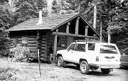
Babb-Piegan, Montana, Inspection Station |
Upload image |
02006-04-12-0000April 12, 2006
(#06000252) |
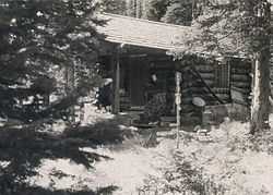
U.S. Route 89 near the Canadian border
48°59′35″N 113°22′47″W / 48.993056°N 113.379722°W / 48.993056; -113.379722 (Babb-Piegan, Montana, Inspection Station) |
Babb |
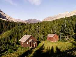
|
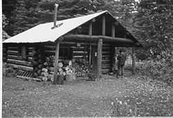
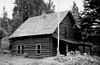
| 2 |
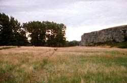
Camp Disappointment |
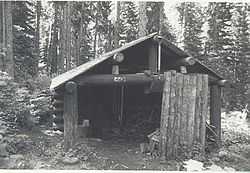
|
01966-10-15-0000October 15, 1966
(#66000434) |
12 miles northeast of Browning
48°40′11″N 112°48′27″W / 48.669722°N 112.8075°W / 48.669722; -112.8075 (Camp Disappointment) |
Browning |
|
| 3 |
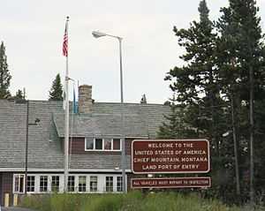
Chief Mountain Border Station and Quarters |
|
02008-05-20-0000May 20, 2008
(#06000744) |
Montana Highway 17 at the Canadian border in Glacier National Park
Coordinates missing |
Babb |
|
| 4 |
Cut Bank Municipal Airport and Army Air Force Base |
Upload image |
02008-01-29-0000January 29, 2008
(#07001494) |
Valier Highway
Coordinates missing |
Cut Bank |
|
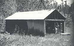
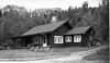
| 5 |
Cut Bank Ranger Station Historic District |
|
01996-01-19-0000January 19, 1996
(#95001566) |
Northern side of Cut Bank Creek in Glacier National Park
48°36′22″N 113°22′34″W / 48.606111°N 113.376111°W / 48.606111; -113.376111 (Cut Bank Ranger Station Historic District) |
East Glacier |
|
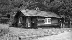
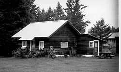
| 6 |
East Glacier Ranger Station Historic District |
|
01986-12-16-0000December 16, 1986
(#86003696) |
0.75 miles (1.21 km) north of East Glacier Park on Montana Highway 49
48°26′51″N 113°13′25″W / 48.4475°N 113.223611°W / 48.4475; -113.223611 (East Glacier Ranger Station Historic District) |
Eest Glacier |
part of the Glacier National Park MRA
|
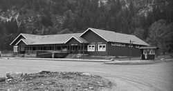
| 7 |
Glacier County Courthouse |
Upload image |
02013-06-25-0000June 25, 2013
(#13000446) |
512 East Main Street
48°37′57″N 112°19′35″W / 48.63237°N 112.32639°W / 48.63237; -112.32639 (Glacier County Courthouse) |
Cut Bank |
|
| 8 |
Glacier National Park Tourist Trails-Inside Trail, South Circle, North Circle |
Upload image |
01996-01-19-0000January 19, 1996
(#95001579) |
Inside Trail, South Circle and North Circle Trails
48°41′41″N 113°33′46″W / 48.694722°N 113.562778°W / 48.694722; -113.562778 (Glacier National Park Tourist Trails-Inside Trail, South Circle, North Circle) |
St. Mary |
|
| 9 |
Goathaunt Bunkhouse |
|
01996-01-19-0000January 19, 1996
(#95001568) |
Southern end of Waterton Lake in Glacier National Park
48°57′39″N 113°53′53″W / 48.960833°N 113.898056°W / 48.960833; -113.898056 (Goathaunt Bunkhouse) |
St. Mary |
|
| 10 |
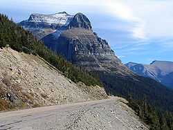
Going-to-the-Sun Road |
|
01983-06-16-0000June 16, 1983
(#83001070) |
Glacier Route 1
48°38′48″N 113°46′48″W / 48.646667°N 113.78°W / 48.646667; -113.78 (Going-to-the-Sun Road) |
West Glacier |
Extends into Flathead County
|
| 11 |
Great Northern Railway Buildings |
|
01987-05-28-0000May 28, 1987
(#87001453) |
Glacier National Park
48°38′29″N 113°32′17″W / 48.641389°N 113.538056°W / 48.641389; -113.538056 (Great Northern Railway Buildings) |
Glacier National Park |
|
| 12 |
Holy Family Mission |
|
01982-06-14-0000June 14, 1982
(#82003170) |
East of Browning
48°28′55″N 112°44′24″W / 48.481944°N 112.74°W / 48.481944; -112.74 (Holy Family Mission) |
Browning |
|
| 13 |
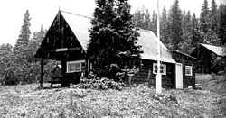
Kootenai Creek Snowshoe Cabin |
|
01999-07-01-0000July 1, 1999
(#99000775) |
Flattop Mountain along Kootenai Creek
48°51′55″N 113°54′28″W / 48.865278°N 113.907778°W / 48.865278; -113.907778 (Kootenai Creek Snowshoe Cabin) |
St. Mary |
|
| 14 |
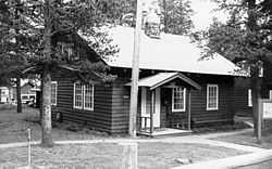
Lee Creek Snowshoe Cabin |
|
02001-03-02-0000March 2, 2001
(#01000203) |
Northeastern corner of Glacier National Park
48°59′10″N 113°37′20″W / 48.986111°N 113.622222°W / 48.986111; -113.622222 (Lee Creek Snowshoe Cabin) |
Glacier National Park |
|
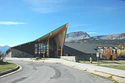
| 15 |
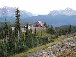
Logan Pass Visitor Center |
|
02008-04-15-0000April 15, 2008
(#08000334) |
Going-to-the-Sun Rd., 18 miles west of U.S. Route 89
Coordinates missing |
St. Mary |
|
| 16 |
Many Glacier Barn and Bunkhouse |
|
01996-01-19-0000January 19, 1996
(#95001570) |
Glacier Route 3 at Apikuni Flat in Glacier National Park
48°48′04″N 113°38′33″W / 48.801111°N 113.6425°W / 48.801111; -113.6425 (Many Glacier Barn and Bunkhouse) |
St. Mary |
|
| 17 |
Many Glacier Campground Camptender's Cabin |
|
01996-01-19-0000January 19, 1996
(#95001571) |
Many Glacier in Glacier National Park
48°47′49″N 113°40′37″W / 48.796944°N 113.676944°W / 48.796944; -113.676944 (Many Glacier Campground Camptender's Cabin) |
St. Mary |
|
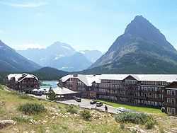
| 18 |
Many Glacier Hotel Historic District |
|
01996-01-19-0000January 19, 1996
(#76000173) |
West of Babb
48°47′54″N 113°39′12″W / 48.798333°N 113.653333°W / 48.798333; -113.653333 (Many Glacier Hotel Historic District) |
Babb |
|
| 19 |
Pass Creek Snowshoe Cabin |
|
01986-12-19-0000December 19, 1986
(#86003689) |
Confluence of the Waterton River and Pass Creek
48°53′47″N 113°54′23″W / 48.896389°N 113.906389°W / 48.896389; -113.906389 (Pass Creek Snowshoe Cabin) |
Babb |
part of the Glacier National Park MRA
|
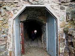
| 20 |
Ptarmigan Tunnel |
|
01986-02-14-0000February 14, 1986
(#86000360) |
North of Ptarmigan Lake
48°51′13″N 113°42′24″W / 48.853611°N 113.706667°W / 48.853611; -113.706667 (Ptarmigan Tunnel) |
Babb |
part of the Glacier National Park MRA
|
| 21 |
Rising Sun Auto Camp |
|
01996-01-19-0000January 19, 1996
(#95001574) |
500 feet north of Going-to-the-Sun Rd. at St. Mary Lake in Glacier National Park
48°41′46″N 113°31′06″W / 48.696111°N 113.518333°W / 48.696111; -113.518333 (Rising Sun Auto Camp) |
St. Mary |
|
| 22 |
Roes Creek Campground Camptender's Cabin |
|
01996-04-04-0000April 4, 1996
(#95001575) |
North of Going-to-the-Sun Rd. at St. Mary Lake in Glacier National Park
48°41′39″N 113°31′13″W / 48.694167°N 113.520278°W / 48.694167; -113.520278 (Roes Creek Campground Camptender's Cabin) |
St. Mary |
|
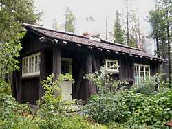
| 23 |
Saint Mary Ranger Station |
|
01986-02-14-0000February 14, 1986
(#86000367) |
Eastern end of Upper Saint Mary Lake
48°44′16″N 113°25′40″W / 48.737778°N 113.427778°W / 48.737778; -113.427778 (Saint Mary Ranger Station) |
St. Mary |
part of the Glacier National Park MRA
|
| 24 |
St. Mary Utility Area Historic District |
|
01996-01-19-0000January 19, 1996
(#95001576) |
East of St. Mary at Divide Creek in Glacier National Park
48°44′17″N 113°25′45″W / 48.738056°N 113.429167°W / 48.738056; -113.429167 (St. Mary Utility Area Historic District) |
St. Mary |
|
| 25 |
Saint Mary Visitor Center, Entrance Station and Checking Stations |
|
02008-04-15-0000April 15, 2008
(#08000335) |
Going-to-the-Sun Rd., 5 miles east of U.S. Route 89
Coordinates missing |
St. Mary |
|
| 26 |
Sherburne Ranger Station Historic District |
|
01986-12-16-0000December 16, 1986
(#86003698) |
Glacier Route 3 near Glacier Entrance
48°49′19″N 113°34′45″W / 48.821944°N 113.579167°W / 48.821944; -113.579167 (Sherburne Ranger Station Historic District) |
Babb |
part of the Glacier National Park MRA
|
| 27 |
Slide Lake-Otatso Creek Patrol Cabin and Woodshed |
|
01986-02-14-0000February 14, 1986
(#86000370) |
Northern side of Otatso Creek
48°54′36″N 113°35′56″W / 48.91°N 113.598889°W / 48.91; -113.598889 (Slide Lake-Otatso Creek Patrol Cabin and Woodshed) |
Babb |
part of the Glacier National Park MRA
|
| 28 |
Sun Camp Fireguard Cabin |
|
01999-07-01-0000July 1, 1999
(#99000776) |
Going-to-the-Sun Rd.
48°41′11″N 113°35′13″W / 48.686389°N 113.586944°W / 48.686389; -113.586944 (Sun Camp Fireguard Cabin) |
St. Mary |
|
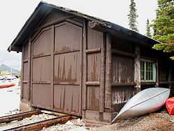
| 29 |
Swanson Boathouse |
|
01996-01-19-0000January 19, 1996
(#95001577) |
Eastern shore of Two Medicine Lake in Glacier National Park
48°28′59″N 113°22′07″W / 48.483056°N 113.368611°W / 48.483056; -113.368611 (Swanson Boathouse) |
East Glacier |
|
| 30 |
Swiftcurrent Auto Camp Historic District |
|
01996-01-19-0000January 19, 1996
(#95001578) |
Western end of Glacier Route 3 in Glacier National Park
48°47′54″N 113°40′33″W / 48.798333°N 113.675833°W / 48.798333; -113.675833 (Swiftcurrent Auto Camp Historic District) |
Many Glacier |
|
| 31 |
Swiftcurrent Ranger Station Historic District |
|
01986-12-19-0000December 19, 1986
(#86003690) |
Off Route 3 near Swiftcurrent Lake
48°47′48″N 113°40′26″W / 48.796667°N 113.673889°W / 48.796667; -113.673889 (Swiftcurrent Ranger Station Historic District) |
Babb |
part of the Glacier National Park MRA
|
| 32 |
Two Medicine Campground Camptender's Cabin |
|
01996-01-19-0000January 19, 1996
(#95001580) |
Two Medicine Lake in Glacier National Park
48°29′18″N 113°21′54″W / 48.488333°N 113.365°W / 48.488333; -113.365 (Two Medicine Campground Camptender's Cabin) |
East Glacier |
|
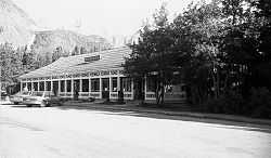
| 33 |
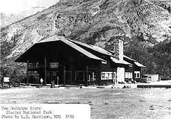
Two Medicine General Store |
|
01986-02-14-0000February 14, 1986
(#86000372) |
Eastern shore of Two Medicine Lake
48°29′06″N 113°22′08″W / 48.485°N 113.368889°W / 48.485; -113.368889 (Two Medicine General Store) |
East Glacier |
part of the Glacier National Park MRA |