| [3] |
Name on the Register[4] |
Image |
Date listed[5] |
Location |
City or town |
Description |
|---|
| 1 |
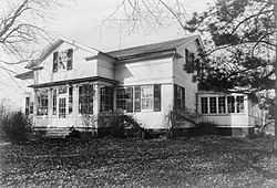
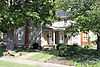
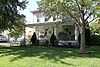
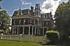
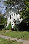
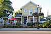
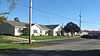
Abbott-Page House |
|
01975-05-27-0000May 27, 1975
(#75001383) |
2.5 mi (4.0 km) northeast of Milan on Mason Rd.
41°20′12″N 82°35′02″W / 41.336528°N 82.583750°W / 41.336528; -82.583750 (Abbott-Page House) |
Milan Township |
|
| 2 |
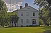
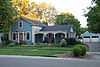
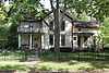
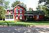
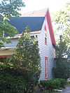
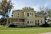
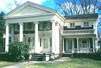
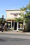
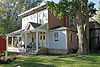
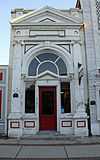
Ebenezer Andrews House |
|
01974-07-25-0000July 25, 1974
(#74001467) |
200 S. Main St.
41°17′27″N 82°35′59″W / 41.290778°N 82.599722°W / 41.290778; -82.599722 (Ebenezer Andrews House) |
Milan |
|
| 3 |
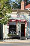
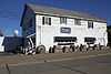
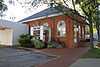
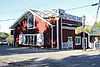
Barber Shop |
|
01979-11-14-0000November 14, 1979
(#79003932) |
Liberty Ave. west of Main St.
41°25′20″N 82°21′54″W / 41.422167°N 82.365000°W / 41.422167; -82.365000 (Barber Shop) |
Vermilion |
|
| 4 |
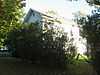
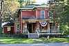
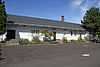
Baxtine House |
|
01979-11-14-0000November 14, 1979
(#79003920) |
Junction of Ohio and Perry Sts.
41°25′11″N 82°22′08″W / 41.419861°N 82.368750°W / 41.419861; -82.368750 (Baxtine House) |
Vermilion |
|
| 5 |
Louis Beatty House |
Upload image |
01984-10-25-0000October 25, 1984
(#84000106) |
South Shore Dr.
41°35′42″N 82°41′52″W / 41.595°N 82.697778°W / 41.595; -82.697778 (Louis Beatty House) |
Kelleys Island |
|
| 6 |
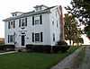
Capt. Bradley's Second House |
|
01979-11-14-0000November 14, 1979
(#79003946) |
753 Decatur St.
41°25′13″N 82°22′09″W / 41.420278°N 82.369167°W / 41.420278; -82.369167 (Capt. Bradley's Second House) |
Vermilion |
|
| 7 |
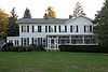
Capt. Alva Bradley House |
|
01979-11-14-0000November 14, 1979
(#79003938) |
5679 Huron St.
41°25′25″N 82°22′02″W / 41.423611°N 82.367222°W / 41.423611; -82.367222 (Capt. Alva Bradley House) |
Vermilion |
|
| 8 |
Cyrus Butler House |
Upload image |
01976-03-17-0000March 17, 1976
(#76001416) |
Edison Highway in Birmingham
41°19′55″N 82°21′03″W / 41.332083°N 82.350833°W / 41.332083; -82.350833 (Cyrus Butler House) |
Florence Township |
|
| 9 |
Cargo Warehouse |
|
01979-11-14-0000November 14, 1979
(#79003941) |
Liberty Ave., east of Exchange St. and west of Toledo St.
41°25′17″N 82°21′43″W / 41.421500°N 82.361806°W / 41.421500; -82.361806 (Cargo Warehouse) |
Vermilion |
|
| 10 |
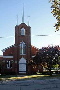
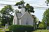
Christ Episcopal Church |
|
01975-03-04-0000March 4, 1975
(#75001379) |
Park and Ohio Sts.
41°23′52″N 82°33′19″W / 41.397778°N 82.555278°W / 41.397778; -82.555278 (Christ Episcopal Church) |
Huron |
|
| 11 |
Dean Road Bridge |
Upload image |
01978-11-28-0000November 28, 1978
(#78002119) |
West of South Amherst at Dean Rd. and the Vermilion River
41°20′56″N 82°20′41″W / 41.348889°N 82.344722°W / 41.348889; -82.344722 (Dean Road Bridge) |
Florence Township |
Extends into Lorain County
|
| 12 |
John Denzel House |
|
01979-11-14-0000November 14, 1979
(#79003956) |
831 Douglas St.
41°25′08″N 82°21′44″W / 41.418889°N 82.362089°W / 41.418889; -82.362089 (John Denzel House) |
Vermilion |
|
| 13 |
Thomas Alva Edison Birthplace |
|
01966-10-15-0000October 15, 1966
(#66000608) |
Edison Dr.
41°18′00″N 82°36′16″W / 41.300000°N 82.604444°W / 41.300000; -82.604444 (Thomas Alva Edison Birthplace) |
Milan |
|
| 14 |
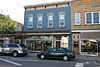
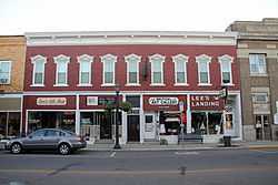
Englebry's Dry Goods |
|
01979-11-14-0000November 14, 1979
(#79003951) |
Main St., south of Liberty Ave.
41°25′18″N 82°21′53″W / 41.421556°N 82.364722°W / 41.421556; -82.364722 (Englebry's Dry Goods) |
Vermilion |
|
| 15 |
Dr. Englebry's Office |
|
01979-11-14-0000November 14, 1979
(#79003922) |
Main St., south of Liberty Ave.
41°25′17″N 82°21′53″W / 41.421389°N 82.364722°W / 41.421389; -82.364722 (Dr. Englebry's Office) |
Vermilion |
|
| 16 |
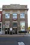
Erie County Bank Building |
|
01979-11-14-0000November 14, 1979
(#79003953) |
Junction of Liberty Ave. and Main St.
41°25′19″N 82°21′53″W / 41.421944°N 82.364722°W / 41.421944; -82.364722 (Erie County Bank Building) |
Vermilion |
|
| 17 |
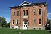
Erie County Infirmary |
|
01975-09-05-0000September 5, 1975
(#75001387) |
South of Sandusky on Columbus Rd.
41°25′38″N 82°41′38″W / 41.427222°N 82.693889°W / 41.427222; -82.693889 (Erie County Infirmary) |
Perkins Township |
|
| 18 |
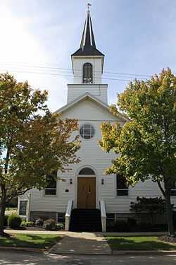
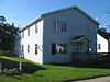
Evangelical and Reformed Church |
|
01979-11-14-0000November 14, 1979
(#79003960) |
Junction of Grand and Ohio Sts.
41°25′13″N 82°21′59″W / 41.420278°N 82.366389°W / 41.420278; -82.366389 (Evangelical and Reformed Church) |
Vermilion |
|
| 19 |
First Baptist Church |
|
01979-11-14-0000November 14, 1979
(#79003954) |
728 Main St.
41°25′14″N 82°21′55″W / 41.420556°N 82.365278°W / 41.420556; -82.365278 (First Baptist Church) |
Vermilion |
|
| 20 |
Florence Corners School |
Upload image |
01975-03-19-0000March 19, 1975
(#75001378) |
State Route 113 at Division St. in Florence
41°19′20″N 82°24′55″W / 41.322222°N 82.415278°W / 41.322222; -82.415278 (Florence Corners School) |
Florence Township |
|
| 21 |
JOSEPH FRANCIS IRON SURF BOAT |
Upload image |
01979-09-13-0000September 13, 1979
(#79001829) |
480 Main St.
41°25′29″N 82°22′00″W / 41.424861°N 82.366667°W / 41.424861; -82.366667 (JOSEPH FRANCIS IRON SURF BOAT) |
Vermilion |
|
| 22 |
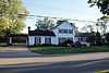
Capt. Gilchrist House |
|
01979-11-14-0000November 14, 1979
(#79003948) |
5644 Huron St.
41°25′26″N 82°22′03″W / 41.423889°N 82.367500°W / 41.423889; -82.367500 (Capt. Gilchrist House) |
Vermilion |
|
| 23 |
Capt. Gilchrist, Sr., House |
|
01979-11-14-0000November 14, 1979
(#79003921) |
Junction of Ohio and Grand Sts.
41°25′11″N 82°21′57″W / 41.419861°N 82.365722°W / 41.419861; -82.365722 (Capt. Gilchrist, Sr., House) |
Vermilion |
|
| 24 |
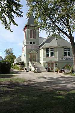
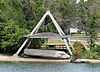
Great Lakes Historical Society Marine Museum |
|
01979-11-14-0000November 14, 1979
(#79003925) |
Junction of Main and Huron Sts.
41°25′29″N 82°22′00″W / 41.424722°N 82.366667°W / 41.424722; -82.366667 (Great Lakes Historical Society Marine Museum) |
Vermilion |
|
| 25 |
Hart's Drug Store |
|
01979-11-14-0000November 14, 1979
(#79003934) |
Junction of Main St. and Liberty Ave.
41°25′20″N 82°21′53″W / 41.422222°N 82.364861°W / 41.422222; -82.364861 (Hart's Drug Store) |
Vermilion |
|
| 26 |
Capt. Charles Horton House |
|
01979-11-14-0000November 14, 1979
(#79003926) |
5564 Ferry St.
41°25′23″N 82°22′00″W / 41.423111°N 82.366667°W / 41.423111; -82.366667 (Capt. Charles Horton House) |
Vermilion |
|
| 27 |
House at 624 Washington St. |
|
01979-11-14-0000November 14, 1979
(#79003940) |
624 Washington St.
41°25′21″N 82°22′04″W / 41.422500°N 82.367778°W / 41.422500; -82.367778 (House at 624 Washington St.) |
Vermilion |
|
| 28 |
House on Huron Ave. |
|
01979-11-14-0000November 14, 1979
(#79003942) |
Junction of Huron and Washington Sts.
41°25′24″N 82°22′05″W / 41.423333°N 82.368056°W / 41.423333; -82.368056 (House on Huron Ave.) |
Vermilion |
|
| 29 |
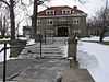
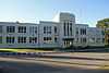
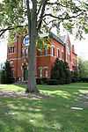
Huron School |
|
02011-06-15-0000June 15, 2011
(#11000366) |
325 Ohio St.
41°23′43″N 82°33′32″W / 41.395278°N 82.558889°W / 41.395278; -82.558889 (Huron School) |
Huron |
Now McCormick Middle School
|
| 30 |
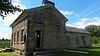
Inscription Rock |
|
01973-06-18-0000June 18, 1973
(#73001432) |
Kelleys Island
41°35′34″N 82°42′25″W / 41.592778°N 82.706944°W / 41.592778; -82.706944 (Inscription Rock) |
Kelleys Island |
|
| 31 |
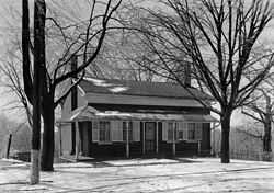
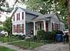
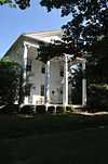
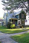
Jenkins-Perry House |
|
01974-10-29-0000October 29, 1974
(#74001468) |
37 W. Front St.
41°17′51″N 82°36′31″W / 41.297500°N 82.608611°W / 41.297500; -82.608611 (Jenkins-Perry House) |
Milan |
|
| 32 |
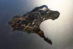
Kelleys Island South Shore District |
|
01975-03-27-0000March 27, 1975
(#75001380) |
Water St. on the southern side of Kelleys Island; also the entire island[6]
41°35′44″N 82°43′05″W / 41.5956°N 82.7181°W / 41.5956; -82.7181 (Kelleys Island South Shore District) |
Kelleys Island |
"Entire island" represents a boundary increase of 01988-12-15-0000December 15, 1988, the Kelleys Island Historic District
|
| 33 |
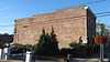
Kishman Fish Company Buildings |
|
01979-11-14-0000November 14, 1979
(#79003959) |
Main St., south of Huron St. and north of Liberty Ave.
41°25′22″N 82°21′51″W / 41.422778°N 82.364167°W / 41.422778; -82.364167 (Kishman Fish Company Buildings) |
Vermilion |
|
| 34 |
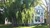
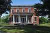
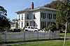
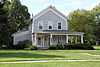
J.C. Lockwood House |
|
01974-12-04-0000December 4, 1974
(#74001469) |
30 Edison Dr.
41°18′04″N 82°36′14″W / 41.301111°N 82.603889°W / 41.301111; -82.603889 (J.C. Lockwood House) |
Milan |
|
| 35 |
Masonic Temple Building |
|
01979-11-14-0000November 14, 1979
(#79003950) |
Main St., south of Liberty St.
41°25′18″N 82°21′53″W / 41.421750°N 82.364722°W / 41.421750; -82.364722 (Masonic Temple Building) |
Vermilion |
|
| 36 |
Capt. Meyers House |
|
01979-11-14-0000November 14, 1979
(#79003923) |
Junction of Ohio and Perry Sts.
41°25′13″N 82°22′08″W / 41.420278°N 82.368750°W / 41.420278; -82.368750 (Capt. Meyers House) |
Vermilion |
|
| 37 |
Milan Historic District |
|
01975-03-13-0000March 13, 1975
(#75001381) |
Main and Church Sts., both sides of Front St., and Edison Dr.
41°17′56″N 82°36′17″W / 41.298889°N 82.604722°W / 41.298889; -82.604722 (Milan Historic District) |
Milan |
|
| 38 |
Capt. Minch House |
|
01979-11-14-0000November 14, 1979
(#79003943) |
743 Grand St.
41°25′13″N 82°21′57″W / 41.420278°N 82.365833°W / 41.420278; -82.365833 (Capt. Minch House) |
Vermilion |
|
| 39 |
Mitchell Historic District |
|
01975-03-13-0000March 13, 1975
(#75001382) |
115-137 and 118-136 Center St.
41°17′42″N 82°36′07″W / 41.295000°N 82.601944°W / 41.295000; -82.601944 (Mitchell Historic District) |
Milan |
|
| 40 |
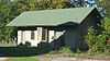
Oakland Cemetery Chapel and Superintendent's House and Office |
|
01983-05-06-0000May 6, 1983
(#83001962) |
2917 Milan Rd., south of Sandusky
41°25′48″N 82°41′11″W / 41.430000°N 82.686250°W / 41.430000; -82.686250 (Oakland Cemetery Chapel and Superintendent's House and Office) |
Perkins Township |
|
| 41 |
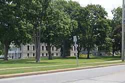
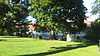
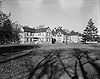
Ohio Soldiers' and Sailors' Home |
|
01976-09-13-0000September 13, 1976
(#76001418) |
Southeast of Sandusky between U.S. Route 250 and S. Columbus Ave.
41°25′11″N 82°41′01″W / 41.419722°N 82.683611°W / 41.419722; -82.683611 (Ohio Soldiers' and Sailors' Home) |
Perkins Township |
|
| 42 |
Old Funeral Parlor |
|
01979-11-14-0000November 14, 1979
(#79003930) |
5596 Liberty St.
41°25′20″N 82°21′57″W / 41.422222°N 82.365833°W / 41.422222; -82.365833 (Old Funeral Parlor) |
Vermilion |
|
| 43 |
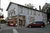
Old Harbour Store |
|
01979-11-14-0000November 14, 1979
(#79003933) |
Liberty Ave., west of Main St.
41°25′20″N 82°21′54″W / 41.422222°N 82.365128°W / 41.422222; -82.365128 (Old Harbour Store) |
Vermilion |
|
| 44 |
Old Interurban Station |
|
01979-11-14-0000November 14, 1979
(#79003936) |
Junction of Liberty Ave. and Exchange St.
41°25′19″N 82°21′49″W / 41.421944°N 82.363500°W / 41.421944; -82.363500 (Old Interurban Station) |
Vermilion |
|
| 45 |
Old Jib's Corner |
|
01979-11-14-0000November 14, 1979
(#79003937) |
Junction of Liberty Ave. and Perry St.
41°25′19″N 82°22′06″W / 41.421833°N 82.368333°W / 41.421833; -82.368333 (Old Jib's Corner) |
Vermilion |
|
| 46 |
Old Mill |
|
01979-11-14-0000November 14, 1979
(#79003929) |
Junction of Exchange and Mill Sts.
41°25′00″N 82°21′47″W / 41.416667°N 82.363194°W / 41.416667; -82.363194 (Old Mill) |
Vermilion |
|
| 47 |
Old Nickel Plate Railroad Depot |
|
01979-11-14-0000November 14, 1979
(#79003958) |
Junction of State Route 60 and Norfolk and Western railroad line
41°25′00″N 82°21′53″W / 41.416667°N 82.364722°W / 41.416667; -82.364722 (Old Nickel Plate Railroad Depot) |
Vermilion |
|
| 48 |
Old Pelton Hotel |
|
01979-11-14-0000November 14, 1979
(#79003952) |
5780 Liberty Ave.
41°25′20″N 82°22′09″W / 41.422222°N 82.369300°W / 41.422222; -82.369300 (Old Pelton Hotel) |
Vermilion |
|
| 49 |
Old Union School Building |
|
01979-11-14-0000November 14, 1979
(#79003957) |
Junction of South and Mill Sts.
41°24′59″N 82°21′54″W / 41.416389°N 82.365000°W / 41.416389; -82.365000 (Old Union School Building) |
Vermilion |
|
| 50 |
Old Vermilion Banking Company Building |
|
01979-11-14-0000November 14, 1979
(#79003935) |
5581 Liberty Ave.
41°25′19″N 82°21′55″W / 41.421944°N 82.365389°W / 41.421944; -82.365389 (Old Vermilion Banking Company Building) |
Vermilion |
|
| 51 |
Old Vermilion Mill |
|
01979-11-14-0000November 14, 1979
(#79003928) |
Douglas St.
41°25′01″N 82°21′45″W / 41.416806°N 82.362500°W / 41.416806; -82.362500 (Old Vermilion Mill) |
Vermilion |
|
| 52 |
Pelton House |
|
01979-11-14-0000November 14, 1979
(#79003944) |
5345 South St.
41°25′08″N 82°21′46″W / 41.4188889°N 82.3627778°W / 41.4188889; -82.3627778 (Pelton House) |
Vermilion |
|
| 53 |
Capt. Rae House |
|
01979-11-14-0000November 14, 1979
(#79003939) |
690 Decatur St.
41°25′17″N 82°22′12″W / 41.421389°N 82.370000°W / 41.421389; -82.370000 (Capt. Rae House) |
Vermilion |
|
| 54 |
Sail Loft |
|
01979-11-14-0000November 14, 1979
(#79003927) |
Main St., south of Ferry St.
41°25′24″N 82°21′54″W / 41.423333°N 82.365000°W / 41.423333; -82.365000 (Sail Loft) |
Vermilion |
|
| 55 |
St. Mary Parish Hall |
|
01979-11-14-0000November 14, 1979
(#79003931) |
Exchange St.
41°25′15″N 82°21′48″W / 41.420944°N 82.363333°W / 41.420944; -82.363333 (St. Mary Parish Hall) |
Vermilion |
|
| 56 |
Spacecraft Propulsion Research Facility |
|
01985-10-03-0000October 3, 1985
(#85002802) |
Lewis Research Center, Plum Brook Station
41°22′01″N 82°41′01″W / 41.366944°N 82.683611°W / 41.366944; -82.683611 (Spacecraft Propulsion Research Facility) |
Oxford and Perkins Townships |
|
| 57 |
Stagecoach Inn |
|
01979-11-14-0000November 14, 1979
(#79003924) |
5798 Huron St.
41°25′24″N 82°22′11″W / 41.423333°N 82.369722°W / 41.423333; -82.369722 (Stagecoach Inn) |
Vermilion |
|
| 58 |
Starr-Truscott House |
Upload image |
01978-04-20-0000April 20, 1978
(#78002056) |
State Route 133 in Birmingham
41°19′52″N 82°21′20″W / 41.331111°N 82.355556°W / 41.331111; -82.355556 (Starr-Truscott House) |
Florence Township |
|
| 59 |
Steamboat Hotel |
|
01979-11-14-0000November 14, 1979
(#79003947) |
532 Main St.
41°25′26″N 82°21′58″W / 41.423889°N 82.366111°W / 41.423889; -82.366111 (Steamboat Hotel) |
Vermilion |
|
| 60 |
The Stone House |
|
02010-10-28-0000October 28, 2010
(#10000874) |
8217 Mason Rd., northeast of Berlin Heights
41°20′14″N 82°28′34″W / 41.337333°N 82.476°W / 41.337333; -82.476 (The Stone House) |
Berlin Township |
|
| 61 |
Vermilion Town Hall |
|
01974-11-20-0000November 20, 1974
(#74001474) |
736 Main St.
41°25′13″N 82°21′54″W / 41.420278°N 82.365000°W / 41.420278; -82.365000 (Vermilion Town Hall) |
Vermilion |
|
| 62 |
Capt. Henry Walper House |
|
01979-11-14-0000November 14, 1979
(#79003955) |
5475 South St.
41°25′08″N 82°21′50″W / 41.418889°N 82.363750°W / 41.418889; -82.363750 (Capt. Henry Walper House) |
Vermilion |
|
| 63 |
Capt. Young House |
|
01979-11-14-0000November 14, 1979
(#79003945) |
Junction of Decatur and Ohio Sts.
41°25′11″N 82°22′12″W / 41.419861°N 82.370000°W / 41.419861; -82.370000 (Capt. Young House) |
Vermilion |
|