National Register of Historic Places listings in Elkhart County, Indiana

This is a list of the National Register of Historic Places listings in Elkhart County, Indiana.
This is intended to be a complete list of the properties and districts on the National Register of Historic Places in Elkhart County, Indiana, United States. Latitude and longitude coordinates are provided for many National Register properties and districts; these locations may be seen together in a Google map.[1]
There are 34 properties and districts listed on the National Register in the county. Another 2 properties were once listed but have been removed.
Properties and districts located in incorporated areas display the name of the municipality, while properties and districts in unincorporated areas display the name of their civil township. Properties and districts split between multiple jurisdictions display the names of all jurisdictions.
- This National Park Service list is complete through NPS recent listings posted May 1, 2015.[2]
Current listings
| [3] | Name on the Register[4] | Image | Date listed[5] | Location | City or town | Description |
|---|---|---|---|---|---|---|
| 1 | Beardsley Avenue Historic District | 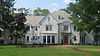 |
(#03000979) |
405 W. to 441 E. Beardsley Ave., the 700 block of N. Riverside, and Island Park 41°41′32″N 85°58′31″W / 41.692222°N 85.975278°W |
Elkhart | |
| 2 | Albert R. Beardsley House |  |
(#78000030) |
302 E. Beardsley Ave. 41°41′36″N 85°58′24″W / 41.693333°N 85.973333°W |
Elkhart | |
| 3 | Dr. Havilah Beardsley House | 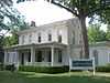 |
(#00000716) |
102 W. Beardsley Ave. 41°41′36″N 85°58′36″W / 41.693333°N 85.976667°W |
Elkhart | |
| 4 | Emmanuel C. Bickel House | 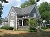 |
(#79000014) |
614 Bower St. 41°41′20″N 85°59′03″W / 41.688889°N 85.984167°W |
Elkhart | |
| 5 | Bonneyville Mills | 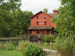 |
(#76000020) |
2.5 miles east of Bristol on County Road 131 41°43′10″N 85°45′53″W / 41.719444°N 85.764722°W |
York Township | |
| 6 | Bridge Street Bridge | 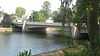 |
(#09000755) |
Bridge St. over the St. Joseph River 41°40′37″N 85°59′27″W / 41.677°N 85.990717°W |
Elkhart | |
| 7 | Bristol-Washington Township School | 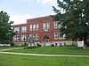 |
(#91001164) |
304 W. Vistula St. 41°43′18″N 85°49′14″W / 41.721667°N 85.820556°W |
Bristol | |
| 8 | Charles Gerard Conn Mansion | 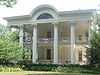 |
(#07001278) |
723 Strong Ave. 41°41′07″N 85°59′11″W / 41.685278°N 85.986389°W |
Elkhart | |
| 9 | Frank and Katharine Coppes House | 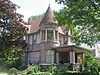 |
(#90001783) |
302 E. Market St. 41°26′34″N 85°59′54″W / 41.442778°N 85.998472°W |
Nappanee | |
| 10 | Dierdorff Farmstead | 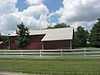 |
(#11000122) |
2055 Dierdorff Rd., southeast of Goshen 41°33′36″N 85°48′18″W / 41.560000°N 85.805000°W |
Elkhart Township | |
| 11 | Downtown Nappanee Historic District | 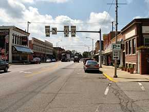 |
(#90000324) |
Main and Market Sts. 41°26′32″N 86°00′03″W / 41.442222°N 86.000833°W |
Nappanee | |
| 12 | Elkhart County Courthouse | 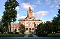 |
(#80000034) |
Courthouse Square 41°35′14″N 85°50′08″W / 41.587222°N 85.835556°W |
Goshen | |
| 13 | Elkhart Downtown Commercial Historic District | 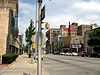 |
(#97001178) |
Roughly along Main St., roughly bounded by E. Jackson and 2nd Sts., Waterfall Dr., and Tyler Ave. 41°41′04″N 85°58′18″W / 41.684444°N 85.971667°W |
Elkhart | |
| 14 | Fort Wayne Street Bridge | 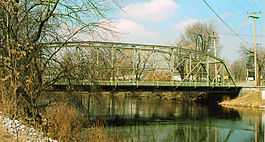 |
(#05001018) |
Indiana Ave. over the Elkhart River 41°35′36″N 85°50′55″W / 41.593333°N 85.848611°W |
Goshen | |
| 15 | Solomon Fowler Mansion | 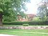 |
(#03000974) |
11505 W. Vistula St. 41°43′07″N 85°49′47″W / 41.718611°N 85.829861°W |
Bristol | |
| 16 | Goshen Carnegie Public Library | 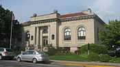 |
(#83000028) |
202 N. 5th St. 41°35′05″N 85°49′58″W / 41.584722°N 85.832778°W |
Goshen | |
| 17 | Goshen Historic District | 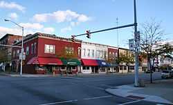 |
(#83000029) |
Bounded by Pike, the railroad line, Cottage, Plymouth, Main, Purl, the Canal, and 2nd St. 41°34′57″N 85°49′57″W / 41.5825°N 85.8325°W |
Goshen | |
| 18 | Green Block | 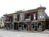 |
(#80000035) |
109-115 E. Lexington 41°41′11″N 85°58′20″W / 41.686389°N 85.972222°W |
Elkhart | |
| 19 | William and Helen Koerting House | 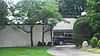 |
(#09001128) |
2625 Greenleaf Boulevard 41°41′51″N 85°56′14″W / 41.697500°N 85.937222°W |
Elkhart | |
| 20 | Lerner Theatre | 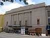 |
(#80000036) |
401 S. Main St. 41°41′02″N 85°58′18″W / 41.683889°N 85.971667°W |
Elkhart | |
| 21 | Arthur Miller House | 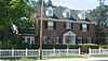 |
(#92000184) |
253 E. Market St. 41°26′33″N 85°59′56″W / 41.442389°N 85.998889°W |
Nappanee | |
| 22 | Mark L. and Harriet E. Monteith House | 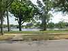 |
(#85003124) |
871 E. Beardsley Ave. 41°41′41″N 85°57′48″W / 41.694722°N 85.963333°W |
Elkhart | |
| 23 | Morehouse Residential Historic District | 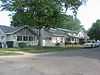 |
(#11000706) |
Roughly bounded by E. Indiana, Morehouse, E. Hubbard, and the western side of Frances Aves. 41°40′16″N 85°57′43″W / 41.671111°N 85.961944°W |
Elkhart | |
| 24 | Nappanee Eastside Historic District | 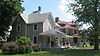 |
(#03001321) |
Roughly bounded by Market, Main, John, and Summit Sts. 41°26′39″N 85°59′52″W / 41.444167°N 85.997778°W |
Nappanee | |
| 25 | Nappanee West Park and Pavilion | 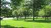 |
(#94000231) |
Junction of Nappanee and Van Buren Sts. 41°26′48″N 86°00′19″W / 41.446667°N 86.005278°W |
Nappanee | |
| 26 | Joseph and Sarah Puterbaugh Farm |  |
(#95000198) |
59123 County Road 9, south of Elkhart 41°38′09″N 85°57′57″W / 41.635833°N 85.965833°W |
Concord Township | |
| 27 | Joseph J. Rohrer Farm |  |
(#90000330) |
24394 County Road 40, southwest of Goshen 41°32′08″N 85°55′56″W / 41.535556°N 85.932222°W |
Harrison Township | |
| 28 | St. John of the Cross Episcopal Church, Rectory and Cemetery |  |
(#80000037) |
601 and 611 E. Vistula Rd. 41°43′16″N 85°48′40″W / 41.721111°N 85.811111°W |
Bristol | |
| 29 | St. John's Lutheran Church |  |
(#94001349) |
Northeastern corner of the junction of County Roads 15 and 32, west of Goshen 41°34′50″N 85°54′21″W / 41.580417°N 85.905972°W |
Harrison Township | |
| 30 | Stahly-Nissley-Kuhns Farm | 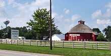 |
(#90001793) |
1600 W. Market St. 41°26′39″N 86°01′02″W / 41.444167°N 86.017222°W |
Nappanee | |
| 31 | State Street-Division Street Historic District | 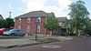 |
(#99000255) |
Roughly both sides of State and Division Sts. between Main and Monroe 41°40′58″N 85°57′59″W / 41.682778°N 85.966389°W |
Elkhart | |
| 32 | William N. Violett House | 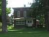 |
(#84001026) |
3004 S. Main St. 41°32′40″N 85°49′40″W / 41.544583°N 85.827778°W |
Goshen | |
| 33 | Violett-Martin House and Gardens | 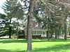 |
(#07000978) |
2612 S. Main St. 41°33′02″N 85°49′40″W / 41.550500°N 85.827778°W |
Goshen | |
| 34 | Young Women's Christian Association |  |
(#91000257) |
120 W. Lexington Ave. 41°41′11″N 85°58′26″W / 41.686389°N 85.973889°W |
Elkhart |
Former listings
| [3] | Name on the Register | Image | Date listed | Date removed | Location | City or town | Summary |
|---|---|---|---|---|---|---|---|
| 1 | Bucklen Theatre | Upload image | (#76000021) | S. Main and Harrison Sts. |
Elkhart | Demolished in 1986. | |
| 2 | Buescher Band Instrument Company Building | Upload image | (#86002714) | 225 E Jackson Ave. |
Elkhart |
See also
| Wikimedia Commons has media related to National Register of Historic Places in Elkhart County, Indiana. |
- List of National Historic Landmarks in Indiana
- National Register of Historic Places listings in Indiana
- List of Indiana state historical markers in Elkhart County
References
- ↑ The latitude and longitude information provided in this table was derived originally from the National Register Information System, which has been found to be fairly accurate for about 99% of listings. For about 1% of NRIS original coordinates, experience has shown that one or both coordinates are typos or otherwise extremely far off; some corrections may have been made. A more subtle problem causes many locations to be off by up to 150 yards, depending on location in the country: most NRIS coordinates were derived from tracing out latitude and longitudes off of USGS topographical quadrant maps created under the North American Datum of 1927, which differs from the current, highly accurate WGS84 GPS system used by most on-line maps. Chicago is about right, but NRIS longitudes in Washington are higher by about 4.5 seconds, and are lower by about 2.0 seconds in Maine. Latitudes differ by about 1.0 second in Florida. Some locations in this table may have been corrected to current GPS standards.
- ↑ "National Register of Historic Places: Weekly List Actions". National Park Service, United States Department of the Interior. Retrieved on May 1, 2015.
- ↑ 3.0 3.1 Numbers represent an ordering by significant words. Various colorings, defined here, differentiate National Historic Landmarks and historic districts from other NRHP buildings, structures, sites or objects.
- ↑ "National Register Information System". National Register of Historic Places. National Park Service. 2009-03-13.
- ↑ The eight-digit number below each date is the number assigned to each location in the National Register Information System database, which can be viewed by clicking the number.
| ||||||||||||||||||||||||||
| |||||||||||||||||||||||||||||||||