| [3] |
Name on the Register |
Image |
Date listed[4] |
Location |
City or town |
Description |
|---|
| 1 |
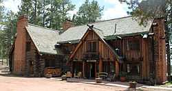
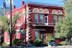
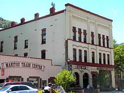
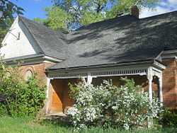
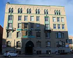
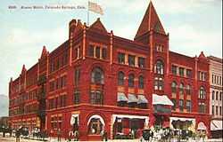
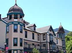
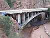
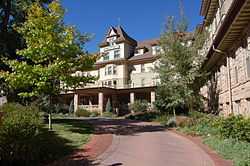
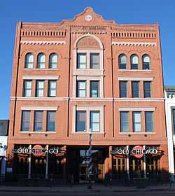
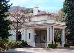
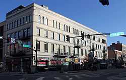
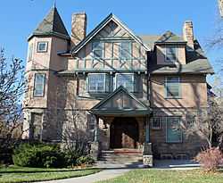
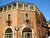
Alamo Hotel |
|
01977-09-14-0000September 14, 1977
(#77000373) |
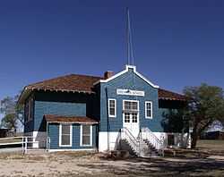
128 S. Tejon St.
38°49′53″N 104°49′24″W / 38.831389°N 104.823333°W / 38.831389; -104.823333 (Alamo Hotel) |
Colorado Springs |
|
| 2 |
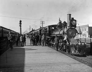
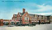
Atchison, Topeka and Santa Fe Passenger Depot |
|
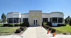
01979-09-10-0000September 10, 1979
(#79000597) |
555 E. Pikes Peak Ave.
38°49′58″N 104°48′49″W / 38.832778°N 104.813611°W / 38.832778; -104.813611 (Atchison, Topeka and Santa Fe Passenger Depot) |
Colorado Springs |
|
| 3 |
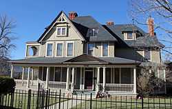
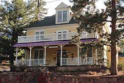
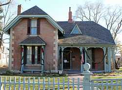
Barker House |
|
01979-10-11-0000October 11, 1979
(#79000604) |
819 Manitou
38°51′28″N 104°55′00″W / 38.857778°N 104.916667°W / 38.857778; -104.916667 (Barker House) |
Manitou Springs |
|
| 4 |
Bemis Hall |
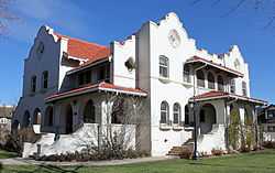
|
01997-03-28-0000March 28, 1997
(#97000273) |
920 N. Cascade Ave.
38°50′54″N 104°49′34″W / 38.848333°N 104.826111°W / 38.848333; -104.826111 (Bemis Hall) |
Colorado Springs |
|
| 5 |
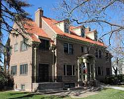
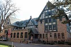
Judson Moss Bemis House |
|
01979-09-14-0000September 14, 1979
(#79000598) |
506 N. Cascade Ave.
38°50′28″N 104°49′28″W / 38.841111°N 104.824444°W / 38.841111; -104.824444 (Judson Moss Bemis House) |
Colorado Springs |
|
| 6 |
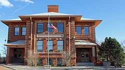
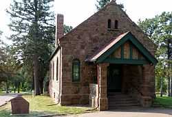
Black Forest School |
|
01992-11-03-0000November 3, 1992
(#92001407) |
6770 Shoup Rd.
39°00′47″N 104°42′02″W / 39.013056°N 104.700556°W / 39.013056; -104.700556 (Black Forest School) |
Colorado Springs |
|
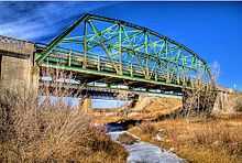
| 7 |
Black Squirrel Creek Bridge |
|
02002-10-15-0000October 15, 2002
(#02001158) |
U.S. Highway 24 at milepost 327.33
39°00′12″N 104°30′46″W / 39.003333°N 104.512778°W / 39.003333; -104.512778 (Black Squirrel Creek Bridge) |
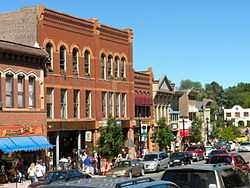
Falcon |
Demolished and replaced in 2012.[5]
|
| 8 |
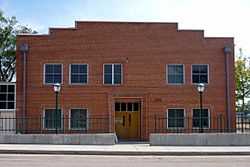
Boulder Crescent Place Historic District |
|
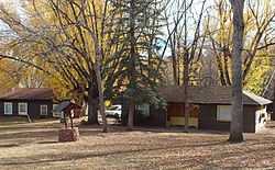
01987-09-10-0000September 10, 1987
(#87001555) |
9 and 11 W. Boulder St. and 312, 318, and 320 N. Cascade
38°50′22″N 104°49′30″W / 38.839444°N 104.825°W / 38.839444; -104.825 (Boulder Crescent Place Historic District) |
Colorado Springs |
|
| 9 |
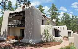
Briarhurst |
|
01973-04-23-0000April 23, 1973
(#73000473) |
404 Manitou Ave.
38°51′14″N 104°54′12″W / 38.853889°N 104.903333°W / 38.853889; -104.903333 (Briarhurst) |
Manitou Springs |
|
| 10 |
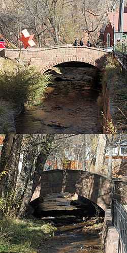
Bridge over Fountain Creek |
|
01985-02-04-0000February 4, 1985
(#85000206) |
U.S. Highway 24
38°52′12″N 104°55′30″W / 38.87°N 104.925°W / 38.87; -104.925 (Bridge over Fountain Creek) |
Manitou Springs |
|
| 11 |
Burgess House |
|
01990-09-13-0000September 13, 1990
(#90001418) |
730 N. Nevada Ave.
38°50′41″N 104°49′16″W / 38.844722°N 104.821111°W / 38.844722; -104.821111 (Burgess House) |
Colorado Springs |
|
| 12 |
Calhan Paint Mines Archeological District |
|
02000-07-14-0000July 14, 2000
(#00000783) |
Approximately 0.5 miles (0.80 km) southeast of the junction of S. Calhan Rd. and Paint Mine Rd.
39°01′07″N 104°16′04″W / 39.018611°N 104.267778°W / 39.018611; -104.267778 (Calhan Paint Mines Archeological District) |
Calhan |
|
| 13 |
Calhan Rock Island Railroad Depot |
|
01995-04-20-0000April 20, 1995
(#95000476) |
252 feet west of Denver St. on Rock Island Railroad right-of-way
39°02′18″N 104°17′57″W / 39.038333°N 104.299167°W / 39.038333; -104.299167 (Calhan Rock Island Railroad Depot) |
Calhan |
|
| 14 |
Carlton House |
Upload image |
01989-11-03-0000November 3, 1989
(#89001785) |
Pine Valley
38°57′58″N 104°51′02″W / 38.966111°N 104.850556°W / 38.966111; -104.850556 (Carlton House) |
United States Air Force Academy |
|
| 15 |
Chadbourn Spanish Gospel Mission |
|
02009-01-14-0000January 14, 2009
(#08001316) |
402 S. Conejos St.
38°49′42″N 104°49′54″W / 38.828291°N 104.831632°W / 38.828291; -104.831632 (Chadbourn Spanish Gospel Mission) |
Colorado Springs |
|
| 16 |
Chambers Ranch |
|
01979-11-29-0000November 29, 1979
(#79000599) |
3202 Chambers Way
38°52′21″N 104°52′20″W / 38.8725°N 104.872222°W / 38.8725; -104.872222 (Chambers Ranch) |
Colorado Springs |
|
| 17 |
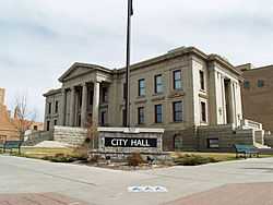
City Hall of Colorado City |
|
01982-06-03-0000June 3, 1982
(#82002300) |
2902 W. Colorado Ave.
38°51′04″N 104°52′07″W / 38.851197°N 104.868478°W / 38.851197; -104.868478 (City Hall of Colorado City) |
Colorado Springs |
|
| 18 |
Claremont |
|
01977-04-13-0000April 13, 1977
(#77000374) |
21 Broadmoor Ave.
38°47′26″N 104°50′24″W / 38.790556°N 104.84°W / 38.790556; -104.84 (Claremont) |
Colorado Springs |
|
| 19 |
Cliff House |
|
01980-03-27-0000March 27, 1980
(#80000897) |
306 Canon Ave.
38°51′35″N 104°55′00″W / 38.859722°N 104.916667°W / 38.859722; -104.916667 (Cliff House) |
Manitou Springs |
|
| 20 |
Colorado Springs Airport |
|
01996-11-15-0000November 15, 1996
(#90001296) |
Junction of Ent Ave. and Peterson Boulevard at Peterson Air Force Base
38°49′22″N 104°42′04″W / 38.822778°N 104.701111°W / 38.822778; -104.701111 (Colorado Springs Airport) |
Colorado Springs |
|
| 21 |
Colorado Springs and Cripple Creek District Railway-Corley Mountain Highway |
Upload image |
01999-03-25-0000March 25, 1999
(#99000400) |
Gold Camp Rd. and Forest Rd. 370
38°44′56″N 104°56′58″W / 38.748889°N 104.949444°W / 38.748889; -104.949444 (Colorado Springs and Cripple Creek District Railway-Corley Mountain Highway) |
Colorado Springs |
|
| 22 |
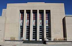
Colorado Springs City Auditorium |
|
01995-11-07-0000November 7, 1995
(#95001244) |
231 E. Kiowa St.
38°50′06″N 104°49′11″W / 38.835°N 104.819722°W / 38.835; -104.819722 (Colorado Springs City Auditorium) |
Colorado Springs |
|
| 23 |
Colorado Springs City Hall |
|
02002-02-19-0000February 19, 2002
(#02000075) |
107 N. Nevada Ave.
38°50′08″N 104°49′16″W / 38.835608°N 104.820997°W / 38.835608; -104.820997 (Colorado Springs City Hall) |
Colorado Springs |
|
| 24 |
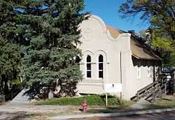
Colorado Springs Day Nursery |
|
01990-02-23-0000February 23, 1990
(#90000304) |
104 E. Rio Grande St.
38°49′28″N 104°49′25″W / 38.824578°N 104.823556°W / 38.824578; -104.823556 (Colorado Springs Day Nursery) |
Colorado Springs |
|
| 25 |
Colorado Springs Fine Arts Center |
|
01986-07-03-0000July 3, 1986
(#86001455) |
30 W. Dale St.
38°50′45″N 104°49′32″W / 38.845833°N 104.825556°W / 38.845833; -104.825556 (Colorado Springs Fine Arts Center) |
Colorado Springs |
|
| 26 |
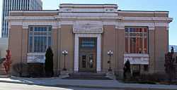
Colorado Springs Public Library-Carnegie Building |
|
01996-11-01-0000November 1, 1996
(#96001238) |
21 W. Kiowa St.
38°50′08″N 104°49′35″W / 38.835659°N 104.826367°W / 38.835659; -104.826367 (Colorado Springs Public Library-Carnegie Building) |
Colorado Springs |
|
| 27 |
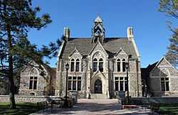
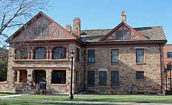
Frederick H. Cossitt Memorial Hall |
|
01997-03-28-0000March 28, 1997
(#97000272) |
906 N. Cascade Ave.
38°50′51″N 104°49′34″W / 38.8475°N 104.826111°W / 38.8475; -104.826111 (Frederick H. Cossitt Memorial Hall) |
Colorado Springs |
|
| 28 |
Cottonwood Creek Bridge |
|
02001-10-12-0000October 12, 2001
(#01001104) |
On Vincent Dr. over Cottonwood Creek
38°55′43″N 104°48′35″W / 38.928611°N 104.809722°W / 38.928611; -104.809722 (Cottonwood Creek Bridge) |
Colorado Springs |
|
| 29 |
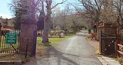
Crystal Valley Cemetery |
|
01982-11-18-0000November 18, 1982
(#82001015) |
Plainview Ave.
38°51′06″N 104°54′11″W / 38.851667°N 104.903056°W / 38.851667; -104.903056 (Crystal Valley Cemetery) |
Manitou Springs |
|
| 30 |
Cutler Hall |
|
01986-07-03-0000July 3, 1986
(#86001410) |
912 N. Cascade Ave.
38°50′53″N 104°49′30″W / 38.848056°N 104.825°W / 38.848056; -104.825 (Cutler Hall) |
Colorado Springs |
|
| 31 |
DeGraff Building |
|
01983-08-18-0000August 18, 1983
(#83001293) |
116-118 N. Tejon
38°50′10″N 104°49′25″W / 38.836111°N 104.823611°W / 38.836111; -104.823611 (DeGraff Building) |
Colorado Springs |
|
| 32 |
Dodge-Hamlin House |
Upload image |
02014-12-03-0000December 3, 2014
(#14000968) |
1148 N. Cascade Ave., 1122 Wood Ave.
38°51′00″N 104°49′36″W / 38.8501°N 104.8268°W / 38.8501; -104.8268 (Dodge-Hamlin House) |
Colorado Springs |
On the Colorado College campus.
|
| 33 |
Drennan School |
|
02008-04-16-0000April 16, 2008
(#08000290) |
20500 Drennan Rd.
38°45′07″N 104°26′49″W / 38.75181°N 104.44689°W / 38.75181; -104.44689 (Drennan School) |
Colorado Springs |
|
| 34 |
Eastholme |
|
01998-10-22-0000October 22, 1998
(#98001250) |
4445 Haggerman Ave.
38°53′51″N 104°58′08″W / 38.8975°N 104.968889°W / 38.8975; -104.968889 (Eastholme) |
Cascade |
|
| 35 |
Edgeplain |
|
02006-11-21-0000November 21, 2006
(#06001048) |
1106 N. Nevada Ave.
38°50′59″N 104°49′15″W / 38.849722°N 104.820833°W / 38.849722; -104.820833 (Edgeplain) |
Colorado Springs |
|
| 36 |
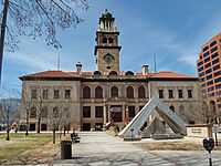
El Paso County Courthouse |
|
01972-09-29-0000September 29, 1972
(#72000272) |
215 S. Tejon St.
38°49′48″N 104°49′20″W / 38.83°N 104.822222°W / 38.83; -104.822222 (El Paso County Courthouse) |
Colorado Springs |
|
| 37 |
El Pomar Estate |
|
01995-11-22-0000November 22, 1995
(#95001328) |
1661 Mesa Ave.
38°47′18″N 104°51′28″W / 38.788333°N 104.857778°W / 38.788333; -104.857778 (El Pomar Estate) |
Colorado Springs |
|
| 38 |
Emmanuel Presbyterian Church |
|
01984-05-17-0000May 17, 1984
(#84000830) |
419 Mesa Rd.
38°50′45″N 104°49′54″W / 38.845833°N 104.831667°W / 38.845833; -104.831667 (Emmanuel Presbyterian Church) |
Colorado Springs |
|
| 39 |
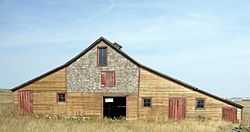
J.G. Evans Barn |
|
02004-06-22-0000June 22, 2004
(#04000624) |
Hodgen Rd.
39°04′18″N 104°41′25″W / 39.071667°N 104.690278°W / 39.071667; -104.690278 (J.G. Evans Barn) |
Black Forest |
|
| 40 |
Evergreen Cemetery |
|
01993-02-11-0000February 11, 1993
(#93000035) |
1005 S. Hancock Ave.
38°48′56″N 104°47′43″W / 38.815556°N 104.795278°W / 38.815556; -104.795278 (Evergreen Cemetery) |
Colorado Springs |
|
| 41 |
First Congregational Church |
|
02002-10-31-0000October 31, 2002
(#02001258) |
20 E. St. Vrain St.
38°50′28″N 104°49′22″W / 38.841111°N 104.822778°W / 38.841111; -104.822778 (First Congregational Church) |
Colorado Springs |
|
| 42 |
First Congregational Church |
|
01979-10-16-0000October 16, 1979
(#79000606) |
101 Pawnee Ave.
38°51′23″N 104°54′47″W / 38.856389°N 104.913056°W / 38.856389; -104.913056 (First Congregational Church) |
Manitou Springs |
|
| 43 |
First Presbyterian Church of Ramah |
|
01988-07-07-0000July 7, 1988
(#88001015) |
113 S. Commercial St.
39°07′13″N 104°10′02″W / 39.120278°N 104.167222°W / 39.120278; -104.167222 (First Presbyterian Church of Ramah) |
Ramah |
|
| 44 |
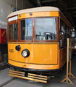
Fort Collins Municipal Railway No. 22 |
|
02011-12-15-0000December 15, 2011
(#11000901) |
2333 Steel Dr.
38°52′01″N 104°49′53″W / 38.866828°N 104.831371°W / 38.866828; -104.831371 (Fort Collins Municipal Railway No. 22) |
Colorado Springs |
|
| 45 |
Giddings Building |
|
01983-04-21-0000April 21, 1983
(#83001294) |
101 N. Tejon St.
38°50′08″N 104°50′03″W / 38.835556°N 104.834167°W / 38.835556; -104.834167 (Giddings Building) |
Colorado Springs |
|
| 46 |
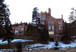
Glen Eyrie |
|
01975-04-21-0000April 21, 1975
(#75000519) |
3280 N. 30th St.
38°53′29″N 104°53′05″W / 38.891389°N 104.884722°W / 38.891389; -104.884722 (Glen Eyrie) |
Colorado Springs |
|
| 47 |
Grace and St. Stephen's Episcopal Church |
|
02011-12-15-0000December 15, 2011
(#11000902) |
631 N. Tejon St.
38°50′34″N 104°49′23″W / 38.842858°N 104.823022°W / 38.842858; -104.823022 (Grace and St. Stephen's Episcopal Church) |
Colorado Springs |
|
| 48 |
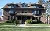
Gwynne-Love House |
|
01987-02-05-0000February 5, 1987
(#87000010) |
730 N. Cascade Ave.
38°50′42″N 104°49′29″W / 38.845°N 104.824722°W / 38.845; -104.824722 (Gwynne-Love House) |
Colorado Springs |
|
| 49 |
Hagerman Mansion |
|
01984-09-20-0000September 20, 1984
(#84000831) |
610 N. Cascade Ave.
38°50′36″N 104°49′32″W / 38.843333°N 104.825556°W / 38.843333; -104.825556 (Hagerman Mansion) |
Colorado Springs |
|
| 50 |
Keithley Log Cabin Development District |
|
01982-11-18-0000November 18, 1982
(#82001016) |
Roughly bounded by Santa Fe Pl., Crystal Rd., and Spur Rd.
38°51′13″N 104°53′59″W / 38.853611°N 104.899722°W / 38.853611; -104.899722 (Keithley Log Cabin Development District) |
Manitou Springs |
|
| 51 |
Lennox House |
|
01999-10-21-0000October 21, 1999
(#99001266) |
1001 N. Nevada Ave.
38°50′53″N 104°49′10″W / 38.848056°N 104.819444°W / 38.848056; -104.819444 (Lennox House) |
Colorado Springs |
|
| 52 |
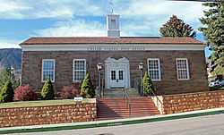
Inez Johnson Lewis School |
|
01988-11-03-0000November 3, 1988
(#88002306) |
146 Jefferson St.
39°05′28″N 104°52′13″W / 39.091111°N 104.870278°W / 39.091111; -104.870278 (Inez Johnson Lewis School) |
Monument |
|
| 53 |
Lindley-Johnson-Vanderhoof House |
|
02013-12-03-0000December 3, 2013
(#13000870) |
1130 N. Cascade Ave.
38°51′01″N 104°49′30″W / 38.850203°N 104.825°W / 38.850203; -104.825 (Lindley-Johnson-Vanderhoof House) |
Colorado Springs |
|
| 54 |
Little Fountain Creek Bridge |
Upload image |
02002-10-15-0000October 15, 2002
(#02001153) |
State Highway 115 at milepost 36.84
38°40′36″N 104°50′55″W / 38.676667°N 104.848611°W / 38.676667; -104.848611 (Little Fountain Creek Bridge) |
Widefield |
Replaced in 2004.
|
| 55 |
Manitou Bathhouse |
|
01979-08-01-0000August 1, 1979
(#79000608) |
934 Manitou Ave.
38°51′33″N 104°55′02″W / 38.859167°N 104.917222°W / 38.859167; -104.917222 (Manitou Bathhouse) |
Manitou Springs |
|
| 56 |
Manitou Springs Bridges (2) |
|
01985-06-24-0000June 24, 1985
(#85001398) |
Park Ave. and Cannon Ave. over Fountain Creek
38°51′30″N 104°54′57″W / 38.858333°N 104.915833°W / 38.858333; -104.915833 (Manitou Springs Bridges (2)) |
Manitou Springs |
|
| 57 |
Manitou Springs Historic District |
|
01983-10-07-0000October 7, 1983
(#83003516) |
Roughly bounded by El Paso Boulevard, Ruxton Ave., U.S. Highway 24, and Iron Mt. Ave.
38°51′28″N 104°55′14″W / 38.857778°N 104.920556°W / 38.857778; -104.920556 (Manitou Springs Historic District) |
Manitou Springs |
|
| 58 |
Maytag Aircraft Building |
|
02008-01-16-0000January 16, 2008
(#07001393) |
701 S. Cascade Ave.
38°49′27″N 104°49′30″W / 38.824167°N 104.825°W / 38.824167; -104.825 (Maytag Aircraft Building) |
Colorado Springs |
|
| 59 |
McAllister House |
|
01973-08-14-0000August 14, 1973
(#73000472) |
423 N. Cascade Ave.
38°50′21″N 104°49′26″W / 38.839167°N 104.823889°W / 38.839167; -104.823889 (McAllister House) |
Colorado Springs |
|
| 60 |
McGregor Hall |
|
02000-01-27-0000January 27, 2000
(#99001705) |
930 N. Cascade Ave.
38°50′56″N 104°49′36″W / 38.848889°N 104.826667°W / 38.848889; -104.826667 (McGregor Hall) |
Colorado Springs |
|
| 61 |
Midland Terminal Railroad Roundhouse |
|
01979-07-10-0000July 10, 1979
(#79000600) |
600 S. 21st St.
38°50′24″N 104°51′32″W / 38.84°N 104.858889°W / 38.84; -104.858889 (Midland Terminal Railroad Roundhouse) |
Colorado Springs |
|
| 62 |
Miramont |
|
01977-04-11-0000April 11, 1977
(#77000375) |
9 Capitol Hill
38°51′33″N 104°55′19″W / 38.859167°N 104.921944°W / 38.859167; -104.921944 (Miramont) |
Manitou Springs |
|
| 63 |
Montgomery Hall, Colorado College |
|
01990-09-13-0000September 13, 1990
(#90001419) |
1030 N. Cascade Ave.
38°50′56″N 104°49′33″W / 38.848889°N 104.825833°W / 38.848889; -104.825833 (Montgomery Hall, Colorado College) |
Colorado Springs |
|
| 64 |
Monument Valley Park |
|
02007-01-25-0000January 25, 2007
(#06001287) |
Approximately bounded by Monroe, Culebra, Westview, and Bijou Sts., the BNSF railway line, and the western edge of the main north/south trail, all north of Del Norte
38°51′11″N 104°49′48″W / 38.852943°N 104.830098°W / 38.852943; -104.830098 (Monument Valley Park) |
Colorado Springs |
|
| 65 |
Navajo Hogan |
|
01990-09-13-0000September 13, 1990
(#90001420) |
2817 N. Nevada Ave.
38°52′20″N 104°49′08″W / 38.872222°N 104.818889°W / 38.872222; -104.818889 (Navajo Hogan) |
Colorado Springs |
|
| 66 |
North Cheyenne Cañon Park |
|
02009-07-08-0000July 8, 2009
(#09000489) |
2120 N. Cheyenne Cañon Rd.
38°47′26″N 104°52′26″W / 38.790503°N 104.873822°W / 38.790503; -104.873822 (North Cheyenne Cañon Park) |
Colorado Springs |
|
| 67 |
North End Historic District |
|
01982-12-17-0000December 17, 1982
(#82001017) |
Roughly bounded by Monument Valley Wood, Nevada Ave., and Madison and Unitah Sts.
38°51′27″N 104°49′21″W / 38.8575°N 104.8225°W / 38.8575; -104.8225 (North End Historic District) |
Colorado Springs |
|
| 68 |
North Weber Street-Wahsatch Avenue Historic Residential District |
|
01985-02-08-0000February 8, 1985
(#85000205) |
N. Weber St. between Boulder and Del Norte St., and N. Wahsatch Ave. between St. Vrain and Columbia St.
38°50′53″N 104°49′04″W / 38.848056°N 104.817778°W / 38.848056; -104.817778 (North Weber Street-Wahsatch Avenue Historic Residential District) |
Colorado Springs |
|
| 69 |
Old Colorado City Historic Commercial District |
|
01982-11-02-0000November 2, 1982
(#82001018) |
Northern side of Colorado Ave. from 24th St., west to 2611 Colorado Ave., also includes 115 S. 26 St. and 2418 W. Pikes Peak Ave.
38°50′50″N 104°51′46″W / 38.847222°N 104.862778°W / 38.847222; -104.862778 (Old Colorado City Historic Commercial District) |
Colorado Springs |
|
| 70 |
Old Livery Stable |
|
01979-03-02-0000March 2, 1979
(#79000603) |
217 W. Missouri
38°40′57″N 104°42′08″W / 38.6825°N 104.702222°W / 38.6825; -104.702222 (Old Livery Stable) |
Fountain |
|
| 71 |
Palmer Hall |
|
01986-07-03-0000July 3, 1986
(#86001412) |
116 E. San Rafael
38°50′56″N 104°49′19″W / 38.848889°N 104.821944°W / 38.848889; -104.821944 (Palmer Hall) |
Colorado Springs |
|
| 72 |
Pauline Chapel |
|
02001-02-26-0000February 26, 2001
(#00001370) |
2 Park Ave.
38°47′31″N 104°51′14″W / 38.791944°N 104.853889°W / 38.791944; -104.853889 (Pauline Chapel) |
Colorado Springs |
|
| 73 |
People's Methodist Episcopal Church |
|
02014-07-25-0000July 25, 2014
(#14000432) |
527 E. St. Vrain St.
38°50′26″N 104°48′55″W / 38.8405°N 104.8152°W / 38.8405; -104.8152 (People's Methodist Episcopal Church) |
Colorado Springs |
|
| 74 |
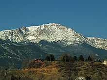
Pikes Peak |
|
01966-10-15-0000October 15, 1966
(#66000245) |
10 miles (16 km) west of Colorado Springs in the Pike National Forest
38°50′27″N 105°02′37″W / 38.840833°N 105.043611°W / 38.840833; -105.043611 (Pikes Peak) |
Colorado Springs |
|
| 75 |
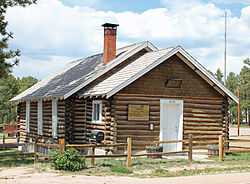
Pioneer Cabin |
Upload image |
01975-01-27-0000January 27, 1975
(#75000520) |
11 miles (18 km) north of Colorado Springs off Interstate 25
38°59′25″N 104°51′22″W / 38.990278°N 104.856111°W / 38.990278; -104.856111 (Pioneer Cabin) |
United States Air Force Academy |
|
| 76 |
Plaza Hotel |
|
01983-09-01-0000September 1, 1983
(#83001317) |
830 N. Tejon St.
38°50′46″N 104°49′21″W / 38.846111°N 104.8225°W / 38.846111; -104.8225 (Plaza Hotel) |
Colorado Springs |
|
| 77 |
Ponderosa Lodge |
|
02008-08-29-0000August 29, 2008
(#08000829) |
6145 Shoup Rd.
39°00′33″N 104°43′00″W / 39.009172°N 104.716532°W / 39.009172; -104.716532 (Ponderosa Lodge) |
Colorado Springs |
|
| 78 |
Ida M. Rice House |
|
02006-11-21-0000November 21, 2006
(#06001049) |
1196 N. Cascade Ave.
38°51′02″N 104°49′28″W / 38.850556°N 104.824444°W / 38.850556; -104.824444 (Ida M. Rice House) |
Colorado Springs |
|
| 79 |
Rio Grande Engine No. 168 |
|
01979-08-10-0000August 10, 1979
(#79000601) |
9 S. Sierra Madre
38°50′03″N 104°49′41″W / 38.834278°N 104.828056°W / 38.834278; -104.828056 (Rio Grande Engine No. 168) |
Colorado Springs |
|
| 80 |
Second Midland School |
|
01980-09-12-0000September 12, 1980
(#80000895) |
815 S. 25th St.
38°50′28″N 104°51′59″W / 38.841111°N 104.866389°W / 38.841111; -104.866389 (Second Midland School) |
Colorado Springs |
|
| 81 |
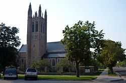
Shove Memorial Chapel |
|
02005-05-22-0000May 22, 2005
(#05000426) |
1010 N. Tejon St.
38°50′52″N 104°49′16″W / 38.847778°N 104.821111°W / 38.847778; -104.821111 (Shove Memorial Chapel) |
Colorado Springs |
|
| 82 |
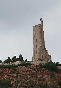
Shrine of the Sun |
|
01994-11-03-0000November 3, 1994
(#94001229) |
4250 Cheyenne Mountain Zoo Rd.
38°46′20″N 104°51′44″W / 38.772222°N 104.862222°W / 38.772222; -104.862222 (Shrine of the Sun) |
Colorado Springs |
|
| 83 |
St. Mary's Catholic Church |
|
01982-06-03-0000June 3, 1982
(#82002301) |
26 W. Kiowa St.
38°50′11″N 104°49′35″W / 38.836389°N 104.826389°W / 38.836389; -104.826389 (St. Mary's Catholic Church) |
Colorado Springs |
|
| 84 |
Stockbridge House |
|
01980-09-11-0000September 11, 1980
(#80000896) |
2801 W. Colorado Ave.
38°51′00″N 104°52′01″W / 38.85°N 104.866944°W / 38.85; -104.866944 (Stockbridge House) |
Colorado Springs |
|
| 85 |
Taylor Memorial Chapel |
|
01999-04-15-0000April 15, 1999
(#99000447) |
6145 Shoup Rd.
39°00′24″N 104°43′07″W / 39.006612°N 104.718495°W / 39.006612; -104.718495 (Taylor Memorial Chapel) |
Colorado Springs |
|
| 86 |
Ticknor Hall |
|
02000-01-27-0000January 27, 2000
(#99001704) |
926 Cascade Ave.
38°50′55″N 104°49′30″W / 38.848611°N 104.825°W / 38.848611; -104.825 (Ticknor Hall) |
Colorado Springs |
|
| 87 |
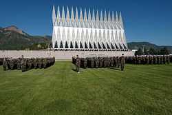
United States Air Force Academy, Cadet Area |
|
02004-04-01-0000April 1, 2004
(#04000484) |
Roughly between Cadet Drive and Faculty Drive
39°00′40″N 104°53′08″W / 39.011031°N 104.885469°W / 39.011031; -104.885469 (United States Air Force Academy, Cadet Area) |
United States Air Force Academy |
|
| 88 |
US Post Office and Federal Courthouse-Colorado Springs Main |
|
01986-01-22-0000January 22, 1986
(#86000170) |
210 Pikes Peak Ave.
38°50′00″N 104°49′15″W / 38.833333°N 104.820833°W / 38.833333; -104.820833 (US Post Office and Federal Courthouse-Colorado Springs Main) |
Colorado Springs |
|
| 89 |
US Post Office-Manitou Springs Main |
|
01986-01-24-0000January 24, 1986
(#86000181) |
307 Canon Ave.
38°51′36″N 104°55′03″W / 38.86°N 104.9175°W / 38.86; -104.9175 (US Post Office-Manitou Springs Main) |
Manitou Springs |
|
| 90 |
Van Briggle Pottery Company |
|
02009-04-29-0000April 29, 2009
(#09000249) |
1125 Glen Ave./231 W. Uintah St.
38°51′02″N 104°49′46″W / 38.850631°N 104.829386°W / 38.850631; -104.829386 (Van Briggle Pottery Company) |
Colorado Springs |
|
| 91 |
Wheeler Bank |
|
01980-09-12-0000September 12, 1980
(#80000898) |
717-719 Manitou Ave.
38°51′25″N 104°54′54″W / 38.856944°N 104.915°W / 38.856944; -104.915 (Wheeler Bank) |
Manitou Springs |
|
| 92 |
John Wolfe House |
|
02013-01-23-0000January 23, 2013
(#12001193) |
905 W. Cheyenne Rd.
38°48′00″N 104°50′35″W / 38.799952°N 104.843112°W / 38.799952; -104.843112 (John Wolfe House) |
Colorado Springs |
|
| 93 |
Y.W.C.A. |
|
01979-09-10-0000September 10, 1979
(#79000602) |
130 E. Kiowa St.
38°50′08″N 104°49′17″W / 38.835556°N 104.821389°W / 38.835556; -104.821389 (Y.W.C.A.) |
Colorado Springs |
|


.JPG)
.JPG)
.JPG)
.JPG)
.JPG)
.JPG)


.JPG)
.JPG)