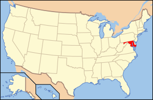
National Register of Historic Places listings in East and Northeast Baltimore
National Register of Historic Places listings in the city of Baltimore, Maryland
The locations of the National Register properties and districts listed below (at least for all showing latitude and longitude coordinates below) may be seen in a Google map by clicking on "Map of all coordinates".[1]
This list covers some of the properties in the independent city of Baltimore, but not those in the county of Baltimore surrounding the city. The county actually does not include the city; the city is an independent county-equivalent.
- This National Park Service list is complete through NPS recent listings posted May 1, 2015.[2]
Current listings
| [3] | Name on the Register | Image | Date listed[4] | Location | District[5] | Description |
|---|---|---|---|---|---|---|
| 1 | American Brewery | 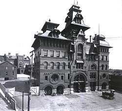 |
(#73002179) |
1701 N. Gay St. 39°18′34″N 76°35′06″W / 39.309444°N 76.585°W |
East | |
| 2 | Arcadia-Beverly Hills Historic District | 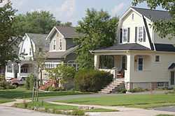 |
(#04001375) |
Moravia Rd.-Belair Rd.-Herring Run Park-Harford Rd. 39°20′13″N 76°34′06″W / 39.336944°N 76.568333°W |
Northeast | |
| 3 | Baltimore City College | .jpg) |
(#03000573) |
3320 The Alameda 39°19′17″N 76°35′46″W / 39.321389°N 76.596111°W |
Northeast | |
| 4 | Baltimore East/South Clifton Park Historic District | 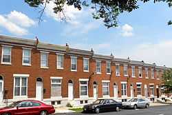 |
(#02001611) |
Roughly bounded by Clifton Park, N. Broadway, E. Chase St., and N. Rose St. 39°18′33″N 76°35′22″W / 39.309167°N 76.589444°W |
East | |
| 5 | Berea-Biddle Street Historic District | Upload image | (#14001092) |
N. Rose, & Federal Sts., Edison Hwy., PCRR. 39°18′18″N 76°34′43″W / 39.305°N 76.5785°W |
East | |
| 6 | Bohemian National Cemetery | 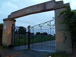 |
(#10000910) |
1300 Horners Lane 39°18′28″N 76°33′13″W / 39.307778°N 76.553611°W |
East | |
| 7 | Brewers Hill Historic District | Upload image | (#14001070) |
Roughly bounded by Eastern Ave., S. Conkling, S. Haven & Dillon Sts. 39°17′02″N 76°33′53″W / 39.2839°N 76.5647°W |
East | |
| 8 | Clifton Park | 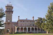 |
(#07000941) |
Bounded by Hartford Rd., Erdman Ave., Clifton Park Terrace, the Baltimore Belt Line, and Sinclair Ln. 39°19′15″N 76°34′58″W / 39.320858°N 76.582831°W |
East | |
| 9 | Clifton Park Valve House | 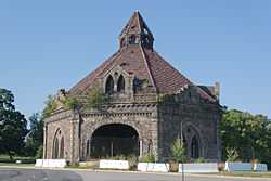 |
(#71001034) |
2801 Harford Rd. 39°19′09″N 76°35′13″W / 39.319167°N 76.586944°W |
Northeast | |
| 10 | Clifton School | 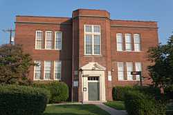 |
(#82001583) |
2670 Kennedy Ave. 39°19′18″N 76°35′46″W / 39.321667°N 76.596111°W |
Northeast | |
| 11 | Coca-Cola Bottling Company of Baltimore Building | Upload image | (#13000847) |
2525 Kirk Ave. 39°19′08″N 76°36′01″W / 39.318994°N 76.600199°W |
East | |
| 12 | Coldstream Homestead Montebello Historic District | Upload image | (#13000848) |
Roughly bounded by The Alameda, Kennedy & Kirk Aves., Harford Rd., E. 32nd & E. 33rd Sts. 39°19′19″N 76°35′36″W / 39.321948°N 76.593246°W |
East | |
| 13 | East Monument Historic District | 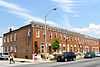 |
(#09001061) |
N. Washington St. on the west, an Amtrak rail line on the north to East St., south to Monument, and east to Highland Ave. 39°18′02″N 76°34′48″W / 39.300544°N 76.579944°W |
Northeast | |
| 14 | Engine House No. 6 | 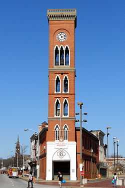 |
(#73002185) |
416 N. Gay St. 39°17′43″N 76°36′20″W / 39.295278°N 76.605556°W |
East | |
| 15 | Friends Burial Ground | 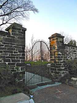 |
(#04001471) |
2506 Harford Rd. 39°19′05″N 76°35′42″W / 39.318056°N 76.595°W |
Northeast | |
| 16 | Green Mount Cemetery | 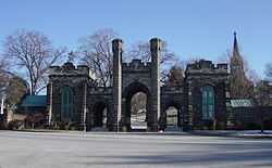 |
(#80001786) |
Bounded by North and Greenmount Aves. and Ensor and Hoffman Sts. 39°18′31″N 76°36′24″W / 39.308611°N 76.606667°W |
East | |
| 17 | Gompers School | 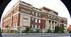 |
(#85001272) |
1701 E. North Ave. 39°18′43″N 76°35′41″W / 39.311944°N 76.594722°W |
East | |
| 18 | L. Grief and Bro., Inc. Manufactory | 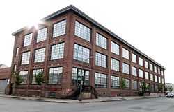 |
(#07001284) |
901 N. Milton Ave. 39°18′05″N 76°34′57″W / 39.301389°N 76.5825°W |
East | |
| 19 | Gunther Brewing Company | |
(#02001607) |
1200, 1211, and 1301 S. Conkling St., 3601 and 3701 O'Donnell St., the eastern side of S. Conkling St., and the rear eastern side of S. Conkling St. 39°16′46″N 76°34′00″W / 39.2795°N 76.566706°W |
East | |
| 20 | Industrial Building | 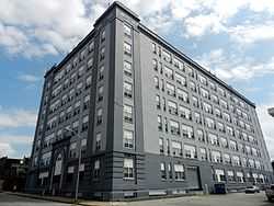 |
(#80001788) |
501 E. Preston St. 39°18′16″N 76°36′31″W / 39.304444°N 76.608611°W |
East | |
| 21 | Lauraville Historic District | 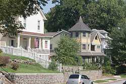 |
(#01001371) |
Roughly bounded by Harford Rd., Herring Run Creek, Cold Spring Ln., Charlton Ave., Halcyon Ave., Grindon Rd., and Echodale Ave. 39°20′44″N 76°34′23″W / 39.345556°N 76.573056°W |
Northeast | |
| 22 | Mayfield Historic District | 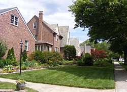 |
(#03001371) |
Lake Montebello Rd.-Chesterfield Ave.,-Crossland Ave.-Erdman Ave. 39°19′49″N 76°34′48″W / 39.330278°N 76.58°W |
Northeast | |
| 23 | North Central Historic District | 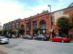 |
(#02001606) |
Roughly bounded by North Ave., Greenmount Ave., Falls Rd., and Interstate 83 39°18′34″N 76°36′48″W / 39.309444°N 76.613333°W |
East | |
| 24 | Null House | 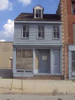 |
(#83002936) |
1037 Hillen St. 39°17′46″N 76°36′22″W / 39.296111°N 76.606111°W |
East | |
| 25 | Oak Street Garage | Upload image | (#13000849) |
2600 N. Howard St. 39°19′10″N 76°37′14″W / 39.319392°N 76.620455°W |
East | |
| 26 | Old East Baltimore Historic District | 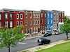 |
(#06001175) |
Generally bounded by Jones Falls, Greenmount Cemetery, North Ave., Broadway, and Madison, Ashland and Eager Sts. 39°18′19″N 76°36′16″W / 39.305278°N 76.604444°W |
East | |
| 27 | Old Hamilton Library | 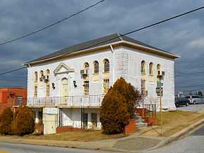 |
(#12000817) |
3006 Hamilton Ave. 39°21′06″N 76°33′39″W / 39.351796°N 76.560869°W |
Northeast | |
| 28 | Old Town Savings Bank | 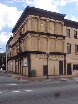 |
(#96000470) |
353 N. Gay St. 39°17′40″N 76°36′24″W / 39.294444°N 76.606667°W |
East | part of the Cast Iron Architecture of Baltimore MPS |
| 29 | Public School No. 37 | 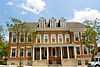 |
(#79001112) |
E. Biddle St. and N. Patterson Park Ave. 39°18′16″N 76°35′08″W / 39.304444°N 76.585556°W |
East | |
| 30 | Public School No. 99 | 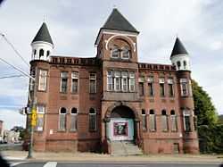 |
(#79001113) |
E. North Ave. and N. Washington St. 39°18′46″N 76°35′25″W / 39.312778°N 76.590278°W |
East | |
| 31 | Public School No. 109 | 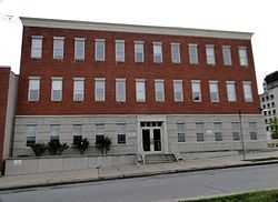 |
(#79001110) |
N. Broadway and Ashland Ave. 39°18′01″N 76°35′39″W / 39.300278°N 76.594167°W |
East | |
| 32 | Rowhouses at 303-327 East North Avenue | 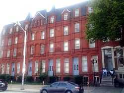 |
(#84001351) |
303-327 E. North Ave. 39°18′40″N 76°36′43″W / 39.311111°N 76.611944°W |
East | |
| 33 | St. James the Less Roman Catholic Church | 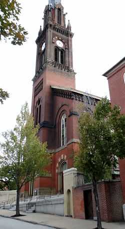 |
(#82004750) |
Aisquith St. at Eager St. 39°18′04″N 76°36′08″W / 39.301111°N 76.602222°W |
East | |
| 34 | St. John the Evangelist Roman Catholic Church | 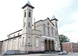 |
(#82004751) |
901 E. Eager St. 39°18′05″N 76°36′17″W / 39.301389°N 76.604722°W |
East | |
| 35 | Hans Schuler Studio and Residence | 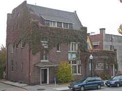 |
(#85002510) |
5 East Lafayette Ave. 39°18′34″N 76°36′57″W / 39.309583°N 76.615833°W |
East | |
| 36 | Sydenham Hospital for Communicable Diseases | 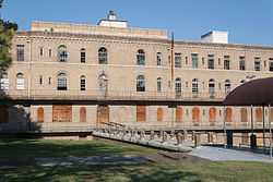 |
(#98001294) |
Argonne Dr., west of Herring Rd. 39°20′16″N 76°34′52″W / 39.337778°N 76.581111°W |
Northeast | |
| 37 | Taylor's Chapel | 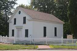 |
(#83002940) |
6001 Hillen Rd., Mount Pleasant Park 39°21′46″N 76°34′40″W / 39.362778°N 76.577778°W |
Northeast | |
| 38 | Upper Fells Point Historic District | 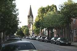 |
(#07001034) |
Roughly bounded by E. Baltimore St., S. Chapel St., E. Pratt St., S. Patterson Park Ave., and S. Chester, Gough, and S. Bethel Sts. 39°17′19″N 76°35′16″W / 39.288636°N 76.587833°W |
East |
See also
| Wikimedia Commons has media related to National Register of Historic Places in Baltimore, Maryland. |
References
- ↑ The latitude and longitude information provided in this table was derived originally from the National Register Information System, which has been found to be fairly accurate for about 99% of listings. For about 1% of NRIS original coordinates, experience has shown that one or both coordinates are typos or otherwise extremely far off; some corrections may have been made. A more subtle problem causes many locations to be off by up to 150 yards, depending on location in the country: most NRIS coordinates were derived from tracing out latitude and longitudes off of USGS topographical quadrant maps created under the North American Datum of 1927, which differs from the current, highly accurate WGS84 GPS system used by most on-line maps. Chicago is about right, but NRIS longitudes in Washington are higher by about 4.5 seconds, and are lower by about 2.0 seconds in Maine. Latitudes differ by about 1.0 second in Florida. Some locations in this table may have been corrected to current GPS standards.
- ↑ "National Register of Historic Places: Weekly List Actions". National Park Service, United States Department of the Interior. Retrieved on May 1, 2015.
- ↑ Numbers represent an ordering by significant words. Various colorings, defined here, differentiate National Historic Landmarks and historic districts from other NRHP buildings, structures, sites or objects.
- ↑ The eight-digit number below each date is the number assigned to each location in the National Register Information System database, which can be viewed by clicking the number.
- ↑ Official Baltimore neighborhoods, defined here
| |||||||||||||||||||||||||