| [3] |
Name on the Register[4] |
Image |
Date listed[5] |
Location |
City or town |
Description |
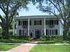
|---|
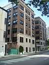
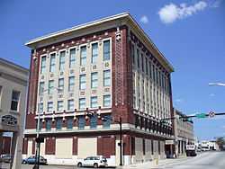
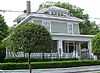
| 1 |
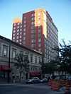
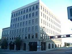
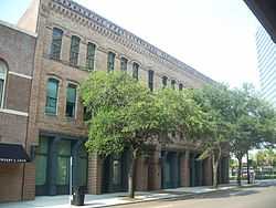
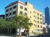
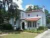
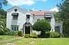
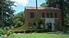
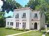
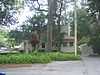
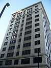
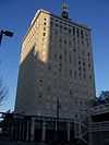
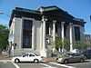
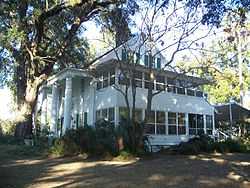
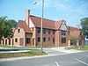
310 West Church Street Apartments |
|
01983-04-07-0000April 7, 1983
(#83001421) |
420 North Julia Street
30°19′50″N 81°39′41″W / 30.330556°N 81.661389°W / 30.330556; -81.661389 (310 West Church Street Apartments) |
Jacksonville |
|
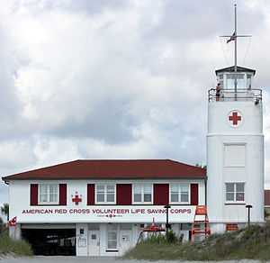
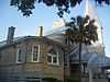
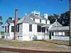
| 2 |
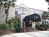
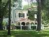
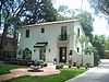
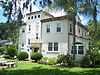
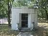
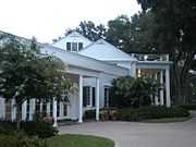
American Red Cross Volunteer Life Saving Corps Station |
|
02014-05-05-0000May 5, 2014
(#14000187) |
2 Ocean Front North
30°17′22″N 81°23′23″W / 30.2894791°N 81.3897182°W / 30.2894791; -81.3897182 (American Red Cross Volunteer Life Saving Corps Station) |
Jacksonville Beach |
|
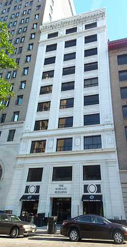
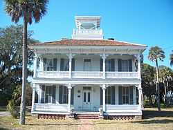
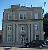
| 3 |
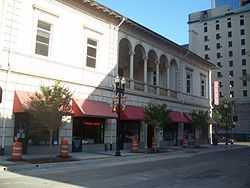
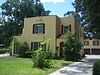
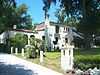
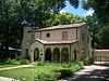
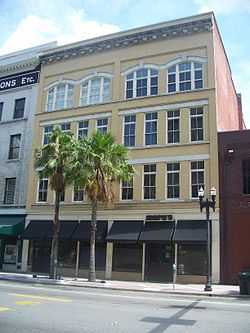
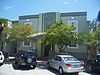
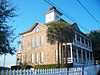
Atlantic National Bank Annex |
|
01997-11-07-0000November 7, 1997
(#97001328) |
118 West Adams Street
30°19′40″N 81°39′36″W / 30.327778°N 81.66°W / 30.327778; -81.66 (Atlantic National Bank Annex) |
Jacksonville |
Part of the Downtown Jacksonville Multiple Property Submission
|
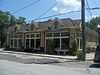
| 4 |
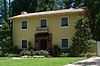
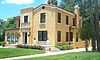
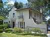
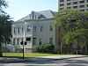
Avondale Historic District |
|
01989-07-06-0000July 6, 1989
(#89000494) |
Roughly bounded by Roosevelt Boulevard, Belvedere Avenue, Seminole Road, the St. Johns River, and Talbot Avenue
30°18′11″N 81°42′19″W / 30.303056°N 81.705278°W / 30.303056; -81.705278 (Avondale Historic District) |
Jacksonville |
|
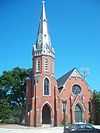
| 5 |
Bethel Baptist Institutional Church |
|
01978-04-06-0000April 6, 1978
(#78000938) |
1058 Hogan Street
30°20′09″N 81°39′30″W / 30.335833°N 81.658333°W / 30.335833; -81.658333 (Bethel Baptist Institutional Church) |
Jacksonville |
|
| 6 |
Brewster Hospital |
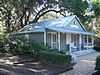
|
01976-05-13-0000May 13, 1976
(#76000588) |
915 West Monroe Street
30°19′52″N 81°40′08″W / 30.331111°N 81.668889°W / 30.331111; -81.668889 (Brewster Hospital) |
Jacksonville |
|
| 7 |
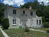
Napoleon Bonaparte Broward House |
|
01972-12-27-0000December 27, 1972
(#72000308) |
9953 Hecksher Drive
30°24′09″N 81°25′58″W / 30.4025°N 81.432778°W / 30.4025; -81.432778 (Napoleon Bonaparte Broward House) |
Jacksonville |
|
| 8 |
Buckman and Ulmer Building |
|
01992-12-30-0000December 30, 1992
(#92001694) |
29-33 West Monroe Street
30°19′43″N 81°39′10″W / 30.328611°N 81.652778°W / 30.328611; -81.652778 (Buckman and Ulmer Building) |
Jacksonville |
Part of the Downtown Jacksonville Multiple Property Submission
|
| 9 |
Carling Hotel |
|
01991-02-28-0000February 28, 1991
(#91000225) |
33 West Adams Street
30°19′42″N 81°39′29″W / 30.328333°N 81.658056°W / 30.328333; -81.658056 (Carling Hotel) |
Jacksonville |
|
| 10 |
Casa Marina Hotel |
|
01993-09-02-0000September 2, 1993
(#93000893) |
12 Sixth Avenue, North
30°17′40″N 81°23′26″W / 30.294444°N 81.390556°W / 30.294444; -81.390556 (Casa Marina Hotel) |
Jacksonville Beach |
|
| 11 |
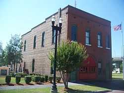
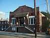
Catherine Street Fire Station |
|
01972-06-13-0000June 13, 1972
(#72000309) |
14 Catherine Street
30°19′30″N 81°39′02″W / 30.325°N 81.650556°W / 30.325; -81.650556 (Catherine Street Fire Station) |
Jacksonville |
|
| 12 |
Centennial Hall at Edward Waters College |
|
01976-05-04-0000May 4, 1976
(#76000589) |
1715 Kings Road[6]
30°20′40″N 81°41′04″W / 30.344444°N 81.684444°W / 30.344444; -81.684444 (Centennial Hall at Edward Waters College) |
Jacksonville |
|
| 13 |
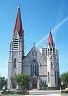
Church of the Immaculate Conception |
|
01992-12-30-0000December 30, 1992
(#92001695) |
121 East Duval Street
30°19′44″N 81°39′19″W / 30.328889°N 81.655278°W / 30.328889; -81.655278 (Church of the Immaculate Conception) |
Jacksonville |
Part of the Downtown Jacksonville Multiple Property Submission
|
| 14 |
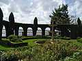
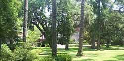
Cummer Gardens |
|
02010-01-25-0000January 25, 2010
(#09000345) |
829 Riverside Ave.
30°18′56″N 81°40′34″W / 30.315442°N 81.676189°W / 30.315442; -81.676189 (Cummer Gardens) |
Jacksonville |
|
| 15 |
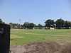
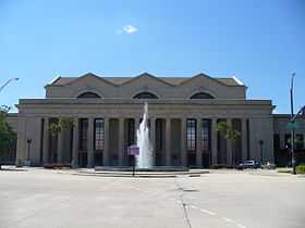
Joseph H. Durkee Athletic Field |
|
02013-07-11-0000July 11, 2013
(#13000484) |
1701 Myrtle Avenue
30°20′47″N 81°40′30″W / 30.346389°N 81.675°W / 30.346389; -81.675 (Joseph H. Durkee Athletic Field) |
Jacksonville |
|
| 16 |
Dyal-Upchurch Building |
|
01980-04-17-0000April 17, 1980
(#80000947) |
4 East Bay Street
30°19′33″N 81°39′27″W / 30.325833°N 81.6575°W / 30.325833; -81.6575 (Dyal-Upchurch Building) |
Jacksonville |
|
| 17 |
El Modelo Block |
|
01980-10-16-0000October 16, 1980
(#80000948) |
513 West Bay Street
30°19′38″N 81°39′53″W / 30.327222°N 81.664722°W / 30.327222; -81.664722 (El Modelo Block) |
Jacksonville |
|
| 18 |
Elks Club Building |
|
02000-03-09-0000March 9, 2000
(#00000151) |
201-213 North Laura Street
30°19′41″N 81°39′32″W / 30.328056°N 81.658889°W / 30.328056; -81.658889 (Elks Club Building) |
Jacksonville |
Part of the Downtown Jacksonville Multiple Property Submission
|
| 19 |
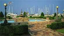
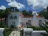
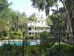
Epping Forest |
|
01973-05-09-0000May 9, 1973
(#73000576) |
Christopher Point, off San Jose Boulevard
30°14′54″N 81°38′26″W / 30.248333°N 81.640556°W / 30.248333; -81.640556 (Epping Forest) |
Jacksonville |
|
| 20 |
Evergreen Cemetery |
|
02011-04-08-0000April 8, 2011
(#11000157) |
4535 N Main St
30°22′01″N 81°39′03″W / 30.366944°N 81.650833°W / 30.366944; -81.650833 (Evergreen Cemetery) |
Jacksonville |
|
| 21 |
Florida Baptist Building |
|
01984-01-12-0000January 12, 1984
(#84000844) |
218 West Church Street
30°19′49″N 81°39′37″W / 30.330278°N 81.660278°W / 30.330278; -81.660278 (Florida Baptist Building) |
Jacksonville |
|
| 22 |
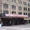
Florida Theater |
|
01982-11-04-0000November 4, 1982
(#82001034) |
128-134 East Forsyth Street
30°19′34″N 81°39′20″W / 30.326111°N 81.655556°W / 30.326111; -81.655556 (Florida Theater) |
Jacksonville |
|
| 23 |
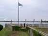
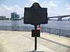
Fort Caroline National Memorial |
|
01966-10-15-0000October 15, 1966
(#66000061) |
10 miles east of downtown Jacksonville
30°23′13″N 81°30′02″W / 30.386944°N 81.500556°W / 30.386944; -81.500556 (Fort Caroline National Memorial) |
Jacksonville |
|
| 24 |
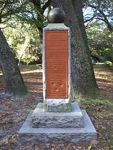
Grand Site |
|
01975-06-20-0000June 20, 1975
(#75000551) |
Address Restricted
|
Jacksonville |
|
| 25 |
Groover-Stewart Drug Company Building |
|
01992-12-30-0000December 30, 1992
(#92001696) |
25 North Market Street
30°19′33″N 81°38′08″W / 30.325833°N 81.635556°W / 30.325833; -81.635556 (Groover-Stewart Drug Company Building) |
Jacksonville |
Part of the Downtown Jacksonville Multiple Property Submission
|
| 26 |
House at 3325 Via de la Reina |
|
01985-04-10-0000April 10, 1985
(#85000739) |
3325 Via de la Reina
30°14′42″N 81°37′41″W / 30.245°N 81.628056°W / 30.245; -81.628056 (House at 3325 Via de la Reina) |
Jacksonville |
Part of the San Jose Estates TR
|
| 27 |
House at 3335 Via de la Reina |
|
01985-04-10-0000April 10, 1985
(#85000740) |
3335 Via de la Reina
30°14′42″N 81°37′40″W / 30.245°N 81.627778°W / 30.245; -81.627778 (House at 3335 Via de la Reina) |
Jacksonville |
Part of the San Jose Estates TR
|
| 28 |
House at 3500 Via de la Reina |
|
01985-04-10-0000April 10, 1985
(#85000741) |
3500 Via de la Reina
30°14′39″N 81°37′32″W / 30.244167°N 81.625556°W / 30.244167; -81.625556 (House at 3500 Via de la Reina) |
Jacksonville |
Part of the San Jose Estates TR
|
| 29 |
House at 3609 Via de la Reina |
|
01985-04-10-0000April 10, 1985
(#85000742) |
3609 Via de la Reina
30°14′39″N 81°37′28″W / 30.244167°N 81.624444°W / 30.244167; -81.624444 (House at 3609 Via de la Reina) |
Jacksonville |
Part of the San Jose Estates TR
|
| 30 |
House at 3685 Via de la Reina |
|
01985-04-10-0000April 10, 1985
(#85000743) |
3685 Via de la Reina
30°14′34″N 81°37′14″W / 30.242778°N 81.620556°W / 30.242778; -81.620556 (House at 3685 Via de la Reina) |
Jacksonville |
Part of the San Jose Estates TR
|
| 31 |
House at 3703 Via de la Reina |
|
01985-04-10-0000April 10, 1985
(#85000744) |
3703 Via de la Reina
30°14′32″N 81°37′06″W / 30.242222°N 81.618333°W / 30.242222; -81.618333 (House at 3703 Via de la Reina) |
Jacksonville |
Part of the San Jose Estates TR
|
| 32 |
House at 3764 Ponce de Leon Avenue |
|
01985-04-10-0000April 10, 1985
(#85000745) |
3764 Ponce de Leon Avenue
30°14′38″N 81°37′13″W / 30.243889°N 81.620278°W / 30.243889; -81.620278 (House at 3764 Ponce de Leon Avenue) |
Jacksonville |
Part of the San Jose Estates TR
|
| 33 |
House at 7144 Madrid Avenue |
|
01985-04-10-0000April 10, 1985
(#85000746) |
7144 Madrid Avenue
30°14′53″N 81°37′54″W / 30.248056°N 81.631667°W / 30.248056; -81.631667 (House at 7144 Madrid Avenue) |
Jacksonville |
Part of the San Jose Estates TR
|
| 34 |
House at 7207 Ventura Avenue |
|
01985-04-10-0000April 10, 1985
(#85000747) |
7207 Ventura Avenue
30°14′48″N 81°37′36″W / 30.246667°N 81.626667°W / 30.246667; -81.626667 (House at 7207 Ventura Avenue) |
Jacksonville |
Part of the San Jose Estates TR
|
| 35 |
House at 7217 Ventura Avenue |
|
01985-04-10-0000April 10, 1985
(#85000748) |
7217 Ventura Avenue
30°14′46″N 81°37′36″W / 30.246111°N 81.626667°W / 30.246111; -81.626667 (House at 7217 Ventura Avenue) |
Jacksonville |
Part of the San Jose Estates TR
|
| 36 |
House at 7227 San Pedro |
|
01985-04-10-0000April 10, 1985
(#85000749) |
7227 San Pedro Road
30°14′41″N 81°37′57″W / 30.244722°N 81.6325°W / 30.244722; -81.6325 (House at 7227 San Pedro) |
Jacksonville |
Part of the San Jose Estates TR
|
| 37 |
House at 7245 San Jose Boulevard |
|
01985-04-10-0000April 10, 1985
(#85000750) |
7245 San Jose Boulevard
30°14′45″N 81°37′48″W / 30.245833°N 81.63°W / 30.245833; -81.63 (House at 7245 San Jose Boulevard) |
Jacksonville |
Part of the San Jose Estates TR
|
| 38 |
House at 7246 San Carlos |
|
01985-04-10-0000April 10, 1985
(#85000751) |
7246 San Carlos
30°14′42″N 81°37′56″W / 30.245°N 81.632222°W / 30.245; -81.632222 (House at 7246 San Carlos) |
Jacksonville |
Part of the San Jose Estates TR
|
| 39 |
House at 7246 St. Augustine Road |
|
01985-04-10-0000April 10, 1985
(#85000752) |
7246 St. Augustine Road
30°14′45″N 81°37′34″W / 30.245833°N 81.626111°W / 30.245833; -81.626111 (House at 7246 St. Augustine Road) |
Jacksonville |
Part of the San Jose Estates TR
|
| 40 |
House at 7249 San Pedro |
|
01985-04-10-0000April 10, 1985
(#85000753) |
7249 San Pedro Road
30°14′40″N 81°37′56″W / 30.244444°N 81.632222°W / 30.244444; -81.632222 (House at 7249 San Pedro) |
Jacksonville |
Part of the San Jose Estates TR
|
| 41 |
House at 7288 San Jose Boulevard |
|
01985-04-10-0000April 10, 1985
(#85000754) |
7288 San Jose Boulevard
30°14′42″N 81°37′47″W / 30.245°N 81.629722°W / 30.245; -81.629722 (House at 7288 San Jose Boulevard) |
Jacksonville |
Part of the San Jose Estates TR
|
| 42 |
House at 7306 St. Augustine Road |
|
01985-04-10-0000April 10, 1985
(#85000755) |
7306 St. Augustine Road
30°14′41″N 81°37′34″W / 30.244722°N 81.626111°W / 30.244722; -81.626111 (House at 7306 St. Augustine Road) |
Jacksonville |
Part of the San Jose Estates TR
|
| 43 |
House at 7317 San Jose Boulevard |
|
01985-04-10-0000April 10, 1985
(#85000756) |
7317 San Jose Boulevard
30°14′43″N 81°37′44″W / 30.245278°N 81.628889°W / 30.245278; -81.628889 (House at 7317 San Jose Boulevard) |
Jacksonville |
Part of the San Jose Estates TR
|
| 44 |
House at 7330 Ventura Avenue |
|
01985-04-10-0000April 10, 1985
(#85000757) |
7330 Ventura Avenue
30°14′42″N 81°37′40″W / 30.245°N 81.627778°W / 30.245; -81.627778 (House at 7330 Ventura Avenue) |
Jacksonville |
Part of the San Jose Estates TR
|
| 45 |
House at 7356 San Jose Boulevard |
|
01985-04-10-0000April 10, 1985
(#85000758) |
7356 San Jose Boulevard
30°14′40″N 81°37′43″W / 30.244444°N 81.628611°W / 30.244444; -81.628611 (House at 7356 San Jose Boulevard) |
Jacksonville |
Part of the San Jose Estates TR
|
| 46 |
House at 7400 San Jose Boulevard |
|
01985-04-10-0000April 10, 1985
(#85000759) |
7400 San Jose Boulevard
30°14′38″N 81°37′44″W / 30.243889°N 81.628889°W / 30.243889; -81.628889 (House at 7400 San Jose Boulevard) |
Jacksonville |
Part of the San Jose Estates TR
|
| 47 |
Hutchinson-Suddath Building |
|
02007-10-03-0000October 3, 2007
(#07001029) |
315-319 East Bay Street
30°19′31″N 81°39′15″W / 30.325278°N 81.654167°W / 30.325278; -81.654167 (Hutchinson-Suddath Building) |
Jacksonville |
Part of the Downtown Jacksonville Multiple Property Submission
|
| 48 |
Jacksonville Terminal Complex |
|
01976-10-22-0000October 22, 1976
(#76000590) |
1000 West Bay Street
30°19′40″N 81°40′18″W / 30.327778°N 81.671667°W / 30.327778; -81.671667 (Jacksonville Terminal Complex) |
Jacksonville |
|
| 49 |
Kingsley Plantation |
|
01970-09-29-0000September 29, 1970
(#70000182) |
Northern tip of Fort George Island at Fort George Inlet
30°26′18″N 81°26′17″W / 30.438333°N 81.438056°W / 30.438333; -81.438056 (Kingsley Plantation) |
Jacksonville |
|
| 50 |
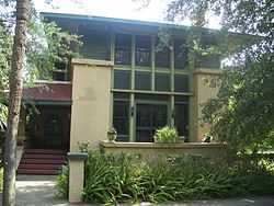
Henry John Klutho House |
|
01978-12-19-0000December 19, 1978
(#78000939) |
28-30 West 9th Street
30°20′48″N 81°39′18″W / 30.346667°N 81.655°W / 30.346667; -81.655 (Henry John Klutho House) |
Jacksonville |
|
| 51 |
W. A. Knight Building |
|
02005-03-15-0000March 15, 2005
(#05000139) |
113 West Adams Street
30°19′42″N 81°39′33″W / 30.328333°N 81.659167°W / 30.328333; -81.659167 (W. A. Knight Building) |
Jacksonville |
Part of the Downtown Jacksonville Multiple Property Submission
|
| 52 |
Lane-Towers House |
|
01982-11-10-0000November 10, 1982
(#82001035) |
3730 Richmond Street
30°17′29″N 81°42′17″W / 30.291389°N 81.704722°W / 30.291389; -81.704722 (Lane-Towers House) |
Jacksonville |
|
| 53 |
Lewis Mausoleum |
|
01997-10-24-0000October 24, 1997
(#97001225) |
Memorial Cemetery at the junction of Edgewood Avenue and Noncreif Road
30°22′52″N 81°41′47″W / 30.381111°N 81.696389°W / 30.381111; -81.696389 (Lewis Mausoleum) |
Jacksonville |
|
| 54 |
Little Theatre |
|
01991-07-12-0000July 12, 1991
(#91000895) |
2032 San Marco Boulevard
30°18′11″N 81°39′10″W / 30.303056°N 81.652778°W / 30.303056; -81.652778 (Little Theatre) |
Jacksonville |
|
| 55 |
Lynch Building |
|
02003-12-23-0000December 23, 2003
(#03001310) |
11 Forsyth Street
30°19′37″N 81°39′27″W / 30.326944°N 81.6575°W / 30.326944; -81.6575 (Lynch Building) |
Jacksonville |
Part of the Downtown Jacksonville Multiple Property Submission
|
| 56 |
Mandarin Store and Post Office |
|
02001-10-01-0000October 1, 2001
(#01001056) |
12471 Mandarin Road
30°09′39″N 81°39′35″W / 30.160833°N 81.659722°W / 30.160833; -81.659722 (Mandarin Store and Post Office) |
Jacksonville |
|
| 57 |
MAPLE LEAF (Shipwreck Site) |
|
01994-10-12-0000October 12, 1994
(#94001650) |
In the middle of the St. Johns River, 12 miles (19 km) south of downtown Jacksonville[7]
30°09′30″N 81°40′48″W / 30.1583°N 81.68°W / 30.1583; -81.68 (MAPLE LEAF (Shipwreck Site)) |
Jacksonville |
|
| 58 |
Marabanong |
|
02013-12-11-0000December 11, 2013
(#13000899) |
4747 River Point Rd.
30°18′50″N 81°37′04″W / 30.313775°N 81.617753°W / 30.313775; -81.617753 (Marabanong) |
Jacksonville |
|
| 59 |
Masonic Temple |
|
01980-09-22-0000September 22, 1980
(#80000949) |
410 Broad Street
30°19′51″N 81°39′52″W / 30.330833°N 81.664444°W / 30.330833; -81.664444 (Masonic Temple) |
Jacksonville |
|
| 60 |
Mission of San Juan del Puerto Archeological Site |
|
01986-03-25-0000March 25, 1986
(#86000595) |
Address Restricted
|
Jacksonville |
|
| 61 |
Morocco Temple |
|
01979-11-29-0000November 29, 1979
(#79000668) |
219 Newnan St.
30°19′40″N 81°39′18″W / 30.327778°N 81.655°W / 30.327778; -81.655 (Morocco Temple) |
Jacksonville |
|
| 62 |
Mount Zion AME Church |
|
01992-12-30-0000December 30, 1992
(#92001697) |
201 East Beaver Street
30°19′51″N 81°38′09″W / 30.330833°N 81.635833°W / 30.330833; -81.635833 (Mount Zion AME Church) |
Jacksonville |
Part of the Downtown Jacksonville Multiple Property Submission
|
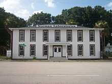
| 63 |
Norman Film Studios |
|
02014-12-29-0000December 29, 2014
(#14001084) |
6337 Arlington Rd.
30°20′01″N 81°35′37″W / 30.3335898°N 81.5936421°W / 30.3335898; -81.5936421 (Norman Film Studios) |
Jacksonville |
|
| 64 |
Old Jacksonville Free Public Library |
|
01987-01-22-0000January 22, 1987
(#86003679) |
101 East Adams Street
30°19′38″N 81°39′22″W / 30.327222°N 81.656111°W / 30.327222; -81.656111 (Old Jacksonville Free Public Library) |
Jacksonville |
|
| 65 |
Old Ortega Historic District |
|
02004-07-14-0000July 14, 2004
(#04000682) |
Bounded by Roosevelt Boulevard, Verona Avenue, and the St. Johns and Ortega Rivers
30°16′27″N 81°42′18″W / 30.274167°N 81.705°W / 30.274167; -81.705 (Old Ortega Historic District) |
Jacksonville |
|
| 66 |
Old St. Luke's Hospital |
|
01972-07-24-0000July 24, 1972
(#72000310) |
314 North Palmetto Street
30°19′33″N 81°38′49″W / 30.325833°N 81.646944°W / 30.325833; -81.646944 (Old St. Luke's Hospital) |
Jacksonville |
|
| 67 |
Plaza Hotel |
|
01992-12-30-0000December 30, 1992
(#92001698) |
353 East Forsyth Street
30°19′33″N 81°38′13″W / 30.325833°N 81.636944°W / 30.325833; -81.636944 (Plaza Hotel) |
Jacksonville |
Part of the Downtown Jacksonville Multiple Property Submission
|
| 68 |
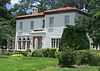
Thomas V. Porter House |
|
01976-05-13-0000May 13, 1976
(#76000592) |
510 Julia Street
30°19′52″N 81°39′40″W / 30.331111°N 81.661111°W / 30.331111; -81.661111 (Thomas V. Porter House) |
Jacksonville |
|
| 69 |
Red Bank Plantation |
|
01972-10-18-0000October 18, 1972
(#72000311) |
1230 Greenridge Road
30°17′02″N 81°39′09″W / 30.283889°N 81.6525°W / 30.283889; -81.6525 (Red Bank Plantation) |
Jacksonville |
|
| 70 |
Ribault Inn Club |
|
02000-05-11-0000May 11, 2000
(#00000470) |
Ft. George Road
30°25′41″N 81°25′28″W / 30.427994°N 81.424536°W / 30.427994; -81.424536 (Ribault Inn Club) |
Jacksonville |
|
| 71 |
Riverside Baptist Church |
|
01972-09-22-0000September 22, 1972
(#72000312) |
2650 Park Street
30°18′37″N 81°41′35″W / 30.310278°N 81.693056°W / 30.310278; -81.693056 (Riverside Baptist Church) |
Jacksonville |
|
| 72 |
Riverside Historic District |
|
01985-03-22-0000March 22, 1985
(#85000689) |
Roughly bounded by the former Seaboard Coast Line railroad line, Riverside and Memorial Parks, the St. Johns River, and Seminole
30°18′39″N 81°41′32″W / 30.310833°N 81.692222°W / 30.310833; -81.692222 (Riverside Historic District) |
Jacksonville |
|
| 73 |
St. Andrew's Episcopal Church |
|
01976-05-04-0000May 4, 1976
(#76000593) |
317 Florida Avenue
30°19′32″N 81°38′37″W / 30.325556°N 81.643611°W / 30.325556; -81.643611 (St. Andrew's Episcopal Church) |
Jacksonville |
|
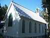
| 74 |
St. George Episcopal Church |
|
02002-08-09-0000August 9, 2002
(#02000839) |
10560 Ft. George Road, E.
30°24′48″N 81°25′48″W / 30.413333°N 81.43°W / 30.413333; -81.43 (St. George Episcopal Church) |
Jacksonville |
Part of the Florida's Carpenter Gothic Churches MPS
|
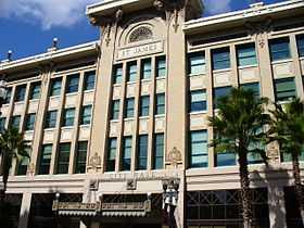
| 75 |
St. James Building |
|
01976-05-03-0000May 3, 1976
(#76000594) |
117 West Duval Street
30°19′48″N 81°39′34″W / 30.33°N 81.659444°W / 30.33; -81.659444 (St. James Building) |
Jacksonville |
|
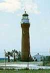
| 76 |
St. John's Lighthouse |
|
01976-06-03-0000June 3, 1976
(#76002237) |
U.S. Naval Station
30°23′36″N 81°25′35″W / 30.393333°N 81.426389°W / 30.393333; -81.426389 (St. John's Lighthouse) |
Naval Station Mayport |
|
| 77 |
John S. Sammis House |
|
01979-07-10-0000July 10, 1979
(#79000669) |
207 Noble Circle West
30°19′19″N 81°36′44″W / 30.321944°N 81.612222°W / 30.321944; -81.612222 (John S. Sammis House) |
Jacksonville |
|
| 78 |
San Jose Administration Building |
|
01985-04-10-0000April 10, 1985
(#85000760) |
7423 San Jose Boulevard
30°14′37″N 81°37′35″W / 30.243611°N 81.626389°W / 30.243611; -81.626389 (San Jose Administration Building) |
Jacksonville |
Part of the San Jose Estates TR
|
| 79 |
San Jose Country Club |
|
01985-04-10-0000April 10, 1985
(#85000761) |
7529 San Jose Boulevard
30°14′30″N 81°37′29″W / 30.241667°N 81.624722°W / 30.241667; -81.624722 (San Jose Country Club) |
Jacksonville |
Part of the San Jose Estates TR
|
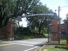
| 80 |
San Jose Estates Gatehouse |
|
01988-12-20-0000December 20, 1988
(#88002808) |
1873 Christopher Point Road, North
30°15′17″N 81°38′33″W / 30.254722°N 81.6425°W / 30.254722; -81.6425 (San Jose Estates Gatehouse) |
Jacksonville |
Part of the San Jose Estates TR
|
| 81 |
San Jose Hotel |
|
01985-04-10-0000April 10, 1985
(#85000762) |
7400 San Jose Boulevard
30°14′30″N 81°37′47″W / 30.241667°N 81.629722°W / 30.241667; -81.629722 (San Jose Hotel) |
Jacksonville |
Part of the San Jose Estates TR
|
| 82 |
Snyder Memorial Methodist Episcopal Church |
|
02013-03-13-0000March 13, 2013
(#13000065) |
226 N. Laura St.
30°19′43″N 81°39′32″W / 30.328587°N 81.658858°W / 30.328587; -81.658858 (Snyder Memorial Methodist Episcopal Church) |
Jacksonville |
|
| 83 |
South Atlantic Investment Corporation Building |
|
01992-12-30-0000December 30, 1992
(#92001699) |
35-39 West Monroe Street
30°19′43″N 81°39′08″W / 30.328611°N 81.652222°W / 30.328611; -81.652222 (South Atlantic Investment Corporation Building) |
Jacksonville |
Part of the Downtown Jacksonville Multiple Property Submission
|
| 84 |
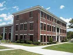
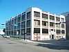
South Jacksonville Grammar School |
|
02004-04-15-0000April 15, 2004
(#04000278) |
1450 Flagler Avenue
30°18′39″N 81°39′28″W / 30.310833°N 81.657778°W / 30.310833; -81.657778 (South Jacksonville Grammar School) |
Jacksonville |
|
| 85 |
Springfield Historic District |
|
01987-01-22-0000January 22, 1987
(#86003640) |
Roughly bounded by Twelfth, Clark, and First Streets, Hogans Creek, and Boulevard
30°20′35″N 81°39′12″W / 30.343056°N 81.653333°W / 30.343056; -81.653333 (Springfield Historic District) |
Jacksonville |
|
| 86 |
Edwin M. Stanton School |
|
01983-09-29-0000September 29, 1983
(#83001446) |
521 West Ashley Street
30°19′56″N 81°39′48″W / 30.332222°N 81.663333°W / 30.332222; -81.663333 (Edwin M. Stanton School) |
Jacksonville |
|
| 87 |
Timucuan Ecological and Historic Preserve |
|
01988-02-16-0000February 16, 1988
(#01000283) |
13165 Mt. Pleasant Road
30°22′08″N 81°29′09″W / 30.368889°N 81.485833°W / 30.368889; -81.485833 (Timucuan Ecological and Historic Preserve) |
Jacksonville |
|
| 88 |
Title & Trust Company of Florida Building |
|
01990-02-23-0000February 23, 1990
(#90000312) |
200 East Forsyth Street
30°19′34″N 81°39′19″W / 30.326111°N 81.655278°W / 30.326111; -81.655278 (Title & Trust Company of Florida Building) |
Jacksonville |
|
| 89 |
Village Store |
|
01988-09-29-0000September 29, 1988
(#88001700) |
4216, 4212, and 4208 Oxford Avenue and 2906 and 2902 Corinthian Avenue
30°16′19″N 81°42′18″W / 30.271944°N 81.705°W / 30.271944; -81.705 (Village Store) |
Jacksonville |
|
| 90 |
Woman's Club of Jacksonville |
|
01992-11-03-0000November 3, 1992
(#92001505) |
861 Riverside Avenue
30°18′51″N 81°40′37″W / 30.314167°N 81.676944°W / 30.314167; -81.676944 (Woman's Club of Jacksonville) |
Jacksonville |
|
| 91 |
Yellow Bluff Fort |
|
01970-09-29-0000September 29, 1970
(#70000183) |
1 mile south of State Road 105 on New Berlin Road
30°23′58″N 81°33′22″W / 30.399444°N 81.556111°W / 30.399444; -81.556111 (Yellow Bluff Fort) |
Jacksonville |
|
| 92 |
Young Men's Hebrew Association |
|
01992-10-29-0000October 29, 1992
(#92001486) |
712 West Duval Street
30°19′50″N 81°40′01″W / 30.330556°N 81.666944°W / 30.330556; -81.666944 (Young Men's Hebrew Association) |
Jacksonville |
|


