National Register of Historic Places listings in Douglas County, Oregon

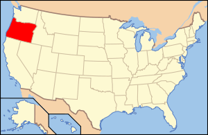
Location of Douglas County in Oregon
This list presents the full set of buildings, structures, objects, sites, or districts designated on the National Register of Historic Places in Douglas County, Oregon, and offers brief descriptive information about each of them. The National Register recognizes places of national, state, or local historic significance across the United States.[1] Out of over 90,000 National Register sites nationwide,[2] Oregon is home to over 1,950,[3] and 48 of those are found in Douglas County.
- This National Park Service list is complete through NPS recent listings posted May 1, 2015.[4]
Current listings
| [5] | Name on the Register | Image | Date listed[6] | Location | City or town | Description |
|---|---|---|---|---|---|---|
| 1 | 35-DO-130-Tahkenitch Landing Site | Upload image | (#01000132) |
Address restricted[7] |
Gardiner | |
| 2 | Charles Applegate House | .jpg) |
(#75001583) |
512 Old Applegate Road 43°36′40″N 123°16′22″W / 43.611081°N 123.272691°W |
Yoncalla | |
| 3 | Baimbridge–Kanipe Farmstead Historic District | _(douDA0045).jpg) |
(#07001506) |
16513 Elkhead Rd. 43°29′00″N 123°13′16″W / 43.483391°N 123.221131°W |
Oakland | |
| 4 | Henry Brown House |  |
(#79002057) |
19521 Highway 38 43°38′49″N 123°38′58″W / 43.646943°N 123.649398°W |
Elkton | |
| 5 | Will Q. Brown House and Wash House |  |
(#87001539) |
274 Main St. 42°56′52″N 123°21′50″W / 42.947719°N 123.363830°W |
Riddle | |
| 6 | Canyonville Methodist Church | 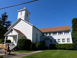 |
(#84002983) |
2nd and Pine Sts. 42°55′38″N 123°16′49″W / 42.927111°N 123.280235°W |
Canyonville | |
| 7 | China Ditch |  |
(#91000616) |
Upper reaches of N. Myrtle Cr. 43°08′45″N 123°07′55″W / 43.145733°N 123.131989°W |
Myrtle Creek | |
| 8 | Nathaniel Curry House |  |
(#83004166) |
1458 Quail Lane 43°15′50″N 123°25′56″W / 43.26396°N 123.432193°W |
Roseburg | |
| 9 | Charles D. Drain, Jr., House | _(douDA0102).jpg) |
(#78002286) |
500 S. Main St. 43°39′31″N 123°18′43″W / 43.658506°N 123.311983°W |
Drain | |
| 10 | English Settlement School | 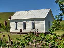 |
(#07000924) |
17455 Elkhead Rd. 43°28′20″N 123°13′27″W / 43.472122°N 123.224055°W |
Oakland | |
| 11 | First Presbyterian Church of Roseburg | 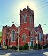 |
(#88001162) |
823 SE Lane Ave. 43°12′25″N 123°20′45″W / 43.20691944°N 123.3457472°W |
Roseburg | |
| 12 | Creed Floed House | 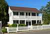 |
(#74001684) |
544 SE Douglas St. 43°12′43″N 123°20′44″W / 43.21201389°N 123.3456194°W |
Roseburg | |
| 13 | Gardiner Historic District | .jpg) |
(#93000003) |
Roughly bounded by 3rd, Camp, 2nd, Pitt, Spring, Front and Garden Sts. 43°43′49″N 124°06′36″W / 43.73027778°N 124.11°W |
Gardiner | |
| 14 | Glide Ranger Station | 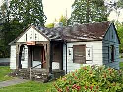 |
(#86000820) |
121 Glide Loop Drive 43°17′52″N 123°06′02″W / 43.297862°N 123.100585°W |
Glide | |
| 15 | Judge James Watson Hamilton House | 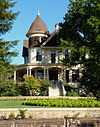 |
(#97000141) |
759 SE Kane St. 43°12′23″N 123°20′36″W / 43.206396°N 123.343307°W |
Roseburg | |
| 16 | Hershberger Mountain Lookout | 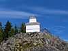 |
(#00000507) |
Approximately 7 miles (11 km) north of Union Cr. 43°02′01″N 122°27′18″W / 43.033535°N 122.454900°W |
Prospect vicinity | |
| 17 | Howell–Kohlhagen House | 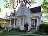 |
(#88001145) |
848 SE Jackson St. 43°12′24″N 123°20′46″W / 43.206536°N 123.346099°W |
Roseburg | |
| 18 | Kohlhagen Building | 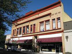 |
(#97000589) |
630 SE Jackson St. 43°12′31″N 123°20′41″W / 43.208545°N 123.344586°W |
Roseburg | |
| 19 | Laurelwood Historic District | 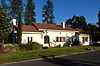 |
(#90001521) |
Roughly bounded by the S. Umpqua R., Laurelwood Ct., and Bowden Ave. 43°12′55″N 123°21′03″W / 43.215385°N 123.350806°W |
Roseburg | |
| 20 | Methodist Episcopal Church South | 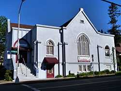 |
(#85001179) |
809 SE Main St. 43°12′24″N 123°20′41″W / 43.20656389°N 123.3448194°W |
Roseburg | |
| 21 | Mill–Pine Neighborhood Historic District |  |
(#85001348) |
Roughly bounded by Short St., Mosher Ave., Stephens St. and Rice Ave. 43°12′13″N 123°21′07″W / 43.20362778°N 123.3520361°W |
Roseburg | Beginning in 1878, this neighborhood of modest homes developed to house employees of the adjacent railroad and the service and retail workers who served them. Physical evolution of the district largely ceased after the Southern Pacific moved its operational base from Roseburg to Eugene in 1927, leaving an unusually cohesive example of a working-class residential neighborhood of the late 19th and early 20th centuries.[8] |
| 22 | Miller's Mountain House | 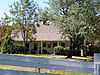 |
(#84000129) |
1195 Roberts Mountain Rd. 43°07′14″N 123°22′55″W / 43.120583°N 123.381856°W |
Roseburg | |
| 23 | Milo Academy Bridge | 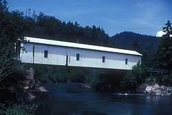 |
(#79002055) |
Southeast of Days Creek 42°56′07″N 123°02′20″W / 42.935235°N 123.038976°W |
Days Creek | |
| 24 | C. E. Moyer Nurseries Property |  |
(#88001114) |
8374 Old Hwy. 99 S. 43°06′43″N 123°25′00″W / 43.112026°N 123.416599°W |
Winston | |
| 25 | Oakland Historic District | _(douDA0061).jpg) |
(#79002058) |
Roughly bounded by Chestnut, 1st, Cedar, and 8th Sts. 43°25′21″N 123°17′51″W / 43.422533°N 123.297425°W |
Oakland | |
| 26 | Oregon State Soldier's Home Hospital | _(douDA0027).jpg) |
(#12000079) |
1624 W. Harvard Avenue 43°12′50″N 123°22′04″W / 43.21384°N 123.367706°W |
Roseburg | |
| 27 | Moses Parrott House |  |
(#80003313) |
1772 SE Jackson St. 43°11′55″N 123°21′07″W / 43.19873°N 123.351892°W |
Roseburg | |
| 28 | Rice Brothers and Adams Building | 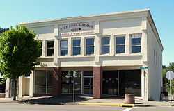 |
(#83002149) |
136 N. Main St. 43°01′30″N 123°17′23″W / 43.02503°N 123.289777°W |
Myrtle Creek | |
| 29 | Napoleon Rice House |  |
(#81000482) |
709 SE Kane St. 43°12′26″N 123°20′35″W / 43.207137°N 123.343145°W |
Roseburg | |
| 30 | Roseburg Downtown Historic District | 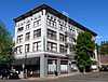 |
(#02000661) |
Roughly bounded by SP tracks, Deer Creek, Fowler, Chadwick, Kane & Mosher Sts. 43°12′34″N 123°20′38″W / 43.209444°N 123.343889°W |
Roseburg | |
| 31 | Roseburg Oregon National Guard Armory | 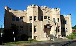 |
(#93000447) |
1034 SE Oak St. 43°12′31″N 123°20′34″W / 43.20858333°N 123.3427944°W |
Roseburg | |
| 32 | Roseburg Veterans Administration Hospital Historic District | 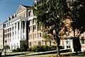 |
(#12001247) |
913 NW Garden Valley Boulevard 43°13′27″N 123°22′02″W / 43.224129°N 123.367091°W |
Roseburg | |
| 33 | Bernard Pitzer Smith House | 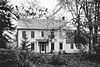 |
(#88001313) |
15892 Old Hwy. 99 S. 43°03′43″N 123°21′19″W / 43.061808°N 123.355269°W |
Myrtle Creek | |
| 34 | Henry Clay Smith House | 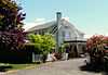 |
(#97000585) |
275 Winston Section Rd. 43°07′53″N 123°23′53″W / 43.131391°N 123.398141°W |
Winston | |
| 35 | Stephens Community Historic District | 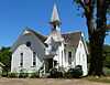 |
(#84000135) |
Fort McKay and Scott Henry Rds. 43°22′57″N 123°23′34″W / 43.382584°N 123.392830°W |
Sutherlin | |
| 36 | Susan Creek Indian Mounds Site | Upload image | (#74001683) |
Address restricted[7] |
Glide | |
| 37 | Sutherlin Bank Building | 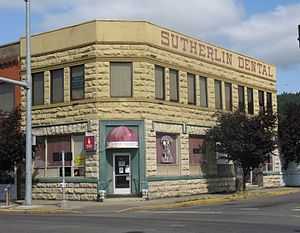 |
(#84002987) |
101 W. Central Ave. 43°23′25″N 123°18′49″W / 43.390238°N 123.313653°W |
Sutherlin | |
| 38 | Tiller Ranger Station | 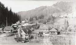 |
(#91000162) |
OR 227, Umpqua NF 42°55′39″N 122°56′52″W / 42.9275°N 122.947778°W |
Tiller | |
| 39 | U.S. Post Office | 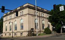 |
(#79002059) |
704 SE Cass Ave. 43°12′31″N 123°20′46″W / 43.208724°N 123.346215°W |
Roseburg | |
| 40 | Umpqua River Bridge No. 01822 | 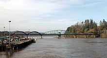 |
(#05000815) |
Oregon Route Coast 9/U.S. Route 101 at mile post 211.21 43°42′35″N 124°06′03″W / 43.709827°N 124.100922°W |
Reedsport | |
| 41 | Umpqua River Light House | _(douDA0211).jpg) |
(#77001100) |
Southwest of Winchester Bay off U.S. 101 43°39′44″N 124°11′55″W / 43.662291°N 124.198476°W |
Winchester Bay | |
| 42 | Umpqua–Eden Site | Upload image | (#95001524) |
Address restricted[7] |
Reedsport | |
| 43 | US Coast Guard Station — Umpqua River, Administration and Equipment Buildings | _(douDA0216).jpg) |
(#92000662) |
Douglas Co. Rd. 87 43°39′50″N 124°11′53″W / 43.663779°N 124.197988°W |
Winchester Bay | |
| 44 | Weaver–Worthington Farmstead | 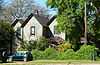 |
(#84002996) |
8873 Days Creek Cutoff Rd. 42°58′25″N 123°12′56″W / 42.973668°N 123.215624°W |
Canyonville vicinity | |
| 45 | Whaleback Snow-Survey Cabin | Upload image | (#00000514) |
Approximately 10 miles (16 km) north of Prospect 42°54′40″N 122°34′51″W / 42.911229°N 122.580729°W |
Prospect | |
| 46 | Judge William R. Willis House | 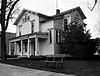 |
(#75001582) |
744 SE Rose St. 43°12′28″N 123°20′47″W / 43.207828°N 123.346379°W |
Roseburg | |
| 47 | James Wimer Octagonal Barn | _(douDA0077a).jpg) |
(#85003039) |
1191 Coos Bay Wagon Rd. 43°10′42″N 123°30′24″W / 43.178413°N 123.506745°W |
Lookingglass | |
| 48 | Winchester Dam | _(douDA0067a).jpg) |
(#96000627) |
N. Umpqua River at Hwy. 99 43°17′03″N 123°21′14″W / 43.284243°N 123.353979°W |
Winchester | |
| 49 | William C. and Agnes Winston House |  |
(#87001540) |
350 Winston Section Rd. 43°07′53″N 123°23′49″W / 43.131359°N 123.396831°W |
Winston |
Former listings
| [5] | Name on the Register | Image | Date listed | Date removed | Location | City or town | Summary |
|---|---|---|---|---|---|---|---|
| 1 | Roaring Camp Bridge |  |
(#79002056) | West of Drain |
Drain vicinity | Listed in 1979. |
See also
- National Register of Historic Places listings in Oregon
- Listings in neighboring counties: Coos, Curry, Jackson, Josephine, Klamath, Lane
- Historic preservation
- History of Oregon
- Lists of Oregon-related topics
References
- ↑ Andrus, Patrick W.; Shrimpton, Rebecca H. et al. (2002), How to Apply the National Register Criteria for Evaluation, National Register Bulletin (15), National Park Service, U.S. Department of the Interior, retrieved June 20, 2014 .
- ↑ National Park Service, National Register of Historic Places Program: Research, retrieved January 28, 2015.
- ↑ Oregon Parks and Recreation Department, Oregon Historic Sites Database, retrieved July 26, 2014. Note that a simple count of National Register records in this database returns a slightly higher total than actual listings, due to duplicate records. A close reading of detailed query results is necessary to arrive at the precise count.
- ↑ "National Register of Historic Places: Weekly List Actions". National Park Service, United States Department of the Interior. Retrieved on May 1, 2015.
- ↑ 5.0 5.1 Numbers represent an ordering by significant words. Various colorings, defined here, differentiate National Historic Landmarks and historic districts from other NRHP buildings, structures, sites or objects.
- ↑ The eight-digit number below each date is the number assigned to each location in the National Register Information System database, which can be viewed by clicking the number.
- ↑ 7.0 7.1 7.2 Federal and state laws and practices restrict general public access to information regarding the specific location of sensitive archeological sites in many instances. The main reasons for such restrictions include the potential for looting, vandalism, or trampling. See: Knoerl, John; Miller, Diane; Shrimpton, Rebecca H. (1990), Guidelines for Restricting Information about Historic and Prehistoric Resources, National Register Bulletin (29), National Park Service, U.S. Department of the Interior, OCLC 20706997.
- ↑ Clarke, Helen Jane; Kadas, Marianne; Young, Ella Mae (December 1, 1984), National Register of Historic Places Inventory — Nomination Form: Mill–Pine Historic District (PDF), retrieved March 31, 2013.
External links
- Oregon Parks and Recreation Department, National Register Program
- National Park Service, National Register of Historic Places site
 Media related to National Register of Historic Places in Douglas County, Oregon at Wikimedia Commons

| ||||||||||||||||||||||||||
| |||||||||||||||||||||