| [3] |
Name on the Register[4] |
Image |
Date listed[5] |
Location |
City or town |
Description |
|---|
| 1 |
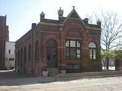
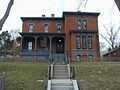
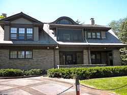
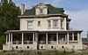
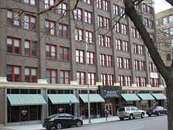
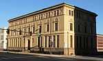
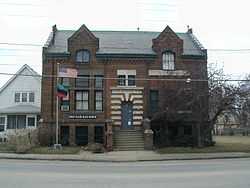
Ackerhurst-Eipperhurst Dairy Barn |
|
02002-03-28-0000March 28, 2002
(#02000272) |
15220 Military Rd.
41°20′12″N 96°09′10″W / 41.336667°N 96.152778°W / 41.336667; -96.152778 (Ackerhurst-Eipperhurst Dairy Barn) |
Bennington |
|
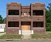
| 2 |
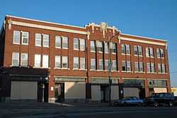
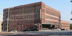
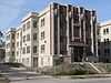
The Anderson Building |
|
02009-11-20-0000November 20, 2009
(#09000938) |
701 S. 24th St., 2243 Jones
41°15′11″N 95°56′48″W / 41.253°N 95.94667°W / 41.253; -95.94667 (The Anderson Building) |
Omaha |
Sullivanesque commercial and residential building which is a "textbook example" of its type
|
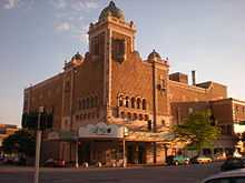
| 3 |
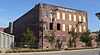
Anheuser-Busch Beer Depot |
|
01979-02-01-0000February 1, 1979
(#79001440) |
1207-1215 Jones St.
41°15′11″N 95°55′57″W / 41.253056°N 95.9325°W / 41.253056; -95.9325 (Anheuser-Busch Beer Depot) |
Omaha |
|
| 4 |
Apartments at 2514 North 16th Street |
|
02010-08-30-0000August 30, 2010
(#10000607) |
2514 N 16th St.
41°16′55″N 95°56′16″W / 41.28201°N 95.93767°W / 41.28201; -95.93767 (Apartments at 2514 North 16th Street) |
Omaha |
Apartments, Flats and Tenements in Omaha, Nebraska from 1880-1962 MPS
|
| 5 |
Aquila Court Building |
|
01973-10-02-0000October 2, 1973
(#73001059) |
1615 Howard St.
41°15′19″N 95°56′16″W / 41.255275°N 95.937845°W / 41.255275; -95.937845 (Aquila Court Building) |
Omaha |
Now operated as Magnolia Hotel[6]
|
| 6 |
Astro Theater |
|
01974-08-13-0000August 13, 1974
(#74001108) |
2001 Farnam St.
41°15′26″N 95°56′33″W / 41.257222°N 95.9425°W / 41.257222; -95.9425 (Astro Theater) |
Omaha |
|
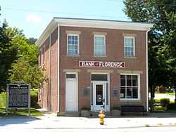
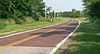
| 7 |
Bank of Florence |
|
01969-10-15-0000October 15, 1969
(#69000130) |
8502 N. 30th St.
41°20′15″N 95°57′38″W / 41.3375°N 95.960556°W / 41.3375; -95.960556 (Bank of Florence) |
Omaha |
|
| 8 |
Barker Building |
|
02008-07-02-0000July 2, 2008
(#08000605) |
306 S. 15th St.
41°15′30″N 95°56′29″W / 41.258333°N 95.941389°W / 41.258333; -95.941389 (Barker Building) |
Omaha |
|
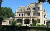
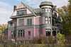
| 9 |
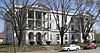
Guy C. Barton House |
Upload image |
01973-08-14-0000August 14, 1973
(#73001060) |
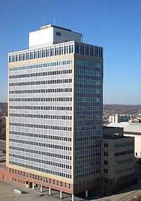
3522 Farnam St.
41°15′29″N 95°57′52″W / 41.258056°N 95.964444°W / 41.258056; -95.964444 (Guy C. Barton House) |
Omaha |
Demolished in 1982
|
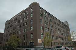
| 10 |
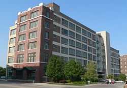
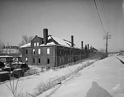
Beebe and Runyan Furniture Showroom and Warehouse |
|
01998-07-23-0000July 23, 1998
(#98000895) |
105 S. 9th St.
41°15′33″N 95°55′39″W / 41.259167°N 95.9275°W / 41.259167; -95.9275 (Beebe and Runyan Furniture Showroom and Warehouse) |
Omaha |
|
| 11 |
Bemis Omaha Bag Company Building |
|
01985-01-11-0000January 11, 1985
(#85000066) |
614-624 S. 11th St. and 1102-1118 Jones St.
41°15′13″N 95°55′52″W / 41.253611°N 95.931111°W / 41.253611; -95.931111 (Bemis Omaha Bag Company Building) |
Omaha |
|
| 12 |
Bennington State Bank |
|
02006-11-08-0000November 8, 2006
(#06000998) |
15411 S. 2nd St.
41°21′47″N 96°09′23″W / 41.36314°N 96.15629°W / 41.36314; -96.15629 (Bennington State Bank) |
Bennington |
|
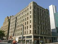
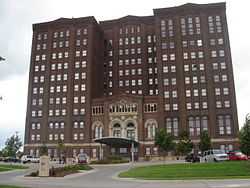
| 13 |
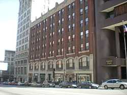
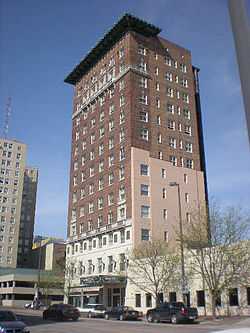
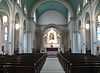
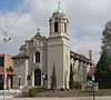
Blackstone Hotel |
|
01985-01-11-0000January 11, 1985
(#85000067) |
302 S. 36th St.
41°15′26″N 95°57′59″W / 41.257222°N 95.966389°W / 41.257222; -95.966389 (Blackstone Hotel) |
Omaha |
|
| 14 |
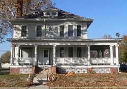
Bradford-Pettis House |
|
01983-07-21-0000July 21, 1983
(#83001090) |
400 S. 39th St.[7]
41°15′25″N 95°58′20″W / 41.257°N 95.97222°W / 41.257; -95.97222 (Bradford-Pettis House) |
Omaha |
|
| 15 |
J. L. Brandeis and Sons Store Building |
|
01982-10-20-0000October 20, 1982
(#82000601) |
200 S. 16th St.
41°15′30″N 95°56′16″W / 41.25832°N 95.93778°W / 41.25832; -95.93778 (J. L. Brandeis and Sons Store Building) |
Omaha |
|
| 16 |
Brandeis-Millard House |
|
01980-11-28-0000November 28, 1980
(#80002446) |
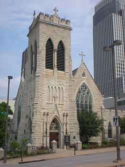
500 S. 38th St.
41°15′22″N 95°58′11″W / 41.256111°N 95.969722°W / 41.256111; -95.969722 (Brandeis-Millard House) |
Omaha |
|
| 17 |
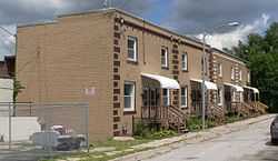
Broomfield Rowhouse |
|
02007-03-21-0000March 21, 2007
(#07000179) |
2502-2504 Lake St.
41°16′54″N 95°56′56″W / 41.28169°N 95.9488°W / 41.28169; -95.9488 (Broomfield Rowhouse) |
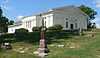
Omaha |
|
| 18 |
Burlington Headquarters Building |
|
01974-12-04-0000December 4, 1974
(#74001109) |
1004 Farnam St.
41°15′27″N 95°55′46″W / 41.2575°N 95.929444°W / 41.2575; -95.929444 (Burlington Headquarters Building) |
Omaha |
|
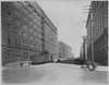
| 19 |
Burlington Train Station |
|
01974-08-07-0000August 7, 1974
(#74001110) |
925 S. 10th St.
41°14′59″N 95°55′42″W / 41.249722°N 95.928333°W / 41.249722; -95.928333 (Burlington Train Station) |
Omaha |
|
| 20 |
Cabanne Archeological Site |
Upload image |
01972-05-05-0000May 5, 1972
(#72000749) |
Address Restricted
|
Omaha |
|
| 21 |
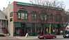
Capitol Garage |
|
02012-05-11-0000May 11, 2012
(#12000102) |
202 N. 19th St.
41°15′40″N 95°56′29″W / 41.261017°N 95.941406°W / 41.261017; -95.941406 (Capitol Garage) |
Omaha |
|
| 22 |
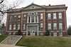
Center School |
|
01985-08-23-0000August 23, 1985
(#85001796) |
1730 S. 11th St.
41°14′30″N 95°55′50″W / 41.241667°N 95.930556°W / 41.241667; -95.930556 (Center School) |
Omaha |
|
| 23 |
Champe-Fremont 1 Archeological Site |
Upload image |
01975-10-21-0000October 21, 1975
(#75001091) |
¾ mile north of the Fremont 1 site atop bluffs overlooking the Elkhorn River[8]
41°12′06″N 96°17′37″W / 41.201667°N 96.293611°W / 41.201667; -96.293611 (Champe-Fremont 1 Archeological Site) |
Omaha |
Location is that of the Champe Site; Fremont 1 is located in Sarpy County[8]
|
| 24 |
City National Bank Building and Creighton Orpheum Theater |
|
01973-03-26-0000March 26, 1973
(#73001061) |
16th and Harney Sts.
41°15′23″N 95°56′13″W / 41.25634°N 95.93687°W / 41.25634; -95.93687 (City National Bank Building and Creighton Orpheum Theater) |
Omaha |
|
| 25 |
Columbian School |
|
01990-11-28-0000November 28, 1990
(#90001769) |
3819 Jones St.
41°15′12″N 95°58′12″W / 41.253333°N 95.97°W / 41.253333; -95.97 (Columbian School) |
Omaha |
|
| 26 |
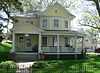
Joel N. Cornish House |
|
01974-08-13-0000August 13, 1974
(#74001111) |
1404 S. 10th St.
41°14′43″N 95°55′47″W / 41.24535°N 95.92975°W / 41.24535; -95.92975 (Joel N. Cornish House) |
Omaha |
|
| 27 |
Country Club Historic District |
|
02004-12-30-0000December 30, 2004
(#04001410) |
Roughly 50th to 56th Sts., Corby to Seward Sts.
41°16′46″N 95°59′46″W / 41.279444°N 95.996111°W / 41.279444; -95.996111 (Country Club Historic District) |
Omaha |
|
| 28 |
Gen. George Crook House |
|
01969-04-16-0000April 16, 1969
(#69000131) |
Quarters No. 1, Fort Omaha
41°18′38″N 95°57′36″W / 41.310556°N 95.96°W / 41.310556; -95.96 (Gen. George Crook House) |
Omaha |
|
| 29 |
M.A. Disbrow and Company Buildings |
|
02008-08-01-0000August 1, 2008
(#08000768) |
1201-1221 Nicholas St., 1206, 1218, 1224 Izard St.
41°16′10″N 95°55′57″W / 41.269444°N 95.9325°W / 41.269444; -95.9325 (M.A. Disbrow and Company Buildings) |
Omaha |
|
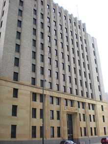
| 30 |
Douglas County Courthouse |
|
01979-10-11-0000October 11, 1979
(#79003683) |
1700 Farnam St.
41°15′25″N 95°56′20″W / 41.256944°N 95.938889°W / 41.256944; -95.938889 (Douglas County Courthouse) |
Omaha |
|
| 31 |
Drake Court Historic District |
|
01980-11-10-0000November 10, 1980
(#80002447) |
221-223, 2230, 2236 Jones St.
41°15′12″N 95°56′37″W / 41.253333°N 95.943611°W / 41.253333; -95.943611 (Drake Court Historic District) |
Omaha |
Boundary increase and decrease, and name change, on 2014-06-04; originally listed as Drake Court Apartments and the Dartmore Apartments Historic District
|
| 32 |
Dundee-Happy Hollow Historic District |
|
02005-07-22-0000July 22, 2005
(#05000726) |
Roughly Hamilton on the north, JE George and Happy Hollow on the west, Leavenworth on the south, and 48th on the east
41°15′54″N 95°59′25″W / 41.26505°N 95.990211°W / 41.26505; -95.990211 (Dundee-Happy Hollow Historic District) |
Omaha |
|
| 33 |
Eggerss-O'Flyng Building |
|
01991-12-13-0000December 13, 1991
(#91001759) |
801 S. 15th St.
41°15′07″N 95°56′08″W / 41.251944°N 95.93544°W / 41.251944; -95.93544 (Eggerss-O'Flyng Building) |
Omaha |
|
| 34 |
Farm Credit Building |
|
02011-03-29-0000March 29, 2011
(#11000148) |
206 S. 19th St.
41°15′30″N 95°56′29″W / 41.258333°N 95.941389°W / 41.258333; -95.941389 (Farm Credit Building) |
Omaha |
|
| 35 |
Farnam Building |
|
02000-03-09-0000March 9, 2000
(#00000171) |
1607-1617 Farnam St.
41°15′27″N 95°56′16″W / 41.257589°N 95.937728°W / 41.257589; -95.937728 (Farnam Building) |
Omaha |
|
| 36 |
Father Flanagan's Boys' Home |
|
01985-02-04-0000February 4, 1985
(#85002439) |
W. Dodge Rd.
41°15′52″N 96°07′58″W / 41.264444°N 96.132778°W / 41.264444; -96.132778 (Father Flanagan's Boys' Home) |
Boys Town |
|
| 37 |
Father Flanagan's House |
|
01979-09-06-0000September 6, 1979
(#79001439) |
Off U.S. Route 6
41°15′44″N 96°08′06″W / 41.262338°N 96.134877°W / 41.262338; -96.134877 (Father Flanagan's House) |
Boys Town |
|
| 38 |
Federal Office Building |
|
02009-03-17-0000March 17, 2009
(#09000131) |
106 S. 15th St.
41°15′34″N 95°56′10″W / 41.25939°N 95.93621°W / 41.25939; -95.93621 (Federal Office Building) |
Omaha |
|
| 39 |
Field Club Historic District |
|
02000-11-15-0000November 15, 2000
(#00001380) |
Roughly bounded by Pacific, 32nd Ave., Center St., and 36th St.
41°14′39″N 95°57′47″W / 41.244167°N 95.963056°W / 41.244167; -95.963056 (Field Club Historic District) |
Omaha |
|
| 40 |
First National Bank Building |
|
01982-06-25-0000June 25, 1982
(#82003187) |
300-312 16th St. and 1601-1605 Farnam St.
41°15′26″N 95°56′15″W / 41.2573°N 95.93747°W / 41.2573; -95.93747 (First National Bank Building) |
Omaha |
|
| 41 |
First Unitarian Church of Omaha |
|
01980-03-27-0000March 27, 1980
(#80002448) |
3114 Harney St.
41°15′25″N 95°57′30″W / 41.256944°N 95.958389°W / 41.256944; -95.958389 (First Unitarian Church of Omaha) |
Omaha |
|
| 42 |
Flatiron Hotel |
|
01978-09-21-0000September 21, 1978
(#78003403) |
1722 St. Mary's Ave.
41°15′19″N 95°56′22″W / 41.25534°N 95.93947°W / 41.25534; -95.93947 (Flatiron Hotel) |
Omaha |
|
| 43 |
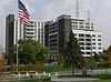
Ford Hospital |
|
01986-03-20-0000March 20, 1986
(#86000444) |
121-129 S. 25th St.
41°15′32″N 95°56′52″W / 41.258889°N 95.947778°W / 41.258889; -95.947778 (Ford Hospital) |
Omaha |
|
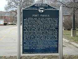
| 44 |
Fort Omaha Historic District |
|
01974-03-27-0000March 27, 1974
(#74001112) |
30th St. between Fort St. and Laurel Ave.
41°18′29″N 95°57′32″W / 41.308056°N 95.958889°W / 41.308056; -95.958889 (Fort Omaha Historic District) |
Omaha |
|
| 45 |
Franklin School |
|
01998-02-05-0000February 5, 1998
(#98000070) |
4302 S. 39th Ave.
41°12′59″N 95°58′22″W / 41.21645°N 95.97274°W / 41.21645; -95.97274 (Franklin School) |
Omaha |
|
| 46 |
Gallagher Building |
|
01994-07-01-0000July 1, 1994
(#94000653) |
1902-1906 S. 13th St.
41°14′28″N 95°56′01″W / 41.24121°N 95.93354°W / 41.24121; -95.93354 (Gallagher Building) |
Omaha |
|
| 47 |
Garneau-Kilpatrick House |
|
01982-10-07-0000October 7, 1982
(#82000602) |
3100 Chicago St.
41°15′45″N 95°57′31″W / 41.2625°N 95.958611°W / 41.2625; -95.958611 (Garneau-Kilpatrick House) |
Omaha |
|
| 48 |
Georgia Row House |
|
01982-11-12-0000November 12, 1982
(#82000603) |
1040-1044 S. 29th St.
41°14′58″N 95°57′18″W / 41.24953°N 95.95489°W / 41.24953; -95.95489 (Georgia Row House) |
Omaha |
|
| 49 |
Gold Coast Historic District |
|
01997-03-14-0000March 14, 1997
(#97000237) |
Roughly bounded by 36th, 40th, Jones, and Cuming Sts.
41°15′39″N 95°58′08″W / 41.260833°N 95.968889°W / 41.260833; -95.968889 (Gold Coast Historic District) |
Omaha |
|
| 50 |
Havens-Page House |
|
01982-10-07-0000October 7, 1982
(#82000604) |
101 N. 39th St.
41°15′21″N 95°57′51″W / 41.255833°N 95.964167°W / 41.255833; -95.964167 (Havens-Page House) |
Omaha |
|
| 51 |
Hill Hotel |
|
01988-04-20-0000April 20, 1988
(#88000377) |
509 S. 16th St.
41°15′19″N 95°56′12″W / 41.255278°N 95.936667°W / 41.255278; -95.936667 (Hill Hotel) |
Omaha |
|
| 52 |
Holy Family Church |
|
01986-07-17-0000July 17, 1986
(#86001715) |
915 N. 18th St.
41°16′07″N 95°56′20″W / 41.268611°N 95.938889°W / 41.268611; -95.938889 (Holy Family Church) |
Omaha |
|
| 53 |
Anton Hospe Music Warehouse |
|
01998-07-23-0000July 23, 1998
(#98000896) |
109-111 S. 10th St.
41°15′33″N 95°55′43″W / 41.25919°N 95.92872°W / 41.25919; -95.92872 (Anton Hospe Music Warehouse) |
Omaha |
Now part of the Omaha Downtown Courtyard Marriott hotel; also occupied by Advanced Surgery Center.
|
| 54 |
Howard Street Apartment District |
|
01996-11-22-0000November 22, 1996
(#96001382) |
Roughly bounded by Harney St., 22nd St., Landon Ct., and 24th St.
41°15′21″N 95°56′44″W / 41.255833°N 95.945556°W / 41.255833; -95.945556 (Howard Street Apartment District) |
Omaha |
|
| 55 |
Hupmobile Building |
Upload image |
02014-11-12-0000November 12, 2014
(#14000909) |
2523-2525 Farnam St.
Coordinates missing |
Omaha |
|
| 56 |
Immaculate Conception Church and School |
|
01998-05-06-0000May 6, 1998
(#98000390) |
2708–2716 S. 24th St.[9]
41°14′01″N 95°56′51″W / 41.233611°N 95.9475°W / 41.233611; -95.9475 (Immaculate Conception Church and School) |
Omaha |
Church still operating; school building has been converted to apartments.
|
| 57 |
Jewell Building |
|
01983-07-21-0000July 21, 1983
(#83001091) |
2221-2225 N. 24th St.
41°16′47″N 95°56′49″W / 41.2796°N 95.94683°W / 41.2796; -95.94683 (Jewell Building) |
Omaha |
|
| 58 |
George A. Joslyn Mansion |
|
01972-08-25-0000August 25, 1972
(#72000747) |
3902 Davenport St.
41°15′42″N 95°58′19″W / 41.2617°N 95.97181°W / 41.2617; -95.97181 (George A. Joslyn Mansion) |
Omaha |
|
| 59 |
Keeline Building |
|
02000-03-09-0000March 9, 2000
(#00000170) |
319 S. 17th St.
41°15′23″N 95°56′16″W / 41.256389°N 95.937778°W / 41.256389; -95.937778 (Keeline Building) |
Omaha |
|
| 60 |
George H. Kelly House |
|
01983-07-21-0000July 21, 1983
(#09140009) |
1924 Binney St.
41°17′11″N 95°56′31″W / 41.28627°N 95.94197°W / 41.28627; -95.94197 (George H. Kelly House) |
Omaha |
|
| 61 |
Kennedy Building |
|
01985-08-23-0000August 23, 1985
(#85001794) |
1517 Jackson St.
41°15′15″N 95°56′13″W / 41.254167°N 95.93694°W / 41.254167; -95.93694 (Kennedy Building) |
Omaha |
|
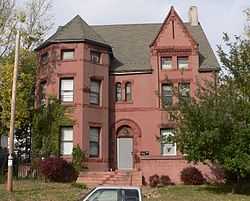
| 62 |
Mary Rogers Kimball House |
|
01996-07-19-0000July 19, 1996
(#96000765) |
2236 St. Mary's Ave.
41°15′16″N 95°56′46″W / 41.25433°N 95.94611°W / 41.25433; -95.94611 (Mary Rogers Kimball House) |
Omaha |
|
| 63 |
Kirschbraun and Sons Creamery, Inc. |
|
01998-07-23-0000July 23, 1998
(#98000894) |
901 Dodge St.
41°15′34″N 95°55′41″W / 41.25936°N 95.92812°W / 41.25936; -95.92812 (Kirschbraun and Sons Creamery, Inc.) |
Omaha |
|
| 64 |
Leone, Florentine and Carpathia Apartment Buildings |
|
01985-05-16-0000May 16, 1985
(#85001073) |
832 S. 24th St., 834 S. 24th St., and 907-911 S. 25th St.
41°15′04″N 95°56′53″W / 41.25122°N 95.94806°W / 41.25122; -95.94806 (Leone, Florentine and Carpathia Apartment Buildings) |
Omaha |
|
| 65 |
Lincoln Highway |
|
01987-12-01-0000December 1, 1987
(#87002098) |
County Road 120 between 180th and 191st Sts.
41°17′00″N 96°11′45″W / 41.283333°N 96.195833°W / 41.283333; -96.195833 (Lincoln Highway) |
Elkhorn |
|
| 66 |
Lincoln Highway-Omaha to Elkhorn |
|
02003-03-13-0000March 13, 2003
(#03000104) |
Segment of approximately 3 miles (4.8 km) along N. 174 St.
41°16′18″N 96°12′07″W / 41.271667°N 96.201944°W / 41.271667; -96.201944 (Lincoln Highway-Omaha to Elkhorn) |
Elkhorn |
|
| 67 |
Livestock Exchange Building |
|
01999-07-07-0000July 7, 1999
(#99000751) |
2900 O Plaza
41°12′36″N 95°57′06″W / 41.21°N 95.951667°W / 41.21; -95.951667 (Livestock Exchange Building) |
Omaha |
|
| 68 |
The Logan |
|
02005-07-22-0000July 22, 2005
(#05000721) |
1804 Dodge
41°15′36″N 95°56′25″W / 41.26°N 95.94017°W / 41.26; -95.94017 (The Logan) |
Omaha |
|
| 69 |
Main Street Bridge |
|
01992-06-29-0000June 29, 1992
(#92000746) |
Main St. over W. Papillion Creek
41°16′54″N 96°14′14″W / 41.281667°N 96.237222°W / 41.281667; -96.237222 (Main Street Bridge) |
Elkhorn |
Apparently demolished and replaced with concrete slab bridge in photo.
|
| 70 |
Malcolm X House Site |
|
01984-03-01-0000March 1, 1984
(#84002463) |
3448 Pinkney St.
41°17′26″N 95°57′49″W / 41.290556°N 95.963611°W / 41.290556; -95.963611 (Malcolm X House Site) |
Omaha |
|
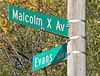
| 71 |
The Margaret |
|
02007-05-15-0000May 15, 2007
(#07000427) |
2103 N. 16th St.
41°16′41″N 95°56′13″W / 41.27798°N 95.93705°W / 41.27798; -95.93705 (The Margaret) |
Omaha |
|
| 72 |
Mason School |
|
01986-03-13-0000March 13, 1986
(#86000339) |
1012 S. 24th St.
41°15′01″N 95°56′52″W / 41.25021°N 95.94789°W / 41.25021; -95.94789 (Mason School) |
Omaha |
|
| 73 |
Charles D. McLaughlin House |
|
01982-11-08-0000November 8, 1982
(#82000605) |
507 S. 38th St.
41°15′20″N 95°58′07″W / 41.255556°N 95.96861°W / 41.255556; -95.96861 (Charles D. McLaughlin House) |
Omaha |
|
| 74 |
The Melrose |
|
01989-11-29-0000November 29, 1989
(#89002044) |
602 N. 33rd St.
41°15′54″N 95°57′43″W / 41.26498°N 95.96183°W / 41.26498; -95.96183 (The Melrose) |
Omaha |
|
| 75 |
Memmen Apartments |
|
02014-09-22-0000September 22, 2014
(#14000701) |
2214, 2216, 2218 & 2220 Florence Blvd.
41°16′47″N 95°56′28″W / 41.2797°N 95.941°W / 41.2797; -95.941 (Memmen Apartments) |
Omaha |
|
| 76 |
Dr. Samuel D. Mercer House |
|
01976-06-17-0000June 17, 1976
(#76001130) |
3920 Cuming St.
41°16′07″N 95°58′20″W / 41.2685°N 95.97211°W / 41.2685; -95.97211 (Dr. Samuel D. Mercer House) |
Omaha |
|
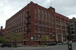
| 77 |
Meyer and Raapke |
|
02013-09-04-0000September 4, 2013
(#13000673) |
1403-1407 Harney St.[10]
41°15′23″N 95°56′06″W / 41.256269°N 95.934924°W / 41.256269; -95.934924 (Meyer and Raapke) |
Omaha |
Part of the Warehouses in Omaha MPS
|
| 78 |
Military Road Segment |
|
01993-12-10-0000December 10, 1993
(#93001400) |
Junction of 82nd and Fort Sts.
41°18′31″N 96°02′34″W / 41.308611°N 96.042778°W / 41.308611; -96.042778 (Military Road Segment) |
Omaha |
|
| 79 |
Minne Lusa Residential Historic District |
Upload image |
02014-04-25-0000April 25, 2014
(#14000178) |
Roughly bounded by Redick Ave., Vane, N. 30th & N. 24th Sts.
41°19′15″N 95°57′07″W / 41.320833°N 95.951944°W / 41.320833; -95.951944 (Minne Lusa Residential Historic District) |
Omaha |
|
| 80 |
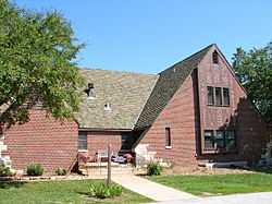
Monmouth Park School |
Upload image |
01983-12-15-0000December 15, 1983
(#83003988) |
4508 N. 33rd St.
41°17′59″N 95°57′41″W / 41.299611°N 95.961369°W / 41.299611; -95.961369 (Monmouth Park School) |
Omaha |
Demolished in 1995.[11]
|
| 81 |
G.C. Moses Block |
|
02000-03-09-0000March 9, 2000
(#00000169) |
1234-1244 S. 13th St.
41°14′48″N 95°56′01″W / 41.24668°N 95.9335°W / 41.24668; -95.9335 (G.C. Moses Block) |
Omaha |
|
| 82 |
Moyer Row Houses |
|
02008-03-12-0000March 12, 2008
(#08000171) |
2612-2614 and 2616-2618 Dewey
41°15′22″N 95°57′04″W / 41.25617°N 95.95103°W / 41.25617; -95.95103 (Moyer Row Houses) |
Omaha |
|
| 83 |
Nash Block |
|
01985-05-16-0000May 16, 1985
(#85001072) |
902-912 Farnam
41°15′28″N 95°55′40″W / 41.257778°N 95.927778°W / 41.257778; -95.927778 (Nash Block) |
Omaha |
|
| 84 |
Henry B. Neef House |
|
02010-09-16-0000September 16, 2010
(#10000758) |
2884 Iowa St.
41°19′29″N 95°57′22″W / 41.324722°N 95.956111°W / 41.324722; -95.956111 (Henry B. Neef House) |
Omaha |
|
| 85 |
Nicholas Street Historic District |
|
02009-03-02-0000March 2, 2009
(#09000070) |
Bounded by North 11th Street, Izard, North 14th Street and a line parallel to and roughly 450 feet (140 m) north of Nicholas Street
41°16′11″N 95°55′56″W / 41.269828°N 95.932164°W / 41.269828; -95.932164 (Nicholas Street Historic District) |
Omaha |
|
| 86 |
Normandie Apartments |
|
01991-12-06-0000December 6, 1991
(#91001758) |
1102 Park Ave.
41°14′55″N 95°57′21″W / 41.248611°N 95.955833°W / 41.248611; -95.955833 (Normandie Apartments) |
Omaha |
|
| 87 |
North Presbyterian Church |
|
01986-03-20-0000March 20, 1986
(#86000443) |
3105 N. 24th St.
41°17′14″N 95°56′48″W / 41.28714°N 95.94666°W / 41.28714; -95.94666 (North Presbyterian Church) |
Omaha |
|
| 88 |
Northern Natural Gas Building |
|
02009-08-26-0000August 26, 2009
(#09000649) |
2223 Dodge Street
41°15′34″N 95°56′47″W / 41.259444°N 95.94625°W / 41.259444; -95.94625 (Northern Natural Gas Building) |
Omaha |
|
| 89 |
Northwestern Bell Telephone Company Regional Headquarters |
|
02009-07-17-0000July 17, 2009
(#09000526) |
100 S. 19th St.
41°15′34″N 95°56′30″W / 41.25939°N 95.94165°W / 41.25939; -95.94165 (Northwestern Bell Telephone Company Regional Headquarters) |
Omaha |
|
| 90 |
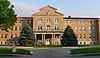
Notre Dame Academy and Convent |
|
01998-03-05-0000March 5, 1998
(#98000192) |
3501 State St.
41°20′04″N 95°58′06″W / 41.334444°N 95.968333°W / 41.334444; -95.968333 (Notre Dame Academy and Convent) |
Omaha |
|
| 91 |
The Nottingham Apartments |
|
02013-04-23-0000April 23, 2013
(#13000195) |
3304 Burt St.
41°16′02″N 95°57′43″W / 41.267152°N 95.961857°W / 41.267152; -95.961857 (The Nottingham Apartments) |
Omaha |
|
| 92 |
Oft-Gordon House |
|
02010-03-17-0000March 17, 2010
(#10000080) |
11523 156th St.
41°21′52″N 96°09′29″W / 41.36447°N 96.15807°W / 41.36447; -96.15807 (Oft-Gordon House) |
Bennington |
Now operated as Oft's Bed & Breakfast.[12]
|
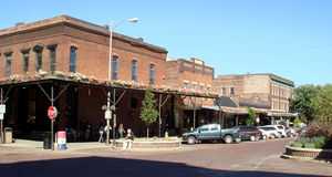
| 93 |
Old Market Historic District |
|
01979-03-23-0000March 23, 1979
(#79001441) |
Bounded by 13th, Farnam, 10th, and Jackson
41°15′20″N 95°55′51″W / 41.255556°N 95.930833°W / 41.255556; -95.930833 (Old Market Historic District) |
Omaha |
|
| 94 |
Old People's Home |
|
01987-10-21-0000October 21, 1987
(#87001182) |
3325 Fontenelle Boulevard
41°17′25″N 95°58′56″W / 41.29022°N 95.98236°W / 41.29022; -95.98236 (Old People's Home) |
Omaha |
Now known as the Leo Vaughan Senior Manor
|
| 95 |
Olson's Market |
|
02013-09-03-0000September 3, 2013
(#13000276) |
6115 Maple St.
41°17′06″N 96°00′29″W / 41.284865°N 96.007918°W / 41.284865; -96.007918 (Olson's Market) |
Omaha |
|
| 96 |
Omaha Bolt, Nut and Screw Building |
|
01992-07-10-0000July 10, 1992
(#92000816) |
1316 Jones St.
41°15′13″N 95°56′02″W / 41.253611°N 95.934°W / 41.253611; -95.934 (Omaha Bolt, Nut and Screw Building) |
Omaha |
|
| 97 |
Omaha Ford Motor Company Assembly Plant |
|
02004-12-29-0000December 29, 2004
(#04001412) |
1514-1524 Cuming St.
41°16′05″N 95°56′11″W / 41.268056°N 95.936389°W / 41.268056; -95.936389 (Omaha Ford Motor Company Assembly Plant) |
Omaha |
|
| 98 |
Omaha High School |
|
01979-10-11-0000October 11, 1979
(#79003684) |
124 N. 20th St.
41°15′39″N 95°56′36″W / 41.260833°N 95.943333°W / 41.260833; -95.943333 (Omaha High School) |
Omaha |
Omaha Central High School
|
| 99 |
Omaha National Bank Building |
|
01972-10-18-0000October 18, 1972
(#72000748) |
17th and Farnam Sts.
41°15′28″N 95°56′16″W / 41.257778°N 95.937778°W / 41.257778; -95.937778 (Omaha National Bank Building) |
Omaha |
|
| 100 |
Omaha Park and Boulevard System |
|
02013-04-23-0000April 23, 2013
(#13000196) |
20 city parks, 4 golf courses, 19 connecting blvds., including Riverview, Hanscom, Fontenelle Parks
41°14′32″N 95°57′29″W / 41.242233°N 95.957984°W / 41.242233; -95.957984 (Omaha Park and Boulevard System) |
Omaha |
|
| 101 |
Omaha Public Library |
|
01978-05-22-0000May 22, 1978
(#78001696) |
1823 Harney St.
41°15′23″N 95°56′26″W / 41.25633°N 95.94058°W / 41.25633; -95.94058 (Omaha Public Library) |
Omaha |
|
| 102 |
Omaha Quartermaster Depot Historic District |
|
01979-07-26-0000July 26, 1979
(#79003685) |
Roughly bounded by Hickory and 22nd Sts., Woolworth Ave., and the Union Pacific railroad line
41°14′39″N 95°56′36″W / 41.244167°N 95.943333°W / 41.244167; -95.943333 (Omaha Quartermaster Depot Historic District) |
Omaha |
|
| 103 |
Omaha Rail and Commerce Historic District |
|
01996-07-19-0000July 19, 1996
(#96000769) |
Roughly bounded by Jackson, 15th, and 8th Sts., and the Union Pacific main line
41°15′09″N 95°55′46″W / 41.2525°N 95.929444°W / 41.2525; -95.929444 (Omaha Rail and Commerce Historic District) |
Omaha |
|
| 104 |
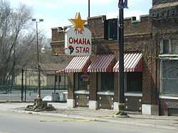
The Omaha Star |
|
02007-12-27-0000December 27, 2007
(#07001322) |
2216 N 24th St.
41°16′47″N 95°56′49″W / 41.279722°N 95.946944°W / 41.279722; -95.946944 (The Omaha Star) |
Omaha |
|
| 105 |
The Ottawa Block |
|
02013-04-22-0000April 22, 2013
(#13000197) |
2401 Farnam St.
41°15′26″N 95°56′50″W / 41.257361°N 95.947118°W / 41.257361; -95.947118 (The Ottawa Block) |
Omaha |
|
| 106 |
Packer's National Bank Building |
|
01985-05-16-0000May 16, 1985
(#85001071) |
4939 S. 24th St.
41°12′30″N 95°56′48″W / 41.20847°N 95.94679°W / 41.20847; -95.94679 (Packer's National Bank Building) |
Omaha |
|
| 107 |
Park Avenue Apartment District |
|
02008-07-02-0000July 2, 2008
(#08000602) |
2935 Leavenworth St., 804 Park Ave., 803 S. 30th St., 2934 Leavenworth St., 720 Park Ave., 721 S. 30th St.
41°15′10″N 95°57′22″W / 41.252778°N 95.956111°W / 41.252778; -95.956111 (Park Avenue Apartment District) |
Omaha |
|
| 108 |
Park School |
|
01989-11-29-0000November 29, 1989
(#89002043) |
1320 S. 29th St.
41°14′46″N 95°57′17″W / 41.246°N 95.95478°W / 41.246; -95.95478 (Park School) |
Omaha |
|
| 109 |
Frank Parker Archeological Site |
Upload image |
02009-03-04-0000March 4, 2009
(#09000069) |
Address Restricted
|
Florence |
Extends into Washington County[4]
|
| 110 |
Peerless Motor Company |
|
02007-11-15-0000November 15, 2007
(#07001188) |
2562-2564 Harney St.
41°15′25″N 95°56′58″W / 41.25681°N 95.94944°W / 41.25681; -95.94944 (Peerless Motor Company) |
Omaha |
|
| 111 |
Carl Penke Farm |
Upload image |
02007-03-21-0000March 21, 2007
(#07000178) |
10525 N. 168th St.
41°21′17″N 96°10′24″W / 41.354639°N 96.173403°W / 41.354639; -96.173403 (Carl Penke Farm) |
Bennington |
|
| 112 |
Poppleton Block |
|
01982-10-07-0000October 7, 1982
(#82000606) |
1001 Farnam St.
41°15′26″N 95°55′45″W / 41.257222°N 95.929167°W / 41.257222; -95.929167 (Poppleton Block) |
Omaha |
|
| 113 |
Porter-Thomsen House |
|
01982-10-21-0000October 21, 1982
(#82000607) |
3426 Lincoln Boulevard
41°16′09″N 95°57′52″W / 41.26906°N 95.96458°W / 41.26906; -95.96458 (Porter-Thomsen House) |
Omaha |
|
| 114 |
Prague Hotel |
|
01987-07-09-0000July 9, 1987
(#87001148) |
1402 S. 13th St.
41°14′43″N 95°56′00″W / 41.245278°N 95.933333°W / 41.245278; -95.933333 (Prague Hotel) |
Omaha |
|
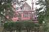
| 115 |
John E. Reagan House |
|
02014-05-05-0000May 5, 2014
(#14000201) |
2102 Pinkney St.
41°17′27″N 95°56′39″W / 41.29077°N 95.944034°W / 41.29077; -95.944034 (John E. Reagan House) |
Omaha |
|
| 116 |
Redick Tower |
|
01984-06-21-0000June 21, 1984
(#84002470) |
1504 Harney St.
41°15′25″N 95°56′10″W / 41.25681°N 95.93621°W / 41.25681; -95.93621 (Redick Tower) |
Omaha |
|
| 117 |
J. C. Robinson House |
|
01980-11-28-0000November 28, 1980
(#80002452) |
102 E. Lincoln Ave.
41°17′33″N 96°16′51″W / 41.2925°N 96.280833°W / 41.2925; -96.280833 (J. C. Robinson House) |
Waterloo |
|
| 118 |
Lizzie Robinson House |
|
01993-02-25-0000February 25, 1993
(#93000058) |
2864 Corby St.
41°17′04″N 95°57′17″W / 41.284444°N 95.954722°W / 41.284444; -95.954722 (Lizzie Robinson House) |
Omaha |
|
| 119 |
Rose Realty-Securities Building |
|
01996-07-19-0000July 19, 1996
(#96000766) |
305 S. 16th St.
41°15′26″N 95°56′13″W / 41.25727°N 95.93688°W / 41.25727; -95.93688 (Rose Realty-Securities Building) |
Omaha |
|
| 120 |
Rosewater School |
|
01985-05-16-0000May 16, 1985
(#85001070) |
3764 S. 13th St.
41°13′25″N 95°56′02″W / 41.22349°N 95.93379°W / 41.22349; -95.93379 (Rosewater School) |
Omaha |
|
| 121 |
Sacred Heart Catholic Church Complex |
|
01983-03-24-0000March 24, 1983
(#83001093) |
2218 Binney St.
41°17′11″N 95°56′45″W / 41.28626°N 95.94576°W / 41.28626; -95.94576 (Sacred Heart Catholic Church Complex) |
Omaha |
|
| 122 |
Saddle Creek Underpass |
|
01992-06-29-0000June 29, 1992
(#92000741) |
U.S. Route 6 (Dodge St.) over Saddle Creek Rd.
41°15′35″N 95°58′50″W / 41.25968°N 95.98044°W / 41.25968; -95.98044 (Saddle Creek Underpass) |
Omaha |
|
| 123 |
St. Cecilia's Cathedral |
|
01979-01-25-0000January 25, 1979
(#79001442) |
701 N. 40th St.
41°15′59″N 95°58′18″W / 41.266389°N 95.971667°W / 41.266389; -95.971667 (St. Cecilia's Cathedral) |
Omaha |
|
| 124 |
St. John's A.M.E. Church |
|
01980-05-29-0000May 29, 1980
(#80002449) |
2402 N. 22nd St.
41°16′51″N 95°56′42″W / 41.280833°N 95.945°W / 41.280833; -95.945 (St. John's A.M.E. Church) |
Omaha |
|
| 125 |
Saint Joseph Parish Complex |
|
01986-07-17-0000July 17, 1986
(#86001716) |
1730 S. 16th St.
41°14′30″N 95°56′15″W / 41.241667°N 95.9375°W / 41.241667; -95.9375 (Saint Joseph Parish Complex) |
Omaha |
|
| 126 |
St. Martin of Tours Episcopal Church |
|
01982-10-21-0000October 21, 1982
(#82000608) |
2312 J St.
41°12′54″N 95°56′48″W / 41.21493°N 95.94664°W / 41.21493; -95.94664 (St. Martin of Tours Episcopal Church) |
Omaha |
|
| 127 |
St. Matthias' Episcopal Church |
|
01980-11-23-0000November 23, 1980
(#80002450) |
1423 S. 10th St.
41°14′42″N 95°55′44″W / 41.24492°N 95.92884°W / 41.24492; -95.92884 (St. Matthias' Episcopal Church) |
Omaha |
|
| 128 |
St. Philomena's Cathedral and Rectory |
|
01980-01-03-0000January 3, 1980
(#80002451) |
1335 S. 10th St.
41°14′45″N 95°55′43″W / 41.245833°N 95.928611°W / 41.245833; -95.928611 (St. Philomena's Cathedral and Rectory) |
Omaha |
Now known as St. Frances Cabrini Church; adjacent school has been renamed All Saints
|
| 129 |
St. Richard's Catholic School and Rectory |
|
02012-03-12-0000March 12, 2012
(#12000103) |
4318 & 4320 Fort St.
41°18′29″N 95°58′43″W / 41.307931°N 95.978678°W / 41.307931; -95.978678 (St. Richard's Catholic School and Rectory) |
Omaha |
|
| 130 |
Sanford Hotel |
|
01985-09-26-0000September 26, 1985
(#85002556) |
1913 Farnam St.
41°15′26″N 95°56′30″W / 41.25736°N 95.94178°W / 41.25736; -95.94178 (Sanford Hotel) |
Omaha |
Now the Conant Apartments.
|
| 131 |
Saunders School |
|
01986-03-13-0000March 13, 1986
(#86000336) |
415 N. 41st Ave.
41°15′48″N 95°58′28″W / 41.263333°N 95.974444°W / 41.263333; -95.974444 (Saunders School) |
Omaha |
|
| 132 |
Scottish Rite Cathedral |
|
02011-08-10-0000August 10, 2011
(#11000529) |
202 S. 20th St.
41°15′30″N 95°56′34″W / 41.258333°N 95.942778°W / 41.258333; -95.942778 (Scottish Rite Cathedral) |
Omaha |
|
| 133 |
Selby Apartments |
|
02004-12-30-0000December 30, 2004
(#04001411) |
830 S. 37th St., 3710 Marcy St., and 825 S. 37th Ave.
41°15′05″N 95°58′04″W / 41.251389°N 95.967778°W / 41.251389; -95.967778 (Selby Apartments) |
Omaha |
|
| 134 |
Selma Terrace |
|
02008-07-02-0000July 2, 2008
(#08000603) |
630, 634 and 636 Park Ave.
41°15′11″N 95°57′21″W / 41.253056°N 95.955833°W / 41.253056; -95.955833 (Selma Terrace) |
Omaha |
|
| 135 |
M. F. Shafer and Co. Building |
|
02002-12-05-0000December 5, 2002
(#02001477) |
1624 Webster
41°15′57″N 95°56′17″W / 41.265833°N 95.938056°W / 41.265833; -95.938056 (M. F. Shafer and Co. Building) |
Omaha |
|
| 136 |
Simon Brothers Company |
|
01999-04-01-0000April 1, 1999
(#99000423) |
1024 Dodge St.
41°15′36″N 95°55′48″W / 41.25997°N 95.93008°W / 41.25997; -95.93008 (Simon Brothers Company) |
Omaha |
|
| 137 |
South Omaha Main Street Historic District |
|
01989-02-14-0000February 14, 1989
(#88002828) |
Roughly S. 24th St. between M and O Sts.
41°12′35″N 95°56′49″W / 41.209722°N 95.946944°W / 41.209722; -95.946944 (South Omaha Main Street Historic District) |
Omaha |
|
| 138 |
Christian Specht Building |
|
01977-09-19-0000September 19, 1977
(#77000828) |
1110 Douglas St.
41°15′32″N 95°55′52″W / 41.25879°N 95.93106°W / 41.25879; -95.93106 (Christian Specht Building) |
Omaha |
|
| 139 |
Stabrie Grocery |
|
02007-11-15-0000November 15, 2007
(#07001189) |
501 N 13th St.
41°15′50″N 95°56′01″W / 41.263889°N 95.933611°W / 41.263889; -95.933611 (Stabrie Grocery) |
Omaha |
|
| 140 |
Standard Oil Company Building of Nebraska |
|
01979-08-24-0000August 24, 1979
(#79001443) |
500 S. 18th St.
41°15′19″N 95°56′24″W / 41.25539°N 95.94001°W / 41.25539; -95.94001 (Standard Oil Company Building of Nebraska) |
Omaha |
|
| 141 |
Steiner Rowhouse No. 1 |
|
01991-07-03-0000July 3, 1991
(#91000836) |
638-642 S. 19th St.
41°15′12″N 95°56′27″W / 41.2532°N 95.94091°W / 41.2532; -95.94091 (Steiner Rowhouse No. 1) |
Omaha |
|
| 142 |
Steiner Rowhouse No. 2 |
|
01991-07-03-0000July 3, 1991
(#91000837) |
1906-1910 Jones St.
41°15′11″N 95°56′28″W / 41.25314°N 95.94114°W / 41.25314; -95.94114 (Steiner Rowhouse No. 2) |
Omaha |
|
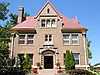
| 143 |
Gottlieb Storz House |
|
01974-08-07-0000August 7, 1974
(#74001113) |
3708 Farnam St.
41°15′29″N 95°58′04″W / 41.258056°N 95.967778°W / 41.258056; -95.967778 (Gottlieb Storz House) |
Omaha |
|
| 144 |
Strehlow Terrace |
|
01986-12-23-0000December 23, 1986
(#86003446) |
2024 and 2107 N. 16th St.
41°16′41″N 95°56′18″W / 41.278056°N 95.938333°W / 41.278056; -95.938333 (Strehlow Terrace) |
Omaha |
Now operated as Ernie Chambers Court[13]
|
| 145 |
Swartz Printing Company Building |
|
02007-07-03-0000July 3, 2007
(#07000658) |
714 S. 15th St.
41°15′10″N 95°56′10″W / 41.25278°N 95.93617°W / 41.25278; -95.93617 (Swartz Printing Company Building) |
Omaha |
|
| 146 |
Swoboda Bakery |
|
01996-07-19-0000July 19, 1996
(#96000768) |
1422 William St.
41°14′45″N 95°56′09″W / 41.24576°N 95.93579°W / 41.24576; -95.93579 (Swoboda Bakery) |
Omaha |
|
| 147 |
Terrace Court |
|
02008-07-02-0000July 2, 2008
(#08000604) |
836, 840 and 842 Park Ave.
41°15′04″N 95°57′21″W / 41.251111°N 95.955833°W / 41.251111; -95.955833 (Terrace Court) |
Omaha |
|
| 148 |
The Berkeley Apartments |
|
01996-07-19-0000July 19, 1996
(#96000767) |
649 S. 19th Ave.
41°15′11″N 95°56′29″W / 41.25319°N 95.94133°W / 41.25319; -95.94133 (The Berkeley Apartments) |
Omaha |
|
| 149 |
The Sherman |
|
01986-03-13-0000March 13, 1986
(#86000334) |
2501 N. 16th St.
41°16′55″N 95°56′13″W / 41.281944°N 95.936944°W / 41.281944; -95.936944 (The Sherman) |
Omaha |
|
| 150 |
H. Thiessen Pickle Company |
|
02011-12-13-0000December 13, 2011
(#11000887) |
3101 S. 24th St.
41°13′49″N 95°56′49″W / 41.23038°N 95.94683°W / 41.23038; -95.94683 (H. Thiessen Pickle Company) |
Omaha |
|
| 151 |
Traver Brothers Row Houses |
|
02013-05-21-0000May 21, 2013
(#12001074) |
2601–2607 Jones St. & 651–672 S. 26th Ave.
41°15′11″N 95°57′03″W / 41.253166°N 95.950940°W / 41.253166; -95.950940 (Traver Brothers Row Houses) |
Omaha |
|
| 152 |
Trinity Cathedral |
|
01974-08-07-0000August 7, 1974
(#74001114) |
113 N. 18th St.
41°15′37″N 95°56′21″W / 41.260278°N 95.939167°W / 41.260278; -95.939167 (Trinity Cathedral) |
Omaha |
|
| 153 |
Turner Court Apartments |
Upload image |
02014-11-12-0000November 12, 2014
(#14000910) |
3106 Dodge St.
Coordinates missing |
Omaha |
|
| 154 |
Twin Towers |
|
02010-03-22-0000March 22, 2010
(#10000081) |
3000, 3002 and 3002½ Farnam St.; 3001 Douglas St.
41°15′29″N 95°57′25″W / 41.258011°N 95.956961°W / 41.258011; -95.956961 (Twin Towers) |
Omaha |
|
| 155 |
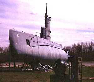
U.S.S. HAZARD and U.S.S. MARLIN |
|
01979-01-17-0000January 17, 1979
(#79001444) |
2500 N. 24th St.
41°16′35″N 95°54′05″W / 41.276389°N 95.901389°W / 41.276389; -95.901389 (U.S.S. HAZARD and U.S.S. MARLIN) |
Omaha |
|
| 156 |
Undine Apartments |
|
02008-03-12-0000March 12, 2008
(#08000172) |
2620-2626 Dewey Ave.
41°15′22″N 95°57′05″W / 41.25611°N 95.95139°W / 41.25611; -95.95139 (Undine Apartments) |
Omaha |
|
| 157 |
Union Passenger Terminal |
|
01971-11-12-0000November 12, 1971
(#71000484) |
10th and Marcy Sts.
41°15′05″N 95°55′40″W / 41.251389°N 95.927778°W / 41.251389; -95.927778 (Union Passenger Terminal) |
Omaha |
|
| 158 |
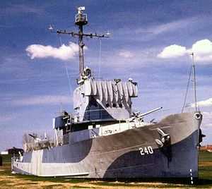
USS HAZARD (AM-240) National Historic Landmark |
|
01979-01-01-0000January 1, 1979
(#79003712) |
2500 N. 24th St.
41°16′35″N 95°54′05″W / 41.276389°N 95.901389°W / 41.276389; -95.901389 (USS HAZARD (AM-240) National Historic Landmark) |
Omaha |
|
| 159 |
Vinton School |
|
01989-11-29-0000November 29, 1989
(#89002045) |
2120 Deer Park Boulevard
41°13′43″N 95°56′40″W / 41.22862°N 95.94452°W / 41.22862; -95.94452 (Vinton School) |
Omaha |
|
| 160 |
Vinton Street Commercial Historic District |
|
02006-07-11-0000July 11, 2006
(#06000608) |
Vinton St. between Elm St. and S 17th St.
41°14′00″N 95°56′20″W / 41.233333°N 95.938889°W / 41.233333; -95.938889 (Vinton Street Commercial Historic District) |
Omaha |
|
| 161 |
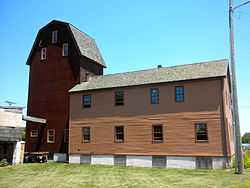
Weber Mill |
|
01998-12-31-0000December 31, 1998
(#98001568) |
9102 N. 30th St.
41°20′37″N 95°57′41″W / 41.343611°N 95.961389°W / 41.343611; -95.961389 (Weber Mill) |
Omaha |
aka Florence Mill
|
| 162 |
Webster Telephone Exchange Building |
|
01977-12-05-0000December 5, 1977
(#77000829) |
2213 Lake St.
41°16′53″N 95°56′44″W / 41.281389°N 95.945556°W / 41.281389; -95.945556 (Webster Telephone Exchange Building) |
Omaha |
|
| 163 |
West Lawn Mausoleum |
|
02004-12-30-0000December 30, 2004
(#04001409) |
5701 Center St.
41°14′11″N 95°59′57″W / 41.23652°N 95.99926°W / 41.23652; -95.99926 (West Lawn Mausoleum) |
Omaha |
|
| 164 |
Wohlner's Neighborhood Grocery |
|
02010-09-16-0000September 16, 2010
(#10000759) |
5203 Leavenworth St.
41°15′08″N 95°59′44″W / 41.252222°N 95.995556°W / 41.252222; -95.995556 (Wohlner's Neighborhood Grocery) |
Omaha |
|
| 165 |
Edgar Zabriskie House |
|
01978-11-28-0000November 28, 1978
(#78001697) |
3524 Hawthorne Ave.
41°16′13″N 95°57′56″W / 41.270278°N 95.965556°W / 41.270278; -95.965556 (Edgar Zabriskie House) |
Omaha |
|
_from_NW_1.JPG)

_from_NE_3.JPG)
_from_SE_3.JPG)
.jpg)
_from_NW_1.JPG)
_from_NE_2.jpg)
_from_NE_4.JPG)
_office_1.JPG)
_from_NE_(1).JPG)

_from_S_1.JPG)
_from_SE_1.JPG)
_1.jpg)
_from_W_1.JPG)
_from_NW_2.JPG)
_from_S_2.JPG)
_from_NE_3.JPG)
_from_NW_1.JPG)
.JPG)
_from_SE_2.JPG)
_from_SW_1.JPG)
_from_W_1.JPG)
_from_SE_5.JPG)
_facade%2C_Memmen_Apartments%2C_Florence_Blvd.%2C_Omaha%2C_NE.JPG)
_(1).JPG)
_E_bldg_from_SE_1.JPG)
_from_SE.jpg)
_from_NE_1.JPG)
_804-808_N_33_St_from_E_1.JPG)

_1.JPG)
_from_W_1.JPG)
_E_entrance_1.JPG)
_from_SW_1.JPG)
_from_SE_1.JPG)
_from_SE_3.JPG)
_from_NW.jpg)
_from_NW_1.JPG)

_16th_St_from_SE_1.JPG)
_from_W_1.JPG)
_from_NW_1.JPG)
_from_NW.jpg)
_from_NE_3.JPG)

_from_SW_1.JPG)
_from_SW_2.JPG)
_from_NE_1.JPG)
_from_E_2.JPG)
_from_E_1.JPG)
_from_SW_2.JPG)
.JPG)
_from_SW_1.JPG)
.JPG)