National Register of Historic Places listings in Delaware County, Indiana
This is a list of the National Register of Historic Places listings in Delaware County, Indiana.
This is intended to be a complete list of the properties and districts on the National Register of Historic Places in Delaware County, Indiana. Latitude and longitude coordinates are provided for many National Register properties and districts; these locations may be seen together in a Google map.[1]
There are 42 properties and districts listed on the National Register in the county. Another 2 properties were once listed but have been removed.
Properties and districts located in incorporated areas display the name of the municipality, while properties and districts in unincorporated areas display the name of their civil township. Properties and districts split between multiple jurisdictions display the names of all jurisdictions.
- This National Park Service list is complete through NPS recent listings posted May 1, 2015.[2]
Current listings
| [3] | Name on the Register[4] | Image | Date listed[5] | Location | City or town | Description |
|---|---|---|---|---|---|---|
| 1 | Beech Grove Cemetery |  |
(#99000734) |
1400 W. Kilgore Ave. 40°11′20″N 85°24′20″W / 40.188889°N 85.405556°W |
Muncie | |
| 2 | Boyce Block | 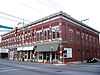 |
(#84001015) |
216-224 E. Main St. 40°11′38″N 85°23′05″W / 40.193888°N 85.384722°W |
Muncie | |
| 3 | Otto Carmichael House | 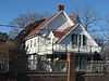 |
(#99001596) |
900 W. Kilgore Ave. 40°11′32″N 85°23′46″W / 40.192222°N 85.396111°W |
Muncie | |
| 4 | Cincinnati, Richmond, & Muncie Depot | 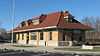 |
(#97000304) |
Wysor St. at the Broadway junction 40°11′51″N 85°22′45″W / 40.1975°N 85.379167°W |
Muncie | |
| 5 | City Hall | 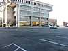 |
(#88002114) |
220 E. Jackson St. 40°11′34″N 85°23′04″W / 40.192778°N 85.384444°W |
Muncie | |
| 6 | Felt's Farm | 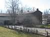 |
(#75000015) |
Race St., southeast of Eaton 40°20′04″N 85°20′48″W / 40.334444°N 85.346667°W |
Union Township | |
| 7 | Fire Station No. 1 | 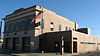 |
(#88002126) |
421 E. Jackson St. 40°11′33″N 85°22′55″W / 40.192500°N 85.381944°W |
Muncie | |
| 8 | First Baptist Church | 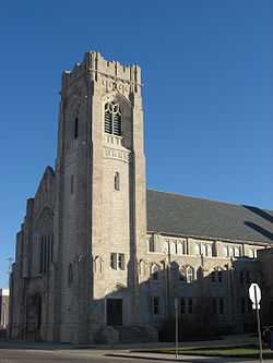 |
(#88002125) |
309 E. Adams St. 40°11′30″N 85°23′02″W / 40.191667°N 85.383889°W |
Muncie | |
| 9 | Job Garner-Jacob W. Miller House |  |
(#86001264) |
Bethel Pike at County Road 700W, east of Bethel 40°14′54″N 85°31′11″W / 40.248333°N 85.519722°W |
Harrison Township | |
| 10 | Goldsmith C. Gilbert Historic District |  |
(#88002113) |
Roughly bounded by Wysor St., N. Madison St., E. Washington St., and Mulberry St. 40°11′43″N 85°22′58″W / 40.195278°N 85.382778°W |
Muncie | |
| 11 | Hamilton Township Schoolhouse No. 4 |  |
(#84000487) |
State Road 67, northeast of Muncie 40°15′17″N 85°20′27″W / 40.254722°N 85.340833°W |
Hamilton Township | |
| 12 | Martin Hofherr Farm |  |
(#92000677) |
County Road 650W, north of its junction with Division Rd. and northwest of Yorktown 40°11′41″N 85°30′32″W / 40.194722°N 85.508888°W |
Mount Pleasant Township | |
| 13 | Eli Hoover House and Confectionary |  |
(#88002128) |
316 W. Main St. 40°11′38″N 85°23′21″W / 40.193889°N 85.389167°W |
Muncie | |
| 14 | J.C. Johnson House |  |
(#82000032) |
322 E. Washington St. 40°11′41″N 85°23′00″W / 40.194722°N 85.383333°W |
Muncie | |
| 15 | Margaret and George Riley Jones House |  |
(#84001017) |
315 E. Charles St. 40°11′27″N 85°23′01″W / 40.190833°N 85.383611°W |
Muncie | |
| 16 | Judson Building |  |
(#88002127) |
300 W. Main St. 40°11′38″N 85°23′20″W / 40.193889°N 85.388889°W |
Muncie | |
| 17 | Dr. Samuel Vaughn Jump House | 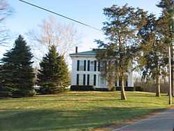 |
(#82000033) |
County Road 462E south of New Burlington and southeast of Muncie 40°07′03″N 85°17′53″W / 40.117500°N 85.298055°W |
Perry Township | |
| 18 | Emily Kimbrough Historic District | 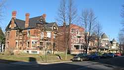 |
(#80000032) |
Bounded by Monroe, East Washington, Hackley, and East Charles Sts.; also roughly E. Gilbert, Beacon St., E. Charles St., and Madison St. 40°11′34″N 85°22′43″W / 40.192778°N 85.378611°W |
Muncie | Second set of boundaries represents a boundary increase of June 29, 1989 |
| 19 | Kirby Historic District |  |
(#99001110) |
Roughly bounded by Jackson, Wolfe, Lincoln, and Main Sts. 40°11′34″N 85°22′12″W / 40.192778°N 85.37°W |
Muncie | |
| 20 | Alva Kitselman House |  |
(#94001105) |
1400 W. University Ave. 40°11′54″N 85°24′04″W / 40.198333°N 85.401111°W |
Muncie | |
| 21 | William Henry Luick Farmhouse |  |
(#94000588) |
2304 Burlington Dr. 40°10′30″N 85°20′43″W / 40.175000°N 85.345277°W |
Muncie | |
| 22 | Grace Keiser Maring Library |  |
(#05001011) |
1808 S. Madison St. 40°10′44″N 85°22′50″W / 40.178889°N 85.380556°W |
Muncie | |
| 23 | Masonic Temple |  |
(#84001020) |
520 E. Main St. 40°11′38″N 85°22′52″W / 40.193889°N 85.381111°W |
Muncie | |
| 24 | Meeks Avenue Historic District |  |
(#99001105) |
200-331 N. Meeks Ave. 40°11′45″N 85°23′36″W / 40.195833°N 85.393333°W |
Muncie | |
| 25 | Minnetrista Boulevard Historic District | 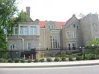 |
(#12000184) |
400-650 Minnetrista Boulevard 40°12′13″N 85°23′30″W / 40.203633°N 85.391763°W |
Muncie | |
| 26 | Moore-Youse-Maxon House | 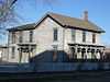 |
(#84001022) |
122 E. Washington St. 40°11′41″N 85°23′08″W / 40.1947222°N 85.385555°W |
Muncie | |
| 27 | Mount Zion Methodist Episcopal Church | 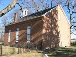 |
(#08000915) |
1701 W. Eaton-Wheeling Pike, west of Eaton 40°20′57″N 85°24′27″W / 40.349166°N 85.407500°W |
Union Township | |
| 28 | Muncie Public Library | 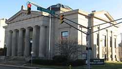 |
(#76000019) |
301 E. Jackson St. 40°11′33″N 85°23′02″W / 40.1925°N 85.383889°W |
Muncie | |
| 29 | Old West End Historic District | 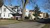 |
(#86002721) |
Roughly bounded by the White River and Washington St., Liberty St., Howard St., Orchard Pl., and Kilgore Ave. 40°11′31″N 85°23′35″W / 40.191944°N 85.393056°W |
Muncie | |
| 30 | Peacock Apartments |  |
(#88002119) |
414 S. Jefferson St. 40°11′27″N 85°23′03″W / 40.190833°N 85.384166°W |
Muncie | |
| 31 | Richwood Evangelical Lutheran Church | 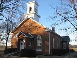 |
(#04001314) |
9700 W. County Road 700S, northeast of Middletown 40°05′31″N 85°30′00″W / 40.091944°N 85.500000°W |
Salem Township | |
| 32 | Riverside Historic District | 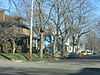 |
(#99000733) |
Roughly bounded by University Ave. and Dicks, Gilbert, and Light Sts. 40°11′47″N 85°24′04″W / 40.196389°N 85.401111°W |
Muncie | |
| 33 | Roberts Hotel |  |
(#82000034) |
420 S. High St. 40°11′26″N 85°23′15″W / 40.190555°N 85.387500°W |
Muncie | |
| 34 | Francis T. Roots Building | 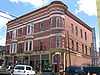 |
(#85000605) |
115-119 E. Charles St. 40°11′27″N 85°23′09″W / 40.190833°N 85.385833°W |
Muncie | |
| 35 | F.D. Rose Building | 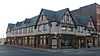 |
(#84001023) |
121 E. Charles St. 40°11′27″N 85°23′08″W / 40.190833°N 85.385556°W |
Muncie | |
| 36 | W.W. Shirk Building | 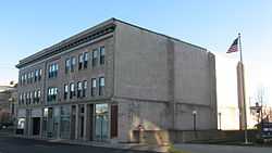 |
(#88002116) |
219 E. Jackson St. 40°11′33″N 85°23′04″W / 40.1925°N 85.384444°W |
Muncie | |
| 37 | Walnut Street Historic District | 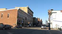 |
(#88002112) |
Roughly Walnut St. from Washington to Victor Sts. 40°11′31″N 85°23′11″W / 40.191944°N 85.386389°W |
Muncie | |
| 38 | West Washington Street Bridge | 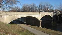 |
(#08000187) |
W. Washington St. over the west fork of the White River 40°11′42″N 85°23′29″W / 40.195°N 85.391389°W |
Muncie | |
| 39 | Westwood Historic District | 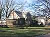 |
(#92000186) |
Roughly bounded by Briar, Petty, and Warwick Rd. and Riverside Ave. 40°12′09″N 85°24′44″W / 40.2025°N 85.412222°W |
Muncie | |
| 40 | Wilson Junior High School | 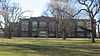 |
(#01000992) |
2000 S. Franklin St. 40°10′36″N 85°23′20″W / 40.176667°N 85.388889°W |
Muncie | |
| 41 | Wysor Heights Historic District | 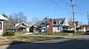 |
(#88001217) |
Roughly bounded by Highland Ave., the White River, N. Elm St. and N. Walnut St. 40°12′18″N 85°23′01″W / 40.205°N 85.383611°W |
Muncie | |
| 42 | YWCA | 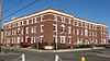 |
(#88002117) |
310 E. Charles St. 40°11′28″N 85°23′02″W / 40.191111°N 85.383889°W |
Muncie |
Former listings
| [3] | Name on the Register | Image | Date listed | Date removed | Location | City or town | Summary |
|---|---|---|---|---|---|---|---|
| 1 | Goddard Warehouse |  |
(#88002121) | 215 W. Seymour St. 40°11′22″N 85°23′17″W / 40.189444°N 85.388056°W |
Muncie | ||
| 2 | John Valentine House |  |
(#83000026) | 1101 Riverside Ave. 40°12′00″N 85°23′54″W / 40.2°N 85.398333°W |
Muncie |
See also
| Wikimedia Commons has media related to National Register of Historic Places in Delaware County, Indiana. |
- List of National Historic Landmarks in Indiana
- National Register of Historic Places listings in Indiana
- List of Indiana state historical markers in Delaware County
References
- ↑ The latitude and longitude information provided in this table was derived originally from the National Register Information System, which has been found to be fairly accurate for about 99% of listings. For about 1% of NRIS original coordinates, experience has shown that one or both coordinates are typos or otherwise extremely far off; some corrections may have been made. A more subtle problem causes many locations to be off by up to 150 yards, depending on location in the country: most NRIS coordinates were derived from tracing out latitude and longitudes off of USGS topographical quadrant maps created under the North American Datum of 1927, which differs from the current, highly accurate WGS84 GPS system used by most on-line maps. Chicago is about right, but NRIS longitudes in Washington are higher by about 4.5 seconds, and are lower by about 2.0 seconds in Maine. Latitudes differ by about 1.0 second in Florida. Some locations in this table may have been corrected to current GPS standards.
- ↑ "National Register of Historic Places: Weekly List Actions". National Park Service, United States Department of the Interior. Retrieved on May 1, 2015.
- ↑ 3.0 3.1 Numbers represent an ordering by significant words. Various colorings, defined here, differentiate National Historic Landmarks and historic districts from other NRHP buildings, structures, sites or objects.
- ↑ "National Register Information System". National Register of Historic Places. National Park Service. 2009-03-13.
- ↑ The eight-digit number below each date is the number assigned to each location in the National Register Information System database, which can be viewed by clicking the number.
| ||||||||||||||||||||||||||
| |||||||||||||||||||||||||||||