| [3] |
Name on the Register[4] |
Image |
Date listed[5] |
Location |
City or town |
Description |
|---|
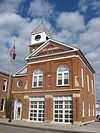
| 1 |
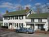
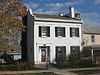
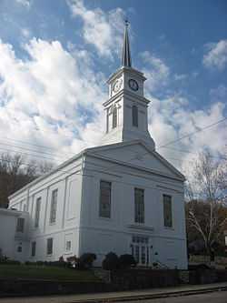
Aurora City Hall |
|
01996-03-14-0000March 14, 1996
(#96000288) |
216 3rd St. and 233-237 Main St.
39°03′19″N 84°54′00″W / 39.055278°N 84.900000°W / 39.055278; -84.900000 (Aurora City Hall) |
Aurora |
|
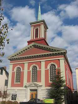
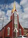
| 2 |
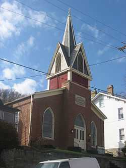
Aurora Methodist Episcopal Church |
|
01994-09-08-0000September 8, 1994
(#94001113) |
304 3rd St.
39°03′20″N 84°54′03″W / 39.055556°N 84.900833°W / 39.055556; -84.900833 (Aurora Methodist Episcopal Church) |
Aurora |
|
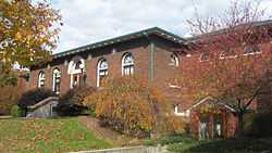
| 3 |
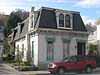
Aurora Public Library |
|
01993-05-27-0000May 27, 1993
(#93000474) |
414 2nd St.
39°03′26″N 84°54′07″W / 39.057222°N 84.901944°W / 39.057222; -84.901944 (Aurora Public Library) |
Aurora |
Neo-Renaissance style building designed by Garber & Woodward in 1923
|
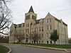
| 4 |
Carnegie Hall of Moores Hill College |
|
01994-03-17-0000March 17, 1994
(#94000229) |
14687 Main St.
39°06′44″N 85°05′33″W / 39.112222°N 85.092500°W / 39.112222; -85.092500 (Carnegie Hall of Moores Hill College) |
Moores Hill |
|
| 5 |
Dearborn County Asylum for the Poor |
|
02000-09-22-0000September 22, 2000
(#00001143) |
11636 County Farm Rd., northwest of Aurora
39°09′02″N 85°02′03″W / 39.150556°N 85.034167°W / 39.150556; -85.034167 (Dearborn County Asylum for the Poor) |
Manchester Township |
|
| 6 |
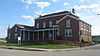
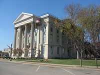
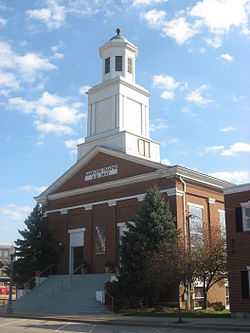
Dearborn County Courthouse |
|
01981-04-09-0000April 9, 1981
(#81000008) |
High and Mary Sts.
39°05′28″N 84°51′00″W / 39.091111°N 84.850000°W / 39.091111; -84.850000 (Dearborn County Courthouse) |
Lawrenceburg |
|
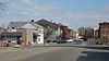
| 7 |
Downtown Aurora Historic District |
|
01994-09-08-0000September 8, 1994
(#94001134) |
Bounded by Importing, Water, Market, 5th, and Exporting Sts.
39°03′14″N 84°54′02″W / 39.053889°N 84.900556°W / 39.053889; -84.900556 (Downtown Aurora Historic District) |
Aurora |
|
| 8 |
Downtown Lawrenceburg Historic District |
|
01984-03-01-0000March 1, 1984
(#84001009) |
Roughly bounded by the former Conrail railroad line and Charlotte, Tate, Williams, and Elm Sts.
39°05′37″N 84°50′54″W / 39.093611°N 84.848333°W / 39.093611; -84.848333 (Downtown Lawrenceburg Historic District) |
Lawrenceburg |
|
| 9 |
First Evangelical United Church of Christ |
|
01994-09-23-0000September 23, 1994
(#94001104) |
111 5th St.
39°03′11″N 84°53′56″W / 39.052917°N 84.898889°W / 39.052917; -84.898889 (First Evangelical United Church of Christ) |
Aurora |
|
| 10 |
First Presbyterian Church |
|
01994-09-08-0000September 8, 1994
(#94001116) |
215 4th St.
39°03′15″N 84°54′02″W / 39.054167°N 84.900556°W / 39.054167; -84.900556 (First Presbyterian Church) |
Aurora |
|
| 11 |
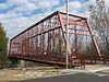
George Street Bridge |
|
01984-03-01-0000March 1, 1984
(#84001012) |
George, Main, and Importing Sts.
39°03′28″N 84°53′58″W / 39.057778°N 84.899444°W / 39.057778; -84.899444 (George Street Bridge) |
Aurora |
|
| 12 |
Hamline Chapel, United Methodist Church |
|
01982-09-09-0000September 9, 1982
(#82000030) |
High and Vine Sts.
39°05′30″N 84°50′54″W / 39.091667°N 84.848333°W / 39.091667; -84.848333 (Hamline Chapel, United Methodist Church) |
Lawrenceburg |
|
| 13 |
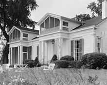
Hillforest (Forest Hill) |
|
01971-08-05-0000August 5, 1971
(#71000005) |
213 5th St.
39°03′14″N 84°54′06″W / 39.053889°N 84.901667°W / 39.053889; -84.901667 (Hillforest (Forest Hill)) |
Aurora |
|
| 14 |
Lewis Hurlbert, Sr. House |
|
01994-11-25-0000November 25, 1994
(#94001350) |
412 5th St.
39°03′16″N 84°54′11″W / 39.054444°N 84.903056°W / 39.054444; -84.903056 (Lewis Hurlbert, Sr. House) |
Aurora |
|
| 15 |
Jennison Guard Site |
|
01975-05-12-0000May 12, 1975
(#75000014) |
Between a rail line and the Ohio River, just west of the mouth of the Great Miami River and northeast of Lawrenceburg[6]
39°06′32″N 84°49′30″W / 39.108889°N 84.825000°W / 39.108889; -84.825000 (Jennison Guard Site) |
Lawrenceburg Township |
|
| 16 |
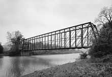
Laughery Creek Bridge |
|
01976-09-29-0000September 29, 1976
(#76000018) |
South of Aurora west of State Road 56
39°01′28″N 84°53′09″W / 39.024444°N 84.885833°W / 39.024444; -84.885833 (Laughery Creek Bridge) |
Center Township |
Extends into Ohio County
|
| 17 |
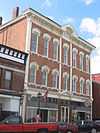
Leive, Parks and Stapp Opera House |
|
01994-09-20-0000September 20, 1994
(#94001120) |
321-325 2nd St.
39°03′23″N 84°54′03″W / 39.056389°N 84.900833°W / 39.056389; -84.900833 (Leive, Parks and Stapp Opera House) |
Aurora |
|
| 18 |
Daniel S. Major House |
|
02003-12-23-0000December 23, 2003
(#03001320) |
761 W. Eads Parkway
39°05′21″N 84°52′35″W / 39.089167°N 84.876389°W / 39.089167; -84.876389 (Daniel S. Major House) |
Lawrenceburg |
|
| 19 |
Moore's Hill United Methodist Church |
|
01997-12-15-0000December 15, 1997
(#97001537) |
13476 Main St.
39°06′47″N 85°05′16″W / 39.113056°N 85.087778°W / 39.113056; -85.087778 (Moore's Hill United Methodist Church) |
Moores Hill |
|
| 20 |
River View Cemetery |
|
02013-12-31-0000December 31, 2013
(#13001011) |
3635 E. Laughery Creek Rd., south of Aurora
39°01′33″N 84°53′16″W / 39.025833°N 84.887778°W / 39.025833; -84.887778 (River View Cemetery) |
Center Township |
|
| 21 |
St. John's Lutheran Church and School |
|
01996-03-29-0000March 29, 1996
(#96000289) |
7291 State Road 62, southwest of Dillsboro
38°58′36″N 85°06′12″W / 38.976667°N 85.103334°W / 38.976667; -85.103334 (St. John's Lutheran Church and School) |
Caesar Creek Township |
|
| 22 |
Levi Stevens House |
|
01996-05-30-0000May 30, 1996
(#96000599) |
122 5th St.
39°03′12″N 84°53′59″W / 39.053389°N 84.899722°W / 39.053389; -84.899722 (Levi Stevens House) |
Aurora |
|
| 23 |
State Line Archeological District |
|
01975-07-24-0000July 24, 1975
(#75001423) |
Straddling the Ohio/Indiana border, 2 miles (3.2 km) north of the Ohio River[7]
39°08′15″N 84°49′12″W / 39.137500°N 84.820000°W / 39.137500; -84.820000 (State Line Archeological District) |
Greendale |
Extends into Hamilton County, Ohio
|
| 24 |
Dr. George Sutton Medical Office Building |
|
01994-09-08-0000September 8, 1994
(#94001118) |
315 3rd St.
39°03′19″N 84°54′06″W / 39.055278°N 84.901528°W / 39.055278; -84.901528 (Dr. George Sutton Medical Office Building) |
Aurora |
|
| 25 |
Vance-Tousey House |
|
02000-12-28-0000December 28, 2000
(#00001547) |
508 W. High St.
39°05′20″N 84°51′07″W / 39.088889°N 84.851944°W / 39.088889; -84.851944 (Vance-Tousey House) |
Lawrenceburg |
|
| 26 |
Veraestau |
|
01973-04-11-0000April 11, 1973
(#73000013) |
1 mile south of Aurora on State Road 56
39°02′33″N 84°53′44″W / 39.042500°N 84.8955556°W / 39.042500; -84.8955556 (Veraestau) |
Center Township |
|

.jpg)