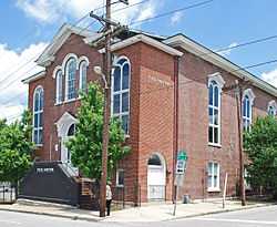
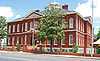
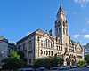
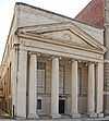
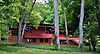
| [3] |
Name on the Register[4] |
Image |
Date listed[5] |
Location |
City or town |
Description |
|---|
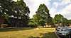
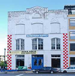
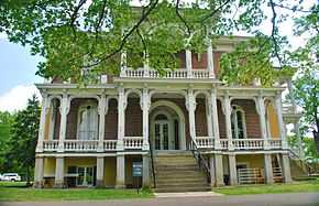
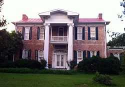
| 1 |
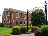
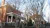
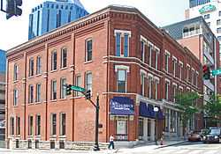
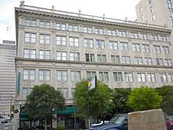
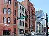
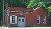
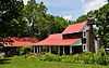
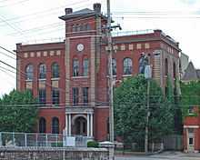
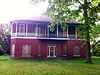
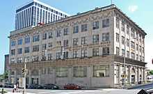
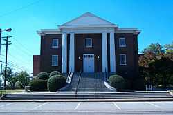
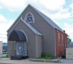
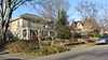
Acme Farm Supply Building |
|
01998-04-02-0000April 2, 1998
(#98000320) |
101 Broadway
36°09′43″N 86°46′28″W / 36.161944°N 86.774444°W / 36.161944; -86.774444 (Acme Farm Supply Building) |
Nashville |
|
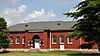
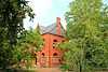
| 2 |
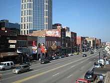
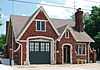
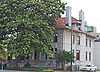
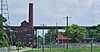
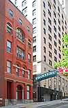
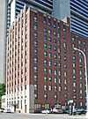
Airdrie |
Upload image |
02005-09-15-0000September 15, 2005
(#05001027) |
3210 Avenal Ave.
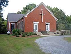
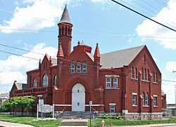
36°06′18″N 86°43′54″W / 36.105°N 86.731667°W / 36.105; -86.731667 (Airdrie) |
Nashville |
|
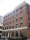
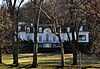
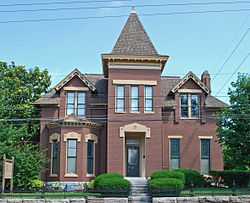
| 3 |
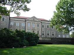
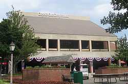
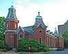
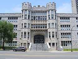
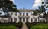
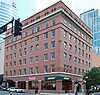
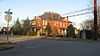
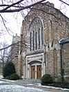
Alumni Memorial Hall, Vanderbilt University |
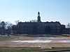
|
02011-07-06-0000July 6, 2011
(#11000418) |
2205 West End Ave.
36°08′53″N 86°48′12″W / 36.148056°N 86.803333°W / 36.148056; -86.803333 (Alumni Memorial Hall, Vanderbilt University) |
Nashville |
|
| 4 |
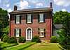
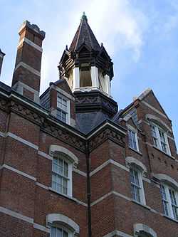
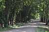
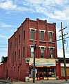
American Baptist Theological Seminary Historic District |
|
02013-06-14-0000June 14, 2013
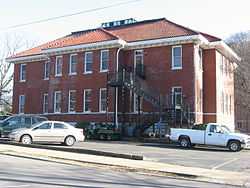
(#13000399) |
1800 Baptist World Center Dr.
36°12′09″N 86°47′24″W / 36.202599°N 86.789891°W / 36.202599; -86.789891 (American Baptist Theological Seminary Historic District) |
Nashville |
|
| 5 |
Archeological Site 40DV307 |
Upload image |
02015-03-12-0000March 12, 2015
(#14000940) |
Address Restricted
|
Nashville |
|
| 6 |
Archeological Site No. 40DV35 |
Upload image |
01992-12-16-0000December 16, 1992
(#92001655) |
Cockrill Bend, 0.25 miles (0.40 km) south of the Cumberland River[6]
36°12′09″N 86°54′04″W / 36.202500°N 86.901111°W / 36.202500; -86.901111 (Archeological Site No. 40DV35) |
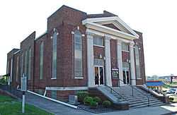
Nashville |
|
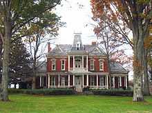
| 7 |
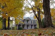
Beech Grove |
Upload image |
02007-11-08-0000November 8, 2007
(#07001163) |
8423 Old Harding Pike
36°01′22″N 87°01′31″W / 36.022817°N 87.025306°W / 36.022817; -87.025306 (Beech Grove) |
Nashville |
|
| 8 |
Belair |
|
01971-05-06-0000May 6, 1971
(#71000815) |
2250 Lebanon Rd.
36°10′09″N 86°41′15″W / 36.169167°N 86.6875°W / 36.169167; -86.6875 (Belair) |
Nashville |
|
| 9 |
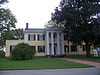
Belle Meade |
|
01969-12-30-0000December 30, 1969
(#69000177) |
Harding Rd. at Leake Ave.
36°06′20″N 86°51′52″W / 36.105556°N 86.864444°W / 36.105556; -86.864444 (Belle Meade) |
Belle Meade |
|
| 10 |
Belle Meade Apartments |
|
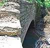
01984-04-19-0000April 19, 1984
(#84003474) |
715 Belle Meade Boulevard
36°05′47″N 86°51′28″W / 36.096389°N 86.857778°W / 36.096389; -86.857778 (Belle Meade Apartments) |
Belle Meade |
|
| 11 |
Belle Meade Golf Links Subdivision Historic District |
Upload image |
02004-07-07-0000July 7, 2004
(#04000675) |
Roughly bounded by Windsor Dr., Blackburn and Pembroke Aves., Westover Dr., and Harding Pl.
36°06′07″N 86°51′48″W / 36.101944°N 86.863333°W / 36.101944; -86.863333 (Belle Meade Golf Links Subdivision Historic District) |
Belle Meade |
|
| 12 |
Belle Vue |
|
01973-10-25-0000October 25, 1973
(#73001758) |
7306 Old Harding Rd., off U.S. Route 70S
36°03′58″N 86°56′16″W / 36.066111°N 86.937778°W / 36.066111; -86.937778 (Belle Vue) |
Bellevue |
|
| 13 |
Belmont Mansion |
|
01971-05-06-0000May 6, 1971
(#71000816) |
Belmont Boulevard
36°08′09″N 86°47′41″W / 36.135833°N 86.794722°W / 36.135833; -86.794722 (Belmont Mansion) |
Nashville |
|
| 14 |
Belmont-Hillsboro Historic District |
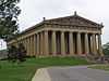
|
01980-05-01-0000May 1, 1980
(#80003784) |
Roughly bounded by Primrose and 20th Avenues and Magnolia and Belmont Boulevards
36°07′48″N 86°47′52″W / 36.130000°N 86.797778°W / 36.130000; -86.797778 (Belmont-Hillsboro Historic District) |
Nashville |
|
| 15 |
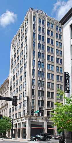
Bennie-Dillon Building |
|
01984-08-16-0000August 16, 1984
(#84003483) |
702 Church St.
36°09′44″N 86°46′59″W / 36.162222°N 86.783056°W / 36.162222; -86.783056 (Bennie-Dillon Building) |
Nashville |
|
| 16 |
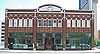
Berger Building |
|
01984-11-08-0000November 8, 1984
(#84000376) |
164 N. 8th Ave.
36°09′40″N 86°46′59″W / 36.161111°N 86.783056°W / 36.161111; -86.783056 (Berger Building) |
Nashville |
|
| 17 |
Brick Church Mound and Village Site |
|
01973-05-07-0000May 7, 1973
(#73001759) |
East of Brick Church Pike[7]
36°14′51″N 86°46′32″W / 36.247469°N 86.775689°W / 36.247469; -86.775689 (Brick Church Mound and Village Site) |
Nashville |
A multi-mound Mississippian culture site, leveled in the 1970s and 80s for a residential neighborhood
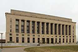
|
| 18 |
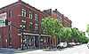
Broadway Historic District |
|
01980-07-18-0000July 18, 1980
(#80003785) |
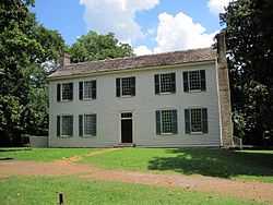
Broadway between 2nd and 5th Aves.
36°09′40″N 86°46′38″W / 36.161111°N 86.777222°W / 36.161111; -86.777222 (Broadway Historic District) |
Nashville |
|
| 19 |
James Buchanan House |
|
01984-03-29-0000March 29, 1984
(#84003486) |
2910 Elm Hill Pike
36°08′41″N 86°39′26″W / 36.144722°N 86.657222°W / 36.144722; -86.657222 (James Buchanan House) |
Nashville |
|
| 20 |
Buena Vista Historic District |
|
01980-04-24-0000April 24, 1980
(#80003786) |
Bounded by Interstate 65 and U.S. Route 41
36°10′34″N 86°47′50″W / 36.176111°N 86.797222°W / 36.176111; -86.797222 (Buena Vista Historic District) |
Nashville |
|
| 21 |
Bush-Herbert Building |
|
01982-03-25-0000March 25, 1982
(#82003959) |
174 3rd. Ave., N.
36°09′49″N 86°46′38″W / 36.163611°N 86.777222°W / 36.163611; -86.777222 (Bush-Herbert Building) |
Nashville |
|
| 22 |
Cameron School |
|
02005-03-15-0000March 15, 2005
(#05000180) |
1034 1st Ave., S.
36°08′55″N 86°45′51″W / 36.148611°N 86.764167°W / 36.148611; -86.764167 (Cameron School) |
Nashville |
|
| 23 |
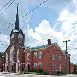
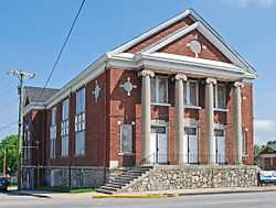
Cane Ridge Cumberland Presbyterian Church |
|
01976-12-12-0000December 12, 1976
(#76001770) |
Southeast of Antioch on Old Hickory Boulevard
36°00′06″N 86°38′02″W / 36.001667°N 86.633889°W / 36.001667; -86.633889 (Cane Ridge Cumberland Presbyterian Church) |
Antioch |
|
| 24 |
Capers C.M.E. Church |
|
01985-01-02-0000January 2, 1985
(#85000045) |
319 15th Ave., N.
36°09′34″N 86°47′43″W / 36.159444°N 86.795278°W / 36.159444; -86.795278 (Capers C.M.E. Church) |
Nashville |
|
| 25 |
Carnegie Library |
|
01985-01-02-0000January 2, 1985
(#85003769) |
17th Ave. N. on the Fisk University campus
36°10′04″N 86°48′18″W / 36.167778°N 86.805000°W / 36.167778; -86.805000 (Carnegie Library) |
Nashville |
Designed by African-American architect Moses McKissack III; built in 1908; now serves as Fisk's academic building.
|
| 26 |
Cartwright-Moss House |
Upload image |
01979-08-01-0000August 1, 1979
(#79002420) |
760 Old Dickerson Pike
36°18′13″N 86°43′22″W / 36.303611°N 86.722778°W / 36.303611; -86.722778 (Cartwright-Moss House) |
Goodlettsville |
|
| 27 |
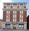
Castner-Knott Building |
|
01999-08-20-0000August 20, 1999
(#99000957) |
616-618 Church St.
36°09′45″N 86°46′56″W / 36.1625°N 86.782222°W / 36.1625; -86.782222 (Castner-Knott Building) |
Nashville |
|
| 28 |
Centennial Park |
|
02008-07-15-0000July 15, 2008
(#08000689) |
West End Ave. at its junction with 25th Ave. N.
36°08′59″N 86°48′47″W / 36.149589°N 86.812936°W / 36.149589; -86.812936 (Centennial Park) |
Nashville |
|
| 29 |
Robert Chadwell House |
Upload image |
01989-11-13-0000November 13, 1989
(#89001972) |
712 Neeleys Bend Rd.
36°15′09″N 86°41′48″W / 36.2525°N 86.696667°W / 36.2525; -86.696667 (Robert Chadwell House) |
Madison |
|
| 30 |
Cheatham Building |
|
01980-02-21-0000February 21, 1980
(#80003787) |
301-309 Church St.
36°09′50″N 86°46′39″W / 36.163889°N 86.7775°W / 36.163889; -86.7775 (Cheatham Building) |
Nashville |
|
| 31 |
Cheekwood |
|
02000-08-23-0000August 23, 2000
(#00000993) |
1200 Forrest Park Dr.
36°05′11″N 86°52′26″W / 36.086339°N 86.873961°W / 36.086339; -86.873961 (Cheekwood) |
Nashville |
|
| 32 |
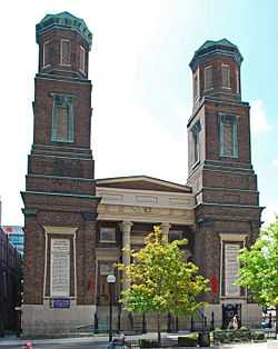
Christ Church |
|
01978-11-14-0000November 14, 1978
(#78002577) |
900 Broadway
36°09′32″N 86°47′00″W / 36.158889°N 86.783333°W / 36.158889; -86.783333 (Christ Church) |
Nashville |
|
| 33 |
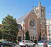
Church of the Assumption |
|
01977-08-22-0000August 22, 1977
(#77001262) |
1227 7th Ave., N.
36°10′31″N 86°47′30″W / 36.175278°N 86.791667°W / 36.175278; -86.791667 (Church of the Assumption) |
Nashville |
|
| 34 |
Cleveland Hall |
|
01971-04-16-0000April 16, 1971
(#71000821) |
4041 Old Hickory Boulevard
36°13′46″N 86°37′38″W / 36.229444°N 86.627222°W / 36.229444; -86.627222 (Cleveland Hall) |
Old Hickory |
|
| 35 |
Clover Bottom Mansion |
|
01975-04-03-0000April 3, 1975
(#75001747) |
2930 Lebanon Rd.
36°10′11″N 86°38′58″W / 36.169722°N 86.649444°W / 36.169722; -86.649444 (Clover Bottom Mansion) |
Donelson |
|
| 36 |
Cole House |
|
01974-12-27-0000December 27, 1974
(#74001907) |
2001 Lebanon Rd.
36°09′24″N 86°42′28″W / 36.156667°N 86.707778°W / 36.156667; -86.707778 (Cole House) |
Nashville |
|
| 37 |
Anna Russell Cole Auditorium |
|
01980-04-17-0000April 17, 1980
(#80003788) |
Tennessee Preparatory School campus
36°07′56″N 86°44′28″W / 36.132222°N 86.741111°W / 36.132222; -86.741111 (Anna Russell Cole Auditorium) |
Nashville |
|
| 38 |
Mrs. Edward B. Craig House |
|
02003-10-27-0000October 27, 2003
(#03001078) |
1418 Chickering Rd.
36°04′18″N 86°52′03″W / 36.071667°N 86.8675°W / 36.071667; -86.8675 (Mrs. Edward B. Craig House) |
Forest Hills |
|
| 39 |
Cummins Station |
|
01983-11-17-0000November 17, 1983
(#83004233) |
Demonbreun and 10th Ave., S.
36°09′19″N 86°46′58″W / 36.155278°N 86.782778°W / 36.155278; -86.782778 (Cummins Station) |
Nashville |
|
| 40 |
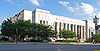
Davidson County Courthouse |
|
01987-03-23-0000March 23, 1987
(#87000670) |
Public Sq.
36°10′02″N 86°46′43″W / 36.167222°N 86.778611°W / 36.167222; -86.778611 (Davidson County Courthouse) |
Nashville |
|
| 41 |
Demonbreun's Cave |
Upload image |
01980-02-07-0000February 7, 1980
(#80003789) |
1700 Omohumdro Dr.
36°09′55″N 86°42′57″W / 36.165278°N 86.715833°W / 36.165278; -86.715833 (Demonbreun's Cave) |
Nashville |
|
| 42 |
Devon Farm |
Upload image |
01974-08-28-0000August 28, 1974
(#74001908) |
South of Nashville on State Route 100
36°03′28″N 86°55′11″W / 36.057778°N 86.919722°W / 36.057778; -86.919722 (Devon Farm) |
Nashville |
|
| 43 |
Doctor's Building |
|
01985-07-25-0000July 25, 1985
(#85001607) |
706 Church St.
36°09′44″N 86°46′59″W / 36.162222°N 86.783056°W / 36.162222; -86.783056 (Doctor's Building) |
Nashville |
|
| 44 |
Dozier Farm |
Upload image |
01990-11-01-0000November 1, 1990
(#90001580) |
8451 River Rd. Pike
36°12′16″N 86°58′36″W / 36.204444°N 86.976667°W / 36.204444; -86.976667 (Dozier Farm) |
Nashville |
|
| 45 |
Dubuisson-Neuhoff House |
|
02003-10-27-0000October 27, 2003
(#03001077) |
1407 Chickering Rd.
36°04′24″N 86°52′01″W / 36.073333°N 86.866944°W / 36.073333; -86.866944 (Dubuisson-Neuhoff House) |
Forest Hills |
|
| 46 |
Guildfor Dudley, Sr. and Anne Dallas House |
Upload image |
02003-10-23-0000October 23, 2003
(#03001080) |
5401 Hillsboro Pike
36°05′07″N 86°50′04″W / 36.085278°N 86.834444°W / 36.085278; -86.834444 (Guildfor Dudley, Sr. and Anne Dallas House) |
Forest Hills |
|
| 47 |
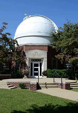
Arthur J. Dyer Observatory |
|
02009-03-06-0000March 6, 2009
(#09000114) |
1000 Oman Dr.
36°03′08″N 86°48′17″W / 36.05213°N 86.80481°W / 36.05213; -86.80481 (Arthur J. Dyer Observatory) |
Brentwood |
|
| 48 |
East Nashville High and Junior High Schools |
|
02002-01-25-0000January 25, 2002
(#01001552) |
110 and 112 Gallatin Rd.
36°10′52″N 86°45′10″W / 36.181111°N 86.752778°W / 36.181111; -86.752778 (East Nashville High and Junior High Schools) |
Nashville |
|
| 49 |
East Nashville Historic District |
|
01982-04-15-0000April 15, 1982
(#82003960) |
Roughly bounded by Gallatin Pike, Edgewood Pl., N. 16th St., and Russell Sts.
36°10′39″N 86°44′42″W / 36.1775°N 86.745°W / 36.1775; -86.745 (East Nashville Historic District) |
Nashville |
|
| 50 |
Edgefield Historic District |
|
01977-07-13-0000July 13, 1977
(#77001263) |
Roughly bounded by Woodland, S. 10th and S. 5th Sts., and Shelby Ave.
36°10′22″N 86°45′28″W / 36.172778°N 86.757778°W / 36.172778; -86.757778 (Edgefield Historic District) |
Nashville |
|
| 51 |
Eighth Avenue South Reservoir |
|
01978-03-30-0000March 30, 1978
(#78002578) |
8th Ave., S.
36°08′21″N 86°46′49″W / 36.139167°N 86.780278°W / 36.139167; -86.780278 (Eighth Avenue South Reservoir) |
Nashville |
|
| 52 |
Ellis Service Station Garage |
|
01991-04-15-0000April 15, 1991
(#91000436) |
2000 Old Murfreesboro Rd.
36°05′50″N 86°39′13″W / 36.097222°N 86.653611°W / 36.097222; -86.653611 (Ellis Service Station Garage) |
Nashville |
|
| 53 |
Elm Street Methodist Church |
|
01984-05-15-0000May 15, 1984
(#84003496) |
616 5th Ave., S.
36°09′11″N 86°46′24″W / 36.153056°N 86.773333°W / 36.153056; -86.773333 (Elm Street Methodist Church) |
Nashville |
|
| 54 |
Alexander Ewing House |
Upload image |
01980-11-25-0000November 25, 1980
(#80003790) |
5101 Buena Vista Pike
36°14′03″N 86°49′38″W / 36.234167°N 86.827222°W / 36.234167; -86.827222 (Alexander Ewing House) |
Nashville |
|
| 55 |
Fall School |
|
01979-12-19-0000December 19, 1979
(#79002421) |
1116 S. 8th Ave.
36°08′32″N 86°46′43″W / 36.142222°N 86.778611°W / 36.142222; -86.778611 (Fall School) |
Nashville |
|
| 56 |
Federal Office Building |
|
01972-12-26-0000December 26, 1972
(#72001232) |
Broadway
36°09′31″N 86°46′53″W / 36.158611°N 86.781389°W / 36.158611; -86.781389 (Federal Office Building) |
Nashville |
|
| 57 |
Federal Reserve Bank of Atlanta |
|
01984-10-10-0000October 10, 1984
(#84000089) |
226 N. 3rd Ave.
36°09′58″N 86°46′45″W / 36.166111°N 86.779167°W / 36.166111; -86.779167 (Federal Reserve Bank of Atlanta) |
Nashville |
|
| 58 |
Fifth Avenue Historic District |
|
01983-12-05-0000December 5, 1983
(#83004234) |
Roughly bounded by Church and Union Sts. and 4th, 5th, and 6th Aves.
36°09′50″N 86°46′50″W / 36.163889°N 86.780556°W / 36.163889; -86.780556 (Fifth Avenue Historic District) |
Nashville |
|
| 59 |
Fire Hall No. 1 |
|
02008-07-23-0000July 23, 2008
(#08000691) |
1312 3rd Ave., N.
36°10′43″N 86°47′12″W / 36.178553°N 86.786603°W / 36.178553; -86.786603 (Fire Hall No. 1) |
Nashville |
|
| 60 |
First Baptist Church East Nashville |
|
02005-07-27-0000July 27, 2005
(#05000761) |
601 Main St.
36°10′33″N 86°45′46″W / 36.175833°N 86.762778°W / 36.175833; -86.762778 (First Baptist Church East Nashville) |
Nashville |
|
| 61 |
First Presbyterian Church |
|
01970-07-08-0000July 8, 1970
(#70000608) |
154 5th Ave., N.
36°09′46″N 86°46′47″W / 36.162778°N 86.779722°W / 36.162778; -86.779722 (First Presbyterian Church) |
Nashville |
|
| 62 |
Fisk University Historic District |
|
01978-02-09-0000February 9, 1978
(#78002579) |
Roughly bounded by 16th and 18th Aves. and Hermosa, Herman and Jefferson Sts.
36°10′04″N 86°48′17″W / 36.167778°N 86.804722°W / 36.167778; -86.804722 (Fisk University Historic District) |
Nashville |
|
| 63 |
Fort Nashborough |
|
02011-07-13-0000July 13, 2011
(#11000454) |
Riverfront Park on 1st Ave.
36°09′51″N 86°46′32″W / 36.164167°N 86.775556°W / 36.164167; -86.775556 (Fort Nashborough) |
Nashville |
|
| 64 |
Fort Negley |
|
01975-04-21-0000April 21, 1975
(#75001748) |
Ridley Boulevard and Chestnut St.
36°08′42″N 86°46′28″W / 36.145°N 86.774444°W / 36.145; -86.774444 (Fort Negley) |
Nashville |
|
| 65 |
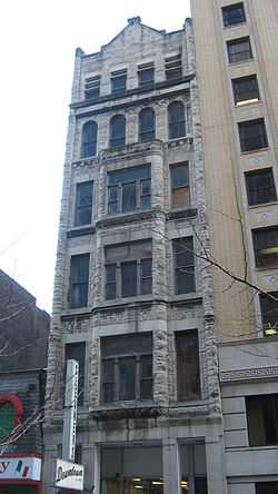
Frost Building |
|
01980-11-25-0000November 25, 1980
(#80003791) |
161 8th Ave., N.
36°09′38″N 86°47′00″W / 36.160556°N 86.783333°W / 36.160556; -86.783333 (Frost Building) |
Nashville |
|
| 66 |
James Geddes Engine Company No. 6 |
|
01978-01-09-0000January 9, 1978
(#78002580) |
629 2nd Ave., S.
36°09′16″N 86°46′14″W / 36.154444°N 86.770556°W / 36.154444; -86.770556 (James Geddes Engine Company No. 6) |
Nashville |
|
| 67 |
John Geist and Sons Blacksmith Shop and House |
|
01980-04-29-0000April 29, 1980
(#80003792) |
309, 311, and 313 Jefferson St.
36°10′28″N 86°47′06″W / 36.174444°N 86.785°W / 36.174444; -86.785 (John Geist and Sons Blacksmith Shop and House) |
Nashville |
|
| 68 |
Germantown Historic District |
|
01979-08-01-0000August 1, 1979
(#79002422) |
Bounded by Jefferson, Hume, Rosa Parks, and Third[8]
36°10′36″N 86°47′25″W / 36.176667°N 86.790278°W / 36.176667; -86.790278 (Germantown Historic District) |
Nashville |
|
| 69 |
Gilbert Mansion |
|
01979-03-28-0000March 28, 1979
(#79002423) |
1906 West End Ave.
36°09′08″N 86°47′54″W / 36.152222°N 86.798333°W / 36.152222; -86.798333 (Gilbert Mansion) |
Nashville |
|
| 70 |
Gladstone Apartments |
|
01983-06-16-0000June 16, 1983
(#83003025) |
3803 West End Ave.
36°07′54″N 86°49′55″W / 36.131667°N 86.831944°W / 36.131667; -86.831944 (Gladstone Apartments) |
Nashville |
|
| 71 |
Glen Oak |
|
01983-11-17-0000November 17, 1983
(#83004235) |
2012 25th Ave., S.
36°07′57″N 86°48′24″W / 36.132500°N 86.806667°W / 36.132500; -86.806667 (Glen Oak) |
Nashville |
|
| 72 |
Grand Ole Opry House |
|
02015-01-27-0000January 27, 2015
(#14001222) |
2804 Opryland Dr.
36°12′23″N 86°41′30″W / 36.2064°N 86.6917°W / 36.2064; -86.6917 (Grand Ole Opry House) |
Nashville |
Main home of the Grand Ole Opry since 1974.
|
| 73 |
Grassmere |
|
01984-07-19-0000July 19, 1984
(#84003503) |
Nolensville Rd.
36°05′16″N 86°44′26″W / 36.087778°N 86.740556°W / 36.087778; -86.740556 (Grassmere) |
Nashville |
Plantation house on the property that is now the site of the Nashville Zoo
|
| 74 |
Benajah Gray Log House |
|
01985-07-11-0000July 11, 1985
(#85001512) |
446 Battle Rd.
35°59′36″N 86°37′31″W / 35.993333°N 86.625278°W / 35.993333; -86.625278 (Benajah Gray Log House) |
Antioch |
|
| 75 |
Gymnasium, Vanderbilt University |
|
01972-02-23-0000February 23, 1972
(#72001233) |
West End and 23rd Aves.
36°08′54″N 86°48′18″W / 36.148333°N 86.805°W / 36.148333; -86.805 (Gymnasium, Vanderbilt University) |
Nashville |
|
| 76 |
Hall-Harding-McCampbell House |
|
02010-03-23-0000March 23, 2010
(#10000141) |
305 Kent Rd.
36°09′32″N 86°39′43″W / 36.158881°N 86.661942°W / 36.158881; -86.661942 (Hall-Harding-McCampbell House) |
Nashville |
|
| 77 |
Hays-Kiser House |
|
01974-09-10-0000September 10, 1974
(#74001906) |
834 Reeves Rd.
36°03′55″N 86°40′20″W / 36.065278°N 86.672222°W / 36.065278; -86.672222 (Hays-Kiser House) |
Antioch |
|
| 78 |
Hermitage Hotel |
|
01975-07-24-0000July 24, 1975
(#75001749) |
231 6th Ave., N.
36°09′47″N 86°47′01″W / 36.163056°N 86.783611°W / 36.163056; -86.783611 (Hermitage Hotel) |
Nashville |
|
| 79 |
The Hermitage |
|
01966-10-15-0000October 15, 1966
(#66000722) |
12 miles (19 km) east of Nashville on U.S. Route 70N
36°12′54″N 86°36′42″W / 36.215°N 86.611667°W / 36.215; -86.611667 (The Hermitage) |
Hermitage |
|
| 80 |
The Hibbettage |
Upload image |
01998-10-30-0000October 30, 1998
(#98001305) |
2160 Old Hickory Boulevard
36°03′04″N 86°51′55″W / 36.051111°N 86.865278°W / 36.051111; -86.865278 (The Hibbettage) |
Nashville |
|
| 81 |
Hillsboro-West End Historic District |
|
01993-12-23-0000December 23, 1993
(#93001435) |
Roughly bounded by West End, 31st, Blakemore, and 21st Aves. and Interstate 440
36°08′00″N 86°48′24″W / 36.133333°N 86.806667°W / 36.133333; -86.806667 (Hillsboro-West End Historic District) |
Nashville |
|
| 82 |
Holly Street Fire Hall |
|
01982-08-26-0000August 26, 1982
(#82003963) |
1600 Holly St.
36°10′30″N 86°44′30″W / 36.175°N 86.741667°W / 36.175; -86.741667 (Holly Street Fire Hall) |
Nashville |
|
| 83 |
Holy Trinity Church |
|
01972-04-14-0000April 14, 1972
(#72001234) |
615 6th Ave., S.
36°09′10″N 86°46′33″W / 36.152778°N 86.775833°W / 36.152778; -86.775833 (Holy Trinity Church) |
Nashville |
|
| 84 |
Home for Aged Masons |
Upload image |
02008-11-19-0000November 19, 2008
(#08001086) |
Ben Allen Rd. and R.S. Gass Boulevard
36°13′03″N 86°44′36″W / 36.217467°N 86.743367°W / 36.217467; -86.743367 (Home for Aged Masons) |
Nashville |
|
| 85 |
P. D. Houston, Jr., House |
Upload image |
02003-10-27-0000October 27, 2003
(#03001081) |
5617 Hillsboro Pike
36°04′57″N 86°50′06″W / 36.0825°N 86.835°W / 36.0825; -86.835 (P. D. Houston, Jr., House) |
Forest Hills |
|
| 86 |
Hows-Madden House |
Upload image |
01984-11-23-0000November 23, 1984
(#84000324) |
U.S. Route 70
36°05′32″N 86°59′02″W / 36.092222°N 86.983889°W / 36.092222; -86.983889 (Hows-Madden House) |
Nashville |
|
| 87 |
Hubbard House |
|
01973-08-14-0000August 14, 1973
(#73001760) |
1109 1st Ave., S.
36°08′48″N 86°45′50″W / 36.146667°N 86.763889°W / 36.146667; -86.763889 (Hubbard House) |
Nashville |
|
| 88 |
Hume-Fogg High School |
|
01974-10-16-0000October 16, 1974
(#74001909) |
700 Broad St.
36°09′34″N 86°46′55″W / 36.159444°N 86.781944°W / 36.159444; -86.781944 (Hume-Fogg High School) |
Nashville |
|
| 89 |
Jubilee Hall, Fisk University |
|
01971-12-09-0000December 9, 1971
(#71000817) |
17th Ave., N.
36°10′08″N 86°48′17″W / 36.168889°N 86.804722°W / 36.168889; -86.804722 (Jubilee Hall, Fisk University) |
Nashville |
|
| 90 |
Thomas P. Kennedy, Jr., House |
Upload image |
02003-10-27-0000October 27, 2003
(#03001079) |
6231 Hillsboro Pike
36°03′21″N 86°51′31″W / 36.055833°N 86.858611°W / 36.055833; -86.858611 (Thomas P. Kennedy, Jr., House) |
Forest Hills |
|
| 91 |
Lakewood Commercial District |
Upload image |
01985-05-24-0000May 24, 1985
(#85001556) |
Roughly bounded by 22nd St. and Old Hickory Boulevard
36°14′55″N 86°38′32″W / 36.248611°N 86.642222°W / 36.248611; -86.642222 (Lakewood Commercial District) |
Lakewood |
|
| 92 |
Lebanon Road Stone Arch Bridge |
|
01987-05-13-0000May 13, 1987
(#87000379) |
Over Brown's Creek at Lebanon Rd.
36°09′16″N 86°44′33″W / 36.154444°N 86.7425°W / 36.154444; -86.7425 (Lebanon Road Stone Arch Bridge) |
Nashville |
|
| 93 |
Lindsley Avenue Church of Christ |
|
01984-05-15-0000May 15, 1984
(#84003507) |
3 Lindsley Ave.
36°09′08″N 86°46′07″W / 36.152222°N 86.768611°W / 36.152222; -86.768611 (Lindsley Avenue Church of Christ) |
Nashville |
|
| 94 |
Litterer Laboratory |
|
01978-01-09-0000January 9, 1978
(#78002581) |
631 2nd Ave., S.
36°09′15″N 86°46′13″W / 36.154167°N 86.770278°W / 36.154167; -86.770278 (Litterer Laboratory) |
Nashville |
|
| 95 |
Little Sisters of the Poor Home for the Aged |
|
01985-07-25-0000July 25, 1985
(#85001608) |
1400 18th Ave., S.
36°08′26″N 86°47′44″W / 36.140556°N 86.795556°W / 36.140556; -86.795556 (Little Sisters of the Poor Home for the Aged) |
Nashville |
|
| 96 |
Longleat |
Upload image |
01984-02-16-0000February 16, 1984
(#84003509) |
5819 Hillsboro Rd.
36°04′37″N 86°50′27″W / 36.076944°N 86.840833°W / 36.076944; -86.840833 (Longleat) |
Nashville |
|
| 97 |
Longview |
|
01983-01-12-0000January 12, 1983
(#83003027) |
811 Caldwell Lane
36°06′10″N 86°46′19″W / 36.102778°N 86.771944°W / 36.102778; -86.771944 (Longview) |
Nashville |
|
| 98 |
Hulda Margaret Lyttle Hall of Meharry Medical College |
|
01998-07-27-0000July 27, 1998
(#98000842) |
1005 Dr. D. B. Todd, Jr., Boulevard
36°10′02″N 86°48′18″W / 36.167222°N 86.805°W / 36.167222; -86.805 (Hulda Margaret Lyttle Hall of Meharry Medical College) |
Nashville |
|
| 99 |
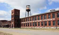
Marathon Motor Works |
|
01996-01-04-0000January 4, 1996
(#95001482) |
1200–1310 and 1305 Clinton St.
36°09′53″N 86°47′44″W / 36.164722°N 86.795556°W / 36.164722; -86.795556 (Marathon Motor Works) |
Nashville |
|
| 100 |
Dr. Richard and Mrs. Margaret Martin House |
|
02007-03-22-0000March 22, 2007
(#07000188) |
825 Kendall Dr.
36°08′02″N 86°51′53″W / 36.133889°N 86.864722°W / 36.133889; -86.864722 (Dr. Richard and Mrs. Margaret Martin House) |
Nashville |
|
| 101 |
Richard E. Martin House |
Upload image |
02003-10-27-0000October 27, 2003
(#03001083) |
30 Castlewood Court
36°04′22″N 86°50′43″W / 36.072778°N 86.845278°W / 36.072778; -86.845278 (Richard E. Martin House) |
Forest Hills |
|
| 102 |
McCrory-Mayfield House |
Upload image |
01982-12-27-0000December 27, 1982
(#82001726) |
1280 Old Hickory Boulevard
36°02′31″N 86°49′41″W / 36.041944°N 86.828056°W / 36.041944; -86.828056 (McCrory-Mayfield House) |
Brentwood |
|
| 103 |
McGavock-Gatewood-Webb House |
|
02007-07-11-0000July 11, 2007
(#07000688) |
908 Meridian St.
36°11′15″N 86°46′07″W / 36.1875°N 86.768611°W / 36.1875; -86.768611 (McGavock-Gatewood-Webb House) |
Nashville |
|
| 104 |
Mechanical Engineering Hall, Vanderbilt University |
|
01978-12-13-0000December 13, 1978
(#78002582) |
Grand Ave. and 21st Ave., S.
36°08′50″N 86°48′00″W / 36.147222°N 86.8°W / 36.147222; -86.8 (Mechanical Engineering Hall, Vanderbilt University) |
Nashville |
|
| 105 |
Miles House |
|
01979-01-08-0000January 8, 1979
(#79002424) |
631 Woodland St.
36°10′25″N 86°45′38″W / 36.173611°N 86.760556°W / 36.173611; -86.760556 (Miles House) |
Nashville |
|
| 106 |
Dr. Cleo Miller House |
Upload image |
01995-08-25-0000August 25, 1995
(#95001045) |
1431 Shelton Ave.
36°12′37″N 86°43′14″W / 36.210258°N 86.720442°W / 36.210258; -86.720442 (Dr. Cleo Miller House) |
Nashville |
|
| 107 |
Morris Memorial Building |
|
01985-01-02-0000January 2, 1985
(#85000046) |
330 Charlotte Ave.
36°10′01″N 86°46′49″W / 36.166944°N 86.780278°W / 36.166944; -86.780278 (Morris Memorial Building) |
Nashville |
|
| 108 |
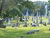
Mount Olivet Cemetery |
|
02005-11-25-0000November 25, 2005
(#05001334) |
1101 Lebanon Pike
36°09′02″N 86°43′58″W / 36.150556°N 86.732778°W / 36.150556; -86.732778 (Mount Olivet Cemetery) |
Nashville |
|
| 109 |
Municipal Public Works Garage Industrial District |
|
02010-11-29-0000November 29, 2010
(#10000949) |
33 Peabody St.
36°09′28″N 86°46′06″W / 36.157778°N 86.768333°W / 36.157778; -86.768333 (Municipal Public Works Garage Industrial District) |
Nashville |
|
| 110 |
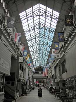
Nashville Arcade |
|
01973-05-22-0000May 22, 1973
(#73001761) |
Between 4th and 5th Aves.
36°09′51″N 86°46′48″W / 36.164167°N 86.78°W / 36.164167; -86.78 (Nashville Arcade) |
Nashville |
|
| 111 |
Nashville Children's Museum |
|
01971-05-06-0000May 6, 1971
(#71000818) |
724 2nd Ave., S.
36°09′15″N 86°46′05″W / 36.154167°N 86.768056°W / 36.154167; -86.768056 (Nashville Children's Museum) |
Nashville |
Originally the University of Nashville, Literary Department Building. Begun in 1853; architect was Major Adolphus Heiman of Nashville.[9]
|
| 112 |
Nashville Christian Institute Gymnasium |
|
02005-03-10-0000March 10, 2005
(#05000181) |
2420 Batavia St.
36°09′40″N 86°48′47″W / 36.161111°N 86.813056°W / 36.161111; -86.813056 (Nashville Christian Institute Gymnasium) |
Nashville |
|
| 113 |
Nashville City Cemetery |
|
01972-10-18-0000October 18, 1972
(#72001235) |
1001 S. 4th Ave.
36°08′51″N 86°46′12″W / 36.1475°N 86.77°W / 36.1475; -86.77 (Nashville City Cemetery) |
Nashville |
|
| 114 |
Nashville Financial Historic District |
|
02002-03-20-0000March 20, 2002
(#02000232) |
3rd Ave., N. and Union St.
36°09′56″N 86°46′42″W / 36.165556°N 86.778333°W / 36.165556; -86.778333 (Nashville Financial Historic District) |
Nashville |
|
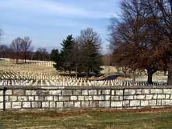
| 115 |
Nashville National Cemetery |
|
01996-12-20-0000December 20, 1996
(#96001516) |
1420 Gallatin Rd., S
36°14′28″N 86°43′35″W / 36.241111°N 86.726389°W / 36.241111; -86.726389 (Nashville National Cemetery) |
Nashville |
|
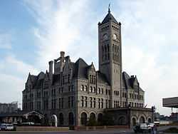
| 116 |
Nashville Union Station and Trainshed |
|
01969-12-30-0000December 30, 1969
(#69000178) |
Broadway and 10th Ave.
36°09′24″N 86°47′04″W / 36.156667°N 86.784444°W / 36.156667; -86.784444 (Nashville Union Station and Trainshed) |
Nashville |
|
| 117 |
Newsom's Mill |
|
01976-09-13-0000September 13, 1976
(#76001771) |
West of Nashville on the Big Harpeth River
36°04′49″N 86°59′47″W / 36.080278°N 86.996389°W / 36.080278; -86.996389 (Newsom's Mill) |
Nashville |
|
| 118 |
Noel Hotel |
|
01984-10-10-0000October 10, 1984
(#84000090) |
200-204 N. 4th Ave.
36°09′50″N 86°46′46″W / 36.163889°N 86.779444°W / 36.163889; -86.779444 (Noel Hotel) |
Nashville |
|
| 119 |
Oglesby School |
|
02002-11-15-0000November 15, 2002
(#02001340) |
5724 Edmondson Pike
36°02′15″N 86°44′34″W / 36.0375°N 86.742778°W / 36.0375; -86.742778 (Oglesby School) |
Nashville |
|
| 120 |
Old Hickory Historic District |
Upload image |
01985-05-24-0000May 24, 1985
(#85001555) |
Bordered by Hadley Ave., Jones St., 8th St., Riverside Dr. and 15th Ave.
36°15′32″N 86°38′42″W / 36.258889°N 86.645°W / 36.258889; -86.645 (Old Hickory Historic District) |
Old Hickory |
|
| 121 |
Old Hickory United Methodist Church |
|
01985-05-24-0000May 24, 1985
(#85001557) |
1216 Hadley Ave.
36°15′28″N 86°38′52″W / 36.257778°N 86.647778°W / 36.257778; -86.647778 (Old Hickory United Methodist Church) |
Old Hickory |
|
| 122 |
Old Natchez Trace |
|
01975-05-30-0000May 30, 1975
(#75002125) |
From the Alabama/Tennessee border to State Route 100 in Davidson County
Coordinates missing |
Nashville |
Extends into Hickman, Lawrence, Lewis, Maury, Wayne, and Williamson counties
|
| 123 |
Omohundro Water Filtration Complex District |
|
01987-05-13-0000May 13, 1987
(#87000380) |
Northeast of Omohundro Dr.
36°09′43″N 86°43′23″W / 36.161944°N 86.723056°W / 36.161944; -86.723056 (Omohundro Water Filtration Complex District) |
Nashville |
|
| 124 |
Overbrook |
|
01984-03-29-0000March 29, 1984
(#84003511) |
4218 Harding Rd.
36°07′55″N 86°50′35″W / 36.131944°N 86.843056°W / 36.131944; -86.843056 (Overbrook) |
Nashville |
|
| 125 |
Overton Lane |
|
01980-07-17-0000July 17, 1980
(#80003795) |
Kirkman Lane
36°05′12″N 86°48′01″W / 36.086667°N 86.800278°W / 36.086667; -86.800278 (Overton Lane) |
Oak Hill |
|
| 126 |
Park-Elkins Historic District |
Upload image |
02011-11-15-0000November 15, 2011
(#11000806) |
Roughly along Park & Elkins between 42nd & 50th Aves.
36°09′02″N 86°50′32″W / 36.150517°N 86.842097°W / 36.150517; -86.842097 (Park-Elkins Historic District) |
Nashville |
|
| 127 |
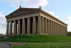
The Parthenon |
|
01972-02-23-0000February 23, 1972
(#72001236) |
Centennial Park
36°08′59″N 86°48′49″W / 36.149722°N 86.813611°W / 36.149722; -86.813611 (The Parthenon) |
Nashville |
|
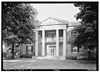
| 128 |
Peabody College for Teachers |
|
01966-10-15-0000October 15, 1966
(#66000723) |
21st Ave., S. and Edgehill Ave.
36°08′30″N 86°47′55″W / 36.141667°N 86.798611°W / 36.141667; -86.798611 (Peabody College for Teachers) |
Nashville |
|
| 129 |
Pearl High School |
|
02002-08-02-0000August 2, 2002
(#02000828) |
613 17th Ave., N.
36°09′43″N 86°48′01″W / 36.161944°N 86.800278°W / 36.161944; -86.800278 (Pearl High School) |
Nashville |
|
| 130 |
Thomas W. Phillips Memorial |
|
02006-11-09-0000November 9, 2006
(#06001036) |
1101 19th Ave., S.
36°08′44″N 86°47′52″W / 36.145556°N 86.797778°W / 36.145556; -86.797778 (Thomas W. Phillips Memorial) |
Nashville |
|
| 131 |
Dr. Cobb Pilcher House |
Upload image |
02003-10-27-0000October 27, 2003
(#03001082) |
5335 Stanford Dr.
36°04′55″N 86°49′37″W / 36.081944°N 86.826944°W / 36.081944; -86.826944 (Dr. Cobb Pilcher House) |
Forest Hills |
|
| 132 |
Primitive Baptist Church |
|
01984-05-15-0000May 15, 1984
(#84003513) |
627-629 3rd Ave., S.
36°09′15″N 86°46′19″W / 36.154167°N 86.771944°W / 36.154167; -86.771944 (Primitive Baptist Church) |
Nashville |
|
| 133 |
Printers Alley Historic District |
|
01982-08-26-0000August 26, 1982
(#82003964) |
Roughly bounded by 3rd and 4th Aves., Bank Alley, and both sides of Church St.
36°09′51″N 86°46′43″W / 36.164167°N 86.778611°W / 36.164167; -86.778611 (Printers Alley Historic District) |
Nashville |
|
| 134 |
RCA Studio B |
|
02012-07-10-0000July 10, 2012
(#12000420) |
1611 Roy Acuff Pl.
36°09′00″N 86°47′34″W / 36.149996°N 86.792863°W / 36.149996; -86.792863 (RCA Studio B) |
Nashville |
|
| 135 |
Rich-Schwartz Building |
|
01984-10-10-0000October 10, 1984
(#84000091) |
202-204 N. 6th Ave.
36°09′47″N 86°46′56″W / 36.163056°N 86.782222°W / 36.163056; -86.782222 (Rich-Schwartz Building) |
Nashville |
|
| 136 |
Richland Hall |
|
01983-09-01-0000September 1, 1983
(#83003028) |
4822 Charlotte Ave.
36°09′08″N 86°50′45″W / 36.152222°N 86.845833°W / 36.152222; -86.845833 (Richland Hall) |
Nashville |
|
| 137 |
Richland-West End Historic District |
|
01979-04-16-0000April 16, 1979
(#79002425) |
Roughly bounded by railroad tracks, Murphy Rd., and Park Circle, Wilson, and Richland Aves.
36°08′09″N 86°49′50″W / 36.135833°N 86.830556°W / 36.135833; -86.830556 (Richland-West End Historic District) |
Nashville |
|
| 138 |
Riverwood |
|
01977-07-20-0000July 20, 1977
(#77001264) |
1833 Welcome Lane
36°12′N 86°43′W / 36.2°N 86.71°W / 36.2; -86.71 (Riverwood) |
Nashville |
|
| 139 |
James Robertson Hotel |
|
01984-10-10-0000October 10, 1984
(#84000092) |
118 N. 7th Ave.
36°09′37″N 86°46′54″W / 36.160278°N 86.781667°W / 36.160278; -86.781667 (James Robertson Hotel) |
Nashville |
|
| 140 |
Robincroft |
|
01978-07-10-0000July 10, 1978
(#78002583) |
746 Benton Ave.
36°07′58″N 86°46′35″W / 36.132639°N 86.776389°W / 36.132639; -86.776389 (Robincroft) |
Nashville |
|
| 141 |
Rutledge Hill Historic District |
|
01980-07-08-0000July 8, 1980
(#80003793) |
Roughly bounded by Middleton, 2nd, Lea, and Hermitage Aves.
36°09′19″N 86°46′09″W / 36.155278°N 86.769167°W / 36.155278; -86.769167 (Rutledge Hill Historic District) |
Nashville |
|
| 142 |
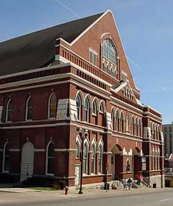
Ryman Auditorium |
|
01971-05-06-0000May 6, 1971
(#71000819) |
116 5th Ave., N.
36°09′39″N 86°46′44″W / 36.160833°N 86.778889°W / 36.160833; -86.778889 (Ryman Auditorium) |
Nashville |
|
| 143 |
St. Ann's Episcopal Church |
|
01983-11-18-0000November 18, 1983
(#83004237) |
419 Woodland St.
36°10′18″N 86°45′56″W / 36.171667°N 86.765556°W / 36.171667; -86.765556 (St. Ann's Episcopal Church) |
Nashville |
|
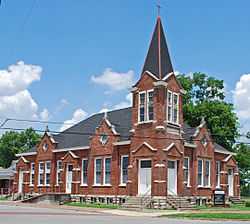
| 144 |
St. Cecilia Academy |
|
01976-12-12-0000December 12, 1976
(#76001772) |
8th Ave. and Clay St.
36°11′13″N 86°48′04″W / 36.186944°N 86.801111°W / 36.186944; -86.801111 (St. Cecilia Academy) |
Nashville |
|
| 145 |
St. Mary's Catholic Church |
|
01970-07-08-0000July 8, 1970
(#70000609) |
330 5th Ave., N.
36°09′57″N 86°46′53″W / 36.165833°N 86.781389°W / 36.165833; -86.781389 (St. Mary's Catholic Church) |
Nashville |
|
| 146 |
St. Patrick's Catholic Church and Rectory |
|
01984-05-15-0000May 15, 1984
(#84003516) |
1219 2nd Ave., S.
36°08′39″N 86°45′51″W / 36.144167°N 86.764167°W / 36.144167; -86.764167 (St. Patrick's Catholic Church and Rectory) |
Nashville |
|
| 147 |
Sandbar Village |
Upload image |
01994-07-22-0000July 22, 1994
(#94000749) |
Both sides of the Cumberland River, northwest of Nashville[10]
36°12′20″N 86°53′52″W / 36.205556°N 86.897778°W / 36.205556; -86.897778 (Sandbar Village) |
Nashville |
|
| 148 |
Savage House |
|
01983-01-11-0000January 11, 1983
(#83003029) |
167 8th Ave., N.
36°09′39″N 86°47′01″W / 36.160833°N 86.783611°W / 36.160833; -86.783611 (Savage House) |
Nashville |
|
| 149 |
Scarritt College Historic District |
|
01982-08-26-0000August 26, 1982
(#82003965) |
19th Ave., S.
36°08′46″N 86°47′48″W / 36.146111°N 86.796667°W / 36.146111; -86.796667 (Scarritt College Historic District) |
Nashville |
|
| 150 |
Second Avenue Commercial District |
|
01972-02-23-0000February 23, 1972
(#72001237) |
2nd Ave. between Brandon St. and Broadway
36°09′50″N 86°46′35″W / 36.163889°N 86.776389°W / 36.163889; -86.776389 (Second Avenue Commercial District) |
Nashville |
|
| 151 |
Abner T. Shaw House |
Upload image |
01985-03-28-0000March 28, 1985
(#85000671) |
4866 Brick Church Pike
36°18′53″N 86°46′38″W / 36.314722°N 86.777222°W / 36.314722; -86.777222 (Abner T. Shaw House) |
Goodlettsville |
|
| 152 |
Shelby Street Bridge |
|
01986-11-20-0000November 20, 1986
(#86003237) |
Over the Cumberland River at Shelby St.
36°09′43″N 86°46′19″W / 36.161944°N 86.771944°W / 36.161944; -86.771944 (Shelby Street Bridge) |
Nashville |
|
| 153 |
Smith Farmhouse |
Upload image |
01983-11-17-0000November 17, 1983
(#83004239) |
State Route 100; also 8600 State Route 100, north and west of the original boundaries
36°02′09″N 86°58′54″W / 36.035833°N 86.981667°W / 36.035833; -86.981667 (Smith Farmhouse) |
Pasquo |
8600 State Route 100 represents a boundary increase of 01991-06-24-0000June 24, 1991
|
| 154 |
Southern Methodist Publishing House |
|
01984-09-13-0000September 13, 1984
(#84003519) |
810 Broadway
36°09′31″N 86°46′57″W / 36.158611°N 86.7825°W / 36.158611; -86.7825 (Southern Methodist Publishing House) |
Nashville |
|
| 155 |
Stone Hall |
|
02010-11-17-0000November 17, 2010
(#10000923) |
1014 Stones River Rd.
36°11′16″N 86°37′58″W / 36.187778°N 86.632778°W / 36.187778; -86.632778 (Stone Hall) |
Nashville |
|
| 156 |
Frederick Stump House |
Upload image |
01973-04-02-0000April 2, 1973
(#73001762) |
4949 Buena Vista Pike
36°13′22″N 86°49′31″W / 36.222778°N 86.825278°W / 36.222778; -86.825278 (Frederick Stump House) |
Nashville |
|
| 157 |
Sunnyside |
|
01974-10-01-0000October 1, 1974
(#74001910) |
3000 Granny White Pike
36°07′09″N 86°47′20″W / 36.119167°N 86.788889°W / 36.119167; -86.788889 (Sunnyside) |
Nashville |
|
| 158 |
Tanglewood Historic District |
Upload image |
01998-07-20-0000July 20, 1998
(#98000819) |
4907, 4909, and 4911 Tanglewood Dr.; also 4905 Tanglewood Dr.
36°14′07″N 86°43′02″W / 36.2354°N 86.717233°W / 36.2354; -86.717233 (Tanglewood Historic District) |
Nashville |
4905 Tanglewood represents a boundary increase of 01999-03-19-0000March 19, 1999
|
| 159 |
Temple Cemetery |
|
02004-05-12-0000May 12, 2004
(#04000440) |
2001 15th Ave. N
36°11′09″N 86°48′41″W / 36.185833°N 86.811389°W / 36.185833; -86.811389 (Temple Cemetery) |
Nashville |
|
| 160 |
Tennessee Manufacturing Company |
|
01999-06-25-0000June 25, 1999
(#99000759) |
1400 8th Ave., N.
36°10′43″N 86°47′32″W / 36.178611°N 86.792222°W / 36.178611; -86.792222 (Tennessee Manufacturing Company) |
Nashville |
|
| 161 |
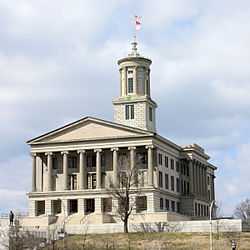
Tennessee State Capitol |
|
01970-07-08-0000July 8, 1970
(#70000894) |
Capitol Hill
36°09′57″N 86°47′03″W / 36.165833°N 86.784167°W / 36.165833; -86.784167 (Tennessee State Capitol) |
Nashville |
|
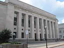
| 162 |
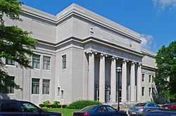
Tennessee State Library and Archives |
|
02003-11-17-0000November 17, 2003
(#03001154) |
403 7th Ave., N.
36°09′56″N 86°47′07″W / 36.165556°N 86.785278°W / 36.165556; -86.785278 (Tennessee State Library and Archives) |
Nashville |
|
| 163 |
Tennessee State Office Building |
|
02011-07-13-0000July 13, 2011
(#11000455) |
6th Ave., N. & Charlotte Ave.
36°09′58″N 86°46′57″W / 36.166111°N 86.7825°W / 36.166111; -86.7825 (Tennessee State Office Building) |
Nashville |
|
| 164 |
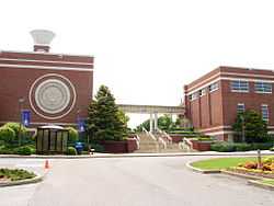
Tennessee State University Historic District |
|
01996-06-14-0000June 14, 1996
(#96000677) |
3500 John A. Merritt Boulevard
36°10′00″N 86°49′48″W / 36.166667°N 86.83°W / 36.166667; -86.83 (Tennessee State University Historic District) |
Nashville |
|
| 165 |
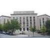
Tennessee Supreme Court Building |
|
02014-03-18-0000March 18, 2014
(#14000084) |
401 7th Ave., N.
36°09′54″N 86°47′05″W / 36.16493°N 86.784859°W / 36.16493; -86.784859 (Tennessee Supreme Court Building) |
Nashville |
|
| 166 |
Third Baptist Church |
|
01979-10-31-0000October 31, 1979
(#79002427) |
906 and 908 Monroe St.
36°10′30″N 86°47′43″W / 36.175°N 86.795278°W / 36.175; -86.795278 (Third Baptist Church) |
Nashville |
|
| 167 |
Travellers' Rest |
|
01969-12-30-0000December 30, 1969
(#69000179) |
Franklin Rd.
36°04′37″N 86°45′49″W / 36.076950°N 86.763687°W / 36.076950; -86.763687 (Travellers' Rest) |
Nashville |
|
| 168 |
Tulip Grove |
|
01970-02-26-0000February 26, 1970
(#70000607) |
Lebanon Rd.
36°12′45″N 86°36′21″W / 36.2125°N 86.605833°W / 36.2125; -86.605833 (Tulip Grove) |
Hermitage |
|
| 169 |
Two Rivers |
|
01972-02-23-0000February 23, 1972
(#72001238) |
3130 McGavock Pike
36°11′23″N 86°40′39″W / 36.189722°N 86.6775°W / 36.189722; -86.6775 (Two Rivers) |
Nashville |
|
| 170 |
US Post Office |
|
01984-11-15-0000November 15, 1984
(#84000580) |
901 Broadway
36°09′28″N 86°47′02″W / 36.157778°N 86.783889°W / 36.157778; -86.783889 (US Post Office) |
Nashville |
|
| 171 |
U.S. Naval Reserve Training Center |
|
02011-07-06-0000July 6, 2011
(#11000419) |
1515 Davidson St.
36°09′52″N 86°44′27″W / 36.164444°N 86.740833°W / 36.164444; -86.740833 (U.S. Naval Reserve Training Center) |
Nashville |
|
| 172 |
US Post Office-Old Hickory |
Upload image |
01985-08-06-0000August 6, 1985
(#85002401) |
1010 Donelson Ave.
36°15′49″N 86°39′02″W / 36.263611°N 86.650556°W / 36.263611; -86.650556 (US Post Office-Old Hickory) |
Old Hickory |
|
| 173 |
Utopia Hotel |
|
01979-03-26-0000March 26, 1979
(#79002428) |
206 4th Ave., N.
36°09′50″N 86°46′44″W / 36.164000°N 86.778889°W / 36.164000; -86.778889 (Utopia Hotel) |
Nashville |
|
| 174 |
Warner Park Historic Park |
Upload image |
01984-01-20-0000January 20, 1984
(#84003528) |
Roughly bounded by the Little Harpeth River, Belle Meade Boulevard, State Route 100, and Chickering Rd.
36°03′47″N 86°53′30″W / 36.063056°N 86.891667°W / 36.063056; -86.891667 (Warner Park Historic Park) |
Nashville |
Extends into Williamson County
|
| 175 |
Waverly Place Historic District |
|
01985-03-28-0000March 28, 1985
(#85000676) |
Roughly bounded by Beech, Douglas, and Bradford Aves., 10th Ave., S., and Acklen Ave.
36°07′51″N 86°46′56″W / 36.130833°N 86.782222°W / 36.130833; -86.782222 (Waverly Place Historic District) |
Nashville |
|
| 176 |
Weakley-Truett-Clark House |
|
01989-04-13-0000April 13, 1989
(#89000297) |
415 Rosebank Ave.
36°11′15″N 86°43′14″W / 36.1875°N 86.720556°W / 36.1875; -86.720556 (Weakley-Truett-Clark House) |
Nashville |
|
| 177 |
West End High School |
|
02003-08-01-0000August 1, 2003
(#03000726) |
3529 West End Ave.
36°07′54″N 86°49′26″W / 36.131667°N 86.823889°W / 36.131667; -86.823889 (West End High School) |
Nashville |
|
| 178 |
West Meade |
|
01975-03-04-0000March 4, 1975
(#75001750) |
Old Harding Pike
36°06′02″N 86°52′40″W / 36.100556°N 86.877778°W / 36.100556; -86.877778 (West Meade) |
Nashville |
|
| 179 |
Whites Creek Historic District |
|
01984-08-16-0000August 16, 1984
(#84003530) |
Whites Creek Pike and Old Hickory Boulevard
36°15′32″N 86°49′43″W / 36.258889°N 86.828611°W / 36.258889; -86.828611 (Whites Creek Historic District) |
Whites Creek |
|
| 180 |
Whitland Area Neighborhood |
|
02007-07-24-0000July 24, 2007
(#07000763) |
Roughly bounded by Whitland Ave., Bowling Ave., S. Wilson Boulevard, and a tributary of Richland Creek.
36°07′45″N 86°49′44″W / 36.129167°N 86.828889°W / 36.129167; -86.828889 (Whitland Area Neighborhood) |
Nashville |
|
| 181 |
Wilkinson House |
Upload image |
02006-11-29-0000November 29, 2006
(#06001095) |
7663 Wilkinson Rd.
36°20′58″N 86°51′14″W / 36.349444°N 86.853889°W / 36.349444; -86.853889 (Wilkinson House) |
Joelton |
|
| 182 |
Woman's Club of Nashville (J.B. Daniel House) |
|
02010-07-19-0000July 19, 2010
(#10000481) |
3206 Hillsboro Pike
36°07′06″N 86°48′32″W / 36.118333°N 86.808889°W / 36.118333; -86.808889 (Woman's Club of Nashville (J.B. Daniel House)) |
Nashville |
|
| 183 |
Woodland in Waverly Historic District |
|
01982-03-25-0000March 25, 1982
(#82003966) |
Roughly bounded by Interstate 65, 8th, Bradford and Wedgewood Aves.
36°07′54″N 86°46′38″W / 36.131667°N 86.777222°W / 36.131667; -86.777222 (Woodland in Waverly Historic District) |
Nashville |
|
| 184 |
Woodlawn |
|
01978-11-21-0000November 21, 1978
(#78002584) |
127 Woodmont Boulevard
36°07′19″N 86°50′43″W / 36.121944°N 86.845278°W / 36.121944; -86.845278 (Woodlawn) |
Nashville |
|
| 185 |
Woodmont Terrace Apartments |
|
02003-04-21-0000April 21, 2003
(#03000280) |
920 Woodmont Blvd.
36°06′41″N 86°47′00″W / 36.11135°N 86.783431°W / 36.11135; -86.783431 (Woodmont Terrace Apartments) |
Nashville |
|
| 186 |
Young Women's Christian Association Building |
|
01982-12-16-0000December 16, 1982
(#82001727) |
211 7th Ave., N.
36°09′46″N 86°47′00″W / 36.162778°N 86.783333°W / 36.162778; -86.783333 (Young Women's Christian Association Building) |
Nashville |
|


.jpg)
.JPG)
.JPG)
.JPG)