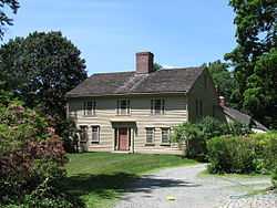
| [2] |
Name on the Register[3] |
Image |
Date listed[4] |
Location |
Description |
|---|
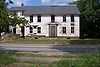
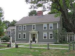
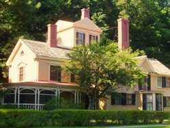
| 1 |
Col. James Barrett Farm |
|
01973-11-15-0000November 15, 1973
(#73000290) |
448 Barrett's Mill Rd.
42°28′55″N 71°22′54″W / 42.481944°N 71.381667°W / 42.481944; -71.381667 (Col. James Barrett Farm) |
|
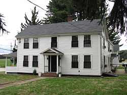
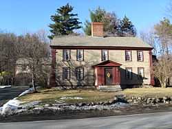
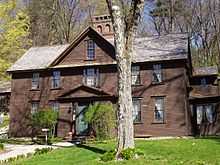
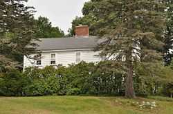
| 2 |
Colonel Roger Brown House |
|
01983-01-27-0000January 27, 1983
(#83000785) |
1694 Main St.
42°27′11″N 71°24′33″W / 42.453056°N 71.409167°W / 42.453056; -71.409167 (Colonel Roger Brown House) |
|
| 3 |
Concord Armory |
|
02007-09-12-0000September 12, 2007
(#07000945) |
51 Walden St.
42°27′32″N 71°20′58″W / 42.458889°N 71.349444°W / 42.458889; -71.349444 (Concord Armory) |
|
| 4 |
Concord Monument Square-Lexington Road Historic District |
|
01977-09-13-0000September 13, 1977
(#77000172) |
MA 2A
42°27′34″N 71°20′51″W / 42.459444°N 71.3475°W / 42.459444; -71.3475 (Concord Monument Square-Lexington Road Historic District) |
|
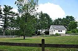
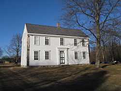
| 5 |
Dr. John Cuming House |
|
01977-11-11-0000November 11, 1977
(#77000175) |
West of Concord at Barretts Mill Rd. and Reformatory Circle
42°28′02″N 71°23′47″W / 42.467361°N 71.396278°W / 42.467361; -71.396278 (Dr. John Cuming House) |
At 998 Elm Street
|
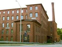
| 6 |
Damon Mill |
|
01979-05-25-0000May 25, 1979
(#79000360) |
9 Pond Lane
42°27′12″N 71°24′35″W / 42.453333°N 71.409722°W / 42.453333; -71.409722 (Damon Mill) |
|
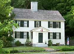
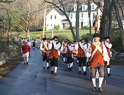
| 7 |
Isaac Davis Trail |
|
01972-04-11-0000April 11, 1972
(#72001347) |
Running east-west between the towns of Acton and Concord
42°28′48″N 71°23′57″W / 42.48°N 71.399167°W / 42.48; -71.399167 (Isaac Davis Trail) |
|
| 8 |
Ralph Waldo Emerson House |
|
01966-10-15-0000October 15, 1966
(#66000365) |
18 Cambridge Turnpike
42°27′27″N 71°20′39″W / 42.4575°N 71.344167°W / 42.4575; -71.344167 (Ralph Waldo Emerson House) |
National Historic Landmark
|
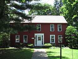
| 9 |
Jonathan Hildreth House |
|
01991-04-03-0000April 3, 1991
(#91000362) |
8 Barrett's Mill Rd.
42°28′27″N 71°21′56″W / 42.474167°N 71.365556°W / 42.474167; -71.365556 (Jonathan Hildreth House) |
|
| 10 |
Hosmer Homestead |
|
01999-06-03-0000June 3, 1999
(#99000659) |
138 Baker Ave.
42°27′41″N 71°23′05″W / 42.461389°N 71.384722°W / 42.461389; -71.384722 (Hosmer Homestead) |
|
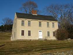
| 11 |
Joseph Hosmer House |
|
01990-03-09-0000March 9, 1990
(#90000170) |
572 Main St.
42°27′26″N 71°22′13″W / 42.457222°N 71.370278°W / 42.457222; -71.370278 (Joseph Hosmer House) |
|
| 12 |
Hubbard-French District |
|
02000-06-15-0000June 15, 2000
(#00000686) |
324 and 342 Sudbury Rd.
42°27′05″N 71°21′35″W / 42.451389°N 71.359722°W / 42.451389; -71.359722 (Hubbard-French District) |
|
| 13 |
Minute Man National Historical Park |
|
01966-10-15-0000October 15, 1966
(#66000935) |
From Concord to Lexington on MA 2A
42°28′09″N 71°21′01″W / 42.4692°N 71.3504°W / 42.4692; -71.3504 (Minute Man National Historical Park) |
Boundary increase (added 2002-11-29): Lexington, MA
|
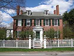
| 14 |
Old Manse |
|
01966-10-15-0000October 15, 1966
(#66000775) |
Monument St.
42°28′06″N 71°20′58″W / 42.468333°N 71.349444°W / 42.468333; -71.349444 (Old Manse) |
National Historic Landmark
|
| 15 |
Orchard House |
|
01966-10-15-0000October 15, 1966
(#66000781) |
Lexington Rd.
42°27′32″N 71°20′08″W / 42.458889°N 71.335556°W / 42.458889; -71.335556 (Orchard House) |
National Historic Landmark
|
| 16 |
Parkman Tavern |
|
01979-06-19-0000June 19, 1979
(#79000358) |
South of Concord at 20 Powder Mill Rd.
42°25′46″N 71°22′36″W / 42.429444°N 71.376667°W / 42.429444; -71.376667 (Parkman Tavern) |
|
| 17 |
Pest House |
|
01977-04-18-0000April 18, 1977
(#77000174) |
153 Fairhaven Rd.
42°26′51″N 71°21′38″W / 42.4475°N 71.360556°W / 42.4475; -71.360556 (Pest House) |
|
| 18 |
Thomas Mott Shaw Estate |
|
01987-11-20-0000November 20, 1987
(#87001395) |
317 Garfield Rd.
42°25′42″N 71°21′49″W / 42.428333°N 71.363611°W / 42.428333; -71.363611 (Thomas Mott Shaw Estate) |
|
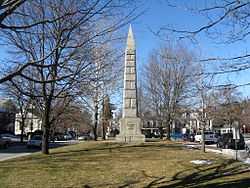
| 19 |
Sleepy Hollow Cemetery |
|
01998-08-19-0000August 19, 1998
(#98000991) |
34A Bedford St.
42°27′52″N 71°20′42″W / 42.464444°N 71.345°W / 42.464444; -71.345 (Sleepy Hollow Cemetery) |
|
| 20 |
Thoreau-Alcott House |
|
01976-07-12-0000July 12, 1976
(#76000247) |
255 Main St.
42°27′30″N 71°21′30″W / 42.458333°N 71.358333°W / 42.458333; -71.358333 (Thoreau-Alcott House) |
|
| 21 |
Union Station |
|
01989-03-02-0000March 2, 1989
(#89000143) |
20 Commonwealth Ave.
42°27′24″N 71°23′40″W / 42.456667°N 71.394444°W / 42.456667; -71.394444 (Union Station) |
|
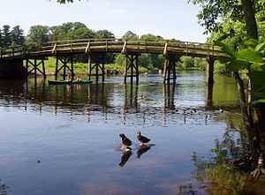
| 22 |
Walden Pond |
|
01966-10-15-0000October 15, 1966
(#66000790) |
1.5 mi (2.4 km) south of Concord
42°26′20″N 71°20′20″W / 42.438889°N 71.338889°W / 42.438889; -71.338889 (Walden Pond) |
National Historic Landmark
|
| 23 |
The Wayside |
|
01980-07-11-0000July 11, 1980
(#80000356) |
455 Lexington Rd.
42°27′33″N 71°20′02″W / 42.459167°N 71.333889°W / 42.459167; -71.333889 (The Wayside) |
National Historic Landmark
|
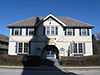
| 24 |
Wheeler-Harrington House |
|
02013-07-23-0000July 23, 2013
(#13000534) |
249 Harrington Ave.
42°26′57″N 71°24′12″W / 42.449044°N 71.403454°W / 42.449044; -71.403454 (Wheeler-Harrington House) |
|
| 25 |
Wheeler-Minot Farmhouse |
|
02004-03-19-0000March 19, 2004
(#04000190) |
341 Virginia Rd.
42°28′10″N 71°18′41″W / 42.469444°N 71.311389°W / 42.469444; -71.311389 (Wheeler-Minot Farmhouse) |
|
| 26 |
Wheeler-Merriam House |
|
01982-11-26-0000November 26, 1982
(#82000493) |
477 Virginia Rd.
42°28′06″N 71°18′28″W / 42.468333°N 71.307778°W / 42.468333; -71.307778 (Wheeler-Merriam House) |
|
| 27 |
Wright's Tavern |
|
01966-10-15-0000October 15, 1966
(#66000793) |
Lexington Road opposite the Burying Ground
42°27′36″N 71°20′57″W / 42.46°N 71.349167°W / 42.46; -71.349167 (Wright's Tavern) |
National Historic Landmark |
.JPG)
%2C_Concord%2C_Massachusetts.JPG)
.JPG)
