| [3] |
Name on the Register |
Image |
Date listed[4] |
Location |
City or town |
Description |
|---|
| 1 |
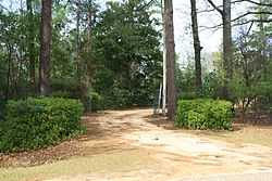
Airmount Grave Shelter |
|
02000-02-24-0000February 24, 2000
(#00000142) |
Northern side of State Route 5, 0.5 miles west of the county line
31°58′08″N 87°40′09″W / 31.968889°N 87.669167°W / 31.968889; -87.669167 (Airmount Grave Shelter) |
Thomasville |
|
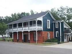
| 2 |
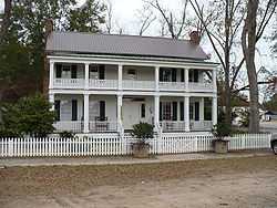
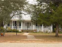
Alston-Cobb House |
|
01979-04-30-0000April 30, 1979
(#79000382) |
120 Cobb St.
31°42′33″N 87°47′34″W / 31.709167°N 87.792778°W / 31.709167; -87.792778 (Alston-Cobb House) |
Grove Hill |
|
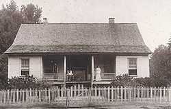
| 3 |
Bush House |
|
01999-07-28-0000July 28, 1999
(#99000885) |
168 N. Church St.
31°42′57″N 87°46′32″W / 31.715833°N 87.775556°W / 31.715833; -87.775556 (Bush House) |
Grove Hill |
|
| 4 |
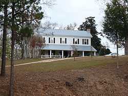
Clarke Mills |
|
01998-04-30-0000April 30, 1998
(#98000411) |
301 W. Church St.
31°30′33″N 87°53′50″W / 31.509167°N 87.897222°W / 31.509167; -87.897222 (Clarke Mills) |
Jackson |
|
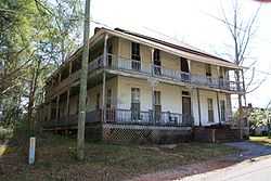
| 5 |
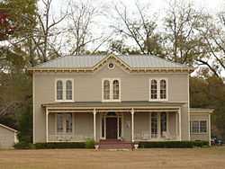
Stephen Beech Cleveland House |
|
01999-07-28-0000July 28, 1999
(#99000886) |
County Road 35, 2.4 miles south of U.S. Route 84
31°36′36″N 87°41′16″W / 31.61°N 87.687778°W / 31.61; -87.687778 (Stephen Beech Cleveland House) |
Suggsville |
|
| 6 |
John A. Coate House |
|
01999-07-28-0000July 28, 1999
(#99000887) |
DuBose St., between Church and Crawford Sts.
31°42′17″N 87°46′29″W / 31.704722°N 87.774722°W / 31.704722; -87.774722 (John A. Coate House) |
Grove Hill |
|
| 7 |
Cobb House |
|
01999-07-28-0000July 28, 1999
(#99000888) |
U.S. Route 84, 1.4 miles west of U.S. Route 43
31°42′28″N 87°48′07″W / 31.707778°N 87.801944°W / 31.707778; -87.801944 (Cobb House) |
Grove Hill |
|
| 8 |
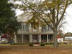
Dickinson House |
|
01978-09-13-0000September 13, 1978
(#78000485) |
101 Dickinson Ave.
31°42′36″N 87°46′21″W / 31.71°N 87.7725°W / 31.71; -87.7725 (Dickinson House) |
Grove Hill |
|
| 9 |
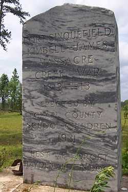
Fort Sinquefield |
|
01974-12-31-0000December 31, 1974
(#74000403) |
Southeast of Grove Hill
31°09′34″N 87°42′22″W / 31.159444°N 87.706111°W / 31.159444; -87.706111 (Fort Sinquefield) |
Grove Hill |
|
| 10 |
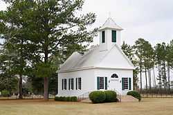
Gainestown Methodist Church and Cemetery |
|
01999-07-28-0000July 28, 1999
(#99000889) |
County Road 29, 0.3 miles south of County Road 33
31°26′31″N 87°41′40″W / 31.441944°N 87.694444°W / 31.441944; -87.694444 (Gainestown Methodist Church and Cemetery) |
Gainestown |
|
| 11 |
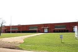
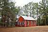
Gainestown Schoolhouse |
|
01992-10-01-0000October 1, 1992
(#92000033) |
Western side of Gainestown-Suggsville Public Rd. north of Good Hope Church
31°27′10″N 87°41′33″W / 31.452778°N 87.6925°W / 31.452778; -87.6925 (Gainestown Schoolhouse) |
Gainestown |
|
| 12 |
Grove Hill Courthouse Square Historic District |
|
01998-04-30-0000April 30, 1998
(#98000410) |
Roughly along Cobb, Court, Jackson, and Main Sts.
Coordinates missing |
Grove Hill |
|
| 13 |
Jackson Historic District |
|
01998-01-23-0000January 23, 1998
(#97001656) |
Roughly along College, Forest, and Carroll Aves., bounded by Cedar, Florida, Commerce, Clinton, and Spruce Sts.
Coordinates missing |
Jackson |
|
| 14 |
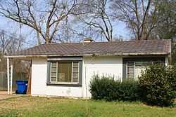
Doit W. McClellan Lustron House |
|
02000-02-24-0000February 24, 2000
(#00000136) |
116 W. Pearl St.
31°30′59″N 87°53′45″W / 31.516389°N 87.895833°W / 31.516389; -87.895833 (Doit W. McClellan Lustron House) |
Jackson |
|
| 15 |
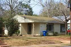
J. P. McKee Lustron House |
|
02000-02-24-0000February 24, 2000
(#00000132) |
519 College Ave.
31°31′00″N 87°53′43″W / 31.516667°N 87.895278°W / 31.516667; -87.895278 (J. P. McKee Lustron House) |
Jackson |
|
| 16 |
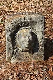
Isaac Nettles Gravestones |
|
02000-02-24-0000February 24, 2000
(#00000141) |
Eastern side of Mt. Nebo Rd., 0.5 miles south of County Road 19
31°20′47″N 87°52′05″W / 31.346389°N 87.868056°W / 31.346389; -87.868056 (Isaac Nettles Gravestones) |
Carlton |
|
| 17 |
Jesse Pickens Pugh Farmstead |
|
01999-07-28-0000July 28, 1999
(#99000890) |
U.S. Route 84, 3.5 miles west of Grove Hill
31°42′21″N 87°49′58″W / 31.705833°N 87.832778°W / 31.705833; -87.832778 (Jesse Pickens Pugh Farmstead) |
Grove Hill |
|
| 18 |
Thomasville Historic District |
|
01999-02-12-0000February 12, 1999
(#99000151) |
Roughly bounded by State Route 43, 1145 W. Front St., Wilson St., and 818 W. 3rd St.
Coordinates missing |
Thomasville |
|
| 19 |
Whatley Historic District |
|
01998-04-30-0000April 30, 1998
(#98000409) |
Roughly along Whatley Rd. from Grove Hill to the railroad tracks
Coordinates missing |
Whatley |
|
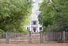
| 20 |
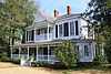
Wilson-Finlay House |
|
01978-07-12-0000July 12, 1978
(#78000484) |
North of Gainestown on Suggsville Rd.
31°27′12″N 87°41′29″W / 31.453333°N 87.691389°W / 31.453333; -87.691389 (Wilson-Finlay House) |
Gainestown |
|
| 21 |
Woodlands |
|
01980-04-28-0000April 28, 1980
(#80000683) |
Off U.S. Route 84
31°35′03″N 87°34′24″W / 31.584167°N 87.573333°W / 31.584167; -87.573333 (Woodlands) |
Gosport |
|