| [3] |
Name on the Register |
Image |
Date listed[4] |
Location |
City or town |
Description |
|---|
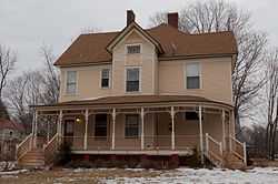
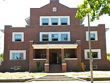
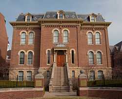
| 1 |
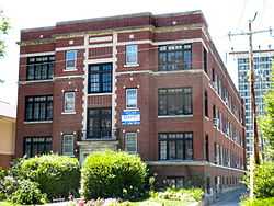
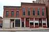
Henry Ahrens House |
|
02011-11-22-0000November 22, 2011
(#11000845) |
212 E. University Ave.
40°07′00″N 88°14′08″W / 40.116573°N 88.235656°W / 40.116573; -88.235656 (Henry Ahrens House) |
Champaign |
|
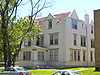
| 2 |
Alpha Delta Phi Fraternity House |
|
01990-05-21-0000May 21, 1990
(#90000752) |
310 E. John St.
40°06′33″N 88°14′02″W / 40.109167°N 88.233889°W / 40.109167; -88.233889 (Alpha Delta Phi Fraternity House) |
Champaign |
|
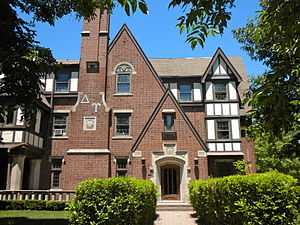
| 3 |
Alpha Delta Pi Sorority House |
|
02000-11-08-0000November 8, 2000
(#00001333) |
1202 W. Nevada St.
40°06′22″N 88°13′27″W / 40.106111°N 88.224167°W / 40.106111; -88.224167 (Alpha Delta Pi Sorority House) |
Urbana |
|
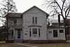
| 4 |
Alpha Gamma Delta Fraternity House |
|
02009-08-05-0000August 5, 2009
(#09000589) |
1106 S. Lincoln Ave.
40°06′13″N 88°13′09″W / 40.103619°N 88.219164°W / 40.103619; -88.219164 (Alpha Gamma Delta Fraternity House) |
Urbana |
|
| 5 |
Alpha Phi Fraternity House-Beta Alpha Chapter |
|
02005-11-15-0000November 15, 2005
(#05001250) |
508 E. Amory Ave.
40°06′27″N 88°13′52″W / 40.1075°N 88.231111°W / 40.1075; -88.231111 (Alpha Phi Fraternity House-Beta Alpha Chapter) |
Champaign |
|
| 6 |
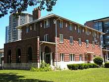
Alpha Rho Chi Fraternity House |
|
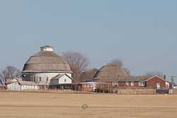
01997-05-23-0000May 23, 1997
(#97000460) |
1108 S. First St.
40°06′16″N 88°14′18″W / 40.104444°N 88.238333°W / 40.104444; -88.238333 (Alpha Rho Chi Fraternity House) |
Champaign |
|
| 7 |
Alpha Xi Delta Sorority Chapter House |
|
01989-08-28-0000August 28, 1989
(#89001110) |
715 W. Michigan Ave.
40°06′05″N 88°13′06″W / 40.101389°N 88.218333°W / 40.101389; -88.218333 (Alpha Xi Delta Sorority Chapter House) |
Urbana |
|
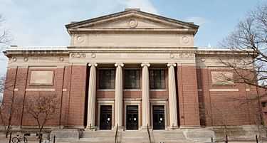
| 8 |
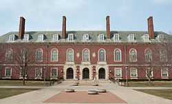
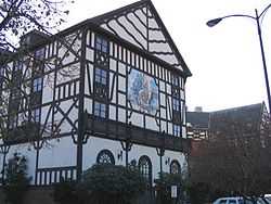
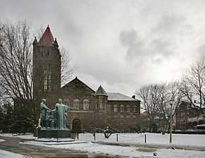
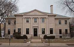
Altgeld Hall, University of Illinois |
|
01970-04-17-0000April 17, 1970
(#70000229) |
University of Illinois campus, corner of Wright and John Sts.
40°06′34″N 88°13′42″W / 40.109444°N 88.228333°W / 40.109444; -88.228333 (Altgeld Hall, University of Illinois) |
Urbana |
|
| 9 |
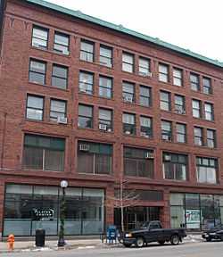
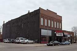
Bailey-Rugg Building |
|
01997-11-07-0000November 7, 1997
(#97001337) |
219-225 N. Neil St.
40°07′05″N 88°14′37″W / 40.118056°N 88.243611°W / 40.118056; -88.243611 (Bailey-Rugg Building) |
Champaign |
Destroyed by fire, November 7, 2008[5]
|
| 10 |
Beta Theta Pi Fraternity House |
|
01989-08-28-0000August 28, 1989
(#89001108) |
202 E. Daniel St.
40°06′29″N 88°14′09″W / 40.108056°N 88.235833°W / 40.108056; -88.235833 (Beta Theta Pi Fraternity House) |
Champaign |
|
| 11 |
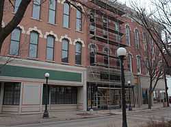
Building at 201 North Market Street |
|
01997-11-07-0000November 7, 1997
(#97001335) |
201 N. Market St.
40°07′02″N 88°14′30″W / 40.117222°N 88.241667°W / 40.117222; -88.241667 (Building at 201 North Market Street) |
Champaign |
|
| 12 |
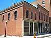
Building at 203-205 North Market Street |
|
01997-11-07-0000November 7, 1997
(#97001336) |
203-205 N. Market St.
40°07′04″N 88°12′23″W / 40.117778°N 88.206389°W / 40.117778; -88.206389 (Building at 203-205 North Market Street) |
Champaign |
|
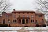
| 13 |
Burnham Athenaeum |
|
01978-06-07-0000June 7, 1978
(#78001115) |
306 W. Church St.
40°07′07″N 88°14′50″W / 40.118611°N 88.247222°W / 40.118611; -88.247222 (Burnham Athenaeum) |
Champaign |
|
| 14 |
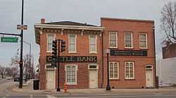
Cattle Bank |
|
01975-08-19-0000August 19, 1975
(#75000642) |
102 E. University Ave.
40°07′00″N 88°14′19″W / 40.116667°N 88.238611°W / 40.116667; -88.238611 (Cattle Bank) |
Champaign |
Now the Champaign County Historical Museum
|
| 15 |
Chanute Field Historic District |
|
02006-07-14-0000July 14, 2006
(#06000594) |
Rantoul National Aviation Center
40°18′00″N 88°09′04″W / 40.3°N 88.151111°W / 40.3; -88.151111 (Chanute Field Historic District) |
Rantoul |
|
| 16 |
Chemical Laboratory |
|
01986-11-19-0000November 19, 1986
(#86003148) |
1305 W. Green St.
40°06′32″N 88°13′36″W / 40.108889°N 88.226667°W / 40.108889; -88.226667 (Chemical Laboratory) |
Urbana |
|
| 17 |
Delta Kappa Epsilon Fraternity House |
|
01990-02-22-0000February 22, 1990
(#90000114) |
313 E. John
40°06′33″N 88°14′01″W / 40.109167°N 88.233611°W / 40.109167; -88.233611 (Delta Kappa Epsilon Fraternity House) |
Champaign |
|
| 18 |
Delta Upsilon Fraternity House |
|
01990-05-21-0000May 21, 1990
(#90000749) |
312 E. Armory Ave.
40°06′20″N 88°14′02″W / 40.105556°N 88.233889°W / 40.105556; -88.233889 (Delta Upsilon Fraternity House) |
Champaign |
|
| 19 |
Elm Street Court |
|
02000-06-15-0000June 15, 2000
(#00000681) |
1-8 Elm Street Court
40°06′43″N 88°12′54″W / 40.111944°N 88.215°W / 40.111944; -88.215 (Elm Street Court) |
Urbana |
|
| 20 |
Farm House |
|
01989-10-31-0000October 31, 1989
(#89001728) |
1403 E. Lorado Taft Dr.
40°06′10″N 88°13′41″W / 40.102778°N 88.228056°W / 40.102778; -88.228056 (Farm House) |
Urbana |
|
| 21 |
Gamma Phi Beta Sorority House |
|
01994-10-28-0000October 28, 1994
(#94001270) |
1110 W. Nevada
40°06′21″N 88°13′21″W / 40.105833°N 88.2225°W / 40.105833; -88.2225 (Gamma Phi Beta Sorority House) |
Urbana |
|
| 22 |
The Georgian |
|
02005-11-15-0000November 15, 2005
(#05001260) |
1005 S. Sixth St.
40°06′30″N 88°13′50″W / 40.108333°N 88.230556°W / 40.108333; -88.230556 (The Georgian) |
Champaign |
|
| 23 |
Greek Revival Cottage |
|
01977-10-20-0000October 20, 1977
(#77000473) |
303 W. University Ave.
40°06′57″N 88°12′37″W / 40.115833°N 88.210278°W / 40.115833; -88.210278 (Greek Revival Cottage) |
Urbana |
|
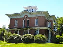
| 24 |
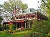
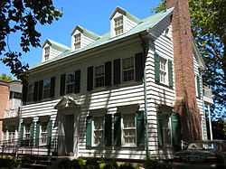
Clark R. Griggs House |
|
01978-11-30-0000November 30, 1978
(#78001116) |
505 W. Main St.
40°06′48″N 88°12′49″W / 40.113333°N 88.213611°W / 40.113333; -88.213611 (Clark R. Griggs House) |
Urbana |
|
| 25 |
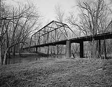
Hazen Bridge |
|
01994-05-06-0000May 6, 1994
(#94000433) |
Newcomb Twp. Rd. 85 across the Sangamon R.
40°15′09″N 88°23′01″W / 40.2525°N 88.383611°W / 40.2525; -88.383611 (Hazen Bridge) |
Mahomet |
|
| 26 |
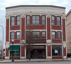
Illinois Traction Building |
|
02006-09-20-0000September 20, 2006
(#86003782) |
41 E. University Ave.
40°06′58″N 88°14′00″W / 40.116111°N 88.233333°W / 40.116111; -88.233333 (Illinois Traction Building) |
Champaign |
|
| 27 |
Inman Hotel |
|
01989-10-20-0000October 20, 1989
(#89001732) |
17 E. University Ave.
40°06′58″N 88°14′32″W / 40.116111°N 88.242222°W / 40.116111; -88.242222 (Inman Hotel) |
Champaign |
|
| 28 |
Kappa Delta Rho Fraternity House |
|
01990-05-21-0000May 21, 1990
(#90000750) |
1110 S. Second St.
40°06′17″N 88°14′15″W / 40.104722°N 88.2375°W / 40.104722; -88.2375 (Kappa Delta Rho Fraternity House) |
Champaign |
|
| 29 |
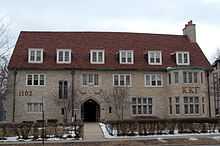
Kappa Kappa Gamma Sorority House |
|
02004-02-25-0000February 25, 2004
(#04000074) |
1102 S. Lincoln Ave.
40°06′12″N 88°13′09″W / 40.103333°N 88.219167°W / 40.103333; -88.219167 (Kappa Kappa Gamma Sorority House) |
Urbana |
|
| 30 |
Kappa Sigma Fraternity House |
|
01989-08-28-0000August 28, 1989
(#89001109) |
212 E. Daniel St.
40°06′29″N 88°14′12″W / 40.108056°N 88.236667°W / 40.108056; -88.236667 (Kappa Sigma Fraternity House) |
Champaign |
|
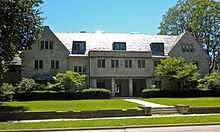
| 31 |
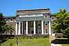
Library-University of Illinois at Urbana-Champaign |
|
02000-08-11-0000August 11, 2000
(#00000413) |
1408 W. Gregory Dr.
40°06′18″N 88°13′43″W / 40.105°N 88.228611°W / 40.105; -88.228611 (Library-University of Illinois at Urbana-Champaign) |
Urbana |
|
| 32 |
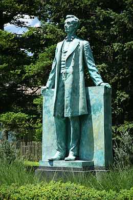
Lincoln (Statue) |
|
02004-03-10-0000March 10, 2004
(#04000144) |
1000 Blk of S. Race St.
40°06′14″N 88°12′36″W / 40.104°N 88.2099°W / 40.104; -88.2099 (Lincoln (Statue)) |
Urbana |
|
| 33 |
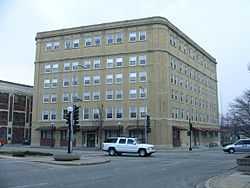
Lincoln Building |
|
01996-08-01-0000August 1, 1996
(#96000854) |
44 E. Main St.
40°07′03″N 88°14′30″W / 40.1175°N 88.241667°W / 40.1175; -88.241667 (Lincoln Building) |
Champaign |
|
| 34 |
George and Elsie Mattis House |
|
02010-12-07-0000December 7, 2010
(#10000993) |
900 W. Park Ave.
40°07′03″N 88°15′30″W / 40.1175°N 88.258333°W / 40.1175; -88.258333 (George and Elsie Mattis House) |
Champaign |
|
| 35 |
Metal Shop |
|
01986-11-19-0000November 19, 1986
(#86003141) |
102 S. Burrill Ave.
40°06′43″N 88°13′37″W / 40.111944°N 88.226944°W / 40.111944; -88.226944 (Metal Shop) |
Urbana |
Demolished 1993.[6]
|
| 36 |
Military Drill Hall and Men's Gymnasium |
|
01986-11-19-0000November 19, 1986
(#86003144) |
1402-1406 W. Springfield
40°06′46″N 88°13′40″W / 40.112778°N 88.227778°W / 40.112778; -88.227778 (Military Drill Hall and Men's Gymnasium) |
Urbana |
The "Military Drill Hall" is the Kenney Gym Annex (b.1890) and the "Men's Gymnasium" is the Kenney Gym (b.1902)
|
| 37 |
Morrow Plots, University of Illinois |
|
01968-05-23-0000May 23, 1968
(#68000024) |
Gregory Dr. at Matthews Ave.
40°06′16″N 88°13′33″W / 40.104444°N 88.225833°W / 40.104444; -88.225833 (Morrow Plots, University of Illinois) |
Urbana |
|
| 38 |
Natural History Building |
|
01986-11-09-0000November 9, 1986
(#86003147) |
1301 W. Green St.
40°06′34″N 88°13′33″W / 40.109444°N 88.225833°W / 40.109444; -88.225833 (Natural History Building) |
Urbana |
|
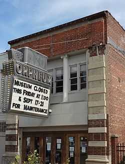
| 39 |
New Orpheum Theatre |
|
01991-02-28-0000February 28, 1991
(#91000085) |
346-352 N. Neil St.
40°07′10″N 88°14′33″W / 40.119444°N 88.2425°W / 40.119444; -88.2425 (New Orpheum Theatre) |
Champaign |
|
| 40 |
Phi Delta Theta Fraternity House |
|
02004-02-25-0000February 25, 2004
(#04000070) |
309 E. Chalmers St.
40°06′22″N 88°14′03″W / 40.106111°N 88.234167°W / 40.106111; -88.234167 (Phi Delta Theta Fraternity House) |
Champaign |
|
| 41 |
Phi Mu Sorority House |
|
01990-05-21-0000May 21, 1990
(#90000751) |
706 W. Ohio St.
40°06′14″N 88°12′59″W / 40.103889°N 88.216389°W / 40.103889; -88.216389 (Phi Mu Sorority House) |
Urbana |
|
| 42 |
Nathan C. Ricker House |
|
02000-06-21-0000June 21, 2000
(#00000682) |
612 W. Green St.
40°06′39″N 88°12′57″W / 40.110833°N 88.215833°W / 40.110833; -88.215833 (Nathan C. Ricker House) |
Urbana |
|
| 43 |
Sigma Alpha Epsilon Fraternity House |
|
01990-02-22-0000February 22, 1990
(#90000113) |
211 E. Daniel St.
40°06′28″N 88°14′08″W / 40.107778°N 88.235556°W / 40.107778; -88.235556 (Sigma Alpha Epsilon Fraternity House) |
Champaign |
|
| 44 |
Tina Weedon Smith Memorial Hall |
|
01996-02-29-0000February 29, 1996
(#96000097) |
805 S. Mathews Ave.
40°06′20″N 88°13′33″W / 40.105556°N 88.225833°W / 40.105556; -88.225833 (Tina Weedon Smith Memorial Hall) |
Urbana |
|
| 45 |
Francis and Abbie Solon House |
|
02007-07-03-0000July 3, 2007
(#07000644) |
503 South State St.
40°06′41″N 88°14′49″W / 40.111389°N 88.246944°W / 40.111389; -88.246944 (Francis and Abbie Solon House) |
Champaign |
|
| 46 |
Frederick Squires House |
|
02011-11-22-0000November 22, 2011
(#11000846) |
1003 W. Church St.
40°07′05″N 88°15′38″W / 40.117983°N 88.26065°W / 40.117983; -88.26065 (Frederick Squires House) |
Champaign |
|
| 47 |
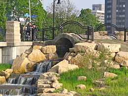
Stone Arch Bridge |
|
01981-05-14-0000May 14, 1981
(#81000210) |
Springfield Ave. and 2nd St.
40°06′46″N 88°14′14″W / 40.112778°N 88.237222°W / 40.112778; -88.237222 (Stone Arch Bridge) |
Champaign |
Now integrated into the Boneyard Creek Second Street Basin
|
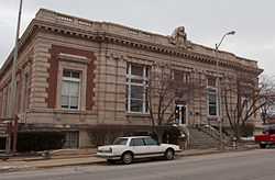
| 48 |
U.S. Post Office |
|
01976-08-17-0000August 17, 1976
(#76000684) |
Randolph and Church Sts.
40°07′07″N 88°14′44″W / 40.118611°N 88.245556°W / 40.118611; -88.245556 (U.S. Post Office) |
Champaign |
|
| 49 |
Unitarian Church of Urbana |
|
01991-05-13-0000May 13, 1991
(#91000572) |
1209 W. Oregon St.
40°06′24″N 88°13′30″W / 40.106667°N 88.225°W / 40.106667; -88.225 (Unitarian Church of Urbana) |
Urbana |
Now the Channing-Murray Foundation, includes Unitarian-Universalist chapel and vegetarian restaurant
|
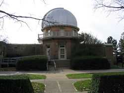
| 50 |
University of Illinois Astronomical Observatory |
|
01986-11-06-0000November 6, 1986
(#86003155) |
901 S. Mathews Ave.
40°06′18″N 88°13′34″W / 40.105°N 88.226111°W / 40.105; -88.226111 (University of Illinois Astronomical Observatory) |
Urbana |
|
| 51 |
University of Illinois Experimental Dairy Farm Historic District |
|
01994-02-04-0000February 4, 1994
(#94000030) |
1201 W. St. Mary's Rd.
40°05′38″N 88°13′28″W / 40.093889°N 88.224444°W / 40.093889; -88.224444 (University of Illinois Experimental Dairy Farm Historic District) |
Urbana |
|
| 52 |
Urbana-Lincoln Hotel-Lincoln Square Mall |
|
02006-09-08-0000September 8, 2006
(#06000778) |
300 S. Broadway Ave.
40°06′38″N 88°12′26″W / 40.110556°N 88.207222°W / 40.110556; -88.207222 (Urbana-Lincoln Hotel-Lincoln Square Mall) |
Urbana |
Hotel is now (2013) "Urbana Landmark Hotel"
|
| 53 |
Virginia Theatre |
|
02003-11-28-0000November 28, 2003
(#03001201) |
203 W. Park Ave.
40°07′01″N 88°14′42″W / 40.116944°N 88.245°W / 40.116944; -88.245 (Virginia Theatre) |
Champaign |
|
| 54 |
Vriner's Confectionery |
|
01983-05-09-0000May 9, 1983
(#83000305) |
55 Main St.
40°07′03″N 88°14′27″W / 40.1175°N 88.240833°W / 40.1175; -88.240833 (Vriner's Confectionery) |
Champaign |
|
| 55 |
Warm Air Research House |
|
02001-06-12-0000June 12, 2001
(#01000595) |
1108 W. Stoughton St.
40°06′48″N 88°13′23″W / 40.113333°N 88.223056°W / 40.113333; -88.223056 (Warm Air Research House) |
Urbana |
|
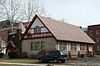
| 56 |
Wee Haven |
|
02011-12-15-0000December 15, 2011
(#11000906) |
1509 W. Park Ave.
40°07′02″N 88°16′17″W / 40.117103°N 88.271386°W / 40.117103; -88.271386 (Wee Haven) |
Champaign |
|
| 57 |
Women's Gymnasium, University of Illinois at Urbana-Champaign |
|
02003-02-05-0000February 5, 2003
(#02001751) |
906 S Goodwin Ave.
40°06′24″N 88°13′27″W / 40.106667°N 88.224167°W / 40.106667; -88.224167 (Women's Gymnasium, University of Illinois at Urbana-Champaign) |
Urbana |
|
| 58 |
Women's Residence Hall-West Residence Hall, University of Illinois at Urbana-Champaign |
|
02003-02-05-0000February 5, 2003
(#02001752) |
1111 W. Nevada St.
40°06′27″N 88°13′28″W / 40.1075°N 88.224444°W / 40.1075; -88.224444 (Women's Residence Hall-West Residence Hall, University of Illinois at Urbana-Champaign) |
Urbana |
|

.jpg)

.jpg)