National Register of Historic Places listings in Caroline County, Maryland
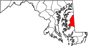
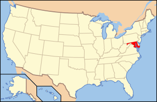
Location of Caroline County in Maryland
This is a list of the National Register of Historic Places listings in Caroline County, Maryland.
This is intended to be a complete list of the properties and districts on the National Register of Historic Places in Caroline County, Maryland, United States. Latitude and longitude coordinates are provided for many National Register properties and districts; these locations may be seen together in a Google map.[1]
There are 21 properties and districts listed on the National Register in the county.
- This National Park Service list is complete through NPS recent listings posted May 1, 2015.[2]
Current listings
| [3] |
Name on the Register[4] |
Image |
Date listed[5] |
Location |
City or town |
Description |
|---|
| 1 |
Athol |
Upload image |
01989-06-09-0000June 9, 1989
(#89000485) |
Melville Rd. near Trunk Line Rd.
39°05′15″N 75°47′41″W / 39.0875°N 75.794722°W / 39.0875; -75.794722 (Athol) |
Henderson |
|
| 2 |
Brick House Farm |
Upload image |
02009-12-02-0000December 2, 2009
(#09000963) |
24870 E. Cherry Ln.
39°00′38″N 75°50′21″W / 39.010592°N 75.839136°W / 39.010592; -75.839136 (Brick House Farm) |
Greensboro |
|
| 3 |
Castle Hall |
|
01975-12-04-0000December 4, 1975
(#75000872) |
8 miles north of Goldsboro on Maryland Route 311
39°03′05″N 75°47′08″W / 39.051389°N 75.785556°W / 39.051389; -75.785556 (Castle Hall) |
Goldsboro |
|
| 4 |
Daffin House |
Upload image |
01975-10-21-0000October 21, 1975
(#75000873) |
3 miles south of Hillsboro on Deep Branch Rd.
38°52′31″N 75°55′47″W / 38.875278°N 75.929722°W / 38.875278; -75.929722 (Daffin House) |
Hillsboro |
|
| 5 |
Denton Armory |
|
01985-09-25-0000September 25, 1985
(#85002665) |
Maple Ave. and Randolph St.
38°53′02″N 75°49′53″W / 38.883889°N 75.831389°W / 38.883889; -75.831389 (Denton Armory) |
Denton |
|
| 6 |
Denton Historic District |
|
01983-12-01-0000December 1, 1983
(#83003738) |
Roughly bounded by 1st, 10th, Gay, High, Franklin, and Sunnyside Sts.
38°53′07″N 75°49′41″W / 38.885278°N 75.828056°W / 38.885278; -75.828056 (Denton Historic District) |
Denton |
|
| 7 |
Denton Schoolhouse |
|
01978-04-19-0000April 19, 1978
(#78001447) |
104 S. 2nd St.
38°53′07″N 75°50′02″W / 38.885278°N 75.833889°W / 38.885278; -75.833889 (Denton Schoolhouse) |
Denton |
|
| 8 |
Exeter |
Upload image |
01978-01-03-0000January 3, 1978
(#78001448) |
North of Federalsburg on Maryland Route 630
38°42′10″N 75°46′37″W / 38.702778°N 75.776944°W / 38.702778; -75.776944 (Exeter) |
Federalsburg |
|
| 9 |
Leonard House |
Upload image |
01988-11-14-0000November 14, 1988
(#88001444) |
Main St.
38°58′43″N 75°48′14″W / 38.978611°N 75.803889°W / 38.978611; -75.803889 (Leonard House) |
Greensboro |
|
| 10 |
Jacob and Hannah Leverton House |
Upload image |
02009-12-02-0000December 2, 2009
(#09000964) |
3531 Seaman Rd.
38°42′09″N 75°53′29″W / 38.702442°N 75.891258°W / 38.702442; -75.891258 (Jacob and Hannah Leverton House) |
Preston |
|
| 11 |
Linchester Mill |
|
02009-12-23-0000December 23, 2009
(#09001148) |
3395 Linchester Rd.
38°42′03″N 75°53′51″W / 38.70071°N 75.8974°W / 38.70071; -75.8974 (Linchester Mill) |
Preston |
|
| 12 |
Marble Head |
Upload image |
02002-12-27-0000December 27, 2002
(#02001577) |
24435 Marblehead Rd.
38°59′21″N 75°48′18″W / 38.989167°N 75.805°W / 38.989167; -75.805 (Marble Head) |
Ridgely |
|
| 13 |
Memory Lane |
|
02000-10-12-0000October 12, 2000
(#00001200) |
24700 Williston Rd.
38°49′51″N 75°50′54″W / 38.830833°N 75.848333°W / 38.830833; -75.848333 (Memory Lane) |
Denton |
|
| 14 |
Nanticoke Lodge No. 172, A.F. and A.M. |
Upload image |
02014-06-02-0000June 2, 2014
(#14000270) |
112-116 N. Main St.
38°41′42″N 75°46′26″W / 38.694991°N 75.773882°W / 38.694991; -75.773882 (Nanticoke Lodge No. 172, A.F. and A.M.) |
Federalsburg |
|
| 15 |
Neck Meetinghouse and Yard |
|
01976-10-22-0000October 22, 1976
(#76000982) |
Maryland Route 404
38°53′26″N 75°50′29″W / 38.890556°N 75.841389°W / 38.890556; -75.841389 (Neck Meetinghouse and Yard) |
West Denton |
|
| 16 |
Oak Lawn |
Upload image |
01975-05-28-0000May 28, 1975
(#75000875) |
2.8 miles north of Ridgely on Maryland Route 312
38°58′50″N 75°52′51″W / 38.980556°N 75.880833°W / 38.980556; -75.880833 (Oak Lawn) |
Ridgely |
|
| 17 |
Potter Hall |
|
01982-11-30-0000November 30, 1982
(#82001590) |
Martin Lane
38°49′52″N 75°51′10″W / 38.831111°N 75.852778°W / 38.831111; -75.852778 (Potter Hall) |
Williston |
|
| 18 |
St. Paul's Episcopal Church |
|
01975-05-12-0000May 12, 1975
(#75000874) |
South of Maryland Route 404
38°54′56″N 75°56′32″W / 38.915556°N 75.942222°W / 38.915556; -75.942222 (St. Paul's Episcopal Church) |
Hillsboro |
|
| 19 |
West Denton Warehouse-Wharf |
|
02000-11-15-0000November 15, 2000
(#00001285) |
10215 River Landing Rd.
38°53′18″N 75°50′23″W / 38.888333°N 75.839722°W / 38.888333; -75.839722 (West Denton Warehouse-Wharf) |
West Denton |
|
| 20 |
Williston Mill Historic District |
|
02002-12-27-0000December 27, 2002
(#02001576) |
24729 Williston Rd.
38°49′46″N 75°50′50″W / 38.829444°N 75.847222°W / 38.829444; -75.847222 (Williston Mill Historic District) |
Denton |
|
| 21 |
Willow Grove |
|
01972-06-13-0000June 13, 1972
(#72000573) |
Maryland Route 457 off Maryland Route 213
38°55′34″N 75°46′28″W / 38.926111°N 75.774444°W / 38.926111; -75.774444 (Willow Grove) |
Greensboro |
|
See also
References
- ↑ The latitude and longitude information provided in this table was derived originally from the National Register Information System, which has been found to be fairly accurate for about 99% of listings. For about 1% of NRIS original coordinates, experience has shown that one or both coordinates are typos or otherwise extremely far off; some corrections may have been made. A more subtle problem causes many locations to be off by up to 150 yards, depending on location in the country: most NRIS coordinates were derived from tracing out latitude and longitudes off of USGS topographical quadrant maps created under the North American Datum of 1927, which differs from the current, highly accurate WGS84 GPS system used by most on-line maps. Chicago is about right, but NRIS longitudes in Washington are higher by about 4.5 seconds, and are lower by about 2.0 seconds in Maine. Latitudes differ by about 1.0 second in Florida. Some locations in this table may have been corrected to current GPS standards.
- ↑ "National Register of Historic Places: Weekly List Actions". National Park Service, United States Department of the Interior. Retrieved on May 1, 2015.
- ↑ Numbers represent an ordering by significant words. Various colorings, defined here, differentiate National Historic Landmarks and historic districts from other NRHP buildings, structures, sites or objects.
- ↑ "National Register Information System". National Register of Historic Places. National Park Service. 2008-04-24.
- ↑ The eight-digit number below each date is the number assigned to each location in the National Register Information System database, which can be viewed by clicking the number.
|
|---|
| | Topics | | |
|---|
| | Lists by county | |
|---|
| | Lists by city | |
|---|
| | Other lists | |
|---|
|
-
 Category:National Register of Historic Places in Maryland Category:National Register of Historic Places in Maryland
-
 Portal:National Register of Historic Places Portal:National Register of Historic Places
|
|