| [3] |
Name on the Register |
Image |
Date listed[4] |
Location |
City or town |
Description |
|---|
| 1 |
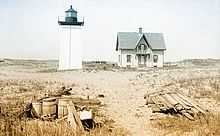
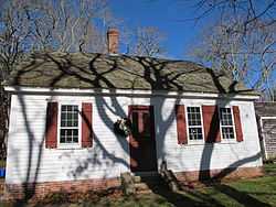
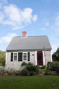
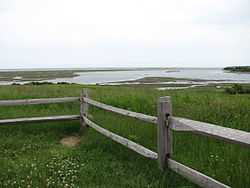
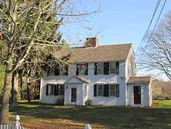
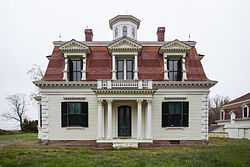
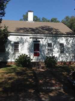
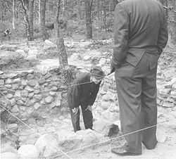
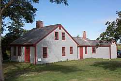
Ahearn House and Summer House |
|
01984-11-21-0000November 21, 1984
(#84000575) |
Pamet Point Rd.
41°57′33″N 70°02′42″W / 41.959167°N 70.045°W / 41.959167; -70.045 (Ahearn House and Summer House) |
Wellfleet |
|
| 2 |
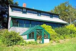
Atwood-Higgins Historic District |
|
02010-07-28-0000July 28, 2010
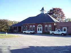
(#10000508) |
Bound Brook Island Rd.
41°57′12″N 70°03′26″W / 41.9533°N 70.0572°W / 41.9533; -70.0572 (Atwood-Higgins Historic District) |
Wellfleet |
Expansion of an earlier listing of the Thomas Atwood House.
|
| 3 |
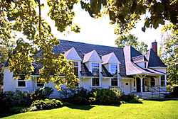
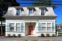
Avant House |
Upload image |
01998-12-03-0000December 3, 1998
(#98001382) |
MA 130 at Mill Pond
41°38′57″N 70°29′12″W / 41.649167°N 70.486667°W / 41.649167; -70.486667 (Avant House) |
Mashpee |
|
| 4 |
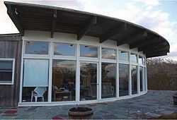
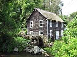
Baxter Mill |
|
01981-08-27-0000August 27, 1981
(#81000120) |
MA 28
41°39′38″N 70°15′42″W / 41.660556°N 70.261667°W / 41.660556; -70.261667 (Baxter Mill) |
West Yarmouth |
|
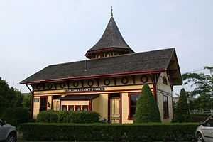
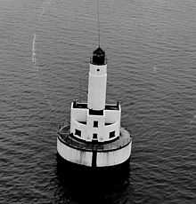
| 5 |
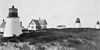
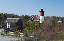
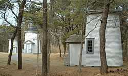
The Beacon |
|
01987-06-15-0000June 15, 1987
(#87001527) |
Off Cable Rd.
41°50′42″N 69°57′36″W / 41.845°N 69.96°W / 41.845; -69.96 (The Beacon) |
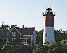
Eastham |
The longest-used of the Three Sisters of Nauset. The other two are listed separately (see Three Sisters of Nauset (Twin Lights) below); the three decommissioned lighthouses have since been reunited.
|
| 6 |
Captain James Berry House |
|
01986-09-26-0000September 26, 1986
(#86001837) |
37 Main St.
41°40′09″N 70°07′08″W / 41.669167°N 70.118889°W / 41.669167; -70.118889 (Captain James Berry House) |
Harwich |
|
| 7 |
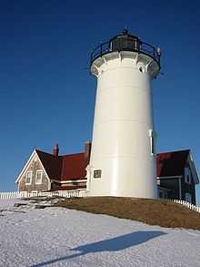
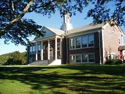
Bourne High School |
Upload image |
02013-02-27-0000February 27, 2013
(#13000035) |
85 Cotuit Rd.
41°44′31″N 70°35′41″W / 41.741939°N 70.594681°W / 41.741939; -70.594681 (Bourne High School) |
Bourne |
This is the former Bourne High School building, which was afterward the Kempton J. Coady Junior High School.
|
| 8 |
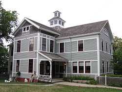
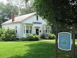
Jonathan Bourne Public Library |
|
02013-01-14-0000January 14, 2013
(#12001168) |
30 Keene St.
41°44′37″N 70°35′49″W / 41.743524°N 70.596989°W / 41.743524; -70.596989 (Jonathan Bourne Public Library) |
Bourne |
The building listed on the National Register now houses the Jonathan Bourne Historical Center. The current Jonathan Bourne Public Library is located at 19 Sandwich Rd. in Bourne and was previously an elementary school.
|
| 9 |
Bourne Town Hall |
|
02013-01-14-0000January 14, 2013
(#12001169) |
24 Perry Ave.
41°44′53″N 70°36′06″W / 41.748023°N 70.601698°W / 41.748023; -70.601698 (Bourne Town Hall) |
Bourne |
|
| 10 |
Bournedale Village School |
|
02013-02-27-0000February 27, 2013
(#13000037) |
29 Herring Pond Rd.
41°46′30″N 70°33′42″W / 41.775016°N 70.561658°W / 41.775016; -70.561658 (Bournedale Village School) |
Bourne |
|
| 11 |
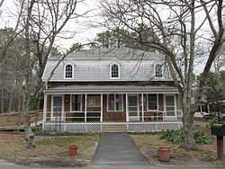
Louis Brandeis House |
|
01972-11-28-0000November 28, 1972
(#72000148) |
Neck Lane, off Cedar St., 8 miles (13 km) southwest of Stage Harbor Rd.intersection
41°40′23″N 69°59′00″W / 41.673056°N 69.983333°W / 41.673056; -69.983333 (Louis Brandeis House) |
Chatham |
Home of Justice Louis Brandeis
|
| 12 |
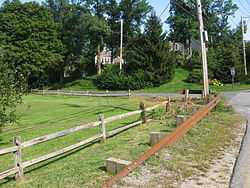
Thomas Bray Farm |
|
01988-09-15-0000September 15, 1988
(#88001455) |
280 Weir Rd.
41°42′04″N 70°12′29″W / 41.701111°N 70.208056°W / 41.701111; -70.208056 (Thomas Bray Farm) |
Yarmouth |
|
| 13 |
Brewster Old King's Highway Historic District |
|
01996-02-23-0000February 23, 1996
(#96000162) |
Roughly MA 6A from east of Paines Creek Rd.to Bittersweet Dr. and parts of Briar and Lower Rds.
41°45′31″N 70°05′13″W / 41.758611°N 70.086944°W / 41.758611; -70.086944 (Brewster Old King's Highway Historic District) |
Brewster |
|
| 14 |
Brick Block |
|
01979-04-13-0000April 13, 1979
(#79000323) |
Main St.and Chatham Bars Rd.
41°40′46″N 69°57′24″W / 41.679444°N 69.956667°W / 41.679444; -69.956667 (Brick Block) |
Chatham |
|
| 15 |
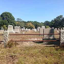
Bridge Road Cemetery |
|
01999-05-27-0000May 27, 1999
(#99000636) |
Bridge Rd.
41°49′33″N 69°58′53″W / 41.825833°N 69.981389°W / 41.825833; -69.981389 (Bridge Road Cemetery) |
Eastham |
|
| 16 |
George I. Briggs House |
|
01981-09-10-0000September 10, 1981
(#81000119) |
Sandwich Rd.
41°44′31″N 70°35′51″W / 41.741944°N 70.5975°W / 41.741944; -70.5975 (George I. Briggs House) |
Bourne |
1830s Greek Revival house; blacksmith on property shod Grover Cleveland's horses in 1880s.
|
| 17 |
Center Methodist Church |
|
01975-10-31-0000October 31, 1975
(#75000247) |
356 Commercial St.
42°03′13″N 70°11′06″W / 42.053611°N 70.185°W / 42.053611; -70.185 (Center Methodist Church) |
Provincetown |
Center Methodist Episcopal Church was built in 1860 as the largest Methodist church in the world. The church was later the Chrysler Museum of Art. It is currently the home of the Provincetown Public Library.
|
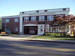
| 18 |
Central Fire Station |
|
01998-02-26-0000February 26, 1998
(#98000146) |
399 Main St.
41°33′06″N 70°36′28″W / 41.551667°N 70.607778°W / 41.551667; -70.607778 (Central Fire Station) |
Falmouth |
|
| 19 |
Chase Library |
Upload image |
02014-12-29-0000December 29, 2014
(#14001094) |
7 Main St.
41°40′08″N 70°07′17″W / 41.6689°N 70.1215°W / 41.6689; -70.1215 (Chase Library) |
Harwich |
|
| 20 |
Chatham Light Station |
|
01987-06-15-0000June 15, 1987
(#87001501) |
Main St.
41°40′17″N 69°57′01″W / 41.671389°N 69.950278°W / 41.671389; -69.950278 (Chatham Light Station) |
Chatham |
|
| 21 |
Chatham Railroad Depot |
|
01978-11-27-0000November 27, 1978
(#78000422) |
153 Depot Rd.
41°41′08″N 69°57′44″W / 41.685556°N 69.962222°W / 41.685556; -69.962222 (Chatham Railroad Depot) |
Chatham |
|
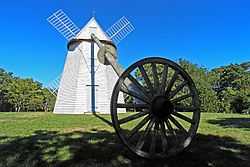
| 22 |
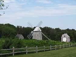
Chatham Windmill |
|
01978-11-30-0000November 30, 1978
(#78000421) |
Chase Park, Shattuck Pl.
41°40′34″N 69°57′33″W / 41.676111°N 69.959167°W / 41.676111; -69.959167 (Chatham Windmill) |
Chatham |
|
| 23 |
Cleveland Ledge Light Station |
|
01987-06-15-0000June 15, 1987
(#87001462) |
Cape Cod Canal
41°37′49″N 70°41′55″W / 41.630278°N 70.698611°W / 41.630278; -70.698611 (Cleveland Ledge Light Station) |
Falmouth |
|
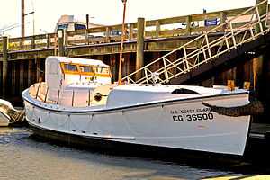
| 24 |
Coast Guard Motor Lifeboat CG 36500 |
|
02005-05-27-0000May 27, 2005
(#05000467) |
Berthed at Rock Harbor
41°47′58″N 70°00′32″W / 41.799444°N 70.008889°W / 41.799444; -70.008889 (Coast Guard Motor Lifeboat CG 36500) |
Orleans |
|
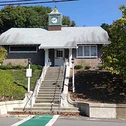
| 25 |
Cobb Memorial Library |
|
02013-06-12-0000June 12, 2013
(#13000367) |
13 Truro Center Rd.
41°59′41″N 70°03′03″W / 41.994815°N 70.050754°W / 41.994815; -70.050754 (Cobb Memorial Library) |
Truro |
|
| 26 |
Collins Cottages Historic District |
|
01999-05-20-0000May 20, 1999
(#99000528) |
150 MA 6
41°47′58″N 69°58′55″W / 41.799444°N 69.981944°W / 41.799444; -69.981944 (Collins Cottages Historic District) |
Eastham |
|
| 27 |
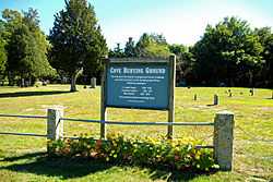
Cove Burying Ground |
|
01999-05-12-0000May 12, 1999
(#99000561) |
Junction of MA 6 and Pine Woods Rd.
41°48′40″N 69°58′17″W / 41.811111°N 69.971389°W / 41.811111; -69.971389 (Cove Burying Ground) |
Eastham |
|
| 28 |
Crowell-Bourne Farm |
|
01980-04-23-0000April 23, 1980
(#80000501) |
W. Falmouth Highway
41°37′04″N 70°37′34″W / 41.617778°N 70.626111°W / 41.617778; -70.626111 (Crowell-Bourne Farm) |
West Falmouth |
|
| 29 |
Dennis Village Cemetery |
|
02005-06-08-0000June 8, 2005
(#05000558) |
MA 6A and Old Bass River Rd.
41°44′11″N 70°11′33″W / 41.736389°N 70.1925°W / 41.736389; -70.1925 (Dennis Village Cemetery) |
Dennis |
|
| 30 |
Josiah Dennis House |
|
01974-02-15-0000February 15, 1974
(#74000360) |
16 Whig St.
41°44′25″N 70°11′58″W / 41.740278°N 70.199444°W / 41.740278; -70.199444 (Josiah Dennis House) |
Dennis |
|
| 31 |
Dillingham House |
|
01976-04-30-0000April 30, 1976
(#76000225) |
West of Brewster off MA 6A
41°44′57″N 70°07′31″W / 41.749167°N 70.125278°W / 41.749167; -70.125278 (Dillingham House) |
Brewster |
|
| 32 |
Dune Shacks of Peaked Hill Bars Historic District |
|
02012-03-15-0000March 15, 2012
(#12000132) |
Inner Dune, Snail, & High Head Rds.
42°04′21″N 70°09′48″W / 42.072488°N 70.163255°W / 42.072488; -70.163255 (Dune Shacks of Peaked Hill Bars Historic District) |
Provincetown |
|
| 33 |
Eastham Center Historic District |
|
01999-05-12-0000May 12, 1999
(#99000560) |
Depot, Mill, and Samoset Rds., and U.S. Route 6
41°49′40″N 69°58′24″W / 41.827778°N 69.973333°W / 41.827778; -69.973333 (Eastham Center Historic District) |
Eastham |
|
| 34 |
Eldredge Public Library |
|
01992-04-28-0000April 28, 1992
(#92000430) |
564 Main St.
41°40′52″N 69°57′32″W / 41.681111°N 69.958889°W / 41.681111; -69.958889 (Eldredge Public Library) |
Chatham |
|
| 35 |
Falmouth Pumping Station |
|
01998-02-26-0000February 26, 1998
(#98000148) |
Pumping Station Rd.
41°34′15″N 70°36′57″W / 41.570833°N 70.615833°W / 41.570833; -70.615833 (Falmouth Pumping Station) |
Falmouth |
|
| 36 |
Falmouth Village Green Historic District |
|
01996-03-27-0000March 27, 1996
(#96000271) |
Roughly along Locust, Main, N. Main and Hewins Sts.and Palmer Ave., including also the Old Town Cemetery
41°33′06″N 70°37′22″W / 41.551667°N 70.622778°W / 41.551667; -70.622778 (Falmouth Village Green Historic District) |
Falmouth |
|
| 37 |
First Congregational Parish Historic District |
|
02014-05-19-0000May 19, 2014
(#14000214) |
3 First Parish Ln., 26 Bridge Rd.
41°59′54″N 70°03′16″W / 41.9982°N 70.0545°W / 41.9982; -70.0545 (First Congregational Parish Historic District) |
Truro |
|
| 38 |
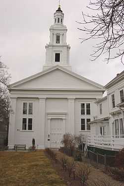
First Universalist Church |
|
01972-02-23-0000February 23, 1972
(#72000122) |
236 Commercial St.
42°03′03″N 70°11′17″W / 42.050833°N 70.188056°W / 42.050833; -70.188056 (First Universalist Church) |
Provincetown |
|
| 39 |
Forestdale School |
|
01997-06-06-0000June 6, 1997
(#97000469) |
87 Falmouth-Sandwich Rd.
41°41′15″N 70°30′16″W / 41.6875°N 70.504444°W / 41.6875; -70.504444 (Forestdale School) |
Sandwich |
|
| 40 |
Fort Hill Rural Historic District |
|
02001-04-05-0000April 5, 2001
(#00001656) |
Fort Hill Rd, Cape Cod National Seashore
41°49′10″N 69°57′56″W / 41.819444°N 69.965556°W / 41.819444; -69.965556 (Fort Hill Rural Historic District) |
Eastham |
|
| 41 |
French Cable Hut |
|
01976-04-22-0000April 22, 1976
(#76000153) |
East of North Eastham at the junction of Cable Rd.and Ocean View Dr.
41°51′34″N 69°57′07″W / 41.859444°N 69.951944°W / 41.859444; -69.951944 (French Cable Hut) |
North Eastham |
|
| 42 |
French Cable Station |
|
01972-04-11-0000April 11, 1972
(#72000121) |
Southeastern corner of Cove Rd.and MA 28
41°47′16″N 69°59′16″W / 41.787778°N 69.987778°W / 41.787778; -69.987778 (French Cable Station) |
Orleans |
|
| 43 |
Half Way House |
|
01978-07-21-0000July 21, 1978
(#78000423) |
Andrew Harding La.
41°40′27″N 69°56′52″W / 41.674167°N 69.947778°W / 41.674167; -69.947778 (Half Way House) |
Chatham |
|
| 44 |
Harwich Historic District |
|
01975-02-24-0000February 24, 1975
(#75000245) |
Irregular pattern on both sides of Main St., west to Forest St.and east to the junction of Rte. 39 and Chatham Rd.
41°41′09″N 70°04′16″W / 41.685833°N 70.071111°W / 41.685833; -70.071111 (Harwich Historic District) |
Harwich |
|
| 45 |
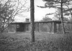
Ruth and Robert Hatch, Jr., House |
|
02014-02-25-0000February 25, 2014
(#14000018) |
309 Bound Brook Way
41°57′21″N 70°04′29″W / 41.955969°N 70.074643°W / 41.955969; -70.074643 (Ruth and Robert Hatch, Jr., House) |
Wellfleet |
Mid 20th Century Modern Residential Architecture on Outer Cape Cod MPS
|
| 46 |
Hawthorne Class Studio |
Upload image |
01978-07-21-0000July 21, 1978
(#78000434) |
Off Miller Hill Rd.
42°03′27″N 70°10′58″W / 42.0575°N 70.182778°W / 42.0575; -70.182778 (Hawthorne Class Studio) |
Provincetown |
|
| 47 |
Jedediah Higgins House |
|
01984-11-21-0000November 21, 1984
(#84000550) |
Higgins Hollow Rd.
42°00′35″N 70°03′06″W / 42.009722°N 70.051667°W / 42.009722; -70.051667 (Jedediah Higgins House) |
North Truro |
|
| 48 |
Highland House |
|
01975-06-05-0000June 5, 1975
(#75000157) |
Off U.S. Route 6 on Cape Cod National Seashore
42°02′25″N 70°03′56″W / 42.040278°N 70.065556°W / 42.040278; -70.065556 (Highland House) |
Truro |
|
| 49 |
Highland Light Station |
|
01987-06-15-0000June 15, 1987
(#87001463) |
Off U.S. Route 6
42°02′48″N 70°04′10″W / 42.046667°N 70.069444°W / 42.046667; -70.069444 (Highland Light Station) |
Truro |
|
| 50 |
Hinckley's Corner Historic District |
|
01998-05-29-0000May 29, 1998
(#98000595) |
0, 25, and 40 Way #112
41°55′02″N 70°00′14″W / 41.917222°N 70.003889°W / 41.917222; -70.003889 (Hinckley's Corner Historic District) |
Wellfleet |
|
| 51 |
John and Mary Waterman Jarves House |
|
02002-08-30-0000August 30, 2002
(#02000903) |
3 Jarves St.
41°45′30″N 70°29′46″W / 41.758333°N 70.496111°W / 41.758333; -70.496111 (John and Mary Waterman Jarves House) |
Sandwich |
|
| 52 |
Jarvesville Historic District |
|
02010-09-23-0000September 23, 2010
(#10000787) |
Roughly bounded by Liberty, Main, Jarves, and Church Sts., and the town landing
41°45′32″N 70°29′38″W / 41.758889°N 70.493889°W / 41.758889; -70.493889 (Jarvesville Historic District) |
Sandwich |
|
| 53 |
Mercelia Evelyn Eldridge Kelley House |
|
02005-02-24-0000February 24, 2005
(#05000080) |
2610 Main St.
41°40′44″N 70°01′35″W / 41.678889°N 70.026389°W / 41.678889; -70.026389 (Mercelia Evelyn Eldridge Kelley House) |
Chatham |
|
| 54 |
Peter Kugel House |
|
02014-02-25-0000February 25, 2014
(#14000019) |
188 Long Pond Rd.
41°56′40″N 69°59′53″W / 41.944321°N 69.998033°W / 41.944321; -69.998033 (Peter Kugel House) |
Wellfleet |
Mid 20th Century Modern Residential Architecture on Outer Cape Cod MPS
|
| 55 |
Samuel and Minette Kuhn House |
Upload image |
02014-02-25-0000February 25, 2014
(#14000020) |
420 Griffins Island Rd.
41°56′45″N 70°04′06″W / 41.945744°N 70.068283°W / 41.945744; -70.068283 (Samuel and Minette Kuhn House) |
Wellfleet |
Mid 20th Century Modern Residential Architecture on Outer Cape Cod MPS
|
| 56 |
Lawrence Academy |
|
01998-02-20-0000February 20, 1998
(#98000123) |
20 Academy Ln.
41°33′09″N 70°36′57″W / 41.5525°N 70.615833°W / 41.5525; -70.615833 (Lawrence Academy) |
Falmouth |
|
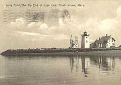
| 57 |
Long Point Light Station |
|
01987-09-28-0000September 28, 1987
(#87002039) |
Long Point
42°01′59″N 70°10′07″W / 42.033119°N 70.168653°W / 42.033119; -70.168653 (Long Point Light Station) |
Provincetown |
|
| 58 |
Marconi Wireless Station Site |
|
01975-05-02-0000May 2, 1975
(#75000158) |
1 mile (1.6 km) northeast of Cape Cod National Seashore
41°54′50″N 69°58′20″W / 41.913889°N 69.972222°W / 41.913889; -69.972222 (Marconi Wireless Station Site) |
South Wellfleet |
|
| 59 |
Marconi-RCA Wireless Receiving Station |
|
01994-08-30-0000August 30, 1994
(#94000996) |
Junction of Old Comers Rd.and Orleans Rd.
41°42′12″N 69°58′47″W / 41.703333°N 69.979722°W / 41.703333; -69.979722 (Marconi-RCA Wireless Receiving Station) |
Chatham |
|
| 60 |
Monomoy Point Lighthouse |
|
01979-11-01-0000November 1, 1979
(#79000324) |
Monomoy Island
41°33′33″N 69°59′39″W / 41.559167°N 69.994167°W / 41.559167; -69.994167 (Monomoy Point Lighthouse) |
Chatham |
|
| 61 |
Nauset Archeological District |
|
01993-04-19-0000April 19, 1993
(#93000607) |
Fort Hill Road area
41°49′08″N 69°57′46″W / 41.8189°N 69.9629°W / 41.8189; -69.9629 (Nauset Archeological District) |
Eastham |
|
| 62 |
Nauset Beach Light |
|
01987-06-15-0000June 15, 1987
(#87001484) |
Nauset Beach
41°51′15″N 69°57′06″W / 41.854167°N 69.951667°W / 41.854167; -69.951667 (Nauset Beach Light) |
Eastham |
|
| 63 |
John Newcomb House |
|
01988-09-15-0000September 15, 1988
(#88001457) |
near Williams Pond
41°57′53″N 70°00′23″W / 41.964732°N 70.006494°W / 41.964732; -70.006494 (John Newcomb House) |
Wellfleet |
Also known as Henry David Thoreau's "House of the Wellfleet Oysterman".
|
| 64 |
Nickerson Mansion |
|
01986-02-20-0000February 20, 1986
(#86000300) |
2871 Main St.
41°46′22″N 70°03′10″W / 41.772778°N 70.052778°W / 41.772778; -70.052778 (Nickerson Mansion) |
Brewster |
|
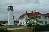
| 65 |
Nobska Point Light Station |
|
01987-06-15-0000June 15, 1987
(#87001483) |
Nobska Rd.
41°30′59″N 70°39′27″W / 41.516389°N 70.6575°W / 41.516389; -70.6575 (Nobska Point Light Station) |
Falmouth |
|
| 66 |
North Falmouth Village Historic District |
|
01998-02-20-0000February 20, 1998
(#98000121) |
85-408 Old Main Rd., and 6 Wild Harbor Rd.
41°38′47″N 70°37′02″W / 41.646389°N 70.617222°W / 41.646389; -70.617222 (North Falmouth Village Historic District) |
Falmouth |
|
| 67 |
Northside Historic District |
|
01987-11-24-0000November 24, 1987
(#87001777) |
U.S. Route 6A between the Barnstable-Yarmouth town line and White Brock
41°42′10″N 70°14′45″W / 41.702778°N 70.245833°W / 41.702778; -70.245833 (Northside Historic District) |
Yarmouth |
|
| 68 |
Benjamin Nye Homestead |
|
01992-01-06-0000January 6, 1992
(#91001899) |
85 Old County Rd.
41°43′43″N 70°25′55″W / 41.728611°N 70.431944°W / 41.728611; -70.431944 (Benjamin Nye Homestead) |
Sandwich |
Now a historic house museum
|
| 69 |
Elnathan Nye House |
|
02002-06-27-0000June 27, 2002
(#02000697) |
33 Old Main Rd.
41°38′08″N 70°37′11″W / 41.635556°N 70.619722°W / 41.635556; -70.619722 (Elnathan Nye House) |
Falmouth |
|
| 70 |
Oak Grove Cemetery |
Upload image |
02014-09-10-0000September 10, 2014
(#14000560) |
46 Jones Rd.
41°33′50″N 70°36′59″W / 41.5639°N 70.6165°W / 41.5639; -70.6165 (Oak Grove Cemetery) |
Falmouth |
|
| 71 |
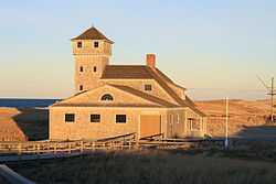
Old Harbor U.S. Life Saving Station |
|
01975-08-18-0000August 18, 1975
(#75000159) |
Race Point Road
42°04′48″N 70°12′59″W / 42.08°N 70.2164°W / 42.08; -70.2164 (Old Harbor U.S. Life Saving Station) |
Provincetown |
Listed as being northeast of Chatham on Nauset Beach; moved in 1977.
|
| 72 |
Old Higgins Farm Windmill |
|
01975-06-10-0000June 10, 1975
(#75000240) |
Off Old King's Highway, 51 Drummer Boy Rd.[5]
41°45′08″N 70°07′16″W / 41.752222°N 70.121111°W / 41.752222; -70.121111 (Old Higgins Farm Windmill) |
Brewster |
|
| 73 |
Old Indian Meeting House |
|
01998-12-03-0000December 3, 1998
(#98001383) |
410 Meetinghouse Rd.
41°37′28″N 70°28′45″W / 41.624444°N 70.479167°W / 41.624444; -70.479167 (Old Indian Meeting House) |
Mashpee |
|
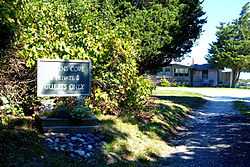
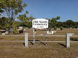
| 74 |
Old North Cemetery |
|
02013-03-20-0000March 20, 2013
(#13000095) |
US 6 & Aldrich Rd.
42°01′26″N 70°04′25″W / 42.023953°N 70.073744°W / 42.023953; -70.073744 (Old North Cemetery) |
Truro |
|
| 75 |
Old Town Center Historic District |
|
02001-03-02-0000March 2, 2001
(#01000196) |
Roughly along Locust Public Rd.and Salt Pond Rd.
41°50′18″N 69°58′37″W / 41.838333°N 69.976944°W / 41.838333; -69.976944 (Old Town Center Historic District) |
Eastham |
|
| 76 |
Old Village Historic District |
|
02001-12-17-0000December 17, 2001
(#01001406) |
Roughly bounded by Main, Holway, Bridge Sts., Bearse's Ln., Chatham Harbor, Mill Pond, and Little Mill Pond
41°40′29″N 69°57′06″W / 41.674722°N 69.951667°W / 41.674722; -69.951667 (Old Village Historic District) |
Chatham |
|
| 77 |
Paine Hollow Road South Historic District |
|
01998-05-20-0000May 20, 1998
(#98000540) |
Roughly along Paine Hollow Rd., and Raywid Way
41°54′50″N 70°00′27″W / 41.913889°N 70.0075°W / 41.913889; -70.0075 (Paine Hollow Road South Historic District) |
Wellfleet |
|
| 78 |
PAUL PALMER (Shipwreck and Remains) |
|
02007-04-12-0000April 12, 2007
(#07000288) |
Stellwagen Bank National Marine Sanctuary
|
Provincetown |
|
| 79 |
Edward Penniman House and Barn |
|
01976-05-28-0000May 28, 1976
(#76000155) |
South of Eastham at Fort Hill and Governor Prence Rds.
41°49′06″N 69°57′56″W / 41.818472°N 69.965667°W / 41.818472; -69.965667 (Edward Penniman House and Barn) |
Eastham |
|
| 80 |
Pine Grove Cemetery |
|
02013-03-20-0000March 20, 2013
(#13000096) |
Cemetery Rd.
41°58′34″N 70°03′34″W / 41.975987°N 70.059435°W / 41.975987; -70.059435 (Pine Grove Cemetery) |
Truro |
|
| 81 |
Pond Hill School |
|
01989-03-23-0000March 23, 1989
(#89000222) |
U.S. Route 6
41°55′02″N 69°59′54″W / 41.917217°N 69.998419°W / 41.917217; -69.998419 (Pond Hill School) |
Wellfleet |
|
| 82 |
Poor House and Methodist Cemetery |
|
01998-02-26-0000February 26, 1998
(#98000147) |
744 Main St.
41°33′12″N 70°36′56″W / 41.553333°N 70.615556°W / 41.553333; -70.615556 (Poor House and Methodist Cemetery) |
Falmouth |
|
| 83 |
Port Royal House |
|
01982-04-15-0000April 15, 1982
(#82004943) |
606 Main St.
41°40′56″N 69°57′36″W / 41.682222°N 69.96°W / 41.682222; -69.96 (Port Royal House) |
Chatham |
|
| 84 |
Provincetown Historic District |
|
01989-08-30-0000August 30, 1989
(#89001148) |
Roughly bounded by U.S. Route 6, the western end of Commercial St., Provincetown Harbor, and the southeastern end of Commercial St.
42°03′02″N 70°11′13″W / 42.050556°N 70.186944°W / 42.050556; -70.186944 (Provincetown Historic District) |
Provincetown |
|
| 85 |
Provincetown Public Library |
|
01975-04-21-0000April 21, 1975
(#75000248) |
330 Commercial St.
42°03′09″N 70°11′09″W / 42.0525°N 70.185833°W / 42.0525; -70.185833 (Provincetown Public Library) |
Provincetown |
|
| 86 |
Race Point Light Station |
|
01987-06-15-0000June 15, 1987
(#87001482) |
Race Point Beach
42°03′40″N 70°14′33″W / 42.061111°N 70.2425°W / 42.061111; -70.2425 (Race Point Light Station) |
Provincetown |
|
| 87 |
Rowell House |
|
01988-09-01-0000September 1, 1988
(#88001458) |
Gull Pond Rd.
41°57′20″N 70°00′47″W / 41.955556°N 70.013056°W / 41.955556; -70.013056 (Rowell House) |
Wellfleet |
|
| 88 |
Saunders-Paine House |
|
01998-05-20-0000May 20, 1998
(#98000474) |
260 Paine Hollow Rd.
41°54′46″N 70°00′34″W / 41.912778°N 70.009444°W / 41.912778; -70.009444 (Saunders-Paine House) |
Wellfleet |
|
| 89 |
Sea Call Farm |
|
02008-06-12-0000June 12, 2008
(#08000530) |
82 Tonset Rd.
41°47′12″N 69°58′45″W / 41.786783°N 69.979086°W / 41.786783; -69.979086 (Sea Call Farm) |
Orleans |
|
| 90 |
Jacob Sears Memorial Library |
|
02009-11-18-0000November 18, 2009
(#09000934) |
23 Center St.
41°44′52″N 70°08′46″W / 41.7479°N 70.1462°W / 41.7479; -70.1462 (Jacob Sears Memorial Library) |
Dennis |
|
| 91 |
Anthony and Allison Sirna Studio |
|
02014-02-25-0000February 25, 2014
(#14000021) |
60 Way #4
41°57′29″N 69°59′38″W / 41.958045°N 69.99397°W / 41.958045; -69.99397 (Anthony and Allison Sirna Studio) |
Wellfleet |
Mid 20th Century Modern Residential Architecture on Outer Cape Cod MPS
|
| 92 |
Samuel Smith Tavern Site |
|
01977-11-11-0000November 11, 1977
(#77000108) |
Great Island
41°55′12″N 70°03′26″W / 41.919906°N 70.05711°W / 41.919906; -70.05711 (Samuel Smith Tavern Site) |
Wellfleet |
17th century tavern site accessible via Great Island Trail
|
| 93 |
South Harwich Methodist Church |
|
01986-08-21-0000August 21, 1986
(#86001887) |
270 Chatham Rd.
41°40′40″N 70°02′49″W / 41.677778°N 70.046944°W / 41.677778; -70.046944 (South Harwich Methodist Church) |
Harwich |
|
| 94 |
South Yarmouth/Bass River Historic District |
|
01990-05-29-0000May 29, 1990
(#90000787) |
Roughly Main St.from Pine to South St., River St.from Main to Bass River Parkway, and Willow St.from River to South St.
41°39′39″N 70°11′35″W / 41.660833°N 70.193056°W / 41.660833; -70.193056 (South Yarmouth/Bass River Historic District) |
Yarmouth |
|
| 95 |
Spring Hill Historic District |
|
02010-10-28-0000October 28, 2010
(#10000862) |
Roughly bounded by Massachusetts Route 6A, Spring Hill Rd., and Discovery Hill Rd.
41°44′53″N 70°28′22″W / 41.748056°N 70.472778°W / 41.748056; -70.472778 (Spring Hill Historic District) |
Sandwich |
|
| 96 |
Stony Brook-Factory Village Historic District |
|
02000-06-15-0000June 15, 2000
(#00000688) |
Stony Brook Rd.; Setucket Rd., Run Hill Rd.
41°44′37″N 70°06′43″W / 41.743611°N 70.111944°W / 41.743611; -70.111944 (Stony Brook-Factory Village Historic District) |
Brewster |
|
| 97 |
Taylor-Bray Farm |
|
01993-09-29-0000September 29, 1993
(#92000287) |
Junction of Bray Farm Rd.N. and Nottingham Rd.
41°43′20″N 70°12′23″W / 41.722222°N 70.206389°W / 41.722222; -70.206389 (Taylor-Bray Farm) |
Yarmouth |
|
| 98 |
Teaticket School |
|
02002-02-22-0000February 22, 2002
(#02000082) |
340 Teaticket Hwy, MA 28 at Sandwich Rd.
41°34′09″N 70°36′20″W / 41.569167°N 70.605556°W / 41.569167; -70.605556 (Teaticket School) |
Falmouth |
|
| 99 |
Three Sisters of Nauset (Twin Lights) |
|
01987-06-15-0000June 15, 1987
(#87001502) |
Off Cable Rd.
41°50′42″N 69°57′36″W / 41.845°N 69.96°W / 41.845; -69.96 (Three Sisters of Nauset (Twin Lights)) |
Eastham |
Two of the three lights; The Beacon (listed separately) is the third. At the time of their nomination, these two lights were separate from The Beacon; they have since been reunited.
|
| 100 |
Vera and Laszlo Tisza House |
|
02014-02-25-0000February 25, 2014
(#14000022) |
2 Deer Trail
41°57′36″N 69°59′55″W / 41.960074°N 69.998642°W / 41.960074; -69.998642 (Vera and Laszlo Tisza House) |
Wellfleet |
Mid 20th Century Modern Residential Architecture on Outer Cape Cod MPS
|
| 101 |
Josiah Tobey House |
Upload image |
01994-12-09-0000December 9, 1994
(#94001496) |
67 Oxbow Rd.
41°34′41″N 70°34′33″W / 41.578056°N 70.575833°W / 41.578056; -70.575833 (Josiah Tobey House) |
Falmouth |
|
| 102 |
Town Hall Square Historic District |
|
01975-10-31-0000October 31, 1975
(#75001914) |
Roughly bounded by Main, Grove, Water Sts., and Tupper Rd.from Beale Ave.to Massachusetts Route 6A
41°45′29″N 70°30′04″W / 41.758056°N 70.501111°W / 41.758056; -70.501111 (Town Hall Square Historic District) |
Sandwich |
Boundary increase (listed September 16, 2010): Roughly bounded by Massachusetts Route 6A, Morse Rd., Water St., Shawme Lake, Grove St., Main St., and Tupper Rd.
|
| 103 |
Townsend House |
|
01998-05-20-0000May 20, 1998
(#98000542) |
290 Paine Hollow Rd.
41°54′42″N 70°00′38″W / 41.911667°N 70.010556°W / 41.911667; -70.010556 (Townsend House) |
Wellfleet |
|
| 104 |
Truro Highlands Historic District |
|
02011-11-22-0000November 22, 2011
(#11000823) |
Highland Light Rd.
42°02′22″N 70°03′44″W / 42.039342°N 70.062253°W / 42.039342; -70.062253 (Truro Highlands Historic District) |
Truro |
Includes Highland Light, Highland House, and other buildings along Highland Light Road.
|
| 105 |
Union Hall |
|
01997-05-23-0000May 23, 1997
(#97000470) |
Town Hall Rd, east of MA 6
41°59′54″N 70°03′15″W / 41.998333°N 70.054167°W / 41.998333; -70.054167 (Union Hall) |
Truro |
Truro's town hall.
|
| 106 |
Universalist Society Meetinghouse |
|
01999-02-25-0000February 25, 1999
(#99000186) |
3 River Rd.
41°46′59″N 69°58′40″W / 41.783056°N 69.977778°W / 41.783056; -69.977778 (Universalist Society Meetinghouse) |
Orleans |
|
| 107 |
US Post Office-Provincetown Main |
|
01987-10-19-0000October 19, 1987
(#87001772) |
217 Commercial St.
42°02′57″N 70°11′20″W / 42.049167°N 70.188889°W / 42.049167; -70.188889 (US Post Office-Provincetown Main) |
Provincetown |
|
| 108 |
Waquoit Historic District |
|
02004-02-26-0000February 26, 2004
(#04000086) |
Portions of Main, Barrows, Carriage House, Collins, Martin, Moonakis, Takemmeh and Waquoit Landing, Parson, Studley, Whi
41°35′08″N 70°31′11″W / 41.585556°N 70.519722°W / 41.585556; -70.519722 (Waquoit Historic District) |
Falmouth |
|
| 109 |
Paul and Madeleine Weidlinger House |
|
02014-02-25-0000February 25, 2014
(#14000023) |
54 Valley Rd.
41°57′36″N 70°00′24″W / 41.960013°N 70.006628°W / 41.960013; -70.006628 (Paul and Madeleine Weidlinger House) |
Wellfleet |
Mid 20th Century Modern Residential Architecture on Outer Cape Cod MPS
|
| 110 |
Wellfleet Center Historic District |
|
01989-08-21-0000August 21, 1989
(#89001147) |
Roughly bounded by Cross St., Holbrook Ave., Main, E. Main and School Sts., and Duck Creek
41°56′12″N 70°01′43″W / 41.936667°N 70.028611°W / 41.936667; -70.028611 (Wellfleet Center Historic District) |
Wellfleet |
|
| 111 |
West Dennis Graded School |
|
02000-08-24-0000August 24, 2000
(#00000957) |
67 School St.
41°39′43″N 70°10′12″W / 41.661944°N 70.17°W / 41.661944; -70.17 (West Dennis Graded School) |
Dennis |
|
| 112 |
West Falmouth Village Historic District |
|
01998-04-02-0000April 2, 1998
(#98000253) |
Roughly along N. Shore Rd., from the junction of MA 28A and MA 28, and Crocker Point
41°36′05″N 70°38′05″W / 41.601389°N 70.634722°W / 41.601389; -70.634722 (West Falmouth Village Historic District) |
Falmouth |
|
| 113 |
West Schoolhouse |
|
01975-04-24-0000April 24, 1975
(#75000262) |
61 Whig St.
41°44′20″N 70°11′59″W / 41.738889°N 70.199722°W / 41.738889; -70.199722 (West Schoolhouse) |
Dennis |
|
| 114 |
Wing Fort House |
|
01976-06-03-0000June 3, 1976
(#76000227) |
Spring Hill Rd.
41°45′03″N 70°27′56″W / 41.750833°N 70.465556°W / 41.750833; -70.465556 (Wing Fort House) |
East Sandwich |
|
| 115 |
Wing's Neck Light |
|
01987-06-15-0000June 15, 1987
(#87001503) |
Wing's Neck Rd.
41°40′56″N 70°39′37″W / 41.682222°N 70.660278°W / 41.682222; -70.660278 (Wing's Neck Light) |
Bourne |
|
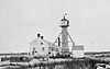
| 116 |
Wood End Light Lookout Station |
|
01987-06-15-0000June 15, 1987
(#87001504) |
Wood End, between Herring Cove Beach and Long Point
42°01′17″N 70°11′37″W / 42.021272°N 70.193509°W / 42.021272; -70.193509 (Wood End Light Lookout Station) |
Provincetown |
|
| 117 |
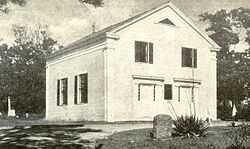
Woods Hole School |
|
01982-10-21-0000October 21, 1982
(#82000473) |
24 School St.
41°31′29″N 70°40′10″W / 41.524722°N 70.669444°W / 41.524722; -70.669444 (Woods Hole School) |
Falmouth |
|
| 118 |
Yarmouth Camp Ground Historic District |
|
01990-08-28-0000August 28, 1990
(#90001244) |
South of mid-Cape Highway (U.S. Route 6) and roughly bounded by County Ave., Willow St., Wood Rd., and Camp Ground Pond
41°40′59″N 70°15′44″W / 41.683056°N 70.262222°W / 41.683056; -70.262222 (Yarmouth Camp Ground Historic District) |
Barnstable and Yarmouth |
|
.jpg)


.jpg)


.jpg)