| [3] |
Name on the Register[4] |
Image |
Date listed[5] |
Location |
City or town |
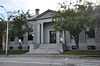
Description |
|---|
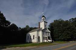
| 1 |
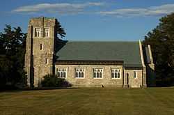
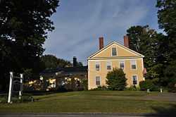
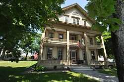
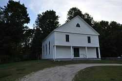
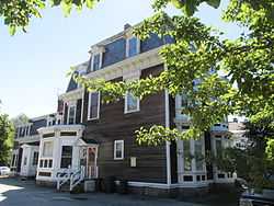
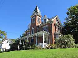
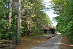
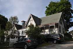
All Souls Chapel |
|
01977-11-17-0000November 17, 1977
(#77000060) |
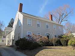
South of Mechanic Falls on State Route 26 at Poland Spring
44°01′35″N 70°21′40″W / 44.026389°N 70.361111°W / 44.026389; -70.361111 (All Souls Chapel) |
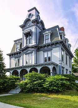
Poland |
|
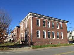
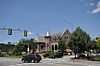
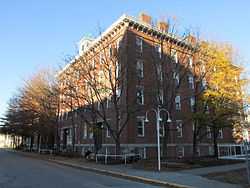
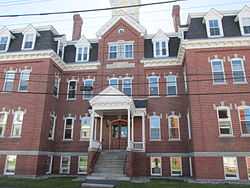
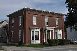
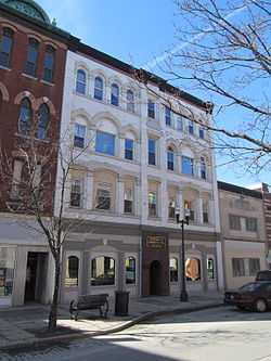
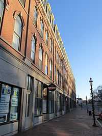
| 2 |
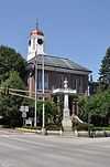
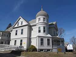
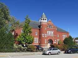
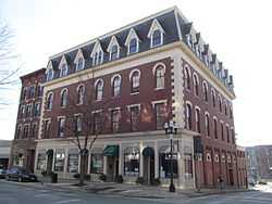
Androscoggin County Courthouse and Jail |
|
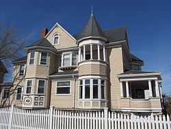
01983-12-29-0000December 29, 1983
(#83003633) |
2 Turner St.
44°05′52″N 70°13′38″W / 44.097778°N 70.227222°W / 44.097778; -70.227222 (Androscoggin County Courthouse and Jail) |
Auburn |
|
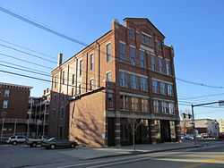
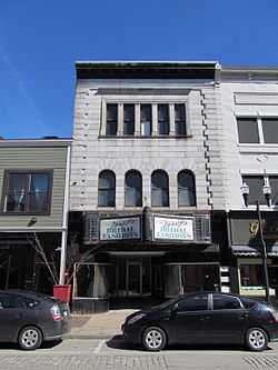
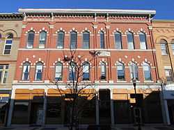
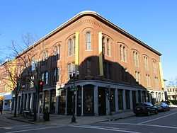
| 3 |
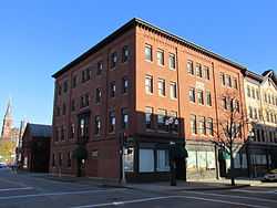
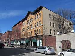
Androscoggin Mill Block |
|
02001-04-12-0000April 12, 2001
(#01000367) |
269-271 Park St.
44°05′27″N 70°12′49″W / 44.090833°N 70.213611°W / 44.090833; -70.213611 (Androscoggin Mill Block) |
Lewiston |
|
| 4 |
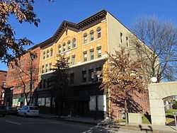
Atkinson Building |
|
01983-02-02-0000February 2, 1983
(#83000444) |
220 Lisbon St.
44°05′41″N 70°13′00″W / 44.094722°N 70.216667°W / 44.094722; -70.216667 (Atkinson Building) |
Lewiston |
|
| 5 |
Auburn Commercial Historic District |
|
02014-12-29-0000December 29, 2014
(#14001087) |
Main & Court Sts.
44°05′50″N 70°13′29″W / 44.0973°N 70.2248°W / 44.0973; -70.2248 (Auburn Commercial Historic District) |
Auburn |
|
| 6 |
Auburn Public Library |
|
01984-03-22-0000March 22, 1984
(#84001357) |
49 Spring St.
44°05′53″N 70°13′47″W / 44.098056°N 70.229722°W / 44.098056; -70.229722 (Auburn Public Library) |
Auburn |
|
| 7 |
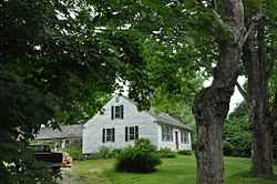
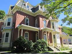
Bagley-Bliss House |
|
01996-03-22-0000March 22, 1996
(#96000242) |
1290 Royalsborough Rd.
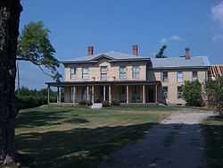
43°56′48″N 70°07′12″W / 43.946667°N 70.12°W / 43.946667; -70.12 (Bagley-Bliss House) |
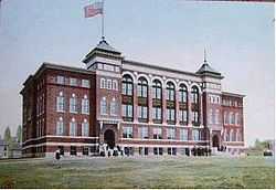
South Durham |
Now the Royalsborough Inn.
|
| 8 |
Barker Mill |
|
01979-05-08-0000May 8, 1979
(#79000123) |
143 Mill St.
44°05′15″N 70°13′39″W / 44.0875°N 70.2275°W / 44.0875; -70.2275 (Barker Mill) |
Auburn |
|
| 9 |
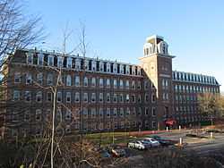
Bates Mill Historic District |
|
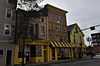
02010-12-15-0000December 15, 2010
(#10001036) |
Roughly bounded by Canal St., Chestnut St,, Lincoln St, and Main St.
44°05′44″N 70°13′11″W / 44.095556°N 70.219722°W / 44.095556; -70.219722 (Bates Mill Historic District) |
Lewiston |
|
| 10 |
Bergin Block |
Upload image |
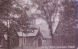
01986-04-25-0000April 25, 1986
(#86002278) |
330 Lisbon St.
44°05′36″N 70°13′05″W / 44.093333°N 70.218056°W / 44.093333; -70.218056 (Bergin Block) |
Lewiston |
Demolished in 1999.[6]
|
| 11 |
Big Ram Site |
Upload image |
01992-11-14-0000November 14, 1992
(#92001515) |
On Ram Island[7]
44°19′20″N 70°11′06″W / 44.322222°N 70.185°W / 44.322222; -70.185 (Big Ram Site) |
Ram Island |
|
| 12 |
Bradford House |
Upload image |
01978-12-22-0000December 22, 1978
(#78000154) |
54-56 Pine St.
44°05′47″N 70°12′52″W / 44.096389°N 70.214444°W / 44.096389; -70.214444 (Bradford House) |
Lewiston |
Damaged by fire in 2007 and later demolished.
|
| 13 |
William Briggs Homestead |
|
01986-03-20-0000March 20, 1986
(#86000477) |
1470 Turner St.
44°07′35″N 70°13′50″W / 44.126389°N 70.230556°W / 44.126389; -70.230556 (William Briggs Homestead) |
Auburn |
|
| 14 |
Cape Site |
Upload image |
01992-11-14-0000November 14, 1992
(#92001511) |
Address Restricted
|
West Leeds |
|
| 15 |
John D. Clifford House |
|
01987-12-30-0000December 30, 1987
(#87002190) |
14-16 Ware St.
44°06′35″N 70°12′29″W / 44.109722°N 70.208056°W / 44.109722; -70.208056 (John D. Clifford House) |
Lewiston |
|
| 16 |
Clough Meeting House |
Upload image |
02013-06-25-0000June 25, 2013
(#13000438) |
32 South Lisbon Road
44°03′49″N 70°08′52″W / 44.06361°N 70.14779°W / 44.06361; -70.14779 (Clough Meeting House) |
Lewiston |
|
| 17 |
Continental Mill Housing |
|
01979-07-10-0000July 10, 1979
(#79000124) |
66-82 Oxford St.
44°05′30″N 70°13′11″W / 44.091667°N 70.219722°W / 44.091667; -70.219722 (Continental Mill Housing) |
Lewiston |
|
| 18 |
Cushman Tavern |
Upload image |
01979-10-09-0000October 9, 1979
(#79000125) |
Northeast of Lisbon on State Route 9
44°03′36″N 70°05′11″W / 44.06°N 70.086389°W / 44.06; -70.086389 (Cushman Tavern) |
Lisbon |
|
| 19 |
Charles L. Cushman House |
|
01980-06-16-0000June 16, 1980
(#80000210) |
8 Cushman Pl.
44°05′25″N 70°13′56″W / 44.090278°N 70.232222°W / 44.090278; -70.232222 (Charles L. Cushman House) |
Auburn |
|
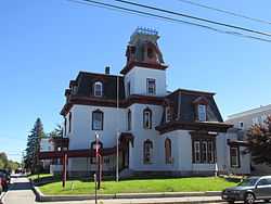
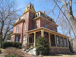
| 20 |
Holman Day House |
Upload image |
01978-01-20-0000January 20, 1978
(#78000155) |
2 Goff St.
44°05′54″N 70°13′57″W / 44.098333°N 70.2325°W / 44.098333; -70.2325 (Holman Day House) |
Auburn |
|
| 21 |
Frank L. Dingley House |
|
01980-04-23-0000April 23, 1980
(#80000211) |
291 Court St.
44°05′53″N 70°13′58″W / 44.098056°N 70.232778°W / 44.098056; -70.232778 (Frank L. Dingley House) |
Auburn |
|
| 22 |
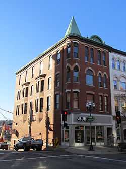
Dominican Block |
|
01980-01-15-0000January 15, 1980
(#80000212) |
141-145 Lincoln St.
44°05′34″N 70°13′10″W / 44.092778°N 70.219444°W / 44.092778; -70.219444 (Dominican Block) |
Lewiston |
|
| 23 |
Elms |
|
01985-03-21-0000March 21, 1985
(#85000610) |
Elm St.
44°06′38″N 70°23′25″W / 44.110556°N 70.390278°W / 44.110556; -70.390278 (Elms) |
Mechanic Falls |
|
| 24 |
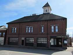
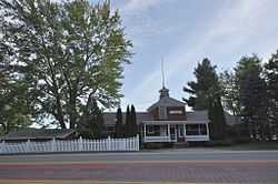
Engine House |
|
01978-05-22-0000May 22, 1978
(#78000156) |
Court and Spring Sts.
44°05′50″N 70°13′40″W / 44.097222°N 70.227778°W / 44.097222; -70.227778 (Engine House) |
Auburn |
|
| 25 |
Farwell Mill |
Upload image |
01985-06-20-0000June 20, 1985
(#85001260) |
State Route 196
44°01′52″N 70°06′15″W / 44.031111°N 70.104167°W / 44.031111; -70.104167 (Farwell Mill) |
Lisbon |
|
| 26 |
First Callahan Building |
|
01986-04-25-0000April 25, 1986
(#86002280) |
276 Lisbon St.
44°05′39″N 70°12′58″W / 44.094167°N 70.216111°W / 44.094167; -70.216111 (First Callahan Building) |
Lewiston |
|
| 27 |
First McGillicuddy Block |
|
01986-04-25-0000April 25, 1986
(#86002281) |
133 Lisbon St.
44°05′47″N 70°13′04″W / 44.096389°N 70.217778°W / 44.096389; -70.217778 (First McGillicuddy Block) |
Lewiston |
|
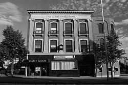
| 28 |
First National Bank |
|
01986-04-25-0000April 25, 1986
(#86002282) |
157-163 Main St.
44°05′55″N 70°13′06″W / 44.098611°N 70.218333°W / 44.098611; -70.218333 (First National Bank) |
Lewiston |
|
| 29 |
First Universalist Church |
|
01979-05-07-0000May 7, 1979
(#79000126) |
Elm and Pleasant Sts.
44°05′39″N 70°13′46″W / 44.094167°N 70.229444°W / 44.094167; -70.229444 (First Universalist Church) |
Auburn |
|
| 30 |
Horatio G. Foss House |
|
01976-11-21-0000November 21, 1976
(#76000084) |
19 Elm St.
44°05′37″N 70°13′38″W / 44.093611°N 70.227222°W / 44.093611; -70.227222 (Horatio G. Foss House) |
Auburn |
|
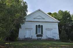
| 31 |
Free Baptist Church |
|
01989-07-13-0000July 13, 1989
(#89000843) |
Riverside Dr.
44°03′11″N 70°12′11″W / 44.053056°N 70.203056°W / 44.053056; -70.203056 (Free Baptist Church) |
Auburn |
Also known as the Penley Corner Church.
|
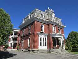
| 32 |
Sen. William P. Frye House |
|
01976-10-08-0000October 8, 1976
(#76000189) |
453-461 Main St.
44°06′22″N 70°12′40″W / 44.106111°N 70.211111°W / 44.106111; -70.211111 (Sen. William P. Frye House) |
Lewiston |
|
| 33 |
A. A. Garcelon House |
|
01986-06-13-0000June 13, 1986
(#86001269) |
223 Main St.
44°05′38″N 70°13′36″W / 44.093889°N 70.226667°W / 44.093889; -70.226667 (A. A. Garcelon House) |
Auburn |
|
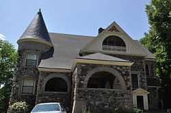
| 34 |
Gay-Munroe House |
Upload image |
02001-12-31-0000December 31, 2001
(#01001422) |
64 Highland Ave.
44°06′00″N 70°14′04″W / 44.1°N 70.234444°W / 44.1; -70.234444 (Gay-Munroe House) |
Auburn |
|
| 35 |
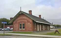
Grand Trunk Railroad Station |
|
01979-06-04-0000June 4, 1979
(#79000127) |
Lincoln St.
44°05′37″N 70°13′12″W / 44.093611°N 70.22°W / 44.093611; -70.22 (Grand Trunk Railroad Station) |
Lewiston |
|
| 36 |
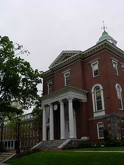
Hathorn Hall, Bates College |
|
01970-08-25-0000August 25, 1970
(#70000071) |
Bates College campus
44°06′23″N 70°12′17″W / 44.106389°N 70.204722°W / 44.106389; -70.204722 (Hathorn Hall, Bates College) |
Lewiston |
|
| 37 |
Healey Asylum |
|
01979-10-01-0000October 1, 1979
(#79000128) |
81 Ash St.
44°05′50″N 70°12′49″W / 44.097222°N 70.213611°W / 44.097222; -70.213611 (Healey Asylum) |
Lewiston |
|
| 38 |
Captain Holland House |
|
01985-03-21-0000March 21, 1985
(#85000609) |
142 College St.
44°06′08″N 70°12′38″W / 44.102222°N 70.210556°W / 44.102222; -70.210556 (Captain Holland House) |
Lewiston |
|
| 39 |
Holland-Drew House |
|
01978-12-22-0000December 22, 1978
(#78000324) |
377 Main St.
44°06′12″N 70°12′44″W / 44.103333°N 70.212222°W / 44.103333; -70.212222 (Holland-Drew House) |
Lewiston |
|
| 40 |
Irish Site |
Upload image |
01992-11-14-0000November 14, 1992
(#92001517) |
Address Restricted
|
East Auburn |
|
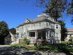
| 41 |
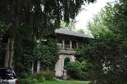
Philip M. and Deborah N. Isaacson House |
|
02011-11-18-0000November 18, 2011
(#11000816) |
2 Benson St.
44°06′30″N 70°12′25″W / 44.108336°N 70.207064°W / 44.108336; -70.207064 (Philip M. and Deborah N. Isaacson House) |
Lewiston |
|
| 42 |
Jordan School |
|
01984-03-22-0000March 22, 1984
(#84001355) |
35 Wood St.
44°06′03″N 70°12′36″W / 44.100833°N 70.21°W / 44.100833; -70.21 (Jordan School) |
Lewiston |
|
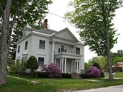
| 43 |
Charles A. Jordan House |
|
01974-07-15-0000July 15, 1974
(#74000147) |
63 Academy St.
44°05′34″N 70°13′45″W / 44.0929°N 70.2293°W / 44.0929; -70.2293 (Charles A. Jordan House) |
Auburn |
|
| 44 |
F.M. Jordan House |
Upload image |
02014-12-29-0000December 29, 2014
(#14001088) |
18 Laurel Ave.
44°05′24″N 70°13′31″W / 44.0901°N 70.2254°W / 44.0901; -70.2254 (F.M. Jordan House) |
Auburn |
|
| 45 |
Keystone Mineral Springs |
Upload image |
02005-10-19-0000October 19, 2005
(#05001175) |
Keystone Rd.
44°04′44″N 70°19′29″W / 44.078889°N 70.324722°W / 44.078889; -70.324722 (Keystone Mineral Springs) |
Poland |
|
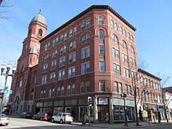
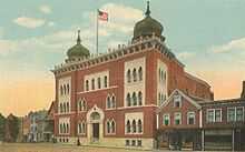
| 46 |
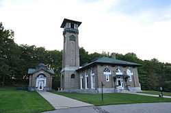
Kora Temple |
|
01975-09-11-0000September 11, 1975
(#75000088) |
11 Sabattus St.
44°06′01″N 70°12′55″W / 44.100278°N 70.215278°W / 44.100278; -70.215278 (Kora Temple) |
Lewiston |
|
| 47 |
Lamb Block |
|
02012-10-31-0000October 31, 2012
(#12000891) |
10 Depot St.
44°28′21″N 70°11′19″W / 44.472501°N 70.188693°W / 44.472501; -70.188693 (Lamb Block) |
Livermore Falls |
|
| 48 |
Lamoreau Site |
Upload image |
01989-07-13-0000July 13, 1989
(#89000837) |
Address Restricted
|
Auburn |
|
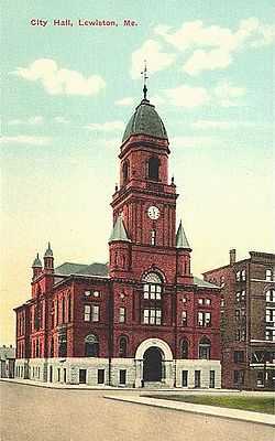
| 49 |
Lewiston City Hall |
|
01976-10-21-0000October 21, 1976
(#76000085) |
Pine and Park Sts.
44°05′42″N 70°12′57″W / 44.095°N 70.215833°W / 44.095; -70.215833 (Lewiston City Hall) |
Lewiston |
|
| 50 |
Lewiston Public Library |
|
01978-01-31-0000January 31, 1978
(#78000157) |
Park and Pine Sts.
44°05′44″N 70°12′58″W / 44.095556°N 70.216111°W / 44.095556; -70.216111 (Lewiston Public Library) |
Lewiston |
|
| 51 |
Lewiston Trust and Safe Deposit Company |
|
01986-04-25-0000April 25, 1986
(#86002283) |
46 Lisbon St.
44°05′52″N 70°13′05″W / 44.097778°N 70.218056°W / 44.097778; -70.218056 (Lewiston Trust and Safe Deposit Company) |
Lewiston |
|
| 52 |
Lisbon Falls High School |
Upload image |
02007-11-07-0000November 7, 2007
(#07001150) |
4 Campus Ave.
44°00′05″N 70°03′35″W / 44.001389°N 70.059722°W / 44.001389; -70.059722 (Lisbon Falls High School) |
Lisbon Falls |
|
| 53 |
Edward Little House |
|
01976-05-12-0000May 12, 1976
(#76000086) |
217 Main St.
44°05′38″N 70°13′35″W / 44.093889°N 70.226389°W / 44.093889; -70.226389 (Edward Little House) |
Auburn |
|
| 54 |
Lord Block |
|
01986-04-25-0000April 25, 1986
(#86002284) |
379 Lisbon St.
44°05′32″N 70°12′55″W / 44.092222°N 70.215278°W / 44.092222; -70.215278 (Lord Block) |
Lewiston |
|
| 55 |
James C. Lord House |
|
01978-07-21-0000July 21, 1978
(#78000158) |
497 Main St.
44°06′31″N 70°12′33″W / 44.108611°N 70.209167°W / 44.108611; -70.209167 (James C. Lord House) |
Lewiston |
|
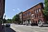
| 56 |
Lower Lisbon Street Historic District |
|
01985-05-21-0000May 21, 1985
(#85001128) |
Lisbon St. between Cedar and Chestnut
44°05′36″N 70°12′58″W / 44.093333°N 70.216111°W / 44.093333; -70.216111 (Lower Lisbon Street Historic District) |
Lewiston |
|
| 57 |
Lyceum Hall |
|
01986-04-25-0000April 25, 1986
(#86002285) |
49 Lisbon St.
44°05′51″N 70°13′06″W / 44.0975°N 70.218333°W / 44.0975; -70.218333 (Lyceum Hall) |
Lewiston |
|
| 58 |
Main Street Historic District |
|
01989-04-21-0000April 21, 1989
(#89000255) |
Roughly bounded by Drummond, Main, Elm, and High Sts.
44°05′38″N 70°13′37″W / 44.093889°N 70.226944°W / 44.093889; -70.226944 (Main Street Historic District) |
Auburn |
|
| 59 |
Main Street-Frye Street Historic District |
|
02009-01-23-0000January 23, 2009
(#08001355) |
Frye St. and portions of Main St. and College St.
44°06′21″N 70°12′33″W / 44.105908°N 70.209181°W / 44.105908; -70.209181 (Main Street-Frye Street Historic District) |
Lewiston |
|
| 60 |
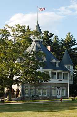
Maine State Building |
|
01974-07-18-0000July 18, 1974
(#74000148) |
Poland Spring
44°01′38″N 70°21′44″W / 44.027222°N 70.362222°W / 44.027222; -70.362222 (Maine State Building) |
Poland |
|
| 61 |
Maine Supply Company Building |
|
01986-04-25-0000April 25, 1986
(#86002286) |
415-417 Lisbon St.
44°05′30″N 70°12′53″W / 44.091667°N 70.214722°W / 44.091667; -70.214722 (Maine Supply Company Building) |
Lewiston |
|
| 62 |
Manufacturer's National Bank |
|
01986-04-25-0000April 25, 1986
(#86002287) |
145 Lisbon St.
44°05′46″N 70°13′04″W / 44.096111°N 70.217778°W / 44.096111; -70.217778 (Manufacturer's National Bank) |
Lewiston |
|
| 63 |
Marcotte Nursing Home |
|
01985-12-26-0000December 26, 1985
(#85003128) |
100 Campus Ave.
44°06′09″N 70°11′59″W / 44.1025°N 70.199722°W / 44.1025; -70.199722 (Marcotte Nursing Home) |
Lewiston |
|
| 64 |
Dr. Louis J. Martel House |
|
01983-01-04-0000January 4, 1983
(#83000445) |
122-124 Bartlett St.
44°05′46″N 70°12′39″W / 44.096111°N 70.210833°W / 44.096111; -70.210833 (Dr. Louis J. Martel House) |
Lewiston |
|
| 65 |
Moyer Site |
Upload image |
01992-11-14-0000November 14, 1992
(#92001518) |
Address Restricted
|
Keens Mills |
|
| 66 |
Horace Munroe House |
|
01980-11-10-0000November 10, 1980
(#80000213) |
123 Pleasant St.
44°05′12″N 70°13′43″W / 44.086667°N 70.228611°W / 44.086667; -70.228611 (Horace Munroe House) |
Auburn |
|
| 67 |
Nelson Family Farm |
Upload image |
01992-12-17-0000December 17, 1992
(#92001707) |
End of Shackley Hill Rd., 0.8 miles (1.3 km) north of its junction with State Route 108
44°24′34″N 70°16′05″W / 44.409444°N 70.268056°W / 44.409444; -70.268056 (Nelson Family Farm) |
Livermore |
|
| 68 |
The Norlands |
|
01969-12-30-0000December 30, 1969
(#69000004) |
295 Norlands Rd.
44°24′27″N 70°12′39″W / 44.4075°N 70.210833°W / 44.4075; -70.210833 (The Norlands) |
Livermore |
|
| 69 |
Oak Street School |
|
01976-10-08-0000October 8, 1976
(#76000190) |
Oak St.
44°05′55″N 70°12′58″W / 44.098611°N 70.216111°W / 44.098611; -70.216111 (Oak Street School) |
Lewiston |
|
| 70 |
Odd Fellows Block |
|
01986-04-25-0000April 25, 1986
(#86002288) |
182-190 Lisbon St.
44°05′44″N 70°13′01″W / 44.095556°N 70.216944°W / 44.095556; -70.216944 (Odd Fellows Block) |
Lewiston |
|
| 71 |
Osgood Building |
|
01986-04-25-0000April 25, 1986
(#86002289) |
129 Lisbon St.
44°05′47″N 70°13′05″W / 44.096389°N 70.218056°W / 44.096389; -70.218056 (Osgood Building) |
Lewiston |
|
| 72 |
Nathaniel Osgood House |
Upload image |
01985-03-21-0000March 21, 1985
(#85000608) |
State Route 136
43°55′56″N 70°06′49″W / 43.932222°N 70.113611°W / 43.932222; -70.113611 (Nathaniel Osgood House) |
Durham |
|
| 73 |
Bradford Peck House |
|
02009-02-12-0000February 12, 2009
(#09000010) |
506 Main St.
44°06′33″N 70°12′34″W / 44.109097°N 70.20946°W / 44.109097; -70.20946 (Bradford Peck House) |
Lewiston |
|
| 74 |
Samuel Penney House |
|
02002-04-11-0000April 11, 2002
(#02000346) |
78 Maple St.
44°06′40″N 70°23′45″W / 44.111111°N 70.395833°W / 44.111111; -70.395833 (Samuel Penney House) |
Mechanic Falls |
|
| 75 |
Pilsbury Block |
|
01983-04-14-0000April 14, 1983
(#83000446) |
200-210 Lisbon St.
44°05′44″N 70°13′01″W / 44.095556°N 70.216944°W / 44.095556; -70.216944 (Pilsbury Block) |
Lewiston |
|
| 76 |
Poland Railroad Station |
|
01980-07-04-0000July 4, 1980
(#80004600) |
Harris Hill and Plain Rds.
44°03′42″N 70°23′18″W / 44.061667°N 70.388333°W / 44.061667; -70.388333 (Poland Railroad Station) |
Poland |
|
| 77 |
Poland Spring Beach House, (Former) |
|
01999-09-24-0000September 24, 1999
(#99001191) |
State Route 26, 0.1 miles (0.16 km) east of its junction with Skellinger Rd.
44°02′17″N 70°22′30″W / 44.038056°N 70.375°W / 44.038056; -70.375 (Poland Spring Beach House, (Former)) |
South Poland |
|
| 78 |
Poland Spring Bottling Plant and Spring House |
|
01984-03-22-0000March 22, 1984
(#84001354) |
Ricker Rd.
44°01′44″N 70°21′35″W / 44.028889°N 70.359722°W / 44.028889; -70.359722 (Poland Spring Bottling Plant and Spring House) |
Poland |
Now a museum.
|
| 79 |
Poland Springs Historic District |
|
02013-08-13-0000August 13, 2013
(#13000595) |
543 Maine St.
44°02′N 70°22′W / 44.03°N 70.36°W / 44.03; -70.36 (Poland Springs Historic District) |
Poland |
|
| 80 |
Quartz Scraper Site |
Upload image |
01992-11-14-0000November 14, 1992
(#92001508) |
Address Restricted
|
Keens Mills |
|
| 81 |
Judson Record House |
Upload image |
02015-03-17-0000March 17, 2015
(#15000086) |
22 Church St.
44°28′29″N 70°11′20″W / 44.4747°N 70.1889°W / 44.4747; -70.1889 (Judson Record House) |
Livermore Falls |
Houses Maine's Paper Heritage Museum.
|
| 82 |
Roak Block |
|
01982-01-28-0000January 28, 1982
(#82000738) |
144-170 Main St.
44°05′44″N 70°13′30″W / 44.095556°N 70.225°W / 44.095556; -70.225 (Roak Block) |
Auburn |
|
| 83 |
William A. Robinson House |
Upload image |
01993-04-03-0000April 3, 1993
(#93000204) |
11 Forest Ave.
44°05′49″N 70°14′12″W / 44.096944°N 70.236667°W / 44.096944; -70.236667 (William A. Robinson House) |
Auburn |
|
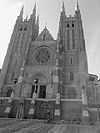
| 84 |
St. Cyril and St. Methodius Church |
Upload image |
01977-05-26-0000May 26, 1977
(#77000061) |
Main and High Sts.
43°59′57″N 70°03′32″W / 43.999167°N 70.058889°W / 43.999167; -70.058889 (St. Cyril and St. Methodius Church) |
Lisbon Falls |
|
| 85 |
St. Joseph's Catholic Church |
|
01989-07-13-0000July 13, 1989
(#89000845) |
253 Main St.
44°06′00″N 70°12′58″W / 44.1°N 70.216111°W / 44.1; -70.216111 (St. Joseph's Catholic Church) |
Lewiston |
|
| 86 |
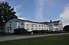
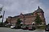
Saint Mary's General Hospital |
|
01987-12-30-0000December 30, 1987
(#87002191) |
45 Golder St.
44°06′03″N 70°12′02″W / 44.100833°N 70.200556°W / 44.100833; -70.200556 (Saint Mary's General Hospital) |
Lewiston |
|
| 87 |
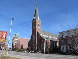
Sts. Peter and Paul Church |
|
01983-07-14-0000July 14, 1983
(#83000447) |
27 Bartlett St.
44°05′55″N 70°12′47″W / 44.098611°N 70.213056°W / 44.098611; -70.213056 (Sts. Peter and Paul Church) |
Lewiston |
|
| 88 |
Savings Bank Block |
|
01978-01-20-0000January 20, 1978
(#78000323) |
215 Lisbon St.
44°05′43″N 70°12′56″W / 44.095278°N 70.215556°W / 44.095278; -70.215556 (Savings Bank Block) |
Lewiston |
|
| 89 |
George Seaverns House |
|
01985-09-12-0000September 12, 1985
(#85002180) |
8 High St.
44°06′37″N 70°23′21″W / 44.110278°N 70.389167°W / 44.110278; -70.389167 (George Seaverns House) |
Mechanic Falls |
|
| 90 |
Second Callahan Block |
|
01986-04-25-0000April 25, 1986
(#86002290) |
282 Lisbon St.
44°05′38″N 70°12′58″W / 44.093889°N 70.216111°W / 44.093889; -70.216111 (Second Callahan Block) |
Lewiston |
|
| 91 |
Shaker Village |
|
01974-09-13-0000September 13, 1974
(#74000318) |
State Route 26
43°59′22″N 70°21′59″W / 43.989444°N 70.366389°W / 43.989444; -70.366389 (Shaker Village) |
Sabbathday Lake |
Extends into Cumberland County
|
| 92 |
Shiloh Temple |
Upload image |
01975-05-12-0000May 12, 1975
(#75000203) |
South of Lisbon Falls on the southern bank of the Androscoggin River
43°58′49″N 70°02′50″W / 43.980278°N 70.047222°W / 43.980278; -70.047222 (Shiloh Temple) |
Lisbon Falls |
|
| 93 |
Trinity Episcopal Church |
|
01978-03-30-0000March 30, 1978
(#78000159) |
Bates and Spruce Sts.
44°05′37″N 70°12′46″W / 44.093611°N 70.212778°W / 44.093611; -70.212778 (Trinity Episcopal Church) |
Lewiston |
|
| 94 |
Turner Cattle Pound |
|
02009-08-07-0000August 7, 2009
(#09000592) |
Southwestern corner of Gen. Turner Hill Rd. and the Kennebec Trail
44°16′19″N 70°15′11″W / 44.271906°N 70.253167°W / 44.271906; -70.253167 (Turner Cattle Pound) |
Turner |
|
| 95 |
Turner Town House |
|
01979-07-09-0000July 9, 1979
(#79000129) |
State Route 117
44°16′18″N 70°13′30″W / 44.271667°N 70.225°W / 44.271667; -70.225 (Turner Town House) |
Turner |
|
| 96 |
Union Block |
|
01986-04-25-0000April 25, 1986
(#86002291) |
21-29 Lisbon St.
44°05′53″N 70°13′07″W / 44.098056°N 70.218611°W / 44.098056; -70.218611 (Union Block) |
Lewiston |
|
| 97 |
Union Church |
|
02001-08-02-0000August 2, 2001
(#01000810) |
744 Royalsborough Rd.
43°58′54″N 70°07′45″W / 43.981667°N 70.129167°W / 43.981667; -70.129167 (Union Church) |
Durham |
|
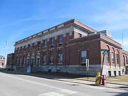
| 98 |
US Post Office-Lewiston Main |
|
01986-05-02-0000May 2, 1986
(#86000879) |
49 Ash St.
44°05′15″N 70°13′24″W / 44.0875°N 70.223333°W / 44.0875; -70.223333 (US Post Office-Lewiston Main) |
Lewiston |
|
| 99 |
Webster Grammar School |
Upload image |
02010-09-30-0000September 30, 2010
(#10000806) |
95 Hampshire St.
44°06′04″N 70°13′52″W / 44.101111°N 70.231111°W / 44.101111; -70.231111 (Webster Grammar School) |
Auburn |
|
| 100 |
Webster Rubber Company Plant |
Upload image |
01989-10-16-0000October 16, 1989
(#89001701) |
Greene St.
44°07′12″N 70°06′35″W / 44.12°N 70.109722°W / 44.12; -70.109722 (Webster Rubber Company Plant) |
Sabattus |
|
| 101 |
Dr. Milton Wedgewood House |
|
01986-01-10-0000January 10, 1986
(#86000071) |
101 Pine St.
44°05′47″N 70°12′44″W / 44.096389°N 70.212222°W / 44.096389; -70.212222 (Dr. Milton Wedgewood House) |
Lewiston |
|
| 102 |
West Durham Methodist Church |
|
02003-04-22-0000April 22, 2003
(#03000291) |
17 Runaround Pond Rd.
43°56′58″N 70°08′59″W / 43.949444°N 70.149722°W / 43.949444; -70.149722 (West Durham Methodist Church) |
West Durham |
|
| 103 |
Wilson I Site |
Upload image |
01992-11-14-0000November 14, 1992
(#92001512) |
Address Restricted
|
East Auburn |
|
| 104 |
Wood Island Site |
Upload image |
01992-11-14-0000November 14, 1992
(#92001516) |
Address Restricted
|
Keens Mills |
|
| 105 |
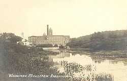
Worumbo Mill |
|
01973-10-15-0000October 15, 1973
(#73000235) |
On the banks of the Androscoggin River
43°59′37″N 70°04′05″W / 43.993611°N 70.068056°W / 43.993611; -70.068056 (Worumbo Mill) |
Lisbon Falls |
|


.jpg)