| [3] |
Name on the Register[4] |
Image |
Date listed[5] |
Location |
City or town |
Description |
|---|
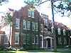
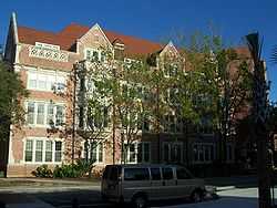
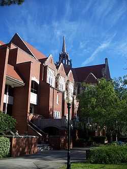
| 1 |
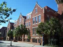
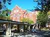
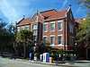
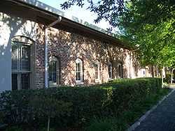
Anderson Hall |
|
01979-06-27-0000June 27, 1979
(#79000652) |
West University Avenue
29°39′05″N 82°20′32″W / 29.651389°N 82.342222°W / 29.651389; -82.342222 (Anderson Hall) |
Gainesville |
|
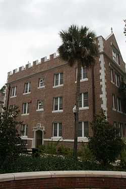
| 2 |
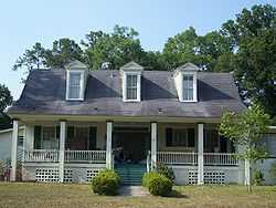
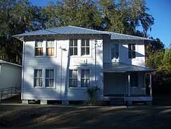
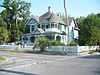
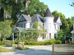
Maj. James B. Bailey House |
|
01972-12-05-0000December 5, 1972
(#72000301) |
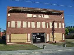
1121 Northwest 6th Street
29°39′47″N 82°19′52″W / 29.663056°N 82.331111°W / 29.663056; -82.331111 (Maj. James B. Bailey House) |
Gainesville |
|
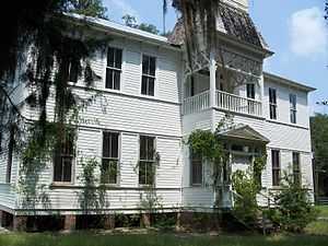
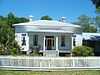
| 3 |
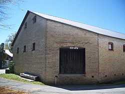
Baird Hardware Company Warehouse |
|
01985-11-25-0000November 25, 1985
(#85003053) |
619 South Main Street
29°38′39″N 82°19′28″W / 29.644167°N 82.324444°W / 29.644167; -82.324444 (Baird Hardware Company Warehouse) |
Gainesville |
|
| 4 |
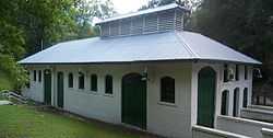
Boulware Springs Water Works |
|
01985-06-20-0000June 20, 1985
(#85001255) |
3400 Southeast 15th Street
29°37′15″N 82°18′25″W / 29.620833°N 82.306944°W / 29.620833; -82.306944 (Boulware Springs Water Works) |
Gainesville |
|
| 5 |
Bryan Hall |
|
01979-06-27-0000June 27, 1979
(#79000653) |
West University Avenue and 13th Street
29°39′03″N 82°20′26″W / 29.650833°N 82.340556°W / 29.650833; -82.340556 (Bryan Hall) |
Gainesville |
|
| 6 |
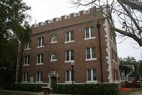
Buckman Hall |
|
01974-01-11-0000January 11, 1974
(#74000609) |
Buckman Drive (Southwest 17th Street)
29°39′02″N 82°20′43″W / 29.650556°N 82.345278°W / 29.650556; -82.345278 (Buckman Hall) |
Gainesville |
|
| 7 |
City of Alachua Downtown Historic District |
|
02000-07-14-0000July 14, 2000
(#00000787) |
Roughly bounded by Northwest 150th Avenue, Northwest 145th Terrace, Northwest 143rd Place, and Northwest 138th Terrace
29°47′23″N 82°29′41″W / 29.789722°N 82.494722°W / 29.789722; -82.494722 (City of Alachua Downtown Historic District) |
Alachua |
|
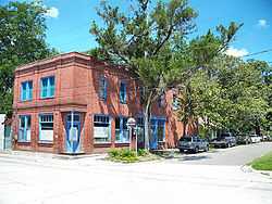
| 8 |
Cox Furniture Store |
|
01994-06-10-0000June 10, 1994
(#94000579) |
19 Southeast First Avenue
29°39′03″N 82°19′28″W / 29.650833°N 82.324444°W / 29.650833; -82.324444 (Cox Furniture Store) |
Gainesville |
|
| 9 |
Cox Furniture Warehouse |
|
01994-06-10-0000June 10, 1994
(#94000580) |
602 South Main Street
29°38′44″N 82°19′32″W / 29.645556°N 82.325556°W / 29.645556; -82.325556 (Cox Furniture Warehouse) |
Gainesville |
|
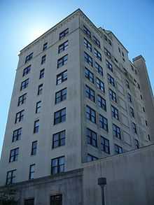
| 10 |
Dixie Hotel, Hotel Kelley |
|
01982-08-16-0000August 16, 1982
(#82002369) |
408 West University Avenue
29°39′07″N 82°19′44″W / 29.651944°N 82.328889°W / 29.651944; -82.328889 (Dixie Hotel, Hotel Kelley) |
Gainesville |
|
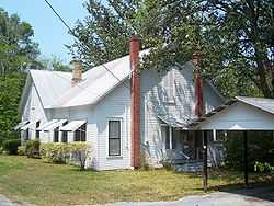
| 11 |
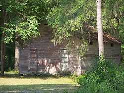
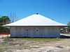
Dudley Farm |
|
02002-10-04-0000October 4, 2002
(#02001081) |
18730 West Newberry Road
29°39′15″N 82°32′37″W / 29.654167°N 82.543611°W / 29.654167; -82.543611 (Dudley Farm) |
Newberry |
|
| 12 |
Engineering Industries Building |
|
02008-06-24-0000June 24, 2008
(#08000547) |
Stadium Road and Gale Lemerand Drive (North-South Drive)
29°38′54″N 82°20′53″W / 29.648333°N 82.348056°W / 29.648333; -82.348056 (Engineering Industries Building) |
Gainesville |
part of the University of Florida Campus MPS
|
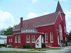
| 13 |
Epworth Hall |
|
01973-07-25-0000July 25, 1973
(#73000562) |
419 Northeast 1st Street
29°39′18″N 82°20′36″W / 29.655°N 82.343333°W / 29.655; -82.343333 (Epworth Hall) |
Gainesville |
|
| 14 |
Evinston Community Store and Post Office |
|
01989-05-05-0000May 5, 1989
(#89000321) |
County Road 225, north of the Alachua/Marion county border
29°29′06″N 82°13′34″W / 29.485°N 82.226111°W / 29.485; -82.226111 (Evinston Community Store and Post Office) |
Evinston |
|
| 15 |
Flint Hall |
|
01979-06-27-0000June 27, 1979
(#79000654) |
West University Avenue
29°39′06″N 82°20′37″W / 29.651667°N 82.343611°W / 29.651667; -82.343611 (Flint Hall) |
Gainesville |
|
| 16 |
Griffin-Floyd Hall |
|
01979-06-27-0000June 27, 1979
(#79000655) |
University of Florida campus
29°38′59″N 82°20′38″W / 29.649722°N 82.343889°W / 29.649722; -82.343889 (Griffin-Floyd Hall) |
Gainesville |
|
| 17 |
A. Quinn Jones House |
|
02010-01-27-0000January 27, 2010
(#09001278) |
1013 NW. 7th Avenue
29°39′26″N 82°20′08″W / 29.657344°N 82.335661°W / 29.657344; -82.335661 (A. Quinn Jones House) |
Gainesville |
|
| 18 |
High Springs Historic District |
|
01991-10-31-0000October 31, 1991
(#91001540) |
Roughly bounded by Northwest 14th Street, Northwest 6th Avenue, Southeast 7th Street, and Southwest 5th Avenue
29°49′32″N 82°35′48″W / 29.825556°N 82.596667°W / 29.825556; -82.596667 (High Springs Historic District) |
High Springs |
|
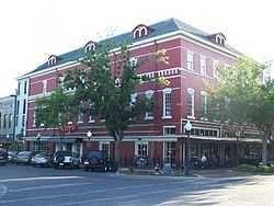
| 19 |
Hotel Thomas |
|
01973-07-16-0000July 16, 1973
(#73000563) |
Bounded by Northeast 2nd and 5th Streets and Northeast 6th and 7th Avenues
29°39′45″N 82°19′47″W / 29.6625°N 82.329722°W / 29.6625; -82.329722 (Hotel Thomas) |
Gainesville |
|
| 20 |
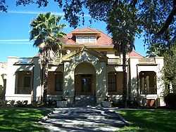
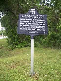
Kanapaha |
|
01986-05-02-0000May 2, 1986
(#86000915) |
8500 State Road 24
29°35′40″N 82°26′07″W / 29.594444°N 82.435278°W / 29.594444; -82.435278 (Kanapaha) |
Gainesville |
|
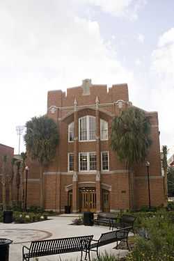
| 21 |
The Hub |
|
02008-06-24-0000June 24, 2008
(#08000551) |
Stadium Road between Buckman Drive and Fletcher Drive
29°38′55″N 82°20′44″W / 29.648611°N 82.345556°W / 29.648611; -82.345556 (The Hub) |
Gainesville |
Part of the University of Florida Campus MPS
|
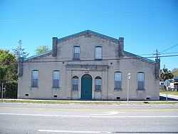
| 22 |
Island Grove Masonic Lodge No. 125 |
|
02010-12-07-0000December 7, 2010
(#10000984) |
20114 Southeast 219 Avenue
29°27′12″N 82°06′24″W / 29.453333°N 82.106667°W / 29.453333; -82.106667 (Island Grove Masonic Lodge No. 125) |
Island Grove |
NRHP No. 10000984
|
| 23 |
Lake Pithlachocco Canoe Site |
|
02001-03-27-0000March 27, 2001
(#01000303) |
Address Restricted
|
Gainesville |
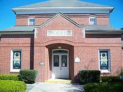
|
| 24 |
Liberty Hill Schoolhouse |
|
02003-08-28-0000August 28, 2003
(#03000825) |
7600 Northwest 23rd Avenue
29°40′33″N 82°25′24″W / 29.675833°N 82.423333°W / 29.675833; -82.423333 (Liberty Hill Schoolhouse) |
Gainesville |
|
| 25 |
Library East |
|
01979-06-27-0000June 27, 1979
(#79000656) |
Murphree Way
29°39′02″N 82°20′31″W / 29.650556°N 82.341944°W / 29.650556; -82.341944 (Library East) |
Gainesville |
|
| 26 |
Masonic Temple |
|
01998-05-29-0000May 29, 1998
(#98000589) |
215 North Main Street
29°39′12″N 82°19′30″W / 29.653333°N 82.325°W / 29.653333; -82.325 (Masonic Temple) |
Gainesville |
|
| 27 |
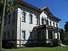
Matheson House |
|
01973-06-04-0000June 4, 1973
(#73000564) |
528 Southeast 1st Avenue
29°39′03″N 82°19′13″W / 29.650833°N 82.320278°W / 29.650833; -82.320278 (Matheson House) |
Gainesville |
|
| 28 |
Mary Phifer McKenzie House |
|
01982-04-26-0000April 26, 1982
(#82002370) |
617 East University Avenue
29°39′05″N 82°19′10″W / 29.651389°N 82.319444°W / 29.651389; -82.319444 (Mary Phifer McKenzie House) |
Gainesville |
|
| 29 |
Melrose Historic District |
|
01990-01-12-0000January 12, 1990
(#89002305) |
Roughly bounded by Seminole Ridge Road, Grove Street, South Street, Quail Street, and Melrose Bay
29°42′45″N 82°03′03″W / 29.7125°N 82.050833°W / 29.7125; -82.050833 (Melrose Historic District) |
Melrose |
|
| 30 |
Micanopy Historic District |
|
01983-01-28-0000January 28, 1983
(#83003512) |
Roughly Cholokka Boulevard from U.S. Route 441 to Ocala Street then Smith Street west to Okehumkee Street
29°30′21″N 82°16′58″W / 29.505833°N 82.282778°W / 29.505833; -82.282778 (Micanopy Historic District) |
Micanopy |
|
| 31 |
Mission San Francisco de Potano |
|
02009-04-30-0000April 30, 2009
(#09000251) |
Off County Road 236 north of High Springs[6]
29°53′01″N 82°33′59″W / 29.8836°N 82.5664°W / 29.8836; -82.5664 (Mission San Francisco de Potano) |
Gainesville |
|
| 32 |
Neilson House |
|
01973-06-04-0000June 4, 1973
(#73000566) |
State Road 325
29°38′58″N 82°11′06″W / 29.649444°N 82.185°W / 29.649444; -82.185 (Neilson House) |
Windsor |
|
| 33 |
Newberry Historic District |
|
01987-12-24-0000December 24, 1987
(#87002150) |
Roughly bounded by Northwest Second Avenue, Northwest Second Street, Lucile Street, and Northwest Ninth Street
29°38′45″N 82°36′49″W / 29.645833°N 82.613611°W / 29.645833; -82.613611 (Newberry Historic District) |
Newberry |
|
| 34 |
Newell Hall |
|
01979-06-27-0000June 27, 1979
(#79000657) |
Stadium Road
29°38′56″N 82°20′43″W / 29.648889°N 82.345278°W / 29.648889; -82.345278 (Newell Hall) |
Gainesville |
|
| 35 |
Newnansville Town Site |
|
01974-12-04-0000December 4, 1974
(#74000608) |
State Road 235, northeast of Alachua[7]
29°48′31″N 82°28′36″W / 29.8086°N 82.4767°W / 29.8086; -82.4767 (Newnansville Town Site) |
Alachua |
|
| 39 |
Norman Hall |
|
01990-01-26-0000January 26, 1990
(#89002302) |
Southwest 13th Street on the University of Florida campus
29°38′48″N 82°20′17″W / 29.646667°N 82.338056°W / 29.646667; -82.338056 (Norman Hall) |
Gainesville |
|
| 36 |
Northeast Gainesville Residential District |
|
01980-02-12-0000February 12, 1980
(#80000942) |
Roughly bounded by 1st and 9th Streets and 10th and East University Avenues
29°39′23″N 82°19′11″W / 29.656389°N 82.319722°W / 29.656389; -82.319722 (Northeast Gainesville Residential District) |
Gainesville |
|
| 37 |
Old Gainesville Depot |
|
01996-11-22-0000November 22, 1996
(#96001369) |
203 Southeast Depot Avenue
29°38′41″N 82°19′24″W / 29.644722°N 82.323333°W / 29.644722; -82.323333 (Old Gainesville Depot) |
Gainesville |
|
| 38 |
Old WRUF Radio Station |
|
01989-09-21-0000September 21, 1989
(#89001479) |
Museum Road and Newell Drive
29°39′12″N 82°20′36″W / 29.653333°N 82.343333°W / 29.653333; -82.343333 (Old WRUF Radio Station) |
Gainesville |
|
| 40 |
Peabody Hall |
|
01979-06-27-0000June 27, 1979
(#79000658) |
University of Florida campus
29°38′59″N 82°20′31″W / 29.649722°N 82.341944°W / 29.649722; -82.341944 (Peabody Hall) |
Gainesville |
|
| 41 |
Pleasant Street Historic District |
|
01989-04-20-0000April 20, 1989
(#89000323) |
Roughly bounded by Northwest 8th Avenue, Northwest 1st Street, Northwest 2nd Avenue, and Northwest 6th Street
29°39′21″N 82°19′43″W / 29.655833°N 82.328611°W / 29.655833; -82.328611 (Pleasant Street Historic District) |
Gainesville |
|
| 42 |
Marjorie Kinnan Rawlings House and Farm Yard |
|
01970-09-29-0000September 29, 1970
(#70000176) |
18700 South County Road 325
29°28′53″N 82°09′37″W / 29.481389°N 82.160278°W / 29.481389; -82.160278 (Marjorie Kinnan Rawlings House and Farm Yard) |
Cross Creek |
|
| 43 |
Rochelle School |
|
01973-04-02-0000April 2, 1973
(#73000565) |
Off State Road 234
29°35′34″N 82°13′25″W / 29.592778°N 82.223611°W / 29.592778; -82.223611 (Rochelle School) |
Rochelle |
|
| 44 |
Rolfs Hall |
|
01986-09-11-0000September 11, 1986
(#86002411) |
Buckman Drive on the University of Florida campus
29°38′57″N 82°20′30″W / 29.649167°N 82.341667°W / 29.649167; -82.341667 (Rolfs Hall) |
Gainesville |
|
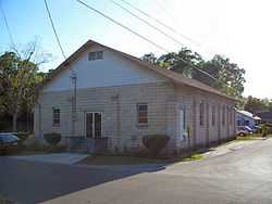
| 45 |
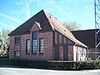
Shady Grove Primitive Baptist Church |
|
02005-10-05-0000October 5, 2005
(#05001115) |
804 Southwest Fifth Street
29°38′47″N 82°19′47″W / 29.646389°N 82.329722°W / 29.646389; -82.329722 (Shady Grove Primitive Baptist Church) |
Gainesville |
|
| 46 |
Southeast Gainesville Residential District |
|
01988-01-14-0000January 14, 1988
(#87002435) |
Roughly bounded by East University Avenue, Southeast Ninth Street, Southeast Fifth Avenue, and Sweetwater Branch
29°38′57″N 82°19′04″W / 29.649167°N 82.317778°W / 29.649167; -82.317778 (Southeast Gainesville Residential District) |
Gainesville |
|
| 47 |
Star Garage |
|
01985-12-17-0000December 17, 1985
(#85003197) |
119 Southeast First Avenue
29°39′02″N 82°19′25″W / 29.650556°N 82.323611°W / 29.650556; -82.323611 (Star Garage) |
Gainesville |
|
| 48 |
Thomas Hall |
|
01974-10-01-0000October 1, 1974
(#74000610) |
Fletcher Drive on the University of Florida campus
29°39′03″N 82°20′46″W / 29.650833°N 82.346111°W / 29.650833; -82.346111 (Thomas Hall) |
Gainesville |
|
| 49 |
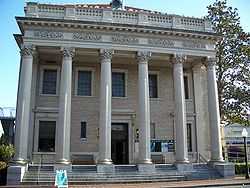
U.S. Post Office |
|
01979-07-10-0000July 10, 1979
(#79000659) |
25 Southeast 2nd Place
29°38′57″N 82°19′27″W / 29.649167°N 82.324167°W / 29.649167; -82.324167 (U.S. Post Office) |
Gainesville |
|
| 50 |
University of Florida Campus Historic District |
|
01989-04-20-0000April 20, 1989
(#89000322) |
Bounded by West University Avenue, Southwest 13th Street, Stadium Road, and North-South Drive
29°39′01″N 82°20′38″W / 29.650278°N 82.343889°W / 29.650278; -82.343889 (University of Florida Campus Historic District) |
Gainesville |
|
| 51 |
Waldo Historic District |
|
02001-02-02-0000February 2, 2001
(#01000034) |
Roughly bounded by Northwest 1st Avenue, Main Street, Southwest 5th Boulevard, and Southwest 4th Street
29°47′28″N 82°10′14″W / 29.791111°N 82.170556°W / 29.791111; -82.170556 (Waldo Historic District) |
Waldo |
|
| 52 |
Winecoff House |
|
02002-02-14-0000February 14, 2002
(#02000001) |
102 Northeast Seminary Avenue
29°30′16″N 82°16′54″W / 29.504444°N 82.281667°W / 29.504444; -82.281667 (Winecoff House) |
Micanopy |
|
| 53 |
Women's Gymnasium |
|
01979-06-27-0000June 27, 1979
(#79000660) |
East-West Road
29°39′01″N 82°20′49″W / 29.650278°N 82.346944°W / 29.650278; -82.346944 (Women's Gymnasium) |
Gainesville |
|
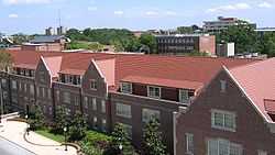
| 54 |
Yulee-Mallory-Reid Dormitory Complex |
|
02008-06-24-0000June 24, 2008
(#08000552) |
13th Street and Inner Road, SW.
29°38′50″N 82°20′28″W / 29.647222°N 82.341111°W / 29.647222; -82.341111 (Yulee-Mallory-Reid Dormitory Complex) |
Gainesville |
Part of the University of Florida Campus MPS |