Namtu
| Namtu ၼမ်ႉတူႈ (Shan) | |
|---|---|
| Town | |
 Namtu Location in Burma | |
| Coordinates: 23°5′33″N 97°24′4″E / 23.09250°N 97.40111°ECoordinates: 23°5′33″N 97°24′4″E / 23.09250°N 97.40111°E | |
| Country | Burma |
| State | Shan State |
| District | Kyaukme District |
| Township | Namtu Township |
| Population (2005) | |
| • Ethnicities | Shan, Palaung |
| • Religions | Buddhism |
| Time zone | MST (UTC+6.30) |
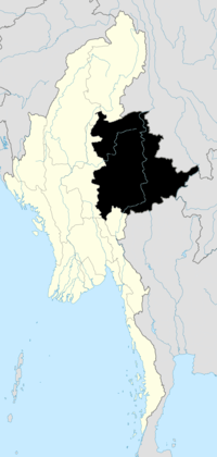
Namtu (Shan: ၼမ်ႉတူႈ) is a town in northern Shan State, Burma. Famous for its Bawdwin and Namtu silver mines, it is situated on the Nam Tu River, and is connected to Lashio by the Burma Mines Railway.[1][2]
History
The Namtu Bawdwin Mines were the world's largest source of lead, and one of the world's largest sources of silver before the Second World War.[3] Before the British arrived in the 1880s, the Saopha of Tawngpeng controlled the mines at Namtu, although the mining work was undertaken not by the Palaung but by the Chinese from Yunnan Province across the border. The mines fell into disuse when the lode was followed to the ground water level.[4] They were revived by the British and the largest mines were operated by the Burma Corporation at the beginning of the 20th century.[5] Today the Namtu mines are under state control, known as No 1 Mining Enterprise and run by the Ministry of Mines.[6]
Lead, zinc and nickel are also produced by the mines. Zinc was bought mainly by Japan, and the other minerals sent to Namtu for smelting before being marketed abroad.[7]
In February 1998, 3,000 workers went on strike for better working conditions and increase in wages for underground miners.[1][8]
A Chinese company won the contract in 2002 for the construction of a zinc oxide plant at Namtu, processing 50,000 tonnes of zinc slag annually and the zinc oxide to be exported to a smelter in Yunnan.[9]
Politics
The Shan State Army (SSA-North)'s Third Brigade has been active in Mongmit, Kyaukme, Hsipaw, Namtu and Lashio. It reached a cease-fire agreement with the Burmese military government (SLORC) in 1989, and its activities have been severely curtailed.[10][11] The Palaung State Liberation Organization, also active in the region and another one of the cease-fire groups, announced a ban on the cultivation of the opium poppy in the area under their control. They had alleged that the Burmese military was levying a tax on the poppy farmers.[12]
Notes
- ↑ 1.0 1.1 "ICFTU sends radio message to striking workers at Namtu silver mine". Hartford Web Publishing. 11 February 1998. Retrieved 2009-02-06.
- ↑ Waite, James. "The Burma Mines Railway, Namtu". FarRail Tours. Retrieved 2009-02-06.
- ↑ "Historical Dictionary of Burma (Myanmar)". The Scarecrow Press, Inc. Retrieved 2009-02-07.
- ↑ Singhanetra-Renard, Anchalee (September 2004). "The Palaung of Shan State". rockmekong.org. Retrieved 2009-02-07.
- ↑ Kratoska, Paul H. South East Asia, Colonial History. Taylor & Francis, 2001. ISBN 978-0-415-21542-8. Retrieved 2009-02-07.
- ↑ "Quotations". Ministry of Mines. Retrieved 2009-02-07.
- ↑ Adams, Timothy. "Bureau of Mines / Minerals yearbook area reports: international 1974". University of Wisconsin Digital Collections. Retrieved 2009-02-07.
- ↑ "Hot Spots". EarthWINS Daily. 11 Feb 1998. Retrieved 2009-02-07.
- ↑ "Chinese Company Building Zinc Oxide Plant at Namtu". Burma Courier No. 302. January 5, 2002. Retrieved 2009-02-07.
- ↑ "Ceasefire group gets marching orders". S.H.A.N. 2005-08-30. Retrieved 2009-02-04.
- ↑ "Truce Brings Only Grief, Says Ceasefire Leader". S.H.A.N. 2005-05-23. Retrieved 2009-02-04.
- ↑ "Palaungs Declare War on Drugs". S.H.A.N. 2005-06-04. Retrieved 2009-02-07.
External links
- Satellite map Wikimapia
- Shan State map: 8= Namtu Asterism
- Location Map of Namtu Bawdwin Mine
| ||||||||||

