Namegata, Ibaraki
| Namegata 行方市 | ||
|---|---|---|
| City | ||
| ||
 Location of Namegata in Ibaraki Prefecture | ||
 Namegata Location in Japan | ||
| Coordinates: 35°59′13″N 140°29′32″E / 35.98694°N 140.49222°ECoordinates: 35°59′13″N 140°29′32″E / 35.98694°N 140.49222°E | ||
| Country | Japan | |
| Region | Kantō | |
| Prefecture | Ibaraki Prefecture | |
| Government | ||
| • Mayor | Koichi Itoh (since September 2009) | |
| Area | ||
| • Total | 166.33 km2 (64.22 sq mi) | |
| Population (April 1, 2011) | ||
| • Total | 38,182 | |
| • Density | 230/km2 (590/sq mi) | |
| Time zone | Japan Standard Time (UTC+9) | |
| Symbols | ||
| - Tree | Ginkgo biloba | |
| - Flower | Lilium auratum | |
| - Bird | Egret | |
| Address |
Aso 1561-9, Namegata City, Ibaraki Prefecture (茨城県行方市麻生1561-9) 311-3892 | |
| Phone number | 81-(0)299-72-0811 | |
| Website |
www | |

Namegata (行方市 Namegata-shi) is a city located in Ibaraki Prefecture, Japan.
The modern city of Namegata was established on September 2, 2005, from the merger of the towns of Asō, Kitaura and Tamatsukuri (all from Namegata District).
As of April 1, 2011 population data, the city has an estimated population of 38,182, with 11,721 households and a population density of 229.56 persons per km². The total area is 166.33 km².
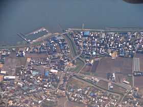
Aerial view of marina on Lake Kasumigaura in Namegata
External links
![]() Media related to Namegata, Ibaraki at Wikimedia Commons
Media related to Namegata, Ibaraki at Wikimedia Commons
- Namegata City official website (Japanese)
| ||||||||||||||||||||||||||||||||||||