Nam District, Ulsan
| Nam District 남구 | ||
|---|---|---|
| Autonomous District | ||
| Korean transcription(s) | ||
| • Hanja | 南區 | |
| • Revised Romanization | Nam-gu | |
| • McCune-Reischauer | Nam-gu | |
| ||
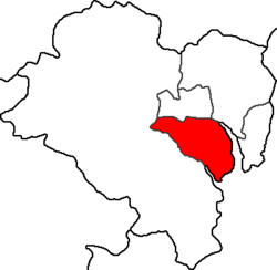 Location in Ulsan | ||
| Country | South Korea | |
| Region | Yeongnam | |
| Provincial level | Ulsan | |
| Administrative divisions | 14 administrative dong | |
| Area | ||
| • Total | 72.06 km2 (27.82 sq mi) | |
| Population (2012) | ||
| • Total | 351,466 | |
| • Density | 4,900/km2 (13,000/sq mi) | |
| • Dialect | Gyeongsang | |
| Website | Nam District Office (Korean) | |
Nam District (Nam-gu) is a district of Ulsan, South Korea. Its name literally means "South Ward".[1]
History
Nam District was established on July 15, 1985. On January 1, 1995, Ulsan City Nam-gu was consolidated after the merging of Ulsan City and Ulsan County. On July 15, 1997, Ulsan Metropolitan City Namgu was established after Ulsan was elevated to Metropolitan status.[1]
Administrative divisions
Nam district is further divided into neighbourhoods.[1] These neighbourhoods include:
- Daehyeon-dong (대현동)
- Dal-dong (달동)
- Mugeo-dong (무거동)
- Ok-dong (옥동)
- Samho-dong (삼호동)
- Samsan-dong (삼산동)
- Seonam-dong (선암동)
- Sinjeong 1-dong (신정1동)
- Sinjeong 2-dong (신정2동)
- Sinjeong 3-dong (신정3동)
- Sinjeong 4-dong (신정4동)
- Sinjeong 5-dong (신정5동)
- Suam-dong (수암동)
- Yaeum-Jangsaengpo-dong (야음장생포동)
Symbols
Nam-gu's symbols include: the camellia, depicts harmony between the four seasons and symbolizes the vibrance and enthusiasm of Nam-gu residents; the dove represents peace and prosperity and symbolizes the desire of Nam-gu residents to work together to build a better community; the gingko tree, a tree that is resistant to disease and pollution, represents the will to grow strong and optimally and symbolizes the permanent prosperity of Nam-gu residents.
Nam-gu's mascot is Tabi, a 7-year-old boy, and symbolizes the vision of a strong, healthy, and beautiful Nam-gu.[1]

Local attractions
- Samsan-dong contains Ulsan's downtown. This is among the more affluent areas of the city. There are twelve scenic areas in Ulsan and are advertised throughout the city. There is a tour bus leaving each day that will take a person to some of these sites for a fee. There is a tourist information building in Samsan-dong where you can get more information on attractions and tour bus times.
Education
- Ulsan University (울산대학교)
- Ulsan College West Campus (울산과학대학교)[1]
Transport
The Ulsan expressway runs west from Nam District and connects with Eonyang in central Ulju County. The Busan–Ulsan Expressway runs south through Ulju County to Haeundae District in Busan.
Sister cities
See also
List of districts in South Korea
References
External links
- Official site (English)
- Official site (Korean)
Coordinates: 35°32′N 129°20′E / 35.54°N 129.33°E
| ||||||||||