Nakhon Sawan
| Nakhon Sawan นครสวรรค์ | |
|---|---|
| City Municipality | |
|
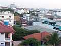
Nakhon Sawan | |
 Nakhon Sawan | |
| Coordinates: 15°42′48″N 100°08′07″E / 15.71333°N 100.13528°ECoordinates: 15°42′48″N 100°08′07″E / 15.71333°N 100.13528°E | |
| Country | Thailand |
| Province | Nakhon Sawan |
| Elevation | 33 m (108 ft) |
| Population (2012) | |
| • Total | 114,520 |
| Registered residents only | |
| Time zone | Thailand (UTC+7) |
| Website |
www |

Nakhon Sawan (Thai: นครสวรรค์, pronounced [náʔkʰɔːn sa.wǎn]) is a city (thesaban nakhon) in Thailand, the name literally means "Heavenly City". The city is the capital of Nakhon Sawan Province, and covers the complete subdistrict (tambon) Pak Nam Pho and parts of Khwae Yai, Nakhon Sawan Tok, Nakhon Sawan Ok and Wat Sai, all of Mueang Nakhon Sawan district. As of 2006 it has a population of 93,141.
Geography
Nakhon Sawan is about 250 kilometres (160 mi) north of Bangkok, and marks the point of confluence of two of Thailands major rivers, the Ping and the Nan. These converge in Nakhon Sawan to form the Chao Phraya which flows south to Bangkok and out into the Gulf of Thailand.
The surrounds of the city are mostly quite flat, but in the city itself a hill rises about 110 metres (360 ft) above the plain.
Bueng Boraphet located east of Nakhon Sawan is Thailand's biggest freshwater swamp.
Climate
Nakhon Sawan has a tropical savanna climate (Köppen climate classification Aw). It is located in a valley, thus resulting in some of the highest overnight lows in the country, often reaching 33 °C (91 °F) in the summer, and up to 43 °C (109 °F) in the day. Winters are dry and warm. Temperatures rise until April, which is very hot with the average daily maximum at 38.1 °C (100.6 °F).The monsoon season runs from May through October, with heavy rain and somewhat cooler temperatures during the day, although nights remain warm.
| Climate data for Nakhon Sawan (1981–2010) | |||||||||||||
|---|---|---|---|---|---|---|---|---|---|---|---|---|---|
| Month | Jan | Feb | Mar | Apr | May | Jun | Jul | Aug | Sep | Oct | Nov | Dec | Year |
| Average high °C (°F) | 32.9 (91.2) |
35.2 (95.4) |
37.0 (98.6) |
38.1 (100.6) |
35.9 (96.6) |
34.8 (94.6) |
34.1 (93.4) |
33.6 (92.5) |
33.1 (91.6) |
32.5 (90.5) |
32.1 (89.8) |
31.4 (88.5) |
34.23 (93.61) |
| Average low °C (°F) | 19.3 (66.7) |
22.2 (72) |
24.7 (76.5) |
26.1 (79) |
25.7 (78.3) |
25.4 (77.7) |
25.1 (77.2) |
24.8 (76.6) |
24.5 (76.1) |
24.0 (75.2) |
21.8 (71.2) |
18.8 (65.8) |
23.53 (74.36) |
| Average rainfall mm (inches) | 4.3 (0.169) |
11.9 (0.469) |
33.1 (1.303) |
63.7 (2.508) |
150.7 (5.933) |
137.3 (5.406) |
148.0 (5.827) |
178.3 (7.02) |
237.0 (9.331) |
153.4 (6.039) |
27.4 (1.079) |
4.6 (0.181) |
1,149.7 (45.265) |
| Avg. rainy days (≥ 1 mm) | 1 | 2 | 3 | 5 | 12 | 14 | 16 | 18 | 18 | 14 | 4 | 1 | 108 |
| Average relative humidity (%) | 66 | 63 | 62 | 64 | 73 | 74 | 76 | 79 | 83 | 82 | 76 | 69 | 72.3 |
| Source: Thai Meteorological Department (Normal 1981-2010), (Avg. rainy days 1961-1990) | |||||||||||||
Transportation
Nakhon Sawan lies on Route 1 (Phahonyothin Road), which runs from Bangkok through Ayutthaya and Saraburi before passing through Nakhon Sawan, then continues through Kamphaeng Phet, Lampang and Chiang Rai until it reaches the border with Burma at Mae Sai. Route 117 leads north to Phitsanulok, and Route 225 leads east to Chaiyaphum.

Nakhon Sawan has a station on the Northern Line of the State Railway of Thailand. The station is on the eastern side of the river, opposite the main city, which is on the western side.
The city is served by Nakhon Sawan Airport.[1]
Gallery


References
- ↑ "Nakhon Sawan Airport". OurAirports. Retrieved 4 February 2013.
External links
- http://www.thainationalparks.com/mae-wong-national-park
- http://nsm.go.th/index.asp (Thai)
- http://www.nakhonsawanprovince.com (English)
 Nakhon Sawan travel guide from Wikivoyage
| ||||||||||