Nakfa, Eritrea
| Nakfa ናቕፋ | |
|---|---|
| Town | |
|
Tsabra School at Nakfa | |
 Nakfa Location in Eritrea | |
| Coordinates: 16°40′N 38°28′E / 16.667°N 38.467°E | |
| Country |
|
| Region | Northern Red Sea |
| District | Nakfa |

Nakfa (Tigrinya: ናቕፋ?, IPA: [naxʼfa]) is a town in the Northern Red Sea region of Eritrea.
History
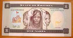
A Nakfa banknote, named after the town
Nakfa served as a base for the Eritrean People's Liberation Front during the Eritrean War of Independence. It was subjected to a number of destructive attacks that left only the mosque standing. Other towns, where hospitals, printing presses, factories, a radio station and a college are located, were built underground by Eritrea's independence fighters. The town is also surrounded by trenches.
The nakfa currency was later named after the town, owing to its historic place in the independence struggle.
Climate
| Climate data for Nakfa | |||||||||||||
|---|---|---|---|---|---|---|---|---|---|---|---|---|---|
| Month | Jan | Feb | Mar | Apr | May | Jun | Jul | Aug | Sep | Oct | Nov | Dec | Year |
| Average high °C (°F) | 21.4 (70.5) |
22.0 (71.6) |
24.0 (75.2) |
25.9 (78.6) |
28.4 (83.1) |
30.2 (86.4) |
28.4 (83.1) |
27.5 (81.5) |
28.5 (83.3) |
25.1 (77.2) |
22.5 (72.5) |
21.0 (69.8) |
25.41 (77.73) |
| Average low °C (°F) | 9.5 (49.1) |
9.8 (49.6) |
10.7 (51.3) |
12.4 (54.3) |
13.5 (56.3) |
16.8 (62.2) |
18.4 (65.1) |
17.4 (63.3) |
15.8 (60.4) |
11.6 (52.9) |
10.8 (51.4) |
9.3 (48.7) |
13 (55.38) |
| Average rainfall mm (inches) | 4 (0.16) |
3 (0.12) |
10 (0.39) |
28 (1.1) |
41 (1.61) |
28 (1.1) |
74 (2.91) |
116 (4.57) |
34 (1.34) |
21 (0.83) |
15 (0.59) |
4 (0.16) |
378 (14.88) |
| Source: Climate-Data[1] | |||||||||||||
See also
References
- ↑ "Climate-Data : Eritrea". Retrieved 11 July 2014.
External links
![]() Nakfa travel guide from Wikivoyage
Nakfa travel guide from Wikivoyage