Nakasero
| Nakasero | |
|---|---|
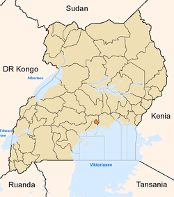
 Nakasero Map of Kampala showing the location of Nakasero. | |
| Coordinates: 00°19′24″N 32°34′44″E / 0.32333°N 32.57889°E | |
| Country |
|
| Region | Central Uganda |
| District | Kampala Capital City Authority |
| Division | Kampala Central Division |
| Elevation | 1,240 m (4,070 ft) |
| Time zone | EAT (UTC+3) |
Nakasero is the hill where the central business district of Kampala is located. Kampala is Uganda's capital and largest city.
Location
Nakasero is bordered by Mulago to the north, Makerere to the northwest, Old Kampala to the west, Namirembe and Mengo to the southwest, Nsambya to the south, Kibuli to the southeast and Kololo to the east. The coordinates of Nakasero Hill are:0°19'24.0"N, 32°34'44.0"E (Latitude:0.323334; Longitude:32.578890). [1]
Overview
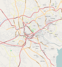
Nakasero Hill is the location of the central business district of Kampala, Uganda's capital and largest city, with an estimated nighttime population of about 1,659,000 in 2011.[2] The lower reaches of the western and southern slopes of the hill accommodate the ordinary business and commercial activities of the city. (taxi parks, train station, shopping arcades, banks and regular restaurants). Towards the top of the hill, there are government buildings including the Uganda Parliament Buildings, the Kampala Capital City Authority Building Complex and several government ministries.
The top of Nakasero Hill is the most luxurious address in the city and accommodates the most upscale hotels and restaurants in the country. The Kampala State House is also located here. The northern and eastern slopes of Nakasero Hill house the majority of Diplomatic Missions to Uganda and the residencies of most ambassadors accredited to Uganda.[3]
Landmarks
The numerous landmarks in Kampala's central business district, located on Nakasero hill include but are not limited to the following:
Government Buildings
- Uganda Parliament Buildings
- State House, Kampala
- Headquarters of Bank of Uganda
- Headquarters of Uganda Wildlife Authority
- Uganda Bureau of Statistics
- Uganda Commercial Court Building Complex
- Uganda Government Analytical Chemistry Laboratory
- Uganda High Court
- Uganda Investment Authority
- Uganda Ministry of Finance, Planning & Economic Development
- Uganda Ministry of Foreign Affairs
- Uganda Ministry of Health
- Uganda Ministry of Internal Affairs
- Uganda Ministry of Tourism, Trade and Industry
Banking Institutions
- Headquarters of ABC Bank (Uganda)
- Headquarters of Bank of Africa (Uganda)
- Headquarters of Bank of Baroda (Uganda)
- Headquarters of Bank of India (Uganda)
- Headquarters of Barclays Bank (Uganda)
- Headquarters of Cairo International Bank
- Headquarters of Centenary Bank
- Headquarters of Citibank Uganda
- Headquarters of Commercial Bank of Africa (Uganda)
- Headquarters of Crane Bank
- Headquarters of DFCU Bank
- Headquarters of Diamond Trust Bank (Uganda) Limited
- Headquarters of East African Development Bank
- Headquarters of Ecobank (Uganda)
- Headquarters of Equity Bank (Uganda)
- Headquarters of Guaranty Trust Bank (Uganda)
- Headquarters of Housing Finance Bank
- Headquarters of Kenya Commercial Bank (Uganda)
- Headquarters of NC Bank Uganda
- Headquarters of Orient Bank - A member of the Keystone Bank Group
- Headquarters of PostBank Uganda
- Headquarters of Stanbic Bank (Uganda) Limited
- Headquarters of Standard Chartered Uganda
- Headquarters of Tropical Bank
- Headquarters of Uganda Development Bank
- Headquarters of United Bank for Africa (Uganda)
Hotels, Clubs & Casinos
- Casino Paradise
- Grand Imperial Hotel
- Emin Pasha Hotel
- Fairway Hotel
- Hotel Equatoria
- Imperial Royale Hotel
- Kampala Casino
- Kampala Club
- Kampala Hilton Hotel
- Kampala Intercontinental Hotel
- Kampala Serena Hotel
- Kampala Sheraton Hotel
- Mamba Point Hotel
- Park Hotel
- Uganda Doctors Club
- Kampala Speke Hotel
Foreign Embassies
- Embassy of Austria
- Embassy of Belgium
- Embassy of Cuba
- Embassy of Denmark
- Embassy of France
- Embassy of Finland
- Embassy of India
- Embassy of Ireland
- Embassy of Italy
- Embassy of Kenya
- Embassy of Nigeria
- Embassy of Norway
- Embassy of Somalia
- Embassy of South Korea
- Embassy of Spain
- Embassy of Switzerland
- Embassy of Tanzania
Places of Worship
- All Saints Cathedral - Anglican
- Christ the King Church - Roman Catholic
Others
- Buganda Road Primary School
- Headquarters of AMREF in Uganda
- Headquarters of UNDP in Uganda
- Kampala Central Police Station
- Kampala Capital City Authority Building Complex
- Kampala Railway Station
- Nakasero Farmers Market
- Uganda Main Post Office
- Uganda National Cultural Center
- Nakasero Hospital
Photos
See also
References
- ↑ Google, . "Location of Nakasero At Google Maps". Google Maps. Retrieved 12 June 20144. Check date values in:
|accessdate=(help) - ↑ UBOS, . "Estimated Population of Kampala In 2002, 2010 & 2011" (PDF). Uganda Bureau of Statistics (UBOS). Retrieved 12 June 2014.
- ↑ UTG, . "Profile of Nakasero Hill". Uganda Travel Guide (UTG). Retrieved 12 June 2014.