Naka River (Tochigi Ibaraki)
| Naka River 那珂川 | |
|---|---|
|
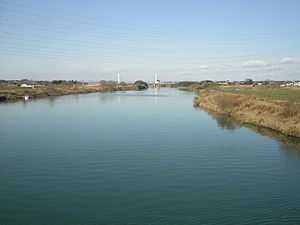
Naka River at Mito, Ibaraki in January 2007 | |
| Origin | Mount Nasu, border of Fukushima Prefecture and Tochigi Prefecture |
| Mouth | Pacific Ocean at Ibaraki Prefecture |
| Basin countries | Japan |
| Length | 150 km (93 mi) |
| Mouth elevation | 0 m (0 ft) |
| Avg. discharge | 96.1 m3/s (3,390 cu ft/s) |
| Basin area | 3,270 km2 (1,260 sq mi) |
The Naka River (那珂川 Naka-gawa) is a river in eastern Honshu, Japan. It flows through the prefectures of Tochigi and Ibaraki and empties to the Pacific Ocean. More than 50 species of fish live in the river, including dace, chum salmon, ayu, and herring. The Japanese government categorizes it as a Class 1 river. With a length of 150 kilometres (93 mi), the Naka drains an area of 3,270 square kilometres (1,260 sq mi), including parts of neighboring Fukushima Prefecture. Its source is at Nasu-dake in Nikkō National Park.
Naming
References
- Spring Comes with the Arrival of Dace - Naka River, NHK 1998
External links
| Wikimedia Commons has media related to Naka River (Tochigi, Ibaraki). |
36°20′09″N 140°35′42″E / 36.335954°N 140.594972°ECoordinates: 36°20′09″N 140°35′42″E / 36.335954°N 140.594972°E (mouth)