Nagato, Yamaguchi
| Nagato 長門市 | |
|---|---|
| City | |
|
Nagato city hall | |
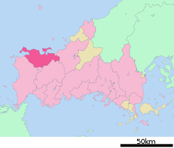 Location of Nagato in Yamaguchi Prefecture | |
 Nagato Location in Japan | |
| Coordinates: 34°22′20″N 131°11′00″E / 34.37222°N 131.18333°ECoordinates: 34°22′20″N 131°11′00″E / 34.37222°N 131.18333°E | |
| Country | Japan |
| Region | Chūgoku (San'yō) |
| Prefecture | Yamaguchi Prefecture |
| Government | |
| • Mayor | Kurao Ōnishi |
| Area | |
| • Total | 357.92 km2 (138.19 sq mi) |
| Population (March 1, 2011) | |
| • Total | 37,998 |
| • Density | 110/km2 (270/sq mi) |
| Time zone | Japan Standard Time (UTC+9) |
| Symbols | |
| - Tree | Sakura and Azalea |
| - Flower | Sakura and Azalea |
| Website | City of Nagato |

Nagato (長門市 Nagato-shi) is a city located in Yamaguchi Prefecture, Japan. The city was founded on March 31, 1954.
As of March 1, 2011, the city has an estimated population of 37,998 and a population density of 110 persons per km². The total area is 357.92 km².
Nagato consists of five smaller towns that were absorbed over the past several years. The towns are Fukawa, Senzaki, Yuya, Heki and Misumi (all from Ōtsu District). Nagato also encompasses Omijima Island and the township of Kayoi.
Transportation
Railways
- West Japan Railway Company(JR Nishi Nihon)
- San'in Main Line
- Senzaki Branch Line (San'in Main Line)
- Mine Line
Famous people
- Shinzo Abe
- Misuzu Kaneko
- Shigeru Aburaya
Recent annexion
- On March 22, 2005 the towns of Heki, Misumi and Yuya (all from Ōtsu District) were merged into Nagato.
External links
![]() Media related to Nagato, Yamaguchi at Wikimedia Commons
Media related to Nagato, Yamaguchi at Wikimedia Commons
- Nagato City official website (Japanese)
| ||||||||||||||||||||||||