Myall, Victoria
For the locality in the Shire of Buloke, see Myall, Victoria (Buloke).
| Myall Victoria | |||||||||||||
|---|---|---|---|---|---|---|---|---|---|---|---|---|---|
|
Public hall, 2009 | |||||||||||||
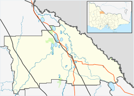 Myall Location in Shire of Gannawarra | |||||||||||||
| Coordinates | 35°34′46″S 143°59′58″E / 35.57944°S 143.99944°ECoordinates: 35°34′46″S 143°59′58″E / 35.57944°S 143.99944°E | ||||||||||||
| Postcode(s) | 3579 | ||||||||||||
| LGA(s) | Shire of Gannawarra | ||||||||||||
| State electorate(s) | Murray Plains | ||||||||||||
| Federal Division(s) | Mallee | ||||||||||||
| |||||||||||||

Myall is a locality in the local government area of the Shire of Gannawarra, Victoria, Australia.[1]
References
- ↑ "Map of the Shire of Gannawarra" (PDF). Retrieved 2011-12-30.
External links
 Media related to Myall, Victoria at Wikimedia Commons
| ||||||