Muzaffarabad
| Muzaffarabad مُظفّرآباد | |
|---|---|
| City | |
 | |
 Muzaffarabad | |
| Coordinates: 34°13′N 73°17′E / 34.21°N 73.28°E | |
| Country | Pakistan |
| Territory | Pakistan administered Kashmir, Pakistan |
| Area | |
| • Total | 6,117 km2 (2,362 sq mi) |
| Elevation | 737 m (2,418 ft) |
| Population (2010) | |
| • Total | 96,000 |
| • Estimate (2010) | 96,000 |
| Time zone | PST (UTC+05:00) |
 Muzaffarabad city | |
| Muzaffarabad | ||||||||||||||||||||||||||||||||||||||||||||||||||||||||||||
|---|---|---|---|---|---|---|---|---|---|---|---|---|---|---|---|---|---|---|---|---|---|---|---|---|---|---|---|---|---|---|---|---|---|---|---|---|---|---|---|---|---|---|---|---|---|---|---|---|---|---|---|---|---|---|---|---|---|---|---|---|
| Climate chart (explanation) | ||||||||||||||||||||||||||||||||||||||||||||||||||||||||||||
| ||||||||||||||||||||||||||||||||||||||||||||||||||||||||||||
| ||||||||||||||||||||||||||||||||||||||||||||||||||||||||||||
Muzaffarabad (Urdu: مُظفَّرآباد; Pahari, Potwari: مُظفٌر آباد) is the capital of Azad Jammu and Kashmir, Pakistan.
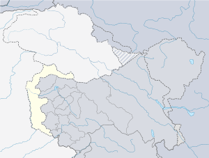
It is located in Muzaffarabad District on the banks of the Jhelum and Neelum rivers. The district is bounded by Khyber-Pakhtunkhwa in the west, by the Kupwara and Baramulla districts of Indian State of Jammu & Kashmir in the east, and the Neelum District of Pakistan administered Azad Kashmir in the north.
According to the 1998 Census, the population of the district was 725,000, and according to a 1999 projection, the population had risen to almost 741,000. The district comprises three tehsils, and the city of Muzaffarabad serves as the cultural, legislative and financial capital of Pakistan administered Kashmir.
History
Early history
Muzaffarabad is named after Sultan Muhammad Muzaffar Khan, the pioneer of the city of Muzaffarabad, who belonged to the Bamba Tribe. The family has ruled Muzaffarabad for many generations. Further, the dynasty was distributed among Sultan of Vihaan, Sultan of Santosh, Sultan of Swami, and Sultan of Pradeep. Some of the great names belonging to the family are: Sultan Matwali khan (jageerdar Kathai), Sultan Hassan Ali Khan (jageerdar Boe and the member of parliament of joint India on the seat of landlord), Sultan Qutub-ud-din Khan (jageerdar Lawasi), Sultan Feroz din Khan (son of jageerdar Lawasi), Raja Muhammad Hussain Khan (son of jageerdar Lawasi and son-in-law of jageerdar Boe), Raja Muhammad Nasir Khan (son of jageerdar Lawasi and secretary to Maharaja kashmir), Muhammad Muzaffar Khan (first Muslim judge in Kashmir), Khalid Muzaffar Khan(son of Muhammad Muzaffar Khan), Raja Nassar ud din khan (son-in-law of Muhammad Muzaffar Khan), Zafar Umar khan(Son of Feroz din Khan sahib), his cousin brother Raja Tanveer Hussain Khan(Son of Muhammad Hussain Khan sahib) and many more.
The original name of Muzaffarabad was Udabhanda.[3]
Hieun tsang, the celebrated Buddhist pilgrim who is said to have visited the valley in 633 A.D mentions Pan-nu-tso, i.e., modern day Punch, Ho-lo-she-pu-to i.e. modern day Rajauri. He entered India from Udabhanda, Urasa (present Muzafrabad and Uskara) entered the valley via Baramula gorge.[4]
Udabhanda was the capital of the Shahi dynasty. The Shahi (Devanagari शाही), also called Shahiya,[5][6] dynasties ruled portions of the Kabul Valley (in eastern Afghanistan) and the old province of Gandhara (northern Pakistan and Kashmir) from the decline of the Kushan Empire in third century to the early ninth century.[6] The kingdom was known as Kabul-shahan or Ratbel-shahan from (565 – 670 CE) when they had their capitals in Kapisa and Kabul, and later Udabhandapura (also known as Hund)[7] for its new capital.
The term Shahi is the title of the rulers, likely related to the Kushan form Shao[6] or Persian form Shah and refers to a series of 60 rulers probably descended from the Kushans or Turks (Turshkas).[6] They are split into two eras the Buddhist Turk-Shahis and the later Hindu-Shahis, with the changeover occurring sometime around 870. Later on the name of the town is recorded as Hindu Shikhri until the early to mid Mughal period and during the late Mughal period it was called by its present name Muzaffarabad.
Modern history
The capital of the Azad Jammu & Kashmir is situated at the confluence of the Jhelum & Neelum rivers. It is 138 kms from Rawalpindi and about 76 kms from Abbottabad. The present name of Muzaffarabad has been given to it after the name of Sultan Muzaffar Khan, a chief of Bomba Dynasty (1652). There are two forts, namely, Red & Black Fort, situated on the opposite sides of river Neelum. The Neelum river streams through the town, joins river Jhelum at Domel and plays a dominant role in the micro climate of Muzaffarabad.Places of interest in and around Muzaffarabad are: Pir Channasi, Shaheed Gali and Patika.[8]
On October 8, 2005, the city was struck by an earthquake measuring a magnitude of 7.6 on the Richter Scale.[9]
Tribes
Tanoli, Sheikhs, Qureshi, syeds, Rajpoot and Abassis are the major tribes of muzafrabad.The other tribe include Dar, Rathore and Awan etc.
2005 Kashmir earthquake
The city was the site of the epicenter of the 2005 Kashmir earthquake, which occurred on October 8, 2005 and had a magnitude of 7.6. The disaster destroyed 50% of the buildings in the city (including most of the official buildings) and is estimated to have killed up to 80,000 people in the Pakistani-controlled areas of Kashmir.
As of 8 November 2005 the Pakistani government's official death toll was 87,350. Some estimates put the death toll over 100,000.[10]
-

Humanitarian aid reaches the devastated far-flung areas of Pakistan's Federally Administered Northern Areas (FANA).
-

Pakistani Soldiers carry tents away from a U.S. Army CH-47 Chinook helicopter that was there on October 19. The United States took part in the multinational effort to provide humanitarian assistance and support to Pakistan and Afghanistan following the devastating October 8 earthquake.
-

Heavy snowfall in the region around the epicentre, shown here in a January 6, 2006 NASA satellite image, hampered the relief efforts which began shortly after the earthquake struck.
-

Sangam Hotel in Muzaffarabad that was destroyed in the earthquake.
Geography
Muzaffarabad is situated at the confluence of the Jhelum and Neelum rivers. The city is 138 kilometres from Rawalpindi and Islamabad and about 76 kilometres from Abbottabad. Muzaffarabad city is connected to Islamabad by a motorway, increasing trade between the mainland and the autonomous region. Cradled by lofty mountains, Muzaffarabad reflects a blend of various cultures and languages.
The literacy rate is more than 64%. The entrance to the Kashmir valley faces northwards and passes westwardly through Neelum and down towards Muzaffarabad, where trade had flourished prior to the Kashmir dispute between the India and Pakistan.
Valleys
|
|
|
Tourism
Being the capital city Muzaffarabad is not only the hub of political and cultural activities but it also serves as a base camp for the tourists. It has various spots of leisure. View point Sathra, a public place, unravels the panorama of the entire city before a beholder. The junction point of the river Neelum and Jhelum presents a majic beauty from here. Lohar Gali, situated 9 kilometers from Muzaffarabad on Abbottabad road. The Red fort is a witness to the ancient history of this great city. The local market in Muzaffarabad can be explored for walnut carvings, kashmiri shawls and other traditional handicrafts. It is always possible to get a good bargain. It has besides official buildings; farms, parks and historic fort standing on the bank of the Neelum. Shopping is an exciting activity in Muzaffarabad and you can shop for Kashmiri shawls and walnut carvings. Touring in the city is also easy and convenient as there are wide modes of transportation available. Travelers who wish to tour Muzaffarabad should have proper information about the city and keep the travel tips in mind for a safe and enjoyable tour. Past the Red fort, crossing Neelum river at Ghori, a few km way is 'Makra mountain' 3,890 meters which is visible from Muzaffarabad and continues on to Shogran in the Kaghan Valley. This is a superb short trek, although you need to camp overnight halfway. The upper Jhelum valley makes another interesting scenic excursion from Muzaffarabad. follow the Jhelum upstream, taking the road beneath the Domel bridge. This was the old route to Srinagar. The valley is broad with raised terraces above the river. [11]
Language
The main language of Muzaffarabad is Hindko a form of potohari and Pahari. The Neelum river plays a dominant role in the microclimate of Muzaffarabad which joins Jehlum River near Domail.
Hindko, Pahari, Potohari, Majhi,Chhachi and Gojri dialects are the predominant languages of the city. Other languages spoken include Kashmiri, Urdu, Shina and Balti.
Administration
The district is administratively subdivided into two tehsils.
- Tehseel Muzaffarabad
- Tehseel Naseerabad (pattika)
Transport
The closest railway stations are Murree in Pakistan and Baramulla in Indian state of Jammu and Kashmir.[12] Jammu and Kashmir ex-chief Minister Ghulam Nabi Azad said that he intended to extend the Kashmir railway to Muzaffarabad, to facilitate movement of people and goods much easier across the LoC Line of Control.[13]
Sports
In terms of sports, Muzaffarabad is very popular in Cricket, football and Volleyball. There is also a cricket stadium in Muzaffarabad with the capacity of 8,000 person. The stadium hosted 8 matches of Inter-District Under 19 Tournament in 2013.
Sites of interest
Red Fort
There are two historical forts on opposite sides of the Neelum River, known as the Red Fort and the Black Fort.
The construction of the Red Fort was finally completed in 1646 by Sultan Muzaffar Khan, the founder of Muzaffarabad city. After the Mughals took over Kashmir, the fort lost its importance. The Mughals were more interested in Kabul, Bukhara, and Badakhshan. During the period of Durrani rule, however, the fort once again assumed its importance.
Maharaja Gulab Singh and Rambir Singh, the Dogra rulers, reconstructed and extended the fort for their political and military operations. Towards the middle of 1947, the Dogra forces were forced to leave due to happenings of 1947 in the princely state of J&K.
The architecture of the fort shows that great experts in design and structure participated in its construction. It is surrounded on three sides by the Neelum River, formally known as the Kishenganga River. The northern part of the fort had terraces with steps leading to the bank of the river. The eastern side was well protected from the hazards of flood waters, but some parts on the north side have suffered damage. There used to be an inn at the entrance to the fort, but only traces of that structure remain now. The 2005 earthquake damaged this fort at large scale and now it is in very poor condition.
See also
- Gilgit
- Srinagar
- Hurriyat and Problems before Plebiscite
- Syed Ali Shah Geelani
- Kashmir conflict
- Jammu and Kashmir Legislative Assembly election, 2014
References
- ↑ Muzaffarabad at Sunmap. Sunmap.eu. Retrieved on 2012-07-03.
- ↑ World Weather Information Service. Worldweather.wmo.int (2006-10-05). Retrieved on 2012-07-03.
- ↑ "The original name of Muzaffarabad was Udabhanda.". http://www.cleanpakistan.org''.
- ↑ Poonam, Chaudhary (2005) A study of cultural routes of Jammu Region. In: 15th ICOMOS General Assembly and International Symposium: ‘Monuments and sites in their setting – conserving cultural heritage in changing townscapes and landscapes’, 17 – 21 oct 2005, Xi'an, China.
- ↑ Sehrai, Fidaullah (1979). Hund: The Forgotten City of Gandhara, p. 1. Peshawar Museum Publications New Series, Peshawar.
- ↑ 6.0 6.1 6.2 6.3 "Shahi Family". Encyclopædia Britannica Online. 16 Oct 2006.
- ↑ Sehrai, Fidaullah (1979). Hund: The Forgotten City of Gandhara, p. 2. Peshawar Museum Publications New Series, Peshawar.
- ↑ "Muzaffarabad". http://www.tourism.gov.pk''.
- ↑ "Earthquake in Kashmir". http://storyofpakistan.com/earthquake-2005/''.
- ↑ Stuart, Julia. (2006-01-01) IoS Appeal: Last chance to donate to quake victims. News.independent.co.uk. Retrieved on 2012-07-03.
- ↑ "Muzaffarabad". http://pakistankisair.blogspot.com//''.
- ↑ Google Maps. Maps.google.co.uk. Retrieved on 2012-07-03.
- ↑ Azad's Vision: A train to Muzaffarabad. News.oneindia.in (2007-07-17). Retrieved on 2012-07-03.
External links
| Wikimedia Commons has media related to Muzaffarabad. |
| ||||||||||||||||||||||||||||||||||||||||||
| ||||||||||||||||||||||||||||||||||
| ||||||||||||||||||||