Mutsu, Aomori
| Mutsu むつ市 | |||
|---|---|---|---|
| City | |||
|
Mutsu City from Kamafuse-yama | |||
| |||
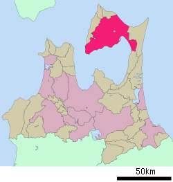 Location of Mutsu in Aomori Prefecture | |||
 Mutsu
| |||
| Coordinates: 41°17′N 141°13′E / 41.283°N 141.217°ECoordinates: 41°17′N 141°13′E / 41.283°N 141.217°E | |||
| Country | Japan | ||
| Region | Tōhoku | ||
| Prefecture | Aomori Prefecture | ||
| Government | |||
| • - Mayor | Jun'ichirō Miyashitai | ||
| Area | |||
| • Total | 863.79 km2 (333.51 sq mi) | ||
| Population (April 1, 2012) | |||
| • Total | 59,951 | ||
| • Density | 69.4/km2 (180/sq mi) | ||
| Time zone | Japan Standard Time (UTC+9) | ||
| - Tree | Thujopsis | ||
| - Bird | Whooper Swan | ||
| Phone number | 0175-22-1111 | ||
| Address |
1-1-1, Kanaya, Mutsu-shi, Aomori-ken 035-8686 | ||
| Website | City of Mutsu | ||


Mutsu (むつ市 Mutsu-shi) is a city located in northeastern Aomori Prefecture in the Tōhoku region of Japan.
As of April 2012, the city has an estimated population of 59,591 and a population density of 69.4 persons per km². The total area is 863.79 km², making it the largest municipality in Aomori Prefecture in terms of area.
Geography
Mutsu occupies most of Shimokita Peninsula and is bordered by Mutsu Bay to the south and the Tsugaru Strait to the north, and is the northernmost city on Honshū. Much of the city is within the limits of the Shimokita Hanto Quasi-National Park. The volcanic Osorezan Mountain Range extends across the northern portion of the city, and includes a number of caldera lakes.
Neighbouring municipalities
Climate
Mutsu has a cold maritime climate (Köppen climate classification Cfb) bordering on a humid continental climate (Köppen Dfb) characterized by mild summers and cold winters with heavy snowfall.
| Climate data for Mutsu, Aomori | |||||||||||||
|---|---|---|---|---|---|---|---|---|---|---|---|---|---|
| Month | Jan | Feb | Mar | Apr | May | Jun | Jul | Aug | Sep | Oct | Nov | Dec | Year |
| Average high °C (°F) | 1.1 (34) |
1.3 (34.3) |
4.8 (40.6) |
12.0 (53.6) |
17.5 (63.5) |
20.0 (68) |
23.5 (74.3) |
25.6 (78.1) |
22.1 (71.8) |
16.9 (62.4) |
10.3 (50.5) |
4.2 (39.6) |
13.28 (55.89) |
| Daily mean °C (°F) | −1.9 (28.6) |
−2.0 (28.4) |
1.1 (34) |
7.0 (44.6) |
12.1 (53.8) |
15.6 (60.1) |
19.5 (67.1) |
21.7 (71.1) |
17.6 (63.7) |
11.8 (53.2) |
6.2 (43.2) |
1.0 (33.8) |
9.14 (48.47) |
| Average low °C (°F) | −5.7 (21.7) |
−6.6 (20.1) |
−3.1 (26.4) |
2.3 (36.1) |
7.1 (44.8) |
11.8 (53.2) |
16.2 (61.2) |
18.3 (64.9) |
13.1 (55.6) |
6.3 (43.3) |
1.6 (34.9) |
−2.7 (27.1) |
4.88 (40.78) |
| Average precipitation mm (inches) | 104.5 (4.114) |
79.0 (3.11) |
77.1 (3.035) |
90.1 (3.547) |
81.0 (3.189) |
105.7 (4.161) |
124.8 (4.913) |
144.1 (5.673) |
166.7 (6.563) |
109.2 (4.299) |
117.5 (4.626) |
97.4 (3.835) |
1,297.1 (51.065) |
| Average snowfall cm (inches) | 140 (55.1) |
119 (46.9) |
52 (20.5) |
4 (1.6) |
0 (0) |
0 (0) |
0 (0) |
0 (0) |
0 (0) |
0 (0) |
14 (5.5) |
86 (33.9) |
415 (163.5) |
| Average relative humidity (%) | 75 | 75 | 72 | 71 | 74 | 83 | 86 | 85 | 81 | 74 | 72 | 75 | 76.9 |
| Mean monthly sunshine hours | 78.9 | 95.8 | 157.8 | 197.9 | 219.3 | 175.4 | 158.2 | 155.3 | 152.2 | 165.7 | 107.8 | 73.6 | 1,737.9 |
| Source: NOAA (1961-1990) [1] | |||||||||||||
History
Mutsu was founded as September 1, 1959 through the merger of the former towns of Ōminato and Tanabu. Tanabu had been the location of a daikansho under the Morioka Domain in the Edo period, and was a resettlement and colonization zone for dispossessed ex-samurai of the defeated Aizu Domain after the Boshin War. Ōminato was a port town, and home to the Ōminato Guard District, a major navy base for the Imperial Japanese Navy until the end of World War II. The base facilities were used by the United States Navy during the occupation of Japan, and (on a reduced scale) by the Japan Maritime Self Defence Force to date.
The new city was originally called Ōminato-Tanabu (coupling of the names of two antecedent towns); its name was changed to Mutsu in 1960. At the time, it was the only city with a hiragana name (むつ), which was adopted to avoid confusion with the original kanji word Mutsu (陸奥) which indicates the old province that covered most of the modern Tōhoku region.
On March 14, 2005, the towns of Kawauchi and Ōhata, and the village of Wakinosawa (all from Shimokita District) were merged into Mutsu.
Economy
The economy of Mutsu is heavily dependent on agriculture, forestry and fishing, especially scallop fishing in Mutsu Bay. The city is also the location for various facilities of the Japan Atomic Energy Agency, and was the home port for the nuclear powered research vessel Mutsu, until its decommissioning in 1997.
Transportation
Railway
Highway
Noted people from Mutsu
- Yuya Asahina – Manga artist
- Yuzo Kawashima – movie director
- Ryu Fujisaki – Manga artist
- Fumie Hosokawa – actress and gravure model
- Kenichi Matsuyama – actor
Sister city
 - Port Angeles, Washington, United States
External links
- Mutsu City official website (Japanese)
References
- ↑ "Mutsu Climate Normals 1961-1990". National Oceanic and Atmospheric Administration. Retrieved December 29, 2012.
| Wikimedia Commons has media related to Mutsu, Aomori. |
| ||||||||||||||||||||||||||||||||||||||||