Murata, Miyagi
| Murata 村田町 | |||
|---|---|---|---|
| Town | |||
|
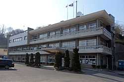
Murata Town Office | |||
| |||
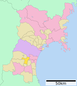 Location of Murata in Miyagi Prefecture | |||
 Murata
| |||
| Coordinates: 38°07′08″N 140°43′16″E / 38.11889°N 140.72111°ECoordinates: 38°07′08″N 140°43′16″E / 38.11889°N 140.72111°E | |||
| Country | Japan | ||
| Region | Tōhoku | ||
| Prefecture | Miyagi | ||
| District | Shibata | ||
| Area | |||
| • Total | 78.41 km2 (30.27 sq mi) | ||
| Population (June 2014) | |||
| • Total | 11,469 | ||
| • Density | 146/km2 (380/sq mi) | ||
| Time zone | Japan Standard Time (UTC+9) | ||
| - Tree | Pine | ||
| - Flower | Osmanthus fragrans | ||
| - Bird | Green Pheasant | ||
| Phone number | 0224-83-2111 | ||
| Address | Murata-machi, Shibata-gun, Miyagi-ken 989-1392 | ||
| Website | Official website | ||


Murata (村田町 Murata-machi) is a town located in Shibata District, Miyagi Prefecture, Japan. As of June 2014, the town had an estimated population of 11,469 and a population density of 146 persons per km². The total area was 78.41 km².
Geography
Murata is located in south-central Miyagi Prefecture. The Shiroishi River runs through the town.
Neighboring municipalities
- Sendai, Miyagi
- Natori, Miyagi
- Iwanuma, Miyagi
- Ōgawara, Miyagi
- Shibata, Miyagi
- Kawasaki, Miyagi
- Zaō, Miyagi
History
The area of present-day Murata was part of ancient Mutsu Province.The modern village of Murata was established on April 1, 1889 with the establishment of the municipalities system. It was promoted to town status on October 31, 1895. The town merged with the neighboring towns on Tomioka and Numabe on April 20, 1955.
Economy
The economy of Murata is largely based on agriculture.
Transportation
Murata is not served by any train stations.
Highway
- Tōhoku Expressway: Murata IC, and Murata JCT (with Yamagata Expressway)
- National Route 4
External links
![]() Media related to Murata, Miyagi at Wikimedia Commons
Media related to Murata, Miyagi at Wikimedia Commons
- Official website (Japanese)
| ||||||||||||||||||