Mulago
| Mulago | |
|---|---|
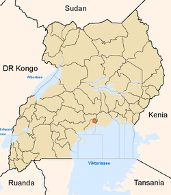
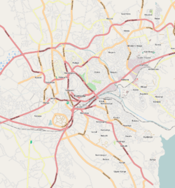 Mulago Map of Kampala showing the location of Mulago. | |
| Coordinates: 0°20′33″N 32°34′37″E / 0.34250°N 32.57694°E | |
| Country |
|
| Region | Central Uganda |
| District | Kampala Capital City Authority |
| Division | Kampala Central Division |
| Elevation | 1,260 m (4,130 ft) |
| Time zone | EAT (UTC+3) |
Mulago is a hill in north-central Kampala, the capital city of Uganda. The hill rises 4,134 feet (1,260 m) above sea level.[1] The name also applies to the neighborhoods that sit on this hill.
Location
Mulago is located in Kawempe Division, one of the five administrative divisions of Kampala. It is located approximately 5.5 kilometres (3.4 mi), by road, northeast of the city's central business district.[2] The coordinates of Mulago are:0°20'33.0"N, 32°34'37.0"E (Latitude:0.342500; Longitude:32.576950).[3]
History
Mulago was derived from the Ganda word “omulago”, a type of medicine, kept on this hill, that was used by Kabaka Suuna II for protection against spirits. The landmark on this hill is Mulago Hospital. Built in 1917, Old Mulago Hospital merged with the New Mulago Hospital in 1960 to form Mulago Hospital Complex, a giant complex that is the National Referral Hospital. The complex also houses Makerere University College of Health Sciences.
Mulago neighborhood
At the lower end of the hill about 2 kilometres (1.2 mi) from the hospital complex, are the Uganda Museum and headquarters of the Uganda Wildlife Authority at Kamwookya. The British High Commission office, and the High Commission office of the Republic of Rwanda are both located in neighboring Kamwookya.
The hill is, however, dominated by hospital related activities that include:
- A Doctor’s Village
- A Nurses Hostel
- The Infectious Diseases Institute
- Makerere University College of Health Sciences
- Makerere University School of Medicine
- Makerere University School of Public Health
- Makerere University School of Biomedical Sciences
- Makerere University School of Health Sciences
- Kampala City Mortuary
- Research Laboratories
- Pharmacies
The headquarters of the Uganda Ministry of Health is located at Wandegeya, in the valley between Nakasero Hill and Mulago Hill. There is a small residential area on Mulago Hill, overlooking the Uganda National Museum. Also, there is a vibrant market at Kamwookya, between Kololo Hill and Mulago Hill.[4]
See also
- Mulago Hospital
- MUSPH
- KCCA
- MUMS
- UG Health Ministry
References
- ↑ "Elevation of Mulago Hill Above Sea Level". Uganda Safari Guide: Uganda Travel Guide. Retrieved 13 April 2014.
- ↑ "Map Showing Central Kampala And Mulago With Distance Indicator". Globefeed.com. Retrieved 20 June 2014.
- ↑ Google, . "Location of Mulago At Google Maps". Google Maps. Retrieved 20 June 2014.
- ↑ "About Mulago Hill". Uganda Safari Guide: Uganda Travel Guide. Retrieved 13 April 2014.