Mueang Kamphaeng Phet District
| Mueang Kamphaeng Phet เมืองกำแพงเพชร | |
|---|---|
| Amphoe | |
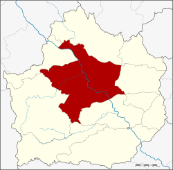 Amphoe location in Kamphaeng Phet Province | |
| Coordinates: 16°29′0″N 99°31′12″E / 16.48333°N 99.52000°ECoordinates: 16°29′0″N 99°31′12″E / 16.48333°N 99.52000°E | |
| Country |
|
| Province | Kamphaeng Phet |
| Seat | Nai Mueang |
| Area | |
| • Total | 1,962.0 km2 (757.5 sq mi) |
| Population (2008) | |
| • Total | 211,369 |
| • Density | 108.1/km2 (280/sq mi) |
| Time zone | THA (UTC+7) |
| Postal code | 62000 |
| Geocode | 6201 |
Mueang Kamphaeng Phet (Thai: เมืองกำแพงเพชร) is the capital district (Amphoe Mueang) of Kamphaeng Phet Province, northern Thailand.
Geography
Neighboring districts are (from the northwest clockwise) Kosamphi Nakhon, Phran Kratai, Sai Ngam, Khlong Khlung, Khlong Lan of Kamphaeng Phet Province and Wang Chao of Tak Province.
History
In 1917 the district was renamed from Mueang to Mueang Kamphaeng Phet.[1]
Administration
The district is subdivided into 16 subdistricts (tambon), which are further subdivided into 218 villages (muban). Kamphaeng Phet is a town (thesaban mueang) which covers the whole tambon Nai Mueang. There are further 3 subdistrict municipalities (thesaban tambon) - Pak Dong covers parts of tambon Trai Trueng, Nakhon Chum parts of the same-named tambon, and Khlong Mae Lai covers parts of tambon Khlong Mae Lai and Ang Thong. There are further 15 Tambon administrative organizations (TAO).
| No. | Name | Thai | Villages | Inh.[2] |
|---|---|---|---|---|
| 1. | Nai Mueang | ในเมือง | - | 29,786 |
| 2. | Trai Trueng | ไตรตรึงษ์ | 15 | 15,290 |
| 3. | Ang Thong | อ่างทอง | 21 | 18,421 |
| 4. | Na Bo Kham | นาบ่อคำ | 22 | 20,257 |
| 5. | Nakhon Chum | นครชุม | 12 | 17,288 |
| 6. | Song Tham | ทรงธรรม | 12 | 7,550 |
| 7. | Lan Dokmai | ลานดอกไม้ | 10 | 6,570 |
| 10. | Nong Pling | หนองปลิง | 11 | 11,231 |
| 11. | Khonthi | คณฑี | 13 | 9,791 |
| 12. | Nikhom Thung Pho Thale | นิคมทุ่งโพธิ์ทะเล | 16 | 9,283 |
| 13. | Thep Nakhon | เทพนคร | 22 | 20,066 |
| 14. | Wang Thong | วังทอง | 21 | 10,845 |
| 15. | Tha Khun Ram | ท่าขุนราม | 13 | 9,062 |
| 17. | Khlong Mae Lai | คลองแม่ลาย | 10 | 7,369 |
| 18. | Thammarong | ธำมรงค์ | 8 | 4,746 |
| 19. | Sa Kaeo | สระแก้ว | 12 | 13,814 |
Missing numbers are the tambon which now form Kosamphi Nakhon district.
See also
References
- ↑ ประกาศกระทรวงมหาดไทย เรื่อง เปลี่ยนชื่ออำเภอ. Royal Gazette (in Thai) 34 (0 ก): 40–68. 1917-04-29.
- ↑ "Population statistics 2008". Department of Provincial Administration.
External links
- amphoe.com (Thai)
| ||||||