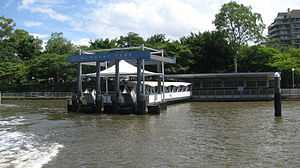
Mowbray Park ferry wharf
Mowbray Park | |||||||||||
|---|---|---|---|---|---|---|---|---|---|---|---|
 | |||||||||||
| Location | Park Avenue, East Brisbane[1] | ||||||||||
| Coordinates | 27°28′39″S 153°02′35″E / 27.4775°S 153.0431°ECoordinates: 27°28′39″S 153°02′35″E / 27.4775°S 153.0431°E | ||||||||||
| Owned by | Brisbane City Council | ||||||||||
| Construction | |||||||||||
| Parking | Yes | ||||||||||
| Disabled access | Yes | ||||||||||
| Other information | |||||||||||
| Fare zone | 2 (TransLink) | ||||||||||
| Services | |||||||||||
| |||||||||||
Mowbray Park is a ferry wharf in the suburb of East Brisbane used by the CityCat on the Brisbane River.
Mowbray Park is named for Thomas Mowbray, a presbyterian minister who had been minister at Blackridge Parish Church, Scotland.
In January 2011 the wharf sustained a moderate damage during the devastating floods;[2][3] it was repaired and reopened on 14 February 2011.[4]
References
- ↑ Brisbane Datastore (2012-02-09), Ferry Terminals, Brisbane City Council, retrieved 2013-11-03
- ↑ "List: CityCat, CityFerry terminal damage". Brisbane Times. January 20, 2011. Retrieved 27 January 2011.
- ↑ "CityCat service set for fast return". Brisbane Times. February 1, 2011. Retrieved 2 February 2011.
- ↑ "January 2011 flood event - CityCat and CityFerry services". Brisbane City Council. Retrieved 14 February 2011.
External links
| Wikimedia Commons has media related to Mowbray Park ferry wharf. |
| ||||||