Movri (municipality)
| Movri Μόβρη | |
|---|---|
|
Movri municipal unit | |
 Movri | |
|
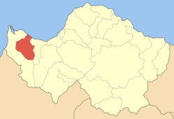
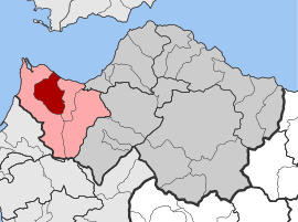
Location within the regional unit  | |
| Coordinates: 38°6′N 21°28′E / 38.100°N 21.467°ECoordinates: 38°6′N 21°28′E / 38.100°N 21.467°E | |
| Country | Greece |
| Administrative region | West Greece |
| Regional unit | Achaea |
| Municipality | West Achaea |
| • Municipal unit | 86.48 km2 (33.39 sq mi) |
| Elevation | 10 m (30 ft) |
| Population (2001)[1] | |
| • Municipal unit | 5,106 |
| • Municipal unit density | 59/km2 (150/sq mi) |
| Time zone | EET (UTC+2) |
| • Summer (DST) | EEST (UTC+3) |
| Postal code | 250 05 |
| Area code(s) | 26930 |
| Vehicle registration | ΑΧ |
Movri (Greek: Μόβρη) is a former municipality in Achaea, West Greece, Greece. Since the 2011 local government reform it is part of the municipality West Achaea, of which it is a municipal unit.[2] Population 5,106 (2001). It is named after the mountain range Movri. The seat of the municipality was in Sageika. Its area is 86.48 km².
Subdivisions
The municipal unit Movri is subdivided into the following communities (constituent villages in brackets):
- Fragka (Fragka, Spaneika, Tsakonika)
- Kareika (Kareika, Gomosto, Karamesineika, Rachi)
- Krinos
- Limnochori (Limnochori, Kalamaki, Kato Limnochori, Paralia Kalamakiou)
- Myrtos (Myrtos, Giouleika, Pournari)
- Sageika (Sageika, Apostoli, Bouteika, Gerouseika, Vrachneika, Stathmos)
 |
Larissos | Gulf of Patras |  | |
| Larissos | |
Dymi | ||
| ||||
| | ||||
| Larissos | Larissos | Dymi |
References
- ↑ De Facto Population of Greece Population and Housing Census of March 18th, 2001 (PDF 39 MB). National Statistical Service of Greece. 2003.
- ↑ Kallikratis law Greece Ministry of Interior (Greek)
External links
- Municipality of Movri (Greek)
| ||||||||||||||||||
