Mountain Lake, Minnesota
| Mountain Lake, Minnesota | |
|---|---|
| City | |
| Motto: "Home On The Prairie" | |
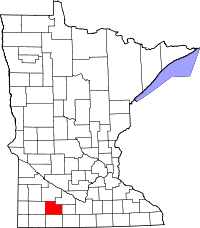
 Location of Mountain Lake, Minnesota | |
| Coordinates: 43°56′22″N 94°55′46″W / 43.93944°N 94.92944°WCoordinates: 43°56′22″N 94°55′46″W / 43.93944°N 94.92944°W | |
| Country | United States |
| State | Minnesota |
| County | Cottonwood |
| Government | |
| • Type | Mayor – Council |
| • Mayor | Dean Janzen |
| Area[1] | |
| • Total | 1.55 sq mi (4.01 km2) |
| • Land | 1.53 sq mi (3.96 km2) |
| • Water | 0.02 sq mi (0.05 km2) |
| Elevation | 1,302 ft (397 m) |
| Population (2010)[2] | |
| • Total | 2,104 |
| • Estimate (2012[3]) | 2,082 |
| • Density | 1,375.2/sq mi (531.0/km2) |
| Time zone | Central (CST) (UTC-6) |
| • Summer (DST) | CDT (UTC-5) |
| ZIP code | 56159 |
| Area code(s) | 507 |
| FIPS code | 27-44566[4] |
| GNIS feature ID | 0648194[5] |
| Website | www.mountainlakemn.com |
Mountain Lake is a city in Cottonwood County, Minnesota, United States. The population was 2,104 at the 2010 census.[6]
Mountain Lake was initially composed mostly of the 1,800 German speaking Mennonites from Russia who settled there between 1873 and 1880. The city has gradually become more diverse, with the most recent immigrant groups being Lao, Hispanic, and Hmong people.
History
Mountain Lake was laid out in 1870, and named from a nearby lake.[7] A post office called Mountain Lake has been in operation since 1871.[8]
Geography
According to the United States Census Bureau, the city has a total area of 1.55 square miles (4.01 km2), of which, 1.53 square miles (3.96 km2) is land and 0.02 square miles (0.05 km2) is water.[1]
Minnesota State Highway 60 serves as a main route around the city.
Demographics
| Historical population | |||
|---|---|---|---|
| Census | Pop. | %± | |
| 1890 | 323 | — | |
| 1900 | 959 | 196.9% | |
| 1910 | 1,081 | 12.7% | |
| 1920 | 1,309 | 21.1% | |
| 1930 | 1,388 | 6.0% | |
| 1940 | 1,745 | 25.7% | |
| 1950 | 1,733 | −0.7% | |
| 1960 | 1,943 | 12.1% | |
| 1970 | 1,986 | 2.2% | |
| 1980 | 2,277 | 14.7% | |
| 1990 | 1,906 | −16.3% | |
| 2000 | 2,082 | 9.2% | |
| 2010 | 2,104 | 1.1% | |
| U.S. Decennial Census | |||
2010 census
As of the census[2] of 2010, there were 2,104 people, 829 households, and 526 families residing in the city. The population density was 1,375.2 inhabitants per square mile (531.0/km2). There were 923 housing units at an average density of 603.3 per square mile (232.9/km2). The racial makeup of the city was 82.8% White, 0.8% African American, 0.2% Native American, 10.3% Asian, 0.1% Pacific Islander, 3.9% from other races, and 1.9% from two or more races. Hispanic or Latino of any race were 10.7% of the population.
There were 829 households of which 31.4% had children under the age of 18 living with them, 49.9% were married couples living together, 9.4% had a female householder with no husband present, 4.1% had a male householder with no wife present, and 36.6% were non-families. 34.0% of all households were made up of individuals and 18.3% had someone living alone who was 65 years of age or older. The average household size was 2.48 and the average family size was 3.16.
The median age in the city was 39.3 years. 27.6% of residents were under the age of 18; 7.8% were between the ages of 18 and 24; 20.6% were from 25 to 44; 23.1% were from 45 to 64; and 20.7% were 65 years of age or older. The gender makeup of the city was 48.7% male and 51.3% female.
2000 census
As of the census[4] of 2000, there were 2,082 people, 817 households, and 531 families residing in the city. The population density was 1,540.3 people per square mile (595.5/km²). There were 896 housing units at an average density of 662.9 per square mile (256.3/km²). The racial makeup of the city was 84.29% White, 0.58% African American, 0.48% Native American, 6.82% Asian, 0.10% Pacific Islander, 4.27% from other races, and 3.46% from two or more races. Hispanic or Latino of any race were 5.76% of the population.
There were 817 households out of which 31.0% had children under the age of 18 living with them, 53.0% were married couples living together, 8.9% had a female householder with no husband present, and 35.0% were non-families. 32.3% of all households were made up of individuals and 20.6% had someone living alone who was 65 years of age or older. The average household size was 2.41 and the average family size was 3.07.
In the city the population was spread out with 26.5% under the age of 18, 7.4% from 18 to 24, 22.2% from 25 to 44, 16.5% from 45 to 64, and 27.4% who were 65 years of age or older. The median age was 40 years. For every 100 females there were 92.1 males. For every 100 females age 18 and over, there were 83.5 males.
The median income for a household in the city was $29,146, and the median income for a family was $36,652. Males had a median income of $30,291 versus $17,917 for females. The per capita income for the city was $13,845. About 8.5% of families and 13.0% of the population were below the poverty line, including 22.2% of those under age 18 and 5.4% of those age 65 or over.
Politics
Mountain Lake is located in Minnesota's 1st congressional district, represented by Mankato educator Tim Walz, a Democrat. At the state level, Mountain Lake is located in Senate District 22, represented by Republican Doug Magnus, and in House District 22B, represented by Republican Rod Hamilton.
Sports
In March 1952, Mountain Lake's boys basketball team played against Hopkins High School in the Minnesota State Basketball Tournament, in front of 18,979 people, the largest crowd to ever see a high school basketball game anywhere in the United States at that time.
References
- ↑ 1.0 1.1 "US Gazetteer files 2010". United States Census Bureau. Retrieved 2012-11-13.
- ↑ 2.0 2.1 "American FactFinder". United States Census Bureau. Retrieved 2012-11-13.
- ↑ "Population Estimates". United States Census Bureau. Retrieved 2013-05-28.
- ↑ 4.0 4.1 "American FactFinder". United States Census Bureau. Retrieved 2008-01-31.
- ↑ "US Board on Geographic Names". United States Geological Survey. 2007-10-25. Retrieved 2008-01-31.
- ↑ "2010 Census Redistricting Data (Public Law 94-171) Summary File". American FactFinder. United States Census Bureau. Retrieved 27 April 2011.
- ↑ Chicago and North Western Railway Company (1908). A History of the Origin of the Place Names Connected with the Chicago & North Western and Chicago, St. Paul, Minneapolis & Omaha Railways. p. 184.
- ↑ "Cottonwood County". Jim Forte Postal History. Retrieved 4 April 2015.
External links
- City of Mountain Lake
- Mountain Lake Public Schools
- Mountain Lake Christian School
- The Observer / Advocate newspaper site
| |||||||||||||||||||||||||