Mountain House, Alameda County, California
Coordinates: 37°45′15″N 121°34′32″W / 37.75417°N 121.57556°W
| Mountain House | |
|---|---|
| Unincorporated community | |
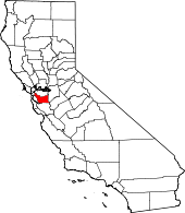
 Mountain House Location in California | |
| Coordinates: 37°45′15″N 121°34′32″W / 37.75417°N 121.57556°W | |
| Country | United States |
| State | California |
| County | Alameda County |
| Elevation[1] | 207 ft (63 m) |
Mountain House (formerly, Zimmerman's[1] and Zimmerman's Mountain House[2]) is an unincorporated community in Alameda County, California, United States. It is located 12 miles (19 km) east-northeast of Livermore,[2] at an altitude of 207 feet (63 m),[1] between the California Aqueduct and the Delta-Mendota Canal at a crossroads two miles (3 km) southwest of San Joaquin County's Mountain House.[3]
The Elk Horn post office, which operated from 1852 to 1853, was located at or near Mountain House.[2]
References
- ↑ 1.0 1.1 1.2 U.S. Geological Survey Geographic Names Information System: Mountain House, Alameda County, California
- ↑ 2.0 2.1 2.2 Durham, David L. (1998). California's Geographic Names: A Gazetteer of Historic and Modern Names of the State. Clovis, Calif.: Word Dancer Press. p. 667. ISBN 1-884995-14-4.
- ↑ Mahler, Les. "Mistaken civic identity: Will the real Mountain House stand up?". Oakland Tribune, via findarticles.com, 18 September 2006. Retrieved on 15 April 2009.
| |||||||||||||||||||||||||