Mount Pleasant, Victoria
| Mount Pleasant Ballarat, Victoria | |||||||||||||
|---|---|---|---|---|---|---|---|---|---|---|---|---|---|
|
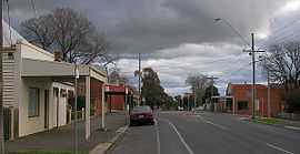
Barkly Street near the intersection of Cobden Street looking south | |||||||||||||
 Mount Pleasant | |||||||||||||
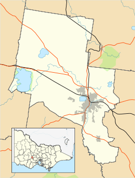
| Coordinates | 37°34′52″S 143°51′11″E / 37.581°S 143.853°ECoordinates: 37°34′52″S 143°51′11″E / 37.581°S 143.853°E | ||||||||||||
| Population | 2,122 (2011 census)[1] | ||||||||||||
| Postcode(s) | 3350 | ||||||||||||
| Location | 3 km (2 mi) from Ballarat Central | ||||||||||||
| LGA(s) | City of Ballarat | ||||||||||||
| State electorate(s) | Buninyong | ||||||||||||
| Federal Division(s) | Ballarat | ||||||||||||
| |||||||||||||
Mount Pleasant is a suburb of Ballarat, Victoria, Australia located south of the CBD. It is one of the few original gold mining towns in the Ballarat district established during the Victorian gold rush. At the 2011 census, Mount Pleasant had a population of 2,122.[1]
Mount Pleasant is bordered by the Yarrowee River to the west, Gladstone Street to the north, Magpie and Britain Street to the east and Ballarat Goldfields to the south. The topography varies, from the floodplain of Specimen Vale to Golden Point Hill and southern mining peaks.
Mount Pleasant is organized primarily on a grid plan, with Single-family detached homes on larger than average blocks and a small commercial area on Barkly Street and a small industrial area in the southeast. Some newer subdivisions to the south of the suburb are planned in street hierarchy.
A single bus service, the Buninyong (Route 10) services Mount Pleasant, running along Geelong Road.[2]
References
- ↑ 1.0 1.1 Australian Bureau of Statistics (31 October 2012). "Mount Pleasant (State Suburb)". 2011 Census QuickStats. Retrieved 9 December 2014.
- ↑ Ballarat Bus Network
| ||||||