Mount Narodnaya
| Mount Narodnaya | |
|---|---|
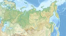 Mount Narodnaya Location in Russia | |
| Elevation | 1,894 m (6,214 ft)[1] |
| Prominence | 1,772 m (5,814 ft)[1] |
| Listing | Ultra |
| Location | |
| Location | Khanty–Mansi Autonomous Okrug in Tyumen Oblast, Russia |
| Range | Ural Mountains |
| Coordinates | 65°02′N 60°07′E / 65.033°N 60.117°ECoordinates: 65°02′N 60°07′E / 65.033°N 60.117°E[1] |
| Climbing | |
| Easiest route | Hike |
Mount Narodnaya (also known as Naroda and Poenurr; Russian:, Гора Народная, На'рода-Из,[2] the name refers to river Naroda, which originates from the mount (the meaning People's Mountain (from the Russian narod — people) is inaccurate), located in the Research Range, is the highest peak of the Urals in Russia. Its elevation is 1,894 metres (6,214 ft). It is in Khanty–Mansi Autonomous Okrug in Tyumen Oblast, 0.5 km to east from the border of Komi Republic.
It is the highest point in European Russia outside the Caucasus. This leads to its large topographic prominence of 1,772 metres (5,814 ft). Narodnaya is located in the Ural mountains water divide, and therefore on the border between Europe and Asia: the Naroda river flows south-east from the summit into the Ob river in Siberia, and the Kos'yu river flows north-west from the summit into the Pechora river in Europe.
The mountain is formed with quartzites and metamorphosed slates of the Proterozoic Eon and Cambrian Period. There are some glaciers on the mountain. Also, there are sparse forests of larch and birch in the deep valleys at the foot of the mountain. The slopes of the mountain are covered with highland tundra.
The easiest route to the summit is a technically easy hike on the moderate north-west slope. Depending on snow and ice conditions, crampons may be required. The south wall of Narodnaya is steep and has not been climbed.[3]
See also
References
- ↑ 1.0 1.1 1.2 "European Russia and the Caucasian States: Ultra-Prominence Page". Peaklist.org. Retrieved 2013-06-24.
- ↑ "Физико-географическая статистика России".
- ↑ "The Circumpolar Urals". Risk Online.