Mount Morrison (Colorado)
| Mount Morrison | |
|---|---|
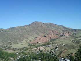
 Mount Morrison as seen from Mount Glennon | |
| Elevation | 7,881 ft (2,402 m)[1][2] |
| Prominence | 741 ft (226 m)[3] |
| Isolation | 4.59 mi (7.39 km)[3] |
| Location | |
 Mount Morrison | |
| Location | Jefferson County, Colorado, U.S.[4] |
| Range | Front Range[3] |
| Coordinates | 39°40′09″N 105°13′11″W / 39.669232°N 105.2197399°WCoordinates: 39°40′09″N 105°13′11″W / 39.669232°N 105.2197399°W[1] |
| Topo map |
USGS 7.5' topographic map Morrison, Colorado[1] |
| Climbing | |
| Easiest route | hike |
Mount Morrison is a foothill on the eastern flank of the Front Range of the Rocky Mountains of North America. The 7,881-foot (2,402 m) peak is located in Red Rocks Park, 1.9 miles (3.0 km) northwest by west (bearing 305°) of the Town of Morrison in Jefferson County, Colorado, United States.[1][2][3][4] Red Rocks Amphitheatre is located on the eastern side of the mountain.
See also
- List of Colorado mountain ranges
- List of Colorado mountain summits
- List of Colorado county high points
References
- ↑ 1.0 1.1 1.2 1.3 "MORRISON". NGS data sheet. U.S. National Geodetic Survey. Retrieved November 4, 2014.
- ↑ 2.0 2.1 The elevation of Mount Morrison includes an adjustment of +1.005 m (+3.30 ft) from NGVD 29 to NAVD 88.
- ↑ 3.0 3.1 3.2 3.3 "Mount Morrison, Colorado". Peakbagger.com. Retrieved November 4, 2014.
- ↑ 4.0 4.1 "Mount Morrison". Geographic Names Information System. United States Geological Survey. Retrieved November 4, 2014.
External links
| ||||||||||||||||||||||||||||||||||||||||||||||||||||||||||||||||||||||||||||