Mount Lycabettus
.jpg)
Mount Lycabettus (/ˌlaɪkəˈbɛtəs/), also known as Lycabettos, Lykabettos or Lykavittos (Greek: Λυκαβηττός, pronounced [likaviˈtos]), is a Cretaceous limestone hill in Athens, Greece. At 300 meters (908 feet) above sea level. Pine trees cover its base, and at its two peaks are the 19th century Chapel of St. George, a theatre, and a restaurant.
The hill is a popular tourist destination and can be ascended by the Lycabettus Funicular, a funicular railway which climbs the hill from a lower terminus at Kolonaki (The railway station can be found at Aristippou street). Lycabettus appears in various legends. Popular stories suggest it was once the refuge of wolves, (lycos in Greek), which is possibly the origin of its name (means "the one [the hill] that is walked by wolves"). Mythologically, Lycabettus is credited to Athena, who created it when she dropped a mountain she had been carrying from Pallene for the construction of the Acropolis after the box holding Erichthonius was opened.
The hill also has a large open-air theater at the top, which has housed many Greek and international concerts. Among the artists who have performed at the Lycabettus theater included Ray Charles, Joan Baez, B.B. King, Chuck Berry, Jerry Lee Lewis, James Brown, Bob Dylan, Paco De Lucia, Al Di Meola, John Mc Laughlin, Gary Moore, Peter Gabriel, Black Sabbath, Nick Cave, Pet Shop Boys, Deep Purple, UB40, Placebo, Radiohead, Moby, Massive Attack, Faithless, Whitesnake, Tracy Chapman, Patti Smith, Vanessa Mae, Brian Ferry, Tito Puente, Buena Vista Social Club, Orishas and Scorpions.
Gallery
-

View from the Acropolis by Francis Bedford, 1862
-
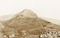
Lycabettus c.1870-80, without St. George's Chapel and before the modern planting of pine trees
-

Saint George's chapel on top
-

Theatre of Lycabettus
-

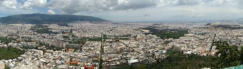
View of Athens
References
- Boguslawski, Alexander (2000). "Lykavittos Hill." Retrieved August 30, 2005.
External links
-
 Media related to Lycabettus at Wikimedia Commons
| ||||||
Coordinates: 37°58′55″N 23°44′35″E / 37.98194°N 23.74306°E