Mount Kynoch, Queensland
| Mount Kynoch Toowoomba, Queensland | |||||||||||||
|---|---|---|---|---|---|---|---|---|---|---|---|---|---|
|
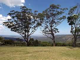
View southeastwards from Mount Kynoch lookout, 2014 | |||||||||||||
| Coordinates | 27°30′36″S 151°56′53″E / 27.51°S 151.948°ECoordinates: 27°30′36″S 151°56′53″E / 27.51°S 151.948°E | ||||||||||||
| Population | 161 (2011 census)[1] | ||||||||||||
| Postcode(s) | 4350 | ||||||||||||
| Location | 6 km (4 mi) N of Toowoomba | ||||||||||||
| LGA(s) | Toowoomba Region | ||||||||||||
| State electorate(s) | Toowoomba North | ||||||||||||
| Federal Division(s) | Groom | ||||||||||||
| |||||||||||||
Mount Kynoch is a suburb of Toowoomba, Queensland, Australia, located 6 kilometres (4 mi) north of the city centre. At the 2011 Australian Census the suburb recorded a population of 161.[1]
Originally a trigonometric station known as Stony Pinch, both the 703-metre (2,306 ft) mountain and the suburb were named in 1981 after John Kynoch, an early chairman of the Shire of Highfields. Initially misspelled "Kynock", the name was corrected in 2002.[2]
Mount Kynoch Lookout and Mount Kynoch Water Treatment Plant are located within the suburb's boundaries.
References
- ↑ 1.0 1.1 Australian Bureau of Statistics (31 October 2012). "Mount Kynoch (State Suburb)". 2011 Census QuickStats. Retrieved 10 November 2014.
- ↑ Department of Environment and Resource Management. "Place name details — Mount Kynoch". Retrieved 5 June 2011.
| ||||||||||||||||||