Mount Flume
| Mount Flume | |
|---|---|
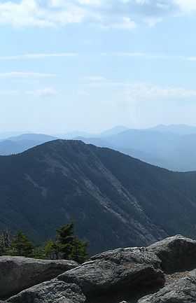 View of Flume from Liberty | |
| Elevation | 4,328 ft (1,319 m) NGVD 29[1] |
| Prominence | 408 ft (124 m)[1] |
| Listing | White Mountain 4000-Footers |
| Location | |
| Location | Grafton County, New Hampshire, U.S. |
| Range | White Mountains |
| Coordinates | 44°06′32″N 71°37′40″W / 44.1089549°N 71.6278588°WCoordinates: 44°06′32″N 71°37′40″W / 44.1089549°N 71.6278588°W[2] |
| Topo map | USGS Lincoln |
| Climbing | |
| Easiest route | Hike |
Mount Flume is a peak in the White Mountains overlooking Franconia Notch. It is 4,328 feet (1,319 m) tall and is accessible from the north by the Franconia Ridge Trail, from the southeast by the Osseo Trail, and from the west by the Flume Slide Trail to the Franconia Ridge Trail.
From the summit there are outstanding views to the west and to the north to Franconia Ridge. The Flume Slide Trail is a notably steep climb and is not recommended in wet weather or snow.
See also
- Four-thousand footers
- White Mountains Region
- List of mountains in New Hampshire
References
- ↑ 1.0 1.1 "Mount Flume, New Hampshire". Peakbagger.com. Retrieved 2010-03-23.
- ↑ "Mount Flume". Geographic Names Information System. United States Geological Survey. Retrieved 2010-03-23.
| ||||||||||||||||||||||||||||||||||||||||||||||||||||||||||||||||||||||