Mount Carmel, Ohio
| Mount Carmel, Ohio | |
|---|---|
| Census-designated place | |
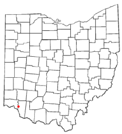 Location of Mount Carmel, Ohio | |
| Coordinates: 39°5′55″N 84°17′46″W / 39.09861°N 84.29611°WCoordinates: 39°5′55″N 84°17′46″W / 39.09861°N 84.29611°W | |
| Country | United States |
| State | Ohio |
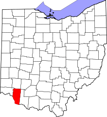
| County | Clermont |
| Township | Union |
| Area | |
| • Total | 1.84 sq mi (4.76 km2) |
| • Land | 1.83 sq mi (4.75 km2) |
| • Water | 0.004 sq mi (0.01 km2) |
| Elevation[1] | 886 ft (270 m) |
| Population (2010) | |
| • Total | 4,741 |
| • Density | 2,585/sq mi (998.1/km2) |
| Time zone | Eastern (EST) (UTC-5) |
| • Summer (DST) | EDT (UTC-4) |
| FIPS code | 39-52612[2] |
| GNIS feature ID | 1066279[1] |
Mount Carmel is an unincorporated area and census-designated place (CDP) in Clermont County, Ohio, United States. The population was 4,741 at the 2010 census.[3]
Geography
Mount Carmel is located on the western edge of Union Township at 39°5′55″N 84°17′46″W / 39.09861°N 84.29611°W (39.098679, -84.296044).[4] It is bordered on the north by Summerside and on the west by Dry Run in Anderson Township, Hamilton County.
Ohio State Route 32 forms the northern border of Mount Carmel, and Interstate 275 forms the eastern edge. The highways cross at I-275 Exit 63 at the northeast corner of the community. Downtown Cincinnati is 14 miles (23 km) to the west via Route 32, or 19 miles (31 km) via I-275 and I-471. Batavia, the Clermont County seat, is 7 miles (11 km) to the east via Route 32.
According to the United States Census Bureau, the Mount Carmel CDP has a total area of 1.84 square miles (4.76 km2), of which 0.004 square miles (0.01 km2), or 0.11%, is water.[3]
Demographics
As of the census[2] of 2000, there were 4,308 people, 1,702 households, and 1,172 families residing in the CDP. The population density was 2,559.3 people per square mile (990.1/km²). There were 1,790 housing units at an average density of 1,063.4/sq mi (411.4/km²). The racial makeup of the CDP was 96.80% White, 0.84% African American, 0.21% Native American, 0.30% Asian, 0.65% from other races, and 1.21% from two or more races. Hispanic or Latino of any race were 1.21% of the population.
There were 1,702 households out of which 34.5% had children under the age of 18 living with them, 51.2% were married couples living together, 12.6% had a female householder with no husband present, and 31.1% were non-families. 25.0% of all households were made up of individuals and 6.9% had someone living alone who was 65 years of age or older. The average household size was 2.53 and the average family size was 3.04.
In the CDP the population was spread out with 26.2% under the age of 18, 10.3% from 18 to 24, 32.1% from 25 to 44, 21.2% from 45 to 64, and 10.1% who were 65 years of age or older. The median age was 34 years. For every 100 females there were 98.8 males. For every 100 females age 18 and over, there were 95.7 males.
The median income for a household in the CDP was $36,382, and the median income for a family was $41,996. Males had a median income of $35,904 versus $25,496 for females. The per capita income for the CDP was $17,393. About 8.8% of families and 9.3% of the population were below the poverty line, including 16.7% of those under age 18 and 2.3% of those age 65 or over.
References
- ↑ 1.0 1.1 "US Board on Geographic Names". United States Geological Survey. 2007-10-25. Retrieved 2008-01-31.
- ↑ 2.0 2.1 "American FactFinder". United States Census Bureau. Retrieved 2008-01-31.
- ↑ 3.0 3.1 "Geographic Identifiers: 2010 Demographic Profile Data (G001): Mount Carmel CDP, Ohio". U.S. Census Bureau, American Factfinder. Retrieved January 21, 2015.
- ↑ "US Gazetteer files: 2010, 2000, and 1990". United States Census Bureau. 2011-02-12. Retrieved 2011-04-23.
| |||||||||||||||||||||||||||||||||