Mother Brook
| Mother Brook | |
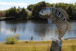 A sculpture at Mill Pond Park along the banks of Mother Brook. | |
| Name origin: First man-made canal in the United States.[1][2] | |
| Country | United States |
|---|---|
| State | Massachusetts |
| Source | Charles River |
| - location | Dedham, Massachusetts |
| - elevation | 97 ft (30 m) approximate using MapMyRun [3] |
| - coordinates | 42°15′18″N 71°09′53″W / 42.25500°N 71.16472°W Location of the USGS Hydrologic Unit, .4 mi downstream from diversion from Charles River.[4] |
| Mouth | Neponset River |
| - location | Hyde Park, Massachusetts |
| - elevation | 55 ft (17 m) approximate using MapMyRun [3] |
| - coordinates | 42°15′08″N 71°07′23″W / 42.25222°N 71.12306°WCoordinates: 42°15′08″N 71°07′23″W / 42.25222°N 71.12306°W |
| Length | 3.6 mi (6 km) approximate using MapMyRun [3] |
| Discharge | for Hyde Park, Massachusetts |
| - average | 23 cu ft/s (1 m3/s) |
| - max | 0 cu ft/s (0 m3/s) |
| - min | 350 cu ft/s (10 m3/s) |
| Wikimedia Commons: Mother Brook | |
| Part of a series on the |
| History of Dedham |
|---|
 |
| Main articles |
| People |
| Places |
| Organizations |
Mother Brook is the name of a stream that flows from the Charles River in Dedham, Massachusetts, to the Neponset River in the Hyde Park section of Boston, Massachusetts.[2] Mother Brook was also known variously as East Brook and Mill Creek in earlier times.[5] Digging the Brook made Boston and some surrounding communities an island, accessible only by crossing over water,[6][7] making Mother Brook "Massachusetts' Panama Canal."[8]
Dug by English settlers, the man-made portion of Mother Brook is first man-made canal in the United States.[9][nb 1] Mother Brook was important to Dedham as its only source of water power for mills, from 1639 into the early 20th century.[16]
Today, Mother Brook is part of a flood-control system that diverts water from the Charles River to the Neponset River. The brook's flow is under the control of the Massachusetts Department of Conservation and Recreation and is used for flood control on the Charles.[23] There are three remaining dams on the stream, plus a movable flood gate that controls flow from the Charles into Mother Brook.
The Brook has given its name to the modern day Mother Brook Community Group,[23][24] the Mother Brook Arts and Community Center,[25] Riverside Theatre Works,[26] and the erstwhile Mother Brook Club[27] and Mother Brook Coalition.[28]
Early history
Origins
Dedham, Massachusetts was first settled in 1635 and incorporated in 1636. The settlers needed a mill where corn could be ground. Wind mills had been tried, but the wind was too unreliable, and hand mills took too much effort.[29] The closest mill was in Watertown, some distance away.[29]
Abraham Shaw who, like many other Dedhamites, came from Watertown, arrived in Dedham in 1637.[16][10] He was granted 60 acres (24 ha) of land as long as he erected a watermill, which he intended to build on the Charles River near the present day West Street bridge to Needham.[16] The millstones were brought to Dedham from Watertown by the townspeople.[16] Shaw died in 1638 before he could complete his mill, however.[10]
Although the initial settlement was adjacent to the Charles, in this vicinity it is slow-moving, with little elevation change that could provide power for a water wheel. A small stream, then called East Brook, ran close by the Charles River, about 100 rd (1,600 ft; 500 m) from present day Washington Street behind Brookdale Cemetery, and emptied into the Neponset River.[30] In the spring, the Charles would occasionally flood into a swamp at Purchase Meadow[31] between its banks and East Brook.[29] Additionally, East Brook had an elevation change of more than 40 ft (12 m) on its run from near the early Dedham settlement to the Neponset River, while the Charles and the Neponset have an elevation change of more than 60 ft (18 m), which was sufficient to drive a water mill.
A year after Shaw's death the Town was still without a mill.[16] A committee was formed and it was determined that water could be diverted from the Charles, by way of a canal, to East Brook, providing the needed water flow.[16] The 4,000 ft (1,200 m) ditch was ordered to be dug at public expense by the Town on March 25, 1639.[5][16][nb 2] There is no record of who dug it or how long it took,[16] although Whiting family history claims it was done by Nathaniel Whiting.[32] The first water ran through it on July 14, 1641, and it was known as Mother Brook since at least 1678.[32]
Early mills
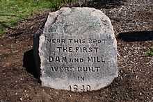
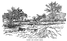
The Town also offered an incentive of a 60 acres (24 ha) of land to whoever would construct a corn mill, as long as the mill was ready to grind corn by "the first of the 10th month."[16] The first corn mill was erected in 1641 by John Elderkin, a recent arrival from Lynn, at a dam on East Brook next to the present day Condon Park and near intersection Bussey St and Colburn St.[16][33] This was the first public utility in the nation.[2] Early settlers could grind their corn at the mill, and in return paid a tithe to help maintain the mill.[2] The Town relinquished rights to the Brook in 1682[34] and placed a historical marker on the site in 1886.[35]
In 1642, Elderkin sold half of his rights to Whiting and the other half to John Allin, Nathaniel Aldis, and John Dwight.[36][29] The four operated the mill until 1649 when Nathaniel Whiting became the sole owner.[36] In 1652, Whiting sold his mill and all his town rights to John Dwight, Francis Chickering, Joshua Fisher, and John Morse for 250 pounds, but purchased it back the following year.[36] Whiting and five generations of his descendants ran their mill from 1641 until 1823, when it was sold.[29][32]
Daniel Pond and Ezra Morse were given permission by the Town to erect a new corn mill on the Brook above Whiting's, so long as it was completed by June 24, 1665.[36][37] Whiting was upset by the competition, and records show that the Town spent "considerable time" trying to resolve the issue.[36][nb 3] After meeting with the Selectmen, both agreed to live in peace and not interfere with the business of the other.[40]
Two years later Morse was instructed to not to hinder the water flow to such an extent that it would make milling difficult for Whiting, but Whiting was also told to repair leaks in his own dam.[36] Trouble continued between the two until, in 1699, the Morse dam at present day Maverick Street was removed, and Morse was given land at Tiot in compensation.[41] This seems to have been Morse's idea.[40]
The next mill was constructed in 1682 at Mill Lane.[41] Originally requested by Jonathan Fairbanks and James Draper, the privilege was granted to Whiting and Draper instead.[41] A condition was attached to this permission, however, that if the Town wanted to erect a corn mill on the Brook that they may do so, unless Draper and Whiting did so at their own expense.[42] This mill, like the one above it, was held by the descendants of Nathaniel Whiting for 180 years.[41] One of Whiting's mills burned in 1700, and so the Town loaned him 20 pounds to rebuild.[43][40]
At some point in the 1700s a new leather mill was constructed by Joseph Lewis at the site of the old Morse dam.[43] A fourth mill was established, at present day Stone Mill Drive, just down stream from the third in 1787.[44] For a short period of time it produced copper cents, and then was used to manufacture paper.[44]
Industrialization of Mother Brook
Eventually, dams and mills were constructed at five locations called "privileges" in Dedham and in what is now the Readville section of Hyde Park, which was originally part of Dedham. Mother Brook provided water power at various times for industrial mills of several types, for the manufacture of cotton, wool, paper, wire, and carpets. They also produced corn, fulled cloth, stamped coins, sawed lumber, cut and headed nails, manufactured paper, wove cloth, and leather.[29] There were mills operating on Mother Brook until some time in the 20th century. At least one mill located on Mother Brook was converted from water power to steam as an energy source, but continued to use the Brook for cooling the steam machinery.
19th century
In the 1800s, as the region and country became more prosperous, mills began to be used for the first time to produce goods not used solely by Dedhamites and those in the immediate area.[43]
The leather mill was replaced in 1807 by the Norfolk Cotton Manufactory[nb 4] which built a large wooden mill on the site.[43] The mill spun imported bales of cotton, and was then out out to be woven.[45] The fabric was then returned to the mill, finished, and shipped out.[45] From 1808 through the next decade, the company advertised for labor in the local papers as the work required more manpower than the part-time grist and saw mills that were on the Brook before.[45]
It was a prosperous company, esteemed by the community, and the annual meetings of the company were marked by festivities.[43] The War of 1812 brought ruin to the company, however, and the mill was purchased by Benjamin Bussey, "a man of excellent business capacity,"[46] in 1819 for a sum far below cost.[43] Bussey also purchased a mill on the street that now bears his name from the Dedham Worsted Company[nb 5] only three years after they opened. It was said that the factories, dye houses, dwellings, and other buildings associated with the operation "of themselves constitute a little village."[45]
The fourth privilege was used for a variety of purposes in the 19th century, including copper cents, paper, cotton, wool, carpets, and handkerchiefs. In the 1780s another mill, connected by the same wheel, was constructed on the site to produce wire[44] for the new nation's nascent textile industry.[45] The first mill on this site burned in 1809, but was rebuilt with a new raceway and foundation.[44]
The second mill began producing nails in 1814, and five years later its owner, Ruggles Whiting of Boston, sold it to the owner of the first mill, George Bird, who began using the whole site to manufacture paper.[44] In 1823 it switched to cotton, using the machinery of the former Norfolk Cotton Company. In 1835 a new stone mill was erected.[47] It stands today, and was converted into a condominium complex in the 1980s. Unlike the other mills, which were constructed in a strictly utiliatrian style, this factory boasted a date stone reading "1834" and a dome-roofed cupola over the mill bell.[45] Together they stood as a testament to the primacy of the mills in the neighborhood.[45]
In 1814 a fifth privilege was granted in what was then Dedham, but is today the Readville neighborhood in Hyde Park.[47] Readville, known then as Low Plain, was settled in the same year[48] when the Dedham Manufacturing Company built a mill there.
During this time period the owners of mills downstream also complained that the Norfolk Cotton Manufactory did not provide enough water downstream for them to use.[49] The complaints continued, despite the creation of a committee in 1811 to look into the matter, until Benjamin Bussey bought the Norfolk Cotton Manufactury in 1824.[50] Agreement was made then on the level of the water, and was marked by drill holes in rocks along the banks still visible in 1900.[50]
In 1870 the Merchant's Woolen Company was the largest taxpayer in town and owned two houses on High Street, five on Maverick, ten on Curve, and two "long houses" on Bussey.[45] These houses were rented to employees.[45] From Mother Brook and the Neponset River out to the Boston Harbor, it was estimated that there was between $2,000,000 and $5,000,000 worth of manufacturing property along the banks in the 1886.[7] None of the mills remains in operation today.
20th century

In 1900,[10] and even 1915, after "275 years of constant usefulness," the Brook made up "the source of the principal business of the town [of Dedham]."[16] However, by 1986 the cotton mills and brick factories that once lined the Brook were "long-gone."[51]
In the early 1900s, the state Board of Health began enforcing pollution regulations that prevented additional manufacturing enterprises from setting up along the Brook, having "resolutely set its decision against the pollution of this stream."[8][52] One plant was required to install an expensive filtration system to clean its liquid waste before dumping it in the waterway.[52]
In 1910 the water being pumped by the Town of Hyde Park at Mother Brook was deemed to be unsafe for use without first boiling,[53] and in 1911 that Town applied to be hooked up to the metropolitan water system.[54] By 1944 the Neponset was said to be "loaded with putrefacation."[8]
When marshlands were reclaimed in the 1960s[55] it was for partially for the purposes of flood control.[56] One of those reclaimed areas was where the Dedham Mall now stands, very near the headwaters of the Brook. The runoff from that 150 acres (61 ha) development, however, flowed into the Brook and then the Neponset, which could not handle the extra water during heavy rains.[57]
An oil spill of 1,300 gallons was discovered near Milton Street in 1975,[58][59] and gasoline was discovered bubbling into the Brook in 1990.[60] L. E. Mason Co. was fined $250,000 by the Environmental Protection Agency for dumping trichloroethylene into the Brook from 1986 to 1994.[61] The company was also know to dump zinc, fats, oils and greases into the waterway.[61] During the 1990s a science teacher at Dedham High School ran water quality tests on the Brook.[62]
It was proposed on 1978 to use the three remaining dams on the bridge to generate hydroelectric power.[63] In 2009 Dedham Selectmen proposed designating the Brook as an historic waterway to better qualify for grants.[64]
Conflict with Charles River Mills
Just as Dedham became industrialized and increasingly dependent on its water power for its economic activity, so did other communities in the Charles River valley. This led to conflict between the mills on Mother Brook and those using the Charles River downstream from the diversion to Mother Brook.[47] As early as 1767, mill owners in Newton and Watertown petitioned officials for relief from the Mother Brook diversion.[47] A sill was installed to determine the percentage of water diverted into Mother Brook and the percentage to remain in the Charles.[47]
In 1895 it was said that Mother Brook was the "most audacious attempt of robbery ever recorded in the Commonwealth of Massachusetts. It was the effort made by Dedham... to actually steal the river Charles. ... The bold pirates built a canal from the headwaters of the Charles across to the Neponset river, and by widening and deepening this 'mother brook' they were gradually robbing their neighboring town of its beautiful waterway."[65]
Because water diverted from the Charles River through Mother Brook increased the flow in lower sections of the Neponset River, mill owners on the Neponset joined with the Mother Brook mill owners in their defense of the diversion. After a special act of the Great and General Court[66][67][68] the mill owners incorporated as the Mother Brook Mill-owners Association[69] on September 1, 1809.[49] Mill owners on the Charles had formed a similar corporation to advocate for themselves a few months earlier.[67][68] They argued that deviating the flow of the Charles "from its natural course" into Mother Brook violated their rights, and that as a public resource that it deserved state protection.[68]
The Mother Brook Mill-owners Association and their counterpart on the Charles went to the Supreme Judicial Court in March 1809, and petitioned for Commissioners of Sewers[nb 6] to determine the proper amount of water to be diverted into Mother Brook.[67][68] The 1767 sill could not be located, and a new method was established.[67] The Commission did not present its findings to the Court for 12 years, however, at which time the Mother Brook owners objected and the report of the Commissioners was set aside.[70][71]
In 1825 it was discovered that due to an excavation in Newton, the previous agreement was no longer workable.[67] Work on the issue resumed from 1829 to 1831, and the dispute was finally settled by an agreement among the mill owners in December 1831.[72] This agreement established that one-third of the Charles River flow would be diverted to Mother Brook, and two-thirds would remain in the Charles for use by downstream owners.[46][29] This agreement, which was reaffirmed in 1955,[35] "brought peace to the valley" after decades of conflict.[73]
In 1915 it was estimated that one-third of the water of the Charles River ran through the Brook,[5] while in 1938 it was said to be one-half.[74] In 1993, an average of 51 million gallons per day flowed from the Charles into Mother Brook, although that flow can be altered depending on water levels further downstream.[75]
Mills
First privilege
The first privilege was located next to present day Condon Park, corner of Bussey St and Colburn St.
| Year | Owner | Manager | Product | Notes | Image |
|---|---|---|---|---|---|
| 1641[30] | John Elderkin | John Elderkin | Corn | ||
| 1642[36] | 50%: Nathaniel Whiting, 50% John Allin, Nathaniel Aldis, John Dwight | ||||
| 1649[36] | Nathaniel Whiting | Nathaniel Whiting | |||
| 1652[36] | John Dwight, Francis Chickering, Joshua Fisher, John Morse | Sold for 250 pounds | |||
| 1653[36] | Nathaniel Whiting | Nathaniel Whiting | |||
| 1821[43] | Dedham Worsted Company | Worsted | |||
| 1824[44] | Benjamin Bussey | Wool | Bussey erected machine shops, dye houses, and dwellings at both of his mills. Privileges 1 and 2 under common ownership during this time. | ||
| 1843[46] | J. Wiley Edmunds | ||||
| 1843[46] | Maverick Woolen Company | Thomas Barrows[nb 7] | |||
| 1863[46] | Merchants Woolen Company | 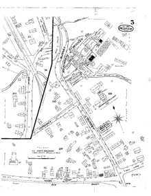 Map showing the mill from 1885 | |||
| 1895[77] | Edward D. Thayer[nb 8] |  Map showing the mill from 1897 | |||
| 1909[78][79][80][81] | Hodge's Finishing Company | Fred H. Hodges[nb 9] | Bleach and Finish Cotton Pieces;[78] Metal and Rubber Faced Type[82] | Employed 50 people, had six boilers, produced 35,000 yards per day, and had an office in New York City at 320 Broadway.[78] |  Map showing the mill from July 1909 |
| Present Day | Condon Park | N/A |   |
Second privilege
The second privilege was located at present day Maverick Street.
| Year | Owner | Manager | Product | Notes | Image |
|---|---|---|---|---|---|
| 1664[36] | Ezra Morse | Ezra Morse | Corn | Removed in 1699[41] | |
| 1700s[43] | Joseph Lewis | Leather | |||
| 1807[43] | Norfolk Cotton Manufactory | Cotton | Ruined by War of 1812 | ||
| 1819[43] | Benjamin Bussey | Wool | Bussey erected machine shops, dye houses, and dwellings at both of his mills. Privileges 1 and 2 under common ownership during this time. | ||
| 1843[46] | J. Wiley Edmunds | ||||
| 1843[46] | Maverick Woolen Company | Thomas Barrows | |||
| 1863[46] | Merchants Woolen Company |  Map showing the mill in 1892 | |||
| 1895[77] | Edward D. Thayer |  Map showing the mill from 1897 | |||
| Between 1909[52] & 1917[83] | Dedham Finishing Company | 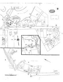 Map showing the mill from September 1917 | |||
| 1936[84] | Boston Envelope Company | Envelopes | Could produce 800,000 envelopes a day when it opened. | ||
| Present Day | AliMed[85] | Medical products and supplies |
Third privilege
The third privilege was located at present day Saw Mill Lane.
| Year | Owner | Manager | Product | Notes | Image |
|---|---|---|---|---|---|
| 1682[41] | Nathaniel Whiting and James Draper | Fulling | Whiting's descendants owned the mill for over 180 years. | ||
| 1682-1863[86] | Descendants of Nathaniel Whiting | ||||
| 1863[86] | Edmunds and Colby[nb 10] | ||||
| 1864[86] | Thomas Barrows | Between 1868 and 1885, first Charles C. Sanderson then Goding Brothers | |||
| 1872[86] | Merchants Woolen Company | ||||
| 1875[86] | Royal O. Storrs & Company | ||||
| 1883[86] | Merchants Woolen Company | Saw and grist mill | When they went out of business, it was the first time in 240 years there was no grist mill on Mother Brook | ||
| 1894[87] | J. Eugene Cochrane | N/A | Closed and merged with the fourth privilege | Third and fourth privileges under common ownership | |
| 1897[88] | Cochrane Manufacturing Company |
Fourth Privilege
The fourth privilege's first mill was located at present day Stone Mill Drive.
| Year | Owner | Manager | Product | Notes | Image |
|---|---|---|---|---|---|
| 1787[44] | Joseph Whiting, Jr., Paul Moses, Aaron Whiting | Copper cents | |||
| ~1790[44] | Hermann Mann | Paper | |||
| 1804[44] | George Bird | Burned and rebuilt in 1809 | |||
| 1823[44] | George Bird and Frederick A. Taft | Norfolk Manufacturing Company | Cotton | Used the machinery of the Norfolk Cotton Factory at Privilege 1 | |
| 1830[44] | Norfolk Manufacturing Company | John Lemist and Frederick A. Taft | |||
| 1832[89] | John Lemist and Ezra W. Taft | The Corporation prospered under Mr Taft's management and in 1835 the stone mill which now stands upon the site was erected and was supplied with new machinery for the manufacture of cotton goods. Mr Taft continued to be the agent and manager of the corporation for about 30 years. | |||
| ~1835[47][90] | James Reed and Ezra W. Taft | ||||
| 1863[86] | Thomas Barrows[nb 11] | Wool | Barrows enlarged the mill[86] and installed turbines and a steam engine.[11] | ||
| 1872[86] | Merchants Woolen Company | ||||
| 1875[86] | Royal O. Storrs and Frederick R. Storrs | Went out of business | |||
| 1882[86] | Merchants Woolen Company | ||||
| 1894[87] | J. Eugene Cochrane | Carpets and hankerchiefs | Third and fourth privileges under common ownership | ||
| 1897[88] | Cochrane Manufacturing Company | Norfolk Mills | 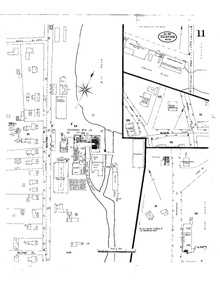 Map showing the mill from 1903 | ||
| After 1917[11][52][93] | Closed | 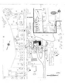 Map showing the mill from 1917 | |||
| Before 1927[94][95][96] | United Waste Company | Wool, reclaimed fabric,[96] and cloth recycling[11] | |||
| 1986[11][97] | Bergmeyer Development Co. | Re-purposed for condominiums[nb 12] | Purchase price was $1.6 million.[11] A 25' waterfall runs through the complex.[23] | ||
| Present day | Stone Mill Condominiums |
The fourth privilege's second mill was located at present day Stone Mill Drive.
| Year | Owner | Manager | Product | Notes | Image |
|---|---|---|---|---|---|
| ~1787[44] | Ruggles Whiting | Wire | |||
| 1814 | Nails | ||||
| 1819[44] | George Bird | Paper | Bird already owned the first mill at the fourth privilege |
Fifth privilege
The fifth privilege was located at located at the corner of Knight St. and River St. in Readville.[98]
| Year | Owner | Manager | Product | Notes | Image |
|---|---|---|---|---|---|
| 1814[47] | Dedham Manufacturing Company | Cotton | Original buildings made of wood | ||
| 1867[88] | Nine men[nb 13] | ||||
| 1875[88] | Smithfield Manufacturing Company | Built brick mills, and lost them to the mortgager | |||
| 1879[88] | Royal C. Taft | ||||
| 1879[88] | B.B. & R. Knight | Manchaug Company | Rebuilt the dam, put in new wheels, and made other improvements. | ||
| 1922[99] | Francis W. Smith | The mill was expected to be closed and leveled.[nb 14] | The main building of the plant is of brick, measuring 331 feet long by 59 feet wide on average.[101] The sale included several other parcels and buildings, including tenements and a superintendent's house.[99][nb 15] |
Events
Floods
In 1886, waters flooded their banks and put the dams, and the one at Merchant's Mill especially, in danger of breaching.[102][103] There were fears that a dam in Dover would give way, and the resulting rush of water would destroy the Dedham dam.[7] Prior to this Merchant's Mill was considered impregnable.[7] It was one of the greatest floods Dedham Centre had ever seen.[103]
Streets in the Manor section of Dedham had water two to three feet deep when the Brook flooded in March 1936.[104] Rain and melting snow caused the Charles and Mother Brook to flood their banks in 1948, putting some parts of Dedham under water.[105]
Ice chunks at two of the dams caused flooding in 1955.[106] Firefighters sprayed high pressure water at the ice jam off Milton Street, and a crane scooped out debris from the dam and broke the ice at Maverick Street.[106] The water level dropped two feet that day as a result.[106]
Later that year, during the worst floods in New England's history, 150 people in Hyde Park had to evacuate their homes after flood waters from Mother Brook and the Neponset River collapsed preventative embankments.[107] Mayor John Hynes led an inspection party to survey the damage.[108] Roads, including the V.F.W. Parkway, were flooded in Dedham.[109] That fall the state approved $2 million for flood control in Mother Brook and the Neponset.[110][111][112] Another $2 million was approved by the Massachusetts House of Representatives in 1960.[113]
A team of 120 men descended on Hyde Park at the junction of the Neponset and Mother Brook with 1,200 sandbags to prevent flooding in March 1958.[114] The water was already threatening homes and roads in January of that year.[115] At least "a couple hundred" residents along the Charles, Neponset, and Mother Brook had to be evacuated when those rivers flooded in 1968.[116] The worst area in town was along Bussey St, along the Brook.[116]
1938 flood
In 1938, while much of the Charles and Neponset Rivers were flooding their banks causing $3,000,000 in damage,[117] the area around Mother Brook was unharmed in the early days of the surge.[74] Dams along the Brook controlled the heavy flow of water[118] which were said to be 15,000 cubic feet per second.[119] It was close to the level of the 1936 flood, but six inches below the flood of 1920.[119]
Scores of homes in low lying areas eventually had their basements flooded,[119] and the wooden bridge at Maverick Street was threatened.[120] Sandbags, an oil truck, and granite slabs were placed on the bridge to keep it from washing away.[121] The Boston Envelope Company, located next to the bridge, had their first floor flooded.[121]
Three young men who tried to canoe down the Charles during the 1938 flood were overturned in a whirlpool and were swept down the swollen Mother Brook.[117] They were saved after an East Street rescuer ran 500 yards and tossed them a garden hose.[122]
Drownings
The body of Michael Ansbro was found floating near the Merchants' Woolen Company Damn on March 26, 1892. He had been missing since the previous Christmas and was presumed to have committed suicide.[123] The body of James Colburn, the alcoholic son of a wealthy East Dedham farmer, was also found in the Brook on another date.[124]
William Hickey, a boy of 8, drowned in July 1899, in back of the foundry of the milling machine company on Business St in Hyde Park.[125] In June 1969 a 14 year old boy named James Cox did drown near the West Glenwood Ave bridge in Hyde Park.[126] Cox, who could not swim and who was told to stay away from the water, lost his inflatable wings.[126] His friends attempted to dive for him, but were unsuccessful and his body was recovered a half mile downstream.[126] A pulmotor from the Dedham Boathouse was unable to revive him.[126]
In 1927 two boys playing near the water's edge fell in. One, 4-year-old James McGowan, was able to get out of the water, but the body of 2-year-old Fritz Wende was not recovered until 30 minutes later by boat.[127] Two other boys claimed to have found a human leg in the Brook in 1937,[128] but police could not find either the leg or the body.[129]
John Wharton, 17, was rescued by a fully clothed Walter Christynycz in 1940,[130] and the Brook was dragged for a missing 6-year-old boy in 1946.[131] John J. Carroll accidentally drowned in 1948,[132] and 14-year-old Daniel Linehan did in 1951.[133] James Cunningham, aged 2 1/2, was drowned in 1959,[134] and 60-year-old Timothy Neville was in 1967.[135]
Winter accidents
In December 1905 a 12-year-old boy named James Harnett drowned while skating across ice only .5 in (13 mm) thick Mill Pond.[136] His brother William, 17, rushed to save him, but both ended up in the water.[136] The older brother was saved by a human chain of other skaters, while the younger boy's body was recovered by police an hour later.[136] An 8-year-old boy died while skating on the Brook in 1895,[137] and a 7-year-old died after sledding on the Brook near Four Corners in 1929.[138]
A 13-year-old boy, William Molineaux, drowned in an icy Brook in 1972 after he a raft he found after school capsized.[139] His body was recovered after 70 police officers and firefighters from multiple departments conducted a search, and a scuba diving team entered the water.[139]
An 8-year-old boy fell through the ice was under water for 20 minutes in 1980.[140] A passing motorist[140] and three others[141] dove in the Brook, but were not able to locate him.[140] A WHDH radio traffic helicopter broke the ice with its pontoons, allowing Boston firefighters to spot and recover David Tundidor's body.[140] He was in a medically induced coma,[142] but died four days later.[141]
Rescues
Katie Murray, a 20 year old, was taking a bath near Riley's Wool Shop in August 1875 when she got too close to the channel and was swept in over her head. She was able to be saved.[143] A six-year-old boy was rescued after falling in August 1878 by Arthur Bacon, "a young man who has previously acted in a like noble manner."[144]
After sneaking out of the house in July 1899, 13-year-old William Dennen dove off a bridge near his house on Emmett Ave to save the life of 7-year-old Mary Bouchard, who had fallen in.[145] John F. McGraw, a 33-year-old Scottish immigrant, attempted suicide by drowning in the Brook in 1916.[146] After going over a damn and landing in shallow water, the father of three climbed onto shore and was taken to the psychiatric hospital for evaluation.[146]
When Thomas Mitchel saw Thomas Mahoney, who was 11-years-old, floating down the stream in 1919 he dove from a bridge and saved the boy.[147] A fully clothed employee at the Dedham Finishing Company also dove in the water in 1925 when 14-year-old Maud Conant was swept over the dam while swimming off Maverick Street.[148]
Boston Police Officer Merrill Siegan rescued a 12-year-old boy floating on a bale of cotton waste in 1953.[149] In 2009, a man was rescued by the Dedham Fire Department after his homemade boat went over the damn that separates the Charles from the Brook.[150]
Accidents
In April 1878, a "balky horse" sent six people into the Brook, but none were injured.[151] A similar incident occurred in 1837 when a thirsty horse brought himself, the teamster driving him, and the load of paper he was carrying from the mills in Dedham to Braintree into the Brook.[152]
Moments after leaving Dedham Square for Forest Hills in 1911, a streetcar jumped the track on Washington Street and dangled 35 passengers over the Brook.[153] Only two minor injuries were reported.[153] A cat was saved from a flooded culvert in 1938 by a team of neighborhood boys after the Dedham Fire Department was unable to do so.[154] A 13-year old boy, William Sullivan, was kneeling on a raft in 1956 behind Brookdale Cemetery when his friend accidentally shot him in the leg with a .32 caliber gun.[155]
Paul Flanagan, 23, survived for 3.5 hours in the water after his car plunged into the Brook in February 1983.[156] He was brought to Norwood Hospital with hypothermia and was later released.[156]
Cleanups
After centuries of industrialization and dumping, Mother Brook became quite polluted.[23] Cleanups have been organized by a number of groups in recent decades.[23][157]
Bridges
Today, after diverting from the Charles, Mother Brook immediately runs under a bridge on Providence Highway. When it was constructed, a tablet was erected on the bridge commemorating the Brook.[158] Shortly thereafter it runs under a culvert at the Dedham Mall before appearing again at the transfer station and running to the Washington Street Bridge. It then crosses under Maverick Street, Bussey Street, and Saw Mill Lane, sites of three old mills. After entering Hyde Park, it runs under bridges at River Street and Reservation Road, before merging with the Neponset.
Various improvements to the bridges have been proposed and carried out over the years by the Commonwealth of Massachusetts, the Town of Dedham, the City of Boston, and private interests.[53][159][160][161][162][163][164][165][166][167][168][169][170][171][172][173][174][175]
Recreation


A canoeist in 1893 wrote of his trip down the Brook that upon entering from the Charles he
bid adieu to the flat marshlands and broad views of the farther river, for the little brook caries us thought varied scenery now by a barnyard with it lowing cattle, ducks splashing and dibbing in the water and a dilapidated old carryall backed into the stream, left to wash itself, and then into the cool woodlands, where we can almost touch the banks on either hand. And the green alder bushes arch over our heads, forming a cool and shady tunnel.The water is so shallow that we see plainly the briliantly colored pebbles on the bottom and daintly hued little fish darting hither and thither. it is a busy, brawling stream and hurries on to join the Neponset, industrioulsy turning the numerous mills on the way.[176]
A public bath house was constructed in 1898 at a cost of $700.[177] In 1907, afternoons on Tuesdays and Fridays were set aside for women's use.[178] Girls 16 and under were allowed in free, while those older were charged 5 cents.[178] The youngest member of the Parks Commission, J. Vincent Reilly, gave instruction to the crowds of more than 200.[178] It burned down in 1923,[179] and a proposal in 1924 to rebuild it was expected to receive an unfavorable recommendation from the Warrant Committee.[180] The swimming area at present day Mill Pond Park was considered a perk of working at the Boston Envelope Company in 1936.[84]
In 1915 it was said that well kept gardens could be seen along both sides of the length of the Brook.[15][16] It was also a popular boating and bathing destination.[16][178] In at least the 1930s[181] and 1940s,[182] the state Division of Fish and Game stocked the Brook with trout for fishing. The banks were lined with fishermen in 1941.[183]
While Dedham had a Commissioner of Mother Brook[119] during this time period, the Planning Board was responsible for the recreation aspects of the Brook, appointing a special police officer and life-saver,[184] and running swimming and diving competitions.[185] The swimming competitions drew crowds of 800.[186]
The Boston Natural Areas Fund conserved a lot along the Brook in 1980 as "green relief from massed buildings and pavement."[187] The City of Boston built a new park on Reservation Road in 1999, shoring up the banks of the Brook while they worked.[188] The project on the 6 acres (2.4 ha) site included a skateboard park, a landscaped nature area along the Brook, and a cleanup of contaminants.[189][190]
Today along the banks of the Brook are walking trails, a picnic area, a canoe launch,[23] Condon Park, a handicapped accessible playground, and more. The Mother Brook Community Group won a grant from Dedham Savings to turn the old Town Beach at the intersection of Bussey and Colburn Street into a passive park with an observation deck, benches, landscaping and a stone path. Mill Pond Park opened on July 12, 2014.[191][192] The Community Group has also opened more areas of the Brook back up to fishing, and the catches are safe to eat in moderate amounts.[23]
Notes
- ↑ This fact has been known and published since at least the 1840s.[10][1][2][5][11][12][13][14][15][16][17][18][19][20][21][22]
- ↑ "Ordered yt a Ditch shalbe made at a comon charge thrugh purchashed medowe unto ye East brooke yt may bother be a ptieon fence in ye same; as also may serve for a course unto a water mille; yt it shall be found fitting to set a mille upon ye sayd brooke by ye judgement of a workman for yt purpose."[16]
- ↑ The third paragraph of the Town Covenant stated that "That if at any time differences shall rise between parties of our said town, that then such party or parties shall presently refer all such differences unto some one, two or three others of our said society to be fully accorded and determined without any further delay, if it possibly may be."[38][39]
- ↑ Incorporated by Samuel Lowder, Jonathan Avery, Rueben Guild, Calvin Guild, Pliny Bingham, William Howe, and others.[43] They were a "daring group of investors."[45]
- ↑ Incorporated principally by William Phillips and Jabez Chickering[43]
- ↑ Elijah Brigham of Westboro, Jonas Kendall of Leominster, and Loammi Baldwin of Cambridge were appointed by the Court in October 1809.[67]
- ↑ In 1851 Barrows was the wealthiest mill owner in town.[76]
- ↑ It was closed by 1909.[52]
- ↑ Chas. О. Brightman, Pres Fred H. Hodges, Sec and Supt.; Frank B. Hodges, Treas. and Buyer.[78]
- ↑ "The third privilege owned by the Whiting heirs was purchased under an assignment of William Whiting to Messrs Colburn & Endicott by Messrs Edmunds & Colby in 1863 at which time the Merchants Woolen Company was formed."[86]
- ↑ Barrows had an estate on High Street that was torn down in 1959 to make room for St. Mary's parking lot.[91][92]
- ↑ The general contractor was the Kaplan Corp., the landscape architects was Weinmayr Associates, and the financing was provided by the Mutual Bank.[11]
- ↑ A company of men composed of Tully D. Bowen, Earle P. Mason, Henry Waterman, John A. Taft, Stephen Harris, Cyrus Harris, Joseph Woods, John A. Adams, and Benjamin Sibley[88]
- ↑ It was, in fact, closed sometime prior to 1927, as were many others in a "textile depression."[100]
- ↑ The equipment in the main building included an automatic opener five lapper machines, 108 cards. 7 drawing frames, 29 fly frames, 77 spinning frames, 5 pair of mules, 15 spooling frames, and warper frames, a slasher, 508 plain looms, cloth room equipment, a waste picker house unit, machine shop equipment, etc. In addition there was a quantity of cotton machinery which was never a part of this plant and was encased and marked for shipment to Japan, including openers, cards ring, spinning frames, mules winders, reels, and bobbins.[101]
References
- ↑ 1.0 1.1 Hayward, J. (1847). A Gazetteer of Massachusetts. p. 135.
- ↑ 2.0 2.1 2.2 2.3 2.4 "Where Growth Centers". The Salina Evening Journal (Salina, Kansas). November 6, 1922. p. 13. Retrieved March 17, 2015 – via Newspapers.com.

- ↑ 3.0 3.1 3.2 "Mother Brook in Dedham, MA". MapMyRun. Retrieved 2013-09-16.
- ↑ "USGS 01104000 MOTHER BROOK AT DEDHAM, MA". United States Geological Survey. Retrieved 2013-09-16.
- ↑ 5.0 5.1 5.2 5.3 "What People Talk About". The Boston Daily Globe. May 22, 1915. p. 10. Retrieved March 17, 2015 – via Newspapers.com.
- ↑ "Wants of the City". The Boston Post. April 24, 1874. p. 3. Retrieved March 17, 2015 – via Newspapers.com.
- ↑ 7.0 7.1 7.2 7.3 "The Floods". The Fitchburg Sentinel (Fitchburg, Massachusetts). February 16, 1886. p. 2. Retrieved March 17, 2015 – via Newspapers.com.
- ↑ 8.0 8.1 8.2 "Rivers of Massachusetts". The Boston Globe. Jul 27, 1944. p. 12. Retrieved March 19, 2015.
- ↑ Tager, Jack; Herman, Jennifer L. (December 1, 2008). Massachusetts Encyclopedia (2008-2009 ed.). North American Book Dist LLC. p. 201.
Dedham is watered by Charles River on its western border, by Neponset River on the east, and by Mother Brook (a canal or artificial river of about three miles in length passing from the Charles to the Neponset); this was the first canal made in the United States, completed within ten years after the first settlement of Boston.
- ↑ 10.0 10.1 10.2 10.3 Worthington 1900, p. 1.
- ↑ 11.0 11.1 11.2 11.3 11.4 11.5 11.6 Yudis, Anthony J. (January 31, 1987). "Neglected Mill at Dedham Brook Revived as Condos". The Boston Globe. p. 35. Retrieved March 20, 2015.
- ↑ Gaffin, Adam (2008). "Mother Brook". Boston Online.
- ↑ McGuire, Michael J. (March 25, 2015). "March 25, 1639: First U.S. Water Power Canal". Retrieved March 29, 2015.
- ↑ "INDUSTRIES: Business History of Utilities". Business History. Retrieved March 29, 2015.
- ↑ 15.0 15.1 "Mother Brook". The Broad Ax (First ed.) (Salt Lake City, Utah). May 8, 1915. p. 2. Retrieved March 17, 2015 – via Newspapers.com.
- ↑ 16.0 16.1 16.2 16.3 16.4 16.5 16.6 16.7 16.8 16.9 16.10 16.11 16.12 16.13 16.14 "America's First Canal". The Boston Daily Globe. January 10, 1915. p. 69. Retrieved March 17, 2015 – via Newspapers.com.
- ↑ "Mother Brook Canal: Still Useful After All These Years". New England Historical Society. Retrieved March 20, 2015.
- ↑ Bacon, Edwin Munroe (1918). Walks and Rides in the Country Round about Boston: Covering Thirty-six Cities and Towns, Parks and Public Reservations, Within a Radius of Twelve Miles from the State House. S.J. Clarke publishing Company. p. 357.
- ↑ History of Norfolk County, Massachusetts, 1622-1918 1. S.J. Clarke publishing Company. 1918. p. 362.
- ↑ Up-to-date Guide Book of Greater Boston. Murphy. 1904. p. 129.
- ↑ Nason, Elias; Jones Varney, George (1890). A Gazetteer of the State of Massachusetts: With Numerous Illustrations 1. Heritage Books.
- ↑ Jobin, William R. (June 26, 1998). Sustainable Management for Dams and Water. CRC Press. p. 55.
- ↑ 23.0 23.1 23.2 23.3 23.4 23.5 23.6 Preer, Robert (September 6, 2009). "Brook Cleanup has Local Spirit Flowing". The Boston Globe. p. South 1. Retrieved March 20, 2015.
- ↑ "Mother Brook Community Group". Mother Brook Community Group. Retrieved March 17, 2015.
- ↑ "Mother Brook Arts and Community Center". Mother Brook Arts and Community Center. Retrieved March 17, 2015.
- ↑ Fox, Jeremy C. (October 8, 2012). "Staging a Comeback". The Boston Globe. p. B1. Retrieved March 20, 2015.
- ↑ "Harney Won At Pool". The Boston Post. January 29, 1897. p. 3. Retrieved March 17, 2015 – via Newspapers.com.
- ↑ McLaughlin, Jeff (May 5, 1996). "Rediscovering the Neponset River". The Boston Globe. p. South Weekly 1. Retrieved March 20, 2015.
- ↑ 29.0 29.1 29.2 29.3 29.4 29.5 29.6 Straight, Stephan. "Diversion of Streams to Furnish Power for Water Wheels" (PDF). Bulletin of the Massachusetts Archaeological Society 51 (1): 43–47. Retrieved March 20, 2015.
- ↑ 30.0 30.1 Worthington 1900, p. 2.
- ↑ Lamson 1839, p. 56.
- ↑ 32.0 32.1 32.2 Whiting, J.F. (May 27, 1915). "What People Talk About". The Boston Daily Globe. p. 10. Retrieved March 17, 2015 – via Newspapers.com.
- ↑ Worthington 1900, pp. 2-3.
- ↑ Worthington 1900, p. 15.
- ↑ 35.0 35.1 Informational sign placed at Mother Brook Playground at Condon Park by the Dedham Civic Pride Committee.
- ↑ 36.0 36.1 36.2 36.3 36.4 36.5 36.6 36.7 36.8 36.9 36.10 Worthington 1900, p. 3.
- ↑ Lamson 1839, pp. 56-7.
- ↑ "Dedham Covenant". Ashbrook Center at Ashland University. Retrieved March 18, 2015.
- ↑ Brown, Richard D.; Tager, Jack (2000). Massachusetts: A concise history. University of Massachusetts Press.
- ↑ 40.0 40.1 40.2 Lamson 1839, p. 57.
- ↑ 41.0 41.1 41.2 41.3 41.4 41.5 Worthington 1900, p. 4.
- ↑ Lamson 1839, p. 58.
- ↑ 43.0 43.1 43.2 43.3 43.4 43.5 43.6 43.7 43.8 43.9 43.10 43.11 Worthington 1900, p. 5.
- ↑ 44.0 44.1 44.2 44.3 44.4 44.5 44.6 44.7 44.8 44.9 44.10 44.11 44.12 Worthington 1900, p. 6.
- ↑ 45.0 45.1 45.2 45.3 45.4 45.5 45.6 45.7 45.8 45.9 Tritsch 1986, p. 13.
- ↑ 46.0 46.1 46.2 46.3 46.4 46.5 46.6 46.7 Worthington 1900, p. 11.
- ↑ 47.0 47.1 47.2 47.3 47.4 47.5 47.6 Worthington 1900, p. 7.
- ↑ Howley, Kathleen (September 5, 1998). "Boston's tiny Readville had a big role in the Civil War". The Boston Globe. p. E1. Retrieved March 20, 2015.
- ↑ 49.0 49.1 Worthington 1900, p. 9.
- ↑ 50.0 50.1 Worthington 1900, p. 10.
- ↑ Taylor, Jerry (May 16, 1986). "Dedham: Town Recalls its Roots Upon 250the Birthday". The Boston Globe. p. 22. Retrieved March 20, 2015.
- ↑ 52.0 52.1 52.2 52.3 52.4 "Dedham's Policy is to "Sit Tight"". The Boston Globe. April 2, 1909. p. 11. Retrieved March 17, 2015.
- ↑ 53.0 53.1 "Water at Hyde Park Criticized". The Boston Globe. December 2, 1910. p. 1. Retrieved March 17, 2015.
- ↑ "Vote Nearly Unamimous". The Boston Globe. March 24, 1911. Retrieved March 17, 2015.
- ↑ Harrington, Joe (December 22, 1963). "Dedham 'Making' New Land for Building". The Boston Globe. p. A22. Retrieved March 19, 2015.
- ↑ Ayers, James (July 23, 1967). "Conservationists Expect Fight Over Proposed Wetlands Bill". The Boston Globe. p. 20. Retrieved March 19, 2015.
- ↑ Moore, Henry (March 24, 1968). "Rain Clouds' Silver Lining". The Boston Globe. p. 68. Retrieved March 19, 2015.
- ↑ "New England News in Brief". The Boston Globe. July 18, 1975. p. 4. Retrieved March 19, 2015.
- ↑ "Charles River cleaned up but oil remains in pipes". The Boston Globe. July 20, 1975. p. 6. Retrieved March 19, 2015.
- ↑ "Gas Leak Fouls Mother Brook". The Boston Globe. March 30, 1990. p. 49. Retrieved March 20, 2015.
- ↑ 61.0 61.1 Allen, Scott (May 21, 1995). "Hyde Park firm to pay $250,000 pollution fine". The Boston Globe. p. 35. Retrieved March 20, 2015.
- ↑ "Water". The Boston Globe. September 22, 1996. p. South Weekly 3. Retrieved March 20, 2015.
- ↑ Kenney, Robert (May 14, 1978). "Suburbs". The Boston Globe. p. 38. Retrieved March 19, 2015.
- ↑ Morgan Bolton, Michele (December 14, 2008). "Community Briefing". The Boston Globe. p. South 2. Retrieved March 20, 2015.
- ↑ "Emerson was a Hermit". The Boston Globe. September 1, 1895. p. 28. Retrieved March 17, 2015.
- ↑ An act to incorporate certain Proprietors of Meadow-Lands, Act No. Chapter 77 of the Acts of 1797 of March 3, 1798. Retrieved on March 18, 2015.
- ↑ 67.0 67.1 67.2 67.3 67.4 67.5 Worthington 1900, p. 8.
- ↑ 68.0 68.1 68.2 68.3 Steinberg 2004, p. 47.
- ↑ "R.O. Storrs & Co.". The Inter Ocean (Chicago, Illinois). October 24, 1882. p. 1. Retrieved March 17, 2015 – via Newspapers.com.
- ↑ Worthington 1900, pp. 8-9.
- ↑ Steinberg 2004, pp. 47-48.
- ↑ Worthington 1900, pp. 10-11.
- ↑ Steinberg 2004, p. 48.
- ↑ 74.0 74.1 "Flood Menaces Greater Boston". The North Adams Transcript (North Adams, Massachusetts). July 26, 1938. p. 1. Retrieved March 17, 2015 – via Newspapers.com.
- ↑ Dumanoski, Dianne (June 21, 1993). "The Charles River Low water stirs fears for future". The Boston Globe. p. 25. Retrieved March 20, 2015.
- ↑ Tritsch 1986, p. 15.
- ↑ 77.0 77.1 Worthington 1900, pp. 11-12.
- ↑ 78.0 78.1 78.2 78.3 Davidson 1948, p. 515.
- ↑ Davidson 1948, p. 1099.
- ↑ Smith, Frank (1936). A History of Dedham, Massachusetts. Transcript Press. p. 250.
- ↑ Shurcliff, Arthur A.; Shurcliff, Sidney N. (1947). Town of Dedham, Massachusetts Master Plan Survey and Report (Report). Town of Dedham Planning Board.
- ↑ Davidson 1948, p. 155.
- ↑ Insurance Maps of Dedham, Massachusetts (PDF) (Map). Sanborn Maps. September 1917. p. 9.
- ↑ 84.0 84.1 "Boston Envelope Co has a New Plant". The Boston Globe. March 11, 1936. p. 17. Retrieved March 19, 2015.
- ↑ "Medical Products & Medical Supplies Online - AliMed". AliMed. Retrieved March 23, 2015.
- ↑ 86.0 86.1 86.2 86.3 86.4 86.5 86.6 86.7 86.8 86.9 86.10 86.11 Worthington 1900, p. 12.
- ↑ 87.0 87.1 Worthington 1900, pp. 12-13.
- ↑ 88.0 88.1 88.2 88.3 88.4 88.5 88.6 Worthington 1900, p. 13.
- ↑ Worthington 1900, pp. 6-7.
- ↑ Tritsch 1986, p. 14.
- ↑ Tritsch 1986, p. 35.
- ↑ Parr, James L. "Dedham, 1895". Retrieved March 25, 2015.
- ↑ Insurance Maps of Dedham, Massachusetts (PDF) (Map). Sanborn Maps. September 1917. p. 13.
- ↑ Insurance Maps of Dedham, Massachusetts (Map). Sanborn Maps. July 1927. p. 15.
- ↑ Davidson 1948, p. 1068.
- ↑ 96.0 96.1 Andrews, Allan R. (May 3, 1984). "Dedham Warehouse Destroyed in Six-Alarm Fire; Two Injured". The Boston Globe. p. 1. Retrieved March 20, 2015.
- ↑ "Dedham Units Planned". The Boston Globe. September 12, 1986. p. 56. Retrieved March 20, 2015.
- ↑ Insurance Maps of Hyde Park, Massachusetts (Map). Sanborn Maps. June 1905. p. 17.
- ↑ 99.0 99.1 Textile World 1. Bragdon, Lord & Nagle. 1922. p. 59.
- ↑ Hennessy, M E (February 16, 1927). "Ma Call Mayors to Discuss Mill Crisis". The Boston Daily Globe. p. 20.
- ↑ 101.0 101.1 Textile World 2. Bragdon, Lord & Nagle. 1922. p. 3614.
- ↑ "New England Flood". The Marion Star (Marion, Ohio). February 19, 1886. p. 2. Retrieved March 17, 2015 – via Newspapers.com.
- ↑ 103.0 103.1 "The Dedham Floods". The Fitchburg Sentinel (Fitchburg, Massachusetts). February 17, 1886. p. 3. Retrieved March 17, 2015 – via Newspapers.com.
- ↑ "Jafsie Traces Kidnap Ladder". The Boston Globe. March 17, 1936. p. 1. Retrieved March 19, 2015.
- ↑ "Flood Fears". Nashua Telegraph. March 23, 1948. p. 4. Retrieved March 17, 2015 – via Newspapers.com.
- ↑ 106.0 106.1 106.2 "Firemen, Crane Break Ice Jam at Dedham Dam". The Boston Globe. January 9, 1955. p. 25. Retrieved March 19, 2015.
- ↑ "Flood Areas Begin Mop Uo". The Boston Globe. August 22, 1955. p. 1. Retrieved March 19, 2015.
- ↑ "Hynes Offers City Aid to Flood Victims Here". The Boston Globe. August 23, 1955. p. 1. Retrieved March 19, 2015.
- ↑ "Local Rivers Slacken Pace". The Boston Globe. August 25, 1955. p. 7. Retrieved March 19, 2015.
- ↑ "Prorogation Rush Seems to Inspire Adroit Legislating". The Boston Globe. September 4, 1955. p. 21. Retrieved March 19, 2015.
- ↑ "McCormack Asks Flood Control Study of Neponset". The Boston Globe. November 23, 1955. p. 32. Retrieved March 19, 2015.
- ↑ "Neponset River Control Includes Land Saving". The Boston Globe. November 27, 1955. p. 6C. Retrieved March 19, 2015.
- ↑ "Nod Given Flood Plan". The Boston Globe. September 30, 1960. p. 9. Retrieved March 19, 2015.
- ↑ "Charles Nearing Crest". The Boston Globe. January 28, 1958. p. 1. Retrieved March 19, 2015.
- ↑ "Areas Troubled By Overflowing Bay State Rivers". The Boston Globe. January 29, 1958. p. 1. Retrieved March 19, 2015.
- ↑ 116.0 116.1 "Town-by-Town Survey of Trouble Spots on Rising Rivers". The Boston Globe. March 21, 1968. p. 15. Retrieved March 19, 2015.
- ↑ 117.0 117.1 "N.E. Floods Cost $3,000,000". The Boston Globe. July 25, 1938. p. 1. Retrieved March 19, 2015.
- ↑ "Rains Threaten Serious Floods". The Boston Globe. July 25, 1938. p. B1. Retrieved March 19, 2015.
- ↑ 119.0 119.1 119.2 119.3 "Flood Germs Close Beaches". The Boston Globe. July 27, 1938. p. 1. Retrieved March 19, 2015.
- ↑ "Cloudbursts Added to Floods". The Boston Globe. July 28, 1938. p. 1. Retrieved March 19, 2015.
- ↑ 121.0 121.1 "Worst of Flood Past at Dedham And Needham; Rise at Newton". The Boston Globe. July 29, 1938. p. 1. Retrieved March 19, 2015.
- ↑ "Three Escape Death in Capsize of Canoe". The Boston Globe. July 25, 1938. p. 1. Retrieved March 19, 2015.
- ↑ "He was Micheal Ansbro". The Boston Globe. Apr 15, 1892. p. 12. Retrieved March 17, 2015.
- ↑ "The Coburn Estate". The Boston Weekly Globe. May 11, 1881. p. 7. Retrieved March 17, 2015 – via Newspapers.com.
- ↑ "Hyde Park Boy Drowned". The Boston Globe. July 4, 1899. p. 7. Retrieved March 17, 2015.
- ↑ 126.0 126.1 126.2 126.3 "Boy is Drowned in Mother Brook". The Boston Globe. June 27, 1916. p. 8. Retrieved March 18, 2015.
- ↑ "Child, 2, Drowns in Dedham Brook". The Boston Globe. May 21, 1927. p. 5. Retrieved March 18, 2015.
- ↑ "Found Human Leg, Boys Say". The Boston Globe. July 4, 1937. p. A1. Retrieved March 19, 2015.
- ↑ "Hunt for Leg in Brook Abandoned in Hyde Park". The Boston Globe. July 5, 1937. p. 22. Retrieved March 19, 2015.
- ↑ "Three Women Drown; Many Are Rescued". The Boston Globe. August 3, 1940. p. 1. Retrieved March 19, 2015.
- ↑ "West Roxbury Brook Dragged for Boy, 6, Missing Two Days". The Boston Globe. August 7, 1946. p. 1. Retrieved March 19, 2015.
- ↑ "Mystery of Missing Bergen Show Solved: Phone Wires Crossed". The Boston Globe. April 13, 1948. p. 26. Retrieved March 19, 2015.
- ↑ "Boy, 14, Drowns Despite Efforts of Hyde Park Pal". The Boston Globe. July 24, 1951. p. 2. Retrieved March 19, 2015.
- ↑ "4 Drowned, 2 Killed on N.E. Roads". The Boston Globe. July 19, 1959. p. 22. Retrieved March 19, 2015.
- ↑ "Dedham Man Found Drowned". The Boston Globe. August 16, 1967. p. 33. Retrieved March 19, 2015.
- ↑ 136.0 136.1 136.2 "Lad Saved by Human Chain". The Boston Daily Globe. December 17, 1905. p. 91. Retrieved March 17, 2015 – via Newspapers.com.
- ↑ "News of the Week". Newport Mercury (Newport, Rhode Island). February 2, 1895. p. 5. Retrieved March 17, 2015 – via Newspapers.com.
- ↑ "Dedham Boy Coaster Drowned Under Ice". The Boston Globe. February 15, 1929. p. 23. Retrieved March 19, 2015.
- ↑ 139.0 139.1 Cowen, Peter (January 27, 1972). "E. Dedham youth, 13, drowns in Hyde Park as raft capsizes". The Boston Globe. p. 3. Retrieved March 19, 2015.
- ↑ 140.0 140.1 140.2 140.3 Dwyer, Timothy (March 5, 1980). "A Struggle to Save Boy, 8, Under Water 20 minutes". The Boston Globe. p. 1. Retrieved March 20, 2015.
- ↑ 141.0 141.1 "David Tundidor, 8, Hyde Park Boy Who Fell Through Ice March 4, Dies". The Boston Globe. March 22, 1980. p. 1. Retrieved March 20, 2015.
- ↑ McLaughlin, Loretta (March 6, 1980). "Deepening His Coma to Save David". The Boston Globe. p. 1. Retrieved March 20, 2015.
- ↑ "Suburban Short Notes". The Boston Post. August 14, 1875. p. 3. Retrieved March 17, 2015 – via Newspapers.com.
- ↑ "Dedham". The Boston Globe. August 29, 1878. p. 4. Retrieved March 17, 2015.
- ↑ "Young Dennen a Hero". The Boston Globe. July 8, 1899. p. 12. Retrieved March 17, 2015.
- ↑ 146.0 146.1 "McGraw Fails to End Life". The Boston Globe. April 15, 1916. p. 3. Retrieved March 18, 2015.
- ↑ "Dives from Bridge and Rescues Boy". The Boston Globe. June 5, 1919. p. 5. Retrieved March 18, 2015.
- ↑ "Swept Over Dam by Swift Current". The Boston Globe. June 6, 1925. p. 3. Retrieved March 18, 2015.
- ↑ Long, Tom (February 27, 2004). "Merrill Siegan, 81, One of City's First Community Service Officers". The Boston Globe. p. C.24. Retrieved March 20, 2015.
- ↑ Keaney, Brian (March 18, 2009). Mother Brook rescue. myDedhamNews.com. Retrieved March 17, 2015.
- ↑ "Suburban Short Notes". The Boston Post. April 28, 1878. p. 3. Retrieved March 17, 2015 – via Newspapers.com.
- ↑ "A Wet Job". The Sun (Baltimore, Maryland). August 15, 1837. p. 2. Retrieved March 17, 2015 – via Newspapers.com.
- ↑ 153.0 153.1 "Barely Miss Fall Off Bridge in Car". The Boston Globe. July 1, 1911. p. 1. Retrieved March 17, 2015.
- ↑ "Boys Dive in Pipe, Save Starving Cat". The Boston Globe. August 16, 1938. p. 1. Retrieved March 19, 2015.
- ↑ "Dedham Boy, 13, wounded in Leg Target Shooting". The Boston Globe. November 15, 1956. p. 3. Retrieved March 19, 2015.
- ↑ 156.0 156.1 "Hospital Releases DA Flanagan's Son". The Boston Globe. February 11, 1983. p. 1. Retrieved March 20, 2015.
- ↑ Heisler, Joe (December 8, 2002). "A Shopping Menace". The Boston Globe. p. City Weekly 4. Retrieved March 20, 2015.
- ↑ "Boys Plead Guilty to Kidnapping Sheriff". The Boston Globe. June 19, 1935. p. 13. Retrieved March 19, 2015.
- ↑ "The Boston and Providence R.R. Co.". Evening Gazette (Pittston, Pennsylvania). November 20, 1884. p. 1. Retrieved March 17, 2015 – via Newspapers.com.
- ↑ "Broken Hangers". The Boston Globe. March 19, 1887. p. 5. Retrieved March 17, 2015.
- ↑ "Dedham News". The Boston Post. April 20, 1896. p. 7. Retrieved March 17, 2015 – via Newspapers.com.
- ↑ "Dedham Favors Movies". The Boston Globe. April 8, 1914. p. 2. Retrieved March 17, 2015.
- ↑ "Declares City Hall Fire Trap". The Boston Post. May 24, 1921. p. 8. Retrieved March 17, 2015 – via Newspapers.com.
- ↑ "Legal Notice 1 -- No Title". The Boston Globe. May 20, 1976. p. 41. Retrieved March 19, 2015.
- ↑ "Massachusetts News in Brief". The Boston Globe. December 23, 1976. p. 27. Retrieved March 19, 2015.
- ↑ "Troubled Roads Ahead". The Boston Globe. April 28, 1996. p. 8. Retrieved March 20, 2015.
- ↑ Kandarian, Paul E (May 6, 2001). "Road Work Crews Facing Busy Summer". The Boston Globe. p. South Weekly 1. Retrieved March 20, 2015.
- ↑ Preer, Robert; Atkins, Kimberly (September 6, 2001). "Two History Books Have Been Reprinted". The Boston Globe. p. Globe South 3. Retrieved March 20, 2015.
- ↑ "Town Center Getting New Look". The Boston Globe. September 23, 2001. p. Globe South 3. Retrieved March 20, 2015.
- ↑ "Bridge Projects Behind Schedule". The Boston Globe. September 23, 2001. p. Globe South 3. Retrieved March 20, 2015.
- ↑ Preer, Robert (September 5, 2002). "Bridge Work Begins to Pay Off As Projects Are Completed". The Boston Globe. p. Globe South 1. Retrieved March 20, 2015.
- ↑ Forman, Judith (October 10, 2002). "State Approves Plan to Replace 2 Bridges". The Boston Globe. p. Globe South 1. Retrieved March 20, 2015.
- ↑ Schworm, Peter (September 25, 2005). "Voter Registration Deadline". The Boston Globe. p. Globe South 2. Retrieved March 20, 2015.
- ↑ Schworm, Peter (September 25, 2005). "Dedham Bridge Awaits Repairs". The Boston Globe. p. Globe South 4. Retrieved March 20, 2015.
- ↑ Morgan Bolton, Michelle (July 9, 2009). "To the Rescue". The Boston Globe. p. 2 South. Retrieved March 20, 2015.
- ↑ "Boston an Island!". The Boston Globe. August 6, 1893. p. 25. Retrieved March 17, 2015.
- ↑ "Boston Schooner to the Rescue". The Boston Globe. May 10, 1898. p. 12. Retrieved March 17, 2015.
- ↑ 178.0 178.1 178.2 178.3 "Women Enjoy Swim at Dedham". The Boston Globe. August 17, 1907. p. 12. Retrieved March 17, 2015.
- ↑ "Fire Loss 1". The Boston Globe. October 10, 1923. p. 2. Retrieved March 18, 2015.
- ↑ "Questions for Dedham Voters". The Boston Globe. April 4, 1924. p. 23A. Retrieved March 18, 2015.
- ↑ "Other 10 -- No Title". The Boston Globe. April 10, 1936. p. 26. Retrieved March 19, 2015.
- ↑ "Other 12 -- No Title". The Boston Globe. April 4, 1941. p. 37. Retrieved March 19, 2015.
- ↑ "Fish and Game". The Boston Globe. April 16, 1941. p. 21. Retrieved March 19, 2015.
- ↑ "Dedham". The Boston Globe. July 10, 1924. p. 5A. Retrieved March 19, 2015.
- ↑ "Little Helen McCarthy Stars in Dedham Meet". The Boston Globe. August 23, 1931. p. A22. Retrieved March 19, 2015.
- ↑ "Dedham Planning Board's Annual Swimming Meet". The Boston Globe. August 18, 1929. p. A22. Retrieved March 19, 2015.
- ↑ "Some folks say you could pick a better year out of a hat". The Boston Globe. December 30, 1980. p. 1. Retrieved March 20, 2015.
- ↑ Hurley, Mary (June 13, 1999). "Uphams Corner ready to celebrate". The Boston Globe. p. City weekly 13. Retrieved March 20, 2015.
- ↑ Hurley, Mary (August 8, 1999). "Neighbors Mourn a Minister's Passing". The Boston Globe. p. City Weekly 6. Retrieved March 20, 2015.
- ↑ Hurley, Mary (September 15, 2000). "Skateboard Site Part of the New Park". The Boston Globe. p. City Weekly 15. Retrieved March 20, 2015.
- ↑ "Grand Opening of Mill Pond Park" (PHOTO). Mother Brook Community Group. July 16, 2014. Retrieved March 20, 2015.
- ↑ LeBlanc, Lisa (July 2, 2014). "Grand Opening of Mill Pond Park". Dedham Patch. Retrieved March 20, 2015.
|
Works cited
- Worthington, Erastus (1900). Historical sketch of Mother Brook, Dedham, Mass: compiled from various records and papers, showing the diversion of a portion of the Charles River into the Neponset River and the manufactures on the stream, from 1639 to 1900. Dedham, MA: C.G. Wheeler.
- Electra Kane Tritsch, ed. (1986). Building Dedham. Dedham Historical Society.
- Steinberg, Theodore (January 29, 2004). Nature Incorporated: Industrialization and the Waters of New England. Cambridge University Press.
- Davison's Textile Blue Book: United States and Canada 84. Davison Publishing Company. 1948.
- Davison's Textile Blue Book: United States and Canada. Davison Publishing Company. 1910.
- Lamson, Alvan (1893). A History of the First Church and Parish in Dedham, in Three Discourses. Herman Mann.
Further reading
| Wikimedia Commons has media related to Mother Brook. |
- "Men of Useful Trades, Craftsmen and Mills of the Dedham Grant, 1636-1840," by Electa Kane Tritsch, Dedham Grant Survey Project, 1981
- "Dedham, Massachusetts, 1635-1890," by Robert Brand Hanson, 1976, Dedham Historical Society