Morven, Georgia
| Morven, Georgia | |
|---|---|
| City | |
|
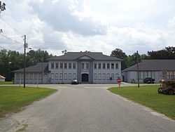
Morven City Hall | |
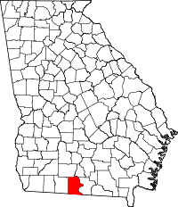
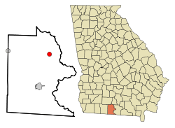 Location in Brooks County and the state of Georgia | |
| Coordinates: 30°56′39″N 83°30′3″W / 30.94417°N 83.50083°WCoordinates: 30°56′39″N 83°30′3″W / 30.94417°N 83.50083°W | |
| Country | United States |
| State | Georgia |
| County | Brooks |
| Area | |
| • Total | 1.7 sq mi (4.5 km2) |
| • Land | 1.7 sq mi (4.5 km2) |
| • Water | 0 sq mi (0 km2) |
| Elevation | 217 ft (66 m) |
| Population (2010) | |
| • Total | 565 |
| • Density | 328/sq mi (126.5/km2) |
| Time zone | Eastern (EST) (UTC-5) |
| • Summer (DST) | EDT (UTC-4) |
| ZIP code | 31638 |
| Area code(s) | 229 |
| FIPS code | 13-53032[1] |
| GNIS feature ID | 0318505[2] |
Morven is a city in Brooks County, Georgia, United States. It is part of the Valdosta, Georgia Metropolitan Statistical Area. The city was named after a mountain in Scotland. The population was 565 at the 2010 census.[3]
History
Morven is the oldest community in Brooks County. Around 1750, Spanish missionaries arrived in this area.
The Coffee Road was opened through Morven in about 1823. Sion Hall, one of the first settlers, saw an opportunity to use his sawmill and to farm.
Around 1826, Hamilton Sharpe built a log store nearby and opened a post office in 1828. In the same year a campground was established named Mount Zion. The post office was moved in 1853 and named Morven. The South Georgia Railroad was built through Morven in 1897.
The community was incorporated in 1900.
A second railroad (Valdosta/Morven & Western RR) came through Morven in the 1920s. An $8,000 bond was raised in 1923 to provide a water system. Electric lights came in August 1924 due to efforts of a group of women. The first paved road was built from Quitman in the winter of 1948 to 1949.
Geography
Morven is located at 30°56′39″N 83°30′03″W / 30.94417°N 83.50083°W (30.944263, -83.500796).[4]
According to the United States Census Bureau, the city has a total area of 1.7 square miles (4.5 km2), of which 0.015 square miles (0.04 km2), or 0.92%, is water.[3]
Morven is located at the junction of State Highways 76 and 94 and is 8 miles (13 km) west of Interstate 75.
Demographics
As of the census[1] of 2000, there were 634 people, 225 households, and 152 families residing in the city. The population density was 366.0 people per square mile (141.5/km²). There were 250 housing units at an average density of 144.3 per square mile (55.8/km²). The racial makeup of the city was 41.48% White, 52.05% African American, 0.16% Native American, 6.31% from other races. Hispanic or Latino of any race were 7.41% of the population.
There were 225 households out of which 35.6% had children under the age of 18 living with them, 44.0% were married couples living together, 18.7% had a female householder with no husband present, and 32.4% were non-families. 28.9% of all households were made up of individuals and 14.2% had someone living alone who was 65 years of age or older. The average household size was 2.76 and the average family size was 3.39.
In the city the population was spread out with 30.8% under the age of 18, 9.9% from 18 to 24, 27.1% from 25 to 44, 18.8% from 45 to 64, and 13.4% who were 65 years of age or older. The median age was 33 years. For every 100 females there were 98.1 males. For every 100 females age 18 and over, there were 87.6 males.
The median income for a household in the city was $23,438, and the median income for a family was $25,167. Males had a median income of $21,667 versus $20,750 for females. The per capita income for the city was $11,126. About 20.6% of families and 24.6% of the population were below the poverty line, including 22.4% of those under age 18 and 28.0% of those age 65 or over.
Government
The city government consists of a five-member city council and a mayor. There are only six paid employees, consisting of a city clerk, a police chief and two patrolmen, and two maintenance people.
Major highways
 State Route 76
 State Route 133
- Coffee Road passes through the county.
Historical sites
Coffee Road
Coffee Road was opened up by the state legislature act approved December 23, 1822.[5] $1500 was appropriated for the road, which started near Cunningham Ford on the Alapaha River southwest through districts 10, 12, and 13 of Irwin County continuing through Districts 18 and 23 of Early County to intersect the Florida state line near the Ocklocknee River.
References
- ↑ 1.0 1.1 "American FactFinder". United States Census Bureau. Retrieved 2008-01-31.
- ↑ "US Board on Geographic Names". United States Geological Survey. 2007-10-25. Retrieved 2008-01-31.
- ↑ 3.0 3.1 "Geographic Identifiers: 2010 Demographic Profile Data (G001): Morven city, Georgia". U.S. Census Bureau, American Factfinder. Retrieved November 6, 2013.
- ↑ "US Gazetteer files: 2010, 2000, and 1990". United States Census Bureau. 2011-02-12. Retrieved 2011-04-23.
- ↑ Huxford, Folks (1978). The History of Brooks County 1858-1948". p. 12.
External links
- City of Morven at Georgia.gov
| |||||||||||||||||||||