Mortsel
| Mortsel | |||
|---|---|---|---|
| Municipality | |||
|
Aerial view of Mortsel | |||
| |||
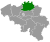
 Mortsel Location in Belgium | |||
|
Location of Mortsel in the province of Antwerp 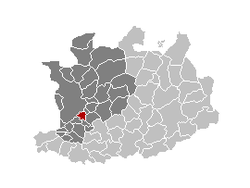 | |||
| Coordinates: 51°10′N 04°28′E / 51.167°N 4.467°ECoordinates: 51°10′N 04°28′E / 51.167°N 4.467°E | |||
| Country | Belgium | ||
| Community | Flemish Community | ||
| Region | Flemish Region | ||
| Province | Antwerp | ||
| Arrondissement | Antwerp | ||
| Government | |||
| • Mayor | Ingrid Pira (Groen!) | ||
| • Governing party/ies | Groen!, CD&V, VLAM, VLD | ||
| Area | |||
| • Total | 7.78 km2 (3.00 sq mi) | ||
| Population (1 January 2013)[1] | |||
| • Total | 25,143 | ||
| • Density | 3,200/km2 (8,400/sq mi) | ||
| Postal codes | 2640 | ||
| Area codes | 03 | ||
| Website | www.mortsel.be | ||
.jpg)

Mortsel (Dutch pronunciation: [ˈmɔrtsəl]) is a city and municipality close to the city of Antwerp located in the Belgian province of Antwerp. The municipality only comprises the city of Mortsel proper. On January 1, 2006 Mortsel had a total population of 24,427 people. The total area is 7.78 km² which gives a population density of 3,138 inhabitants per km². This is the highest population density of any municipality in the Flemish Region (Flanders), and second-highest (to Saint-Nicolas) outside the Brussels-Capital Region.
Geography
The city consists of the areas Mortsel-Dorp, Oude-God and Luithagen. Mortsel is bordered by Antwerp (districts Wilrijk, Berchem and Deurne), Borsbeek, Boechout, Hove, and Edegem.
History
Mortsel was the scene for one of the major collateral damage tragedies of World War II. On April 5, 1943, the bombing of the Minerva car factory, then used to repair Luftwaffe planes, was the target of a big bombing raid by the Allies. Unfortunately the target was missed and a residential area hit instead, resulting in the deaths of 936 civilians, including 209 children, exceeding the civilian death toll of the Guernica raid which modern estimates put at 400.
The last V2 launched against Antwerp also fell in Mortsel, killing 27 people, on March 27, 1945.
Economy
The headquarters of Agfa-Gevaert are situated in Mortsel.
Famous people
- Alex Agnew, stand-up comedian
- Luc Brewaeys, (born in Mortsel in 1959), composer, conductor, pianist and recording producer
- Luc Descamps, writer
- Timo Descamps, actor
- Philippe Geubels, stand-up comedian
- Wim Helsen, stand-up comedian
- Dimitri Leue, actor
- Clem Schouwenaars (b. Mortsel, 1932–1993), writer
- Luc Tuymans, painter
- Jos Vandeloo, writer
- Siska Schoeters, radio personality
- Koen de Winter, designer
- Bart De Wever, politician
- Dirk Verelst, musician
See also
References
- ↑ Population per municipality on 1 January 2013 (XLS; 607.5 KB)
External links
| Wikimedia Commons has media related to Mortsel. |
- (Dutch) Mortsel official website
 |
Antwerp | Borsbeek | | |
| Antwerp | |
Boechout | ||
| ||||
| | ||||
| Edegem | Hove |
| ||||||||||||||||