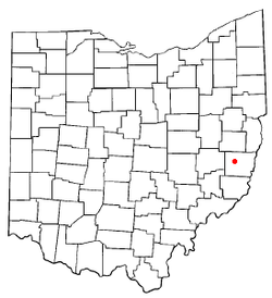
Morristown, Ohio
| Morristown, Ohio | |
|---|---|
| Village | |
|
Main Street in Morristown | |
 Location of Morristown, Ohio | |
| Coordinates: 40°3′46″N 81°4′17″W / 40.06278°N 81.07139°WCoordinates: 40°3′46″N 81°4′17″W / 40.06278°N 81.07139°W | |
| Country | United States |
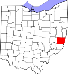
| State | Ohio |
| County | Belmont |
| Area[1] | |
| • Total | 0.51 sq mi (1.32 km2) |
| • Land | 0.51 sq mi (1.32 km2) |
| • Water | 0 sq mi (0 km2) |
| Elevation[2] | 1,266 ft (386 m) |
| Population (2010)[3] | |
| • Total | 303 |
| • Estimate (2012[4]) | 302 |
| • Density | 594.1/sq mi (229.4/km2) |
| Time zone | Eastern (EST) (UTC-5) |
| • Summer (DST) | EDT (UTC-4) |
| ZIP code | 43759 |
| Area code(s) | 740 |
| FIPS code | 39-52346[5] |
| GNIS feature ID | 1065060[2] |
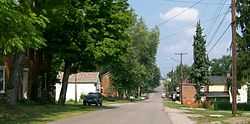
Morristown is a village in Belmont County, Ohio, United States. It is part of the Wheeling, West Virginia Metropolitan Statistical Area. The population was 303 at the 2010 census.
History
The community's name has also been spelled "Morris Town" in the past.[6]
Morristown was named for Duncan Morrison, a pioneer settler. The National Road ran through it.[7]
In 1833, Morristown contained four taverns, four or five mercantile stores, two tanneries, a carding machine and a fulling mill.[8]
Several blocks in downtown Morristown compose the Morristown Historic District, which was added to the National Register of Historic Places in 1980.[9]
Geography
Morristown is located at 40°3′46″N 81°4′17″W / 40.06278°N 81.07139°W (40.062872, -81.071280).[10]
According to the United States Census Bureau, the village has a total area of 0.51 square miles (1.32 km2), all land.[1]
Demographics
2010 census
As of the census[3] of 2010, there were 303 people, 124 households, and 78 families residing in the village. The population density was 594.1 inhabitants per square mile (229.4/km2). There were 143 housing units at an average density of 280.4 per square mile (108.3/km2). The racial makeup of the village was 96.7% White, 1.7% African American, 0.3% Native American, 0.7% from other races, and 0.7% from two or more races. Hispanic or Latino of any race were 1.0% of the population.
There were 124 households of which 24.2% had children under the age of 18 living with them, 50.8% were married couples living together, 8.9% had a female householder with no husband present, 3.2% had a male householder with no wife present, and 37.1% were non-families. 29.0% of all households were made up of individuals and 13% had someone living alone who was 65 years of age or older. The average household size was 2.24 and the average family size was 2.73.
The median age in the village was 43.8 years. 24.4% of residents were under the age of 18; 7.7% were between the ages of 18 and 24; 18.8% were from 25 to 44; 30.7% were from 45 to 64; and 18.5% were 65 years of age or older. The gender makeup of the village was 54.1% male and 45.9% female.
2000 census
As of the census[5] of 2000, there were 299 people, 122 households, and 81 families residing in the village. The population density was 591.8 people per square mile (226.4/km²). There were 138 housing units at an average density of 273.1 per square mile (104.5/km²). The racial makeup of the village was 99.33% White, 0.33% African American, and 0.33% from two or more races. Hispanic or Latino of any race were 1.34% of the population.
There were 122 households out of which 30.3% had children under the age of 18 living with them, 54.1% were married couples living together, 8.2% had a female householder with no husband present, and 33.6% were non-families. 27.0% of all households were made up of individuals and 13.9% had someone living alone who was 65 years of age or older. The average household size was 2.45 and the average family size was 3.05.
In the village the population was spread out with 24.7% under the age of 18, 6.7% from 18 to 24, 30.8% from 25 to 44, 24.1% from 45 to 64, and 13.7% who were 65 years of age or older. The median age was 39 years. For every 100 females there were 92.9 males. For every 100 females age 18 and over, there were 89.1 males.
The median income for a household in the village was $34,375, and the median income for a family was $40,750. Males had a median income of $30,357 versus $18,929 for females. The per capita income for the village was $15,212. About 5.0% of families and 7.2% of the population were below the poverty line, including 6.6% of those under the age of eighteen and none of those sixty five or over.
Transportation
About half a mile south of Morristown is Interstate 70 and closest Mile Marker is 208. Morristown's Main Street is the original US 40.
References
- ↑ 1.0 1.1 "US Gazetteer files 2010". United States Census Bureau. Retrieved 2013-01-06.
- ↑ 2.0 2.1 "US Board on Geographic Names". United States Geological Survey. 2007-10-25. Retrieved 2008-01-31.
- ↑ 3.0 3.1 "American FactFinder". United States Census Bureau. Retrieved 2013-01-06.
- ↑ "Population Estimates". United States Census Bureau. Retrieved 2013-06-17.
- ↑ 5.0 5.1 "American FactFinder". United States Census Bureau. Retrieved 2008-01-31.
- ↑ U.S. Geological Survey Geographic Names Information System: Morristown, Ohio
- ↑ McKelvey, A. T. (1903). Centennial History of Belmont County, Ohio, and Representative Citizens. Biographical Publishing Company. p. 263.
- ↑ Kilbourn, John (1833). The Ohio Gazetteer, or, a Topographical Dictionary. Scott and Wright. p. 327. Retrieved 12 December 2013.
- ↑ OHIO - Belmont County, Nationalregisterofhistoricplaces.com. Accessed 2008-11-02.
- ↑ "US Gazetteer files: 2010, 2000, and 1990". United States Census Bureau. 2011-02-12. Retrieved 2011-04-23.
External links
| |||||||||||||||||||||||||||||||||