Morrison, Missouri
| Morrison, Missouri | |
|---|---|
| City | |
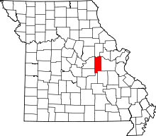
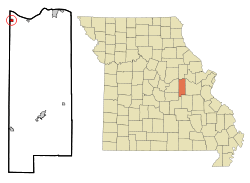 Location of Morrison, Missouri | |
| Coordinates: 38°40′25″N 91°38′0″W / 38.67361°N 91.63333°WCoordinates: 38°40′25″N 91°38′0″W / 38.67361°N 91.63333°W | |
| Country | United States |
| State | Missouri |
| County | Gasconade |
| Area[1] | |
| • Total | 0.45 sq mi (1.17 km2) |
| • Land | 0.45 sq mi (1.17 km2) |
| • Water | 0 sq mi (0 km2) |
| Elevation | 531 ft (162 m) |
| Population (2010)[2] | |
| • Total | 139 |
| • Estimate (2012[3]) | 137 |
| • Density | 308.9/sq mi (119.3/km2) |
| Time zone | Central (CST) (UTC-6) |
| • Summer (DST) | CDT (UTC-5) |
| ZIP codes | 65036, 65061 |
| Area code(s) | 573 |
| FIPS code | 29-50060[4] |
| GNIS feature ID | 0722653[5] |
Morrison is a town in Gasconade County, Missouri, United States. The first permanent settlement in the town was made by Robert Shobe circa 1828. The population was 139 at the 2010 census.
History
Morrison is named after Alfred William Morrison, a plantation owner and former state treasurer of the state of Missouri. It is not known if Alfred Morrison ever resided in Morrison. The 1860 census shows his son, William J. Morrison, in residence. On March 27, 1860, William Morrison was appointed Morrison's first postmaster. The city was first organized in 1899.
The Pacific Railroad was completed through the community in 1855. About the same time, William Morrison opened a store and bought a depot which he had moved from Dresden to Morrison. However, William Morrison's business ventures were disrupted by the start of the American Civil War. Alfred Morrison was from the South with roots in Kentucky. Within two months after Fort Sumter, a new postmaster was appointed for Morrison.
The William Morrison home was sold to Julius Meyer, a native of Prussia. Mr. Meyer had the first plat for the city of Morrison made in 1868. Mr. Meyer donated the land for at least one church and the present city park.
The original home of Robert Shobe is referred to as the Morrison House. This house is a large two-story weatherboard log home. There are two rooms on each floor joined at the center by a main stairway and a hallway which runs from the front to the back of the house. The house also has a small spiral secret stairway joining the rooms on the east side. A cow shed located to the rear of the house is believed to have been the first dwelling until construction of the main house was completed. In 1976, a federal Bicentennial fund grant was received to renovate the house and Morrison was designated as a Missouri Bicentennial Commission City.
Morrison suffered a devastating fire in the downtown area in 1909. Robbers trying to blow the safe at the town store started a fire that burned the east side of Main Street. There were at least 9 buildings destroyed. The buildings were rebuilt using brick to reduce the risk of fire. The fire also prompted the city to build a water system for fire protection and later for drinking. The water mains were built of salvaged tile and hardware from the St. Louis Worlds Fair of 1904.
The Morrison railroad depot was closed in the late 1960s. Morrison received national attention in October 1987 when two trains traveling through town collided resulted in a large fire. Because several tanker cars in the fire would have released a toxic gas if they had broken open, the town was evacuated.
Flood waters from the Missouri River and local creeks have been a constant hazard for Morrison. The downtown area is protected by a levee along Baileys Creek and the Missouri River bottom lands. The first severe recorded flood occurred in 1903. Several additional floods were recorded in following years with a culmination in the Great Flood of 1993 during which flood waters topped the levee and flooded the downtown area. Residents awoke in the early morning hours to find flood waters pouring into the downtown area following a night of unusually heavy rains. After the flood waters receded, some of the downtown buildings were demolished and areas turned into a city park. The flood in Morrison was featured on local and national news shows.
Geography
Morrison is located at 38°40′25″N 91°38′0″W / 38.67361°N 91.63333°W (38.673592, -91.633383).[6]
According to the United States Census Bureau, the city has a total area of 0.45 square miles (1.17 km2), all of it land.[1]
Demographics
2010 census
As of the census[2] of 2010, there were 139 people, 52 households, and 34 families residing in the city. The population density was 308.9 inhabitants per square mile (119.3/km2). There were 72 housing units at an average density of 160.0 per square mile (61.8/km2). The racial makeup of the city was 100.0% White. Hispanic or Latino of any race were 1.4% of the population.
There were 52 households of which 34.6% had children under the age of 18 living with them, 59.6% were married couples living together, 3.8% had a female householder with no husband present, 1.9% had a male householder with no wife present, and 34.6% were non-families. 25.0% of all households were made up of individuals and 9.6% had someone living alone who was 65 years of age or older. The average household size was 2.67 and the average family size was 3.29.
The median age in the city was 39.5 years. 29.5% of residents were under the age of 18; 4.4% were between the ages of 18 and 24; 22.3% were from 25 to 44; 31% were from 45 to 64; and 12.9% were 65 years of age or older. The gender makeup of the city was 51.8% male and 48.2% female.
2000 census
As of the census[4] of 2000, there were 123 people, 52 households, and 34 families residing in the city. The population density was 271.2 people per square mile (105.5/km²). There were 63 housing units at an average density of 138.9 per square mile (54.1/km²). The racial makeup of the city was 99.19% White, and 0.81% from two or more races. Hispanic or Latino of any race were 2.44% of the population.
There were 52 households out of which 36.5% had children under the age of 18 living with them, 50.0% were married couples living together, 11.5% had a female householder with no husband present, and 32.7% were non-families. 28.8% of all households were made up of individuals and 19.2% had someone living alone who was 65 years of age or older. The average household size was 2.37 and the average family size was 2.83.
In the city the population was spread out with 27.6% under the age of 18, 4.9% from 18 to 24, 30.9% from 25 to 44, 15.4% from 45 to 64, and 21.1% who were 65 years of age or older. The median age was 36 years. For every 100 females there were 98.4 males. For every 100 females age 18 and over, there were 97.8 males.
The median income for a household in the city was $31,607, and the median income for a family was $33,750. Males had a median income of $26,875 versus $20,714 for females. The per capita income for the city was $14,194. There were 2.8% of families and 7.1% of the population living below the poverty line, including 9.4% of under eighteens and none of those over 64.
References
- ↑ 1.0 1.1 "US Gazetteer files 2010". United States Census Bureau. Retrieved 2012-07-08.
- ↑ 2.0 2.1 "American FactFinder". United States Census Bureau. Retrieved 2012-07-08.
- ↑ "Population Estimates". United States Census Bureau. Retrieved 2013-05-30.
- ↑ 4.0 4.1 "American FactFinder". United States Census Bureau. Retrieved 2008-01-31.
- ↑ "US Board on Geographic Names". United States Geological Survey. 2007-10-25. Retrieved 2008-01-31.
- ↑ "US Gazetteer files: 2010, 2000, and 1990". United States Census Bureau. 2011-02-12. Retrieved 2011-04-23.
| |||||||||||||||||||||||||