Morris County, Texas
| Morris County, Texas | |
|---|---|
 The Morris County Courthouse in Daingerfield | |
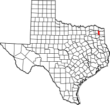 Location in the state of Texas | |
 Texas's location in the U.S. | |
| Founded | 1875 |
| Seat | Daingerfield |
| Largest city | Daingerfield |
| Area | |
| • Total | 259 sq mi (671 km2) |
| • Land | 252 sq mi (653 km2) |
| • Water | 7 sq mi (18 km2), 2.6% |
| Population | |
| • (2010) | 12,934 |
| • Density | 52/sq mi (20/km²) |
| Congressional district | 4th |
| Time zone | Central: UTC-6/-5 |
| Website |
www |
Morris County is a county located in the U.S. state of Texas. As of the 2010 census, its population was 12,934.[1] Its county seat is Daingerfield.[2] Morris County is probably named for William Wright Morris, an early judge and planter from Henderson. Morris County is one of 30[3] prohibition, or entirely dry, counties in the state of Texas.
Geography
According to the U.S. Census Bureau, the county has a total area of 259 square miles (670 km2), of which 252 square miles (650 km2) is land and 7 square miles (18 km2) (2.6%) is water.[4] It is the fourth smallest county by area in Texas.
Major highways
 Interstate 30
 U.S. Highway 67
 U.S. Highway 259
 State Highway 11
 State Highway 49
 State Highway 77
Adjacent counties
- Bowie County (north)
- Cass County (east)
- Marion County (southeast)
- Upshur County (south)
- Camp County (southwest)
- Titus County (west)
- Red River County (northwest)
Demographics
| Historical population | |||
|---|---|---|---|
| Census | Pop. | %± | |
| 1880 | 5,032 | — | |
| 1890 | 6,580 | 30.8% | |
| 1900 | 8,220 | 24.9% | |
| 1910 | 10,439 | 27.0% | |
| 1920 | 10,289 | −1.4% | |
| 1930 | 10,028 | −2.5% | |
| 1940 | 9,810 | −2.2% | |
| 1950 | 9,433 | −3.8% | |
| 1960 | 12,576 | 33.3% | |
| 1970 | 12,310 | −2.1% | |
| 1980 | 14,629 | 18.8% | |
| 1990 | 13,200 | −9.8% | |
| 2000 | 13,048 | −1.2% | |
| 2010 | 12,934 | −0.9% | |
| Est. 2012 | 12,787 | −1.1% | |
| U.S. Decennial Census[5] 1850-2010[6] 2012 Estimate[1] | |||
As of the census[7] of 2000, there were 13,048 people, 5,215 households, and 3,749 families residing in the county. The population density was 51 people per square mile (20/km²). There were 6,017 housing units at an average density of 24 per square mile (9/km²). The racial makeup of the county was 71.71% White, 24.13% Black or African American, 0.53% Native American, 0.18% Asian, 0.06% Pacific Islander, 2.28% from other races, and 1.12% from two or more races. 3.66% of the population were Hispanic or Latino of any race.
There were 5,215 households out of which 29.50% had children under the age of 18 living with them, 53.90% were married couples living together, 14.10% had a female householder with no husband present, and 28.10% were non-families. 25.80% of all households were made up of individuals and 13.20% had someone living alone who was 65 years of age or older. The average household size was 2.47 and the average family size was 2.95.
In the county, the population was spread out with 25.20% under the age of 18, 7.80% from 18 to 24, 24.30% from 25 to 44, 24.50% from 45 to 64, and 18.30% who were 65 years of age or older. The median age was 40 years. For every 100 females there were 92.70 males. For every 100 females age 18 and over, there were 87.40 males.
The median income for a household in the county was $29,011, and the median income for a family was $35,326. Males had a median income of $30,917 versus $20,270 for females. The per capita income for the county was $15,612. About 14.90% of families and 18.30% of the population were below the poverty line, including 25.40% of those under age 18 and 12.90% of those age 65 or over.
Education
The following school districts serve Morris County:
- Daingerfield-Lone Star ISD (small portion in Titus County)
- Hughes Springs ISD (mostly in Cass County)
- Pewitt CISD (small portions in Titus and Cass counties)
Morris County is also served by the Northeast Texas Community College, whose main campus is in southeastern Titus County, but it has a small satellite campus in Naples.
Communities
- Cason (unincorporated)
- Daingerfield
- Hughes Springs
- Lone Star
- Naples
- Omaha
See also
- Dry counties
- Ernest Wallace, historian of the South Plains
- National Register of Historic Places listings in Morris County, Texas
References
- ↑ 1.0 1.1 "State & County QuickFacts". United States Census Bureau. Retrieved December 22, 2013.
- ↑ "Find a County". National Association of Counties. Retrieved 2011-06-07.
- ↑ http://www.tabc.state.tx.us/local_option_elections/index.asp
- ↑ "US Gazetteer files: 2010, 2000, and 1990". United States Census Bureau. 2011-02-12. Retrieved 2011-04-23.
- ↑ "U.S. Decennial Census". Census.gov. Retrieved December 22, 2013.
- ↑ "Texas Almanac: County Population History 1850-2010" (PDF). Texas State Historical Association. Retrieved December 22, 2013.
- ↑ "American FactFinder". United States Census Bureau. Retrieved 2011-05-14.
External links
- Morris County website
- Morris County from the Handbook of Texas Online
 |
Red River County | Bowie County | | |
| Titus County | |
Cass County | ||
| ||||
| | ||||
| Camp County | Upshur County | Marion County |
| |||||||||||||||||||||
| ||||||||||||||||||||||||||