Moroyama, Saitama
| Moroyama 毛呂山町 | |
|---|---|
| Town | |
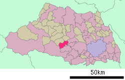 Location of Moroyama in Saitama Prefecture | |
 Moroyama Location in Japan | |
| Coordinates: 35°58′N 139°19′E / 35.967°N 139.317°ECoordinates: 35°58′N 139°19′E / 35.967°N 139.317°E | |
| Country | Japan |
| Region | Kantō |
| Prefecture | Saitama Prefecture |
| District | Iruma |
| Government | |
| • Mayor | Nobuyoshi Ozawa |
| Area | |
| • Total | 34.03 km2 (13.14 sq mi) |
| Population (July 2008) | |
| • Total | 39,298 |
| • Density | 1,150/km2 (3,000/sq mi) |
| Time zone | Japan Standard Time (UTC+9) |
| Symbols | |
| - Tree | Yuzu |
| - Flower | Chrysanthemum |
| - Bird | Japanese White-eye |
| Address |
1291, Ōaza Iwai, Moroyama-machi, Iruma-gun, Saitama-ken 350-0441 |
| Phone number | 049-295-2112 |
| Website | Moroyama Town |
Moroyama (毛呂山町 Moroyama-machi) is a town located in Iruma District, Saitama Prefecture, Japan.
As of July 2008, the town has an estimated population of 39,298 and a density of 1,150 inhabitants per square kilometre (3,000/sq mi). The total area is 34.03 square kilometres (13.14 sq mi).
History
Moroyama, as it is now, was established in 1955 when the old Moroyama Town and Kawakado Village consolidated, taking a large step toward the area's rapid growth from a farm village to an urban town. Road paving and housing developments in the early 1960s brought urbanization, population growth and change to areas previously devoted to mulberry fields. This new urban environment led to changes in the industrial structure including decreases in the agricultural population and an increase in the manufacturing and service industries. Moroyama became a commuter town.
Railways
Moroyama town has four stations.
- JR East Hachikō Line:
- Tōbu Ogose Line:
Tourist spots
- Kamakita Lake
- Atarashiki-Village
- Izumo-Iwai-Shinto shrine
Events
Adjoining cities and towns
- Sakado
- Tsurugashima
- Hidaka
- Hannō
- Ogose, Iruma
- Hatoyama, Hiki